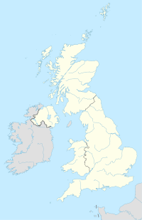
Centre points of the United Kingdom

Last updated

This stake is one of several way markers that mark the location of variously calculated geographic centres of Britain.
It is located just to the west of Whitendale Hanging Stones in Lancashire at SD 64188 56541. Geograph-2385708-Centre-of-Britain.jpg
This stake is one of several way markers that mark the location of variously calculated geographic centres of Britain. It is located just to the west of Whitendale Hanging Stones in Lancashire at SD 64188 56541.
"Centrographers" at the centre of mainland Great Britain, in a field near Whalley, Lancashire at Grid Ref SD 72321.72 36671.1 (approximately), in December 2005 The Centre of Mainland Great Britain - geograph.org.uk - 95500.jpg
"Centrographers" at the centre of mainland Great Britain, in a field near Whalley, Lancashire at Grid Ref SD 72321.72 36671.1 (approximately), in December 2005

There has long been debate over the exact location of the geographical centre of the United Kingdom, and its constituent countries, due to the complexity and method of the calculation, such as whether to include offshore islands, and the fact that erosion will cause the position to change over time. There are two main methods of calculating this "centre": either as the centroid of the two-dimensional shape made by the country (projected to the Airy ellipsoid then flattened using the Transverse Mercator projection), or as the point farthest from the boundary of the country (either the sea, or, in the case of constituent countries, a land border). These two methods give quite different answers.

Contents

Traditional locations

The town of Haltwhistle in Northumberland has banners stating that it is the "Centre of Britain". [1] By another calculation the centre can also be said to be Dunsop Bridge, Lancashire, 71 miles (114 km) to the south. [2]

However, in 2002 the Ordnance Survey conducted studies that pinpointed the respective centres more precisely, and it is their results that are quoted below. [3]

Centroid locations

The centroid is a mathematically derived point that is in every sense the centre of a two dimensional area like a piece of land. If a straight line is drawn through a centroid in any direction there will be equal length of the line on either side of the centroid as measured from it to the boundary if the line is unbroken on either side. If a line crosses an inlet of the sea then it can be considered as a stick of uniform weight with a material of negligible weight crossing the water, the line would then balance precisely at the centroid point if suspended.

Staffordshire UK location map.svg
Map of centres of UK and England by various methods

Put simply, the centroid is the point at which a cardboard cut-out of the area could be perfectly balanced on the tip of a pencil. [4] Islands are assumed fixed to the mainland in their precise position by invisible rigid weightless wires. A mathematical method is used to do the balancing to a much greater accuracy than the practical method could achieve.

Unless stated, positions are the centroids of the two-dimensional shapes made by the countries. Calculations include offshore islands unless stated.

United Kingdom

Great Britain

Great Britain (mainland only)

England

Northern Ireland

Scotland

Wales

Locations found by other methods

Point farthest from the sea

Point farthest from high tide mark (including tidal rivers)

Mid point of the longest north–south axis

Centre of population

A calculation by Danny Dorling using the mean (least squares) method based on local authority district data from the 1990s gave the population centre of Great Britain at Appleby Parva, Leicestershire, 20 miles south of Derby. Since then, the population centre will have moved slightly south and east. [12] [13] > [14]

Centre of England

Plaque on the ancient cross at Meriden, West Midlands, the traditional centre of England Meriden cross plaque 1951.jpg
Plaque on the ancient cross at Meriden, West Midlands, the traditional centre of England
Road sign welcoming visitors to the Centre of England at Morton, Derbyshire The Centre of England - geograph.org.uk - 372568.jpg
Road sign welcoming visitors to the Centre of England at Morton, Derbyshire

For centuries the parish of Meriden to the west of Coventry has claimed to be the geographical centre of England, and there has been a stone cross there commemorating the claim for at least 500 years. The justification is that the point farthest from the sea is in the parish.[ citation needed ] Morton, Derbyshire also claims to be the centre of England as it is not only midway along England's longest north-south axis,[ citation needed ] but also midway between the east coast and the Welsh border.[ citation needed ] Claims are also made for a tree, the Midland Oak, in Leamington Spa, Warwickshire, although the basis for these claims is not clear.

See also

Further reading

Related Research Articles

<span class="mw-page-title-main">Westmorland</span> Historic county of England

Westmorland is a historic county in Northern England.

<span class="mw-page-title-main">West Riding of Yorkshire</span> One of the historic subdivisions of Yorkshire, England

The West Riding of Yorkshire was one of three historic subdivisions of Yorkshire, England. From 1889 to 1974 the riding was an administrative county named County of York, West Riding. The lieutenancy at that time included the city of York and as such was named "West Riding of the County of York and the County of the City of York". The riding ceased to be used for administrative purposes in 1974, when England's local government was reformed.

<span class="mw-page-title-main">Forest of Bowland</span> Upland conservation area in Lancashire, England

The Forest of Bowland, also known as the Bowland Fells and formerly the Chase of Bowland, is an area of gritstone fells, deep valleys and peat moorland, mostly in north-east Lancashire, England, with a small part in North Yorkshire. It is a western outlier of the Pennines.

<span class="mw-page-title-main">Pole of inaccessibility</span> Geographic location

A pole of inaccessibility with respect to a geographical criterion of inaccessibility marks a location that is the most challenging to reach according to that criterion. Often it refers to the most distant point from the coastline, implying a maximum degree of continentality or oceanity. In these cases, a pole of inaccessibility can be defined as the center of the largest circle that can be drawn within an area of interest without encountering a coast. Where a coast is imprecisely defined, the pole will be similarly imprecise.

<span class="mw-page-title-main">Haltwhistle</span> Human settlement in England

Haltwhistle is a market town and civil parish in Northumberland, England, 22.9 miles east of Carlisle and 36.8 miles west of Newcastle upon Tyne. It had a population of 3,811 at the 2011 Census.

<span class="mw-page-title-main">Hexham (UK Parliament constituency)</span> Parliamentary constituency in the United Kingdom, 1885 onwards

Hexham is a constituency in Northumberland represented in the House of Commons of the UK Parliament since 2010 by Guy Opperman, a Conservative. As with all constituencies, the constituency elects one Member of Parliament (MP) by the first past the post system of election at least every five years.

Aislaby is a small village and civil parish on the north bank of the River Tees within the borough of Stockton-on-Tees and the ceremonial county of County Durham, England. It is located to the west of Eaglescliffe and Yarm. The name, first attested as Asulue(s)bi in 1086, is of Viking origin and means "Aslak's farm." Aislaby was listed in the Domesday Book of 1086.

<span class="mw-page-title-main">Cornriggs</span> Human settlement in England

Cornriggs is a hamlet in the civil parish of Stanhope, in County Durham, England. It is situated on the north side of Weardale in the North Pennines, which is designated as both an Area of Outstanding Natural Beauty and a UNESCO Global Geopark.

<span class="mw-page-title-main">Hunstanworth</span>

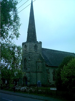
Hunstanworth is a village in County Durham, England. It is situated approximately 10 miles to the west of Consett, south-west of the village of Blanchland. The population of the village as taken at the 2011 Census was 116.

<span class="mw-page-title-main">Center of population</span> Geographical point

In demographics, the center of population of a region is a geographical point that describes a centerpoint of the region's population. There are several ways of defining such a "center point", leading to different geographical locations; these are often confused.

The Pennine Cycleway is a Sustrans-sponsored route in the Pennines range in northern England, an area often called the "backbone of England". The route passes through the counties of Derbyshire, West Yorkshire, Lancashire, North Yorkshire, Cumbria and Northumberland. It is part of the National Cycle Network (NCN). Sustrans founder John Grimshaw calls it 'the best National Cycle Network route of the lot'.
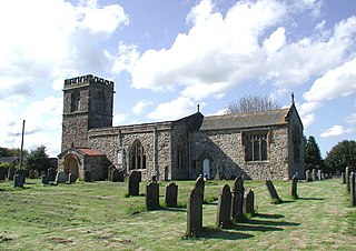
<span class="mw-page-title-main">Coton in the Elms</span> Human settlement in England

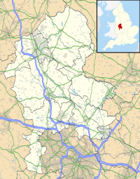
Coton in the Elms is a village and parish in the English county of Derbyshire. At 70 miles (110 km) from the coast, it is one of the furthest places in the United Kingdom from coastal waters. The population of the civil parish as of the 2011 census was 896. It is located 5 miles (8.0 km) southwest of Swadlincote and 6 miles (9.7 km) south of Burton upon Trent.

<span class="mw-page-title-main">Slyne-with-Hest</span> Human settlement in England

Slyne-with-Hest is a civil parish in the City of Lancaster in Lancashire, England. It had a population of 3,163 recorded in the 2001 census, decreasing to 3,126 at the 2011 Census. The parish is north of Lancaster and consists of two villages; Slyne, on the A6 road, and Hest Bank on the coast.

In geography, the centroid of the two-dimensional shape of a region of the Earth's surface is known as its geographic centre or geographical centre or gravitational centre. Informally, determining the centroid is often described as finding the point upon which the shape would balance. This method is also sometimes described as the "gravitational method".

<span class="mw-page-title-main">Trough of Bowland</span>

The Trough of Bowland is a valley and high pass in the Forest of Bowland Area of Outstanding Natural Beauty, Lancashire, England.

<span class="mw-page-title-main">Brennand Farm</span> British geographical location

Brennand Farm is often claimed to be the true centre of Great Britain. This is about seven kilometres north-west of Dunsop Bridge - which has the nearest BT phone box to the 'true centre'. A plaque reads “You are calling from the BT payphone that marks the centre of Great Britain”.

<span class="mw-page-title-main">Way of the Roses</span>

The Way of the Roses is the newest of Great Britain's coast-to-coast long-distance cycle routes and is based on minor roads, disused railway lines and specially constructed cycle paths. It lies entirely within the counties of Lancashire and Yorkshire, crossing the Yorkshire Dales and the Yorkshire Wolds in the North of England, passing through the historic cities of Lancaster, Ripon and York and scenic towns and villages including Settle and Pateley Bridge

<span class="mw-page-title-main">Jenny Brown's Point</span> Headland in Silverdale, Lancashire, England

Jenny Brown's Point is a small headland in Silverdale parish, south of the village of Silverdale, in City of Lancaster district, Lancashire, England, on the edge of Morecambe Bay.

References

  1. Vanessa Barford (22 August 2014). "Scottish independence: The town at the centre of Britain". BBC News . Retrieved 20 November 2015.
  2. 1 2 3 Brady Haran (20 October 2002). "Stuck in the middle with ewe". BBC News . Retrieved 2 January 2010.
  3. Social Media Manager, Gemma (22 August 2014). "Where is the centre of Great Britain?". The Official OS Blog. OS. Retrieved 20 May 2017.
  4. 1 2 "Brave hearts of Scotland". BBC. 2002-10-24. Retrieved 2010-01-02.
  5. BBC News (calculation made by Ordnance Survey) 16 September 2014
  6. "Q. Where is the centre of mainland Great Britain?". MapZone. Ordnance Survey. Retrieved 23 November 2011.
  7. "A tale of two centres". BBC. 2002-10-22. Retrieved 2010-01-02.
  8. "New centre of England marked in Fenny Drayton". BBC. 2013-06-14. Retrieved 2013-06-14.
  9. "Meg in the middle". BBC. 2002-10-23. Retrieved 2010-01-02.
  10. "Saving the centre of Wales". BBC. 2002-10-24. Retrieved 2010-01-02.
  11. The Centre of Britain Archived January 29, 2012, at the Wayback Machine , Centre of Britain Hotel, Haltwhistle, Northumberland. Accessed May 2012
  12. "News Item:". University of Leeds . Archived from the original on 3 October 2006. Retrieved 25 November 2007.
  13. "Population Centre". Appleby Magna & Appleby Parva. Archived from the original on 23 November 2007. Retrieved 25 November 2007.
  14. Dorling, D; Atkins, D J (1995). Population density, change and concentration in Great Britain 1971, 1981 and 1991 (Studies on Medical and Population Subjects No. 58). HMSO.