Lindley Hall Farm

Last updated

Lindley Hall Farm
The Centre of England and outbuildings - geograph.org.uk - 337259.jpg
An image taken at Lindley Hall Farm, at the point which the Ordnance Survey calculated to be the geographical centre of England.
Lindley Hall Farm
Location of Lindley Hall Farm
Town/City Hinckley and Bosworth, Leicestershire, England
Coordinates 52°33′38″N1°28′13″W / 52.56056°N 1.47028°W / 52.56056; -1.47028 Coordinates: 52°33′38″N1°28′13″W / 52.56056°N 1.47028°W / 52.56056; -1.47028
OwnerStephen Farmer

Lindley Hall Farm is a farm in Leicestershire, England, in close proximity to Fenny Drayton and Higham on the Hill. The farm is owned by Stephen Farmer. It has been best known as the geographical centre of England since the Ordnance Survey's investigation in 2002. A plaque has been erected by the Ordnance Survey denoting the geographical central point and disputing the historically believed idea that Meriden was the geographical centre.

Contents

History

It is unknown when the farm was established, but it was named after the nearby former Lindley Hall, which was once present on the Leicestershire countryside near Higham on the Hill. Five years following the death of the Lindley Hall estate's owner (Lieutenant Commander Francis Eyre RN), Lindley Hall and the Roman Catholic chapel beside it were ultimately demolished, being one of the country houses and estates in the Nuneaton area to fall victim to redevelopment. However, the remains of the old chapel and hall remain at Lindley House, which is built at Lindley Park on the former site of Lindley Hall. [1]

Having been in ownership of the Farmer family, Lindley Hall Farm used to be a dairy farm. However, after an outbreak of foot-and-mouth disease, all of the farm's animals were killed, leading to the farm halting the production of dairy. Following this, the farm would go on to cultivate sheep, cattle, wheat, oats and barley. [2]

Geographical centre of England

A post marking the geographical centre of England as measured by the Ordnance Survey in Lindley Hall Farm. Centre of England, Lindley Hall Farm.jpg
A post marking the geographical centre of England as measured by the Ordnance Survey in Lindley Hall Farm.

In October 2002, using global satellite positioning, [3] the Ordnance Survey initiated a study to find the geographical centre of England, challenging previous myths that the geographical centre of England was located in places such as Meriden in the West Midlands, approximately 11 kilometres to the south of Lindley Hall Farm, which had traditionally claimed to be the geographical centre of England, having a 500-year-old monument claiming the title. [2] They found that the geographical centre was located on a field in Lindley Hall Farm, with the new OS grid reference being SP 36373.66, 96143.05. However, the islands of England were used along with the English mainland to calculate the centre point. [4]

There is also a plaque erected by the Ordnance Survey in one of the farm's fields, reading: "In 2002 the Ordnance Survey defined this spot as the Geographical Centre of England", along with the coordinates and grid reference underneath.

Tourism

Due to Lindley Hall Farm being private property, tourist access for the proposed geographical central point of England has been restricted. [5] Upon receiving requests to build tearooms on the site of the farm to attract "American tourists", Margaret Farmer (former co-owner of the farm, aged 80 at the time) responded with "I think we are a bit old for this". [2]

However, the current owner of the farm, Stephen Farmer, wishes for the farm to be turned into a tourist attraction, [6] as well as Steve Wegerif, chairman of Hinckley and Bosworth Tourism Partnership, saying that it "seems only right" that the centre of England is located in the farm [5] and that it was "fantastic for the centre to be officially recognised and have it marked in the county." [6]

Disputes over status

Plaque in Meriden claiming to be the location of the geographical centre of England. Meriden cross plaque 1951.jpg
Plaque in Meriden claiming to be the location of the geographical centre of England.

Despite the Ordnance Survey claiming that the geographical centre of England is Lindley Hall Farm, several places are continuing to claim this status. Meriden, the historical geographical centre of England, continues to uphold its status with a plaque describing itself as the centre of England, having made this claim for the past 500 years. [7] Additionally, Morton in Derbyshire makes the same claim, having a sign upon entrance stating "Welcome to Morton, the centre of England." [8] The Midland Oak in Leamington Spa is also said by many to be the geographical centre of England, however, it is not known where the basis for this claim came from. [9]

See also

Related Research Articles

<span class="mw-page-title-main">Leicestershire</span> County of England

Leicestershire is a ceremonial and non-metropolitan county in the East Midlands, England. The county borders Nottinghamshire to the north, Lincolnshire to the north-east, Rutland to the east, Northamptonshire to the south-east, Warwickshire to the south-west, Staffordshire to the west, and Derbyshire to the north-west. The border with most of Warwickshire is Watling Street, the modern A5 road.

<span class="mw-page-title-main">Atherstone</span> Market town and civil parish in Warwickshire, England

Atherstone is a market town and civil parish in the North Warwickshire district of Warwickshire, England. Located in the far north of the county, Atherstone is on the A5 national route, and is adjacent to the border with Leicestershire which is here formed by the River Anker. It is only 4+12 miles from Staffordshire. It lies between the larger towns of Tamworth and Nuneaton. Atherstone is the administrative centre of the North Warwickshire district, with the offices of North Warwickshire Borough Council located in the town.

<span class="mw-page-title-main">Hinckley and Bosworth</span> Borough in England

Hinckley and Bosworth is a local government district with borough status in south-western Leicestershire, England, administered by Hinckley and Bosworth Borough Council. Its only towns are Hinckley, Earl Shilton and Market Bosworth. Villages include Barwell, Burbage, Stoke Golding, Groby, Shackerstone and Twycross. The population of the Borough at the 2011 census was 105,078.

<span class="mw-page-title-main">Coalville</span> Town in Leicestershire, England

Coalville is a town and unparished area in the district of North West Leicestershire, Leicestershire in the East Midlands of England, with a population at the 2011 census of 34,575. It lies on the A511 trunk road between Leicester and Burton upon Trent, close to junction 22 of the M1 motorway where the A511 meets the A50 between Ashby-de-la-Zouch and Leicester. It borders the upland area of Charnwood Forest to the east of the town.

<span class="mw-page-title-main">Bletchley</span> Human settlement in England

Bletchley is a constituent town of Milton Keynes, Buckinghamshire, England. It is situated in the south-west of Milton Keynes, and is split between the civil parishes of Bletchley and Fenny Stratford and West Bletchley.

<span class="mw-page-title-main">A45 road</span> Major road in England

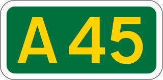
The A45 is a major road in England. It runs east from Birmingham past the National Exhibition Centre and the M42, then bypasses Coventry and Rugby, where it briefly merges with the M45 until it continues to Daventry. It then heads to Northampton and Wellingborough before running north of Rushden and Higham Ferrers and terminating at its junction with the A14 in Thrapston.

<span class="mw-page-title-main">Meriden, West Midlands</span> Human settlement in England

Meriden is a village and civil parish in the Metropolitan Borough of Solihull, West Midlands, England. Historically, it is part of Warwickshire and lies between the cities of Birmingham and Coventry. It is located close to the North Warwickshire district border within a green belt of the countryside known as the Meriden Gap and is in the ecclesiastical parish of the Diocese of Coventry. The village is 6.75 miles east-northeast of Solihull, 6.5 miles west-northwest of Coventry and 4.5 miles east-southeast of Birmingham Airport. Birmingham city centre is 12.5 miles east-northeast of the village. Known as "Alspath" in the Domesday Book, it was historically thought to be the geographical centre of England until the early 2000s, though after an analysis by the Ordnance Survey this was proved to be incorrect.

<span class="mw-page-title-main">Centre points of the United Kingdom</span>

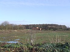
There has long been debate over the exact location of the geographical centre of the United Kingdom, and its constituent countries, due to the complexity and method of the calculation, such as whether to include offshore islands, and the fact that erosion will cause the position to change over time. There are two main methods of calculating this "centre": either as the centroid of the two-dimensional shape made by the country, or as the point farthest from the boundary of the country. These two methods give quite different answers.

<span class="mw-page-title-main">Higham, Lancashire</span> Human settlement in England

Higham is a village in the Borough of Pendle in Lancashire, England, south of Pendle Hill. The civil parish is named Higham with West Close Booth. The village is 2 miles (3 km) north-east of Padiham and about 4 miles (6 km) south-west of Nelson along the A6068 road.

<span class="mw-page-title-main">Fenny Drayton</span> Village in Leicestershire, England

Fenny Drayton is a village and former civil parish, now in the parish of Witherley, in the Hinckley and Bosworth district of Leicestershire, England. It lies near the Warwickshire boundary, three miles north-east of Atherstone in the Coventry postcode area, just off the A444, the Roman Watling Street. Another Roman road crosses at the end of the scenic Fenn Lanes. The village is four miles from Stoke Golding, where Henry VII of England was crowned after the Battle of Bosworth in 1485. The reinterment of Richard III of England on 21 March 2015 started along Fenn Lanes, near the village. In 1931 the parish had a population of 125. On 1 April 1935 the parish was abolished and merged with Witherley, parts also went to Hartshill, Mancetter and Caldecote. The name means "farm/settlement for portage" or "farm/settlement used as a dragging place". "Fenny" reflects the fen-like ground along the Roman road.

<span class="mw-page-title-main">Morton, Derbyshire</span> Human settlement in England

Morton is a civil parish and village, three miles north of Alfreton in North East Derbyshire, Derbyshire, England. The civil parish population at the 2011 Census was 1,195.

Snarestone is a small rural village in North West Leicestershire, England.

Bletchley and Fenny Stratford is a civil parish with a town council, in Milton Keynes, Buckinghamshire, England. It was formed in 2001 from the unparished area of Milton Keynes, and according to the 2011 census had a population of 15,313. Together with West Bletchley, it forms the Bletchley built-up area.

<span class="mw-page-title-main">Higham on the Hill</span> Human settlement in England

Higham on the Hill is a village and civil parish in the Hinckley and Bosworth district of Leicestershire, England. The population at the 2011 census was 840.

<span class="mw-page-title-main">Coton in the Elms</span> Human settlement in England

Coton in the Elms is a village and parish in the English county of Derbyshire. At 70 miles (110 km) from the coast, it is the one of the furthest places in the United Kingdom from coastal waters. The population of the civil parish as of the 2011 census was 896. It is located 5 miles (8.0 km) southwest of Swadlincote and 6 miles (9.7 km) south of Burton upon Trent.

HORIBA MIRA Ltd. is an automotive engineering and development consultancy company headquartered near Nuneaton in Warwickshire, United Kingdom. It provides product engineering, research, testing, information and certification services to the automotive sector. Its headquarters are in the MIRA Technology Park Enterprise Zone. On 14 July 2015 MIRA announced that it was being bought by the Japanese-owned testing equipment group Horiba.

<span class="mw-page-title-main">University Hospital Coventry</span> Hospital in Coventry, West Midlands, England

University Hospital Coventry is a large National Health Service (NHS) hospital situated in the Walsgrave on Sowe area of Coventry, West Midlands, England, 4 miles (6 km) north-east of the city centre. It is part of the University Hospitals Coventry and Warwickshire NHS Trust, and is the main hospital covering Coventry and Rugby. It works in partnership with the University of Warwick's Warwick Medical School. It has a large, progressive accident & emergency department providing a trauma service to Coventry and Warwickshire.

<span class="mw-page-title-main">A444 road</span> Road in the West Midlands, England

The A444 is a primary road running between Coventry and Burton upon Trent in England, usually referred to as the "A treble four" or "A triple four".

<span class="mw-page-title-main">River Sence</span> River in Leicestershire, England

The River Sence is a river which flows in Leicestershire, England. The tributaries of the Sence, including the Saint and Tweed, fan out over much of western Leicestershire from Charnwood Forest and Coalville in the north-east to Hinckley and almost to Watling Street in the south and south-west. Its watershed almost coincides with Hinckley and Bosworth Borough of Leicestershire, which was formed in 1974 by amalgamation of Market Bosworth Rural District and Hinckley Urban District. It flows into the Anker, which in turn flows into the River Tame. It is part of the wider River Trent catchment, which covers much of central England. In 1881, Sebastian Evans wrote that the usual names for this river were Shenton Brook and Sibson Brook.

References

  1. "Lindley Hall near Higham on the Hill, Leicestershire". www.hinckleypastpresent.org. Retrieved 23 November 2022.
  2. 1 2 3 "A tale of two centres". 22 October 2002. Retrieved 15 November 2022.
  3. Halifax, Justine (15 May 2015). "Meriden monument is the centre of England". BirminghamLive. Retrieved 15 November 2022.
  4. "Where Is The Centre Of Great Britain? | Blog". www.ordnancesurvey.co.uk. Retrieved 15 November 2022.
  5. 1 2 "New centre of England marked in Fenny Drayton". BBC (prose from first citation is sourced from the text below the video, second citation is from the video at 00:03). 14 June 2013.
  6. 1 2 "Plaque marks new centre of England". BBC News. Retrieved 15 November 2022.
  7. Live, Coventry (22 October 2002). "Centre of England hell for Meriden". CoventryLive. Retrieved 15 November 2022.
  8. "Centre of England - History". www.mortonparishcouncil.org.uk. Retrieved 15 November 2022.
  9. Stocker, Gary. "Site of 'The Midlands Oak'". Our Warwickshire. Retrieved 15 November 2022.