List of islands of England

Last updated

This is a list of islands of England (excluding the mainland which is itself a part of the island of Great Britain), as well as a table of the largest English islands by area and by population.

Contents

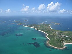
Islands by type and name

Offshore and inshore islands

St Martin's, The Isles of Scilly St Martins - aerial photo.jpg
St Martin's, The Isles of Scilly
St Michael's Mount, Cornwall England-Saint-Michaels-Mount-1900-1.jpg
St Michael's Mount, Cornwall

To group islands by geographical region, sort the table by "Island Group/Location" (click the icon by the column heading).

NameGroup/location
Annet Isles of Scilly
Asparagus Island Cornwall
Baker's Island Langstone Harbour
Birnbeck Island Severn Estuary
Black Nab Saltwick Bay, Whitby
Brownsea Island Poole Harbour
Bryher Isles of Scilly
Burgh Island Devon
Burnt Island Isles of Scilly
Burntwick Island Medway Estuary
Burrow Island Portsmouth Harbour
Canvey Island Thames Estuary
Chapel Island Islands of Furness
Cindery Island Essex
Cobmarsh Island Essex
Coquet Island Northumberland
Crow Island Isles of Scilly
Deadman's Island Medway Estuary
Drake's Island Devon
Dova Haw Islands of Furness
English Island Isles of Scilly
Foulness Island Essex
Foulney Island Islands of Furness
Fowley Island Chichester Harbour
Furzey Island Poole Harbour
Gigger's Island Poole Harbour
Godrevy Island Cornwall
Gorregan Isles of Scilly
Great Arthur Isles of Scilly
Great Cob Island Essex
Great Ganinick Isles of Scilly
Great Ganilly Isles of Scilly
Great Innisvouls Isles of Scilly
Great Mew Stone Devon
Green Island Isles of Scilly
Green Island Poole Harbour
Gugh Isles of Scilly
Gull Island Hampshire
Guther's Island Isles of Scilly
Gweal Isles of Scilly
Hanjague Isles of Scilly
Havengore Island Essex
Havergate Island Suffolk
Hayling Island Chichester Harbour
Headin Haw Islands of Furness
Hedge-end Island Essex
Hilbre Island Wirral
Horsea Island Portsmouth Harbour
Horsey Island Essex
Inner Farne Farne Islands
Lindisfarne Northumberland
Little Arthur Isles of Scilly
Little Eye Wirral
Little Ganinick Isles of Scilly
Little Ganilly Isles of Scilly
Little Innisvouls Isles of Scilly
Longships Land's End
Long Island Poole Harbour
Long Island Langstone Harbour
Looe Island Cornwall
Lower Horse Essex
Lothingland Suffolk and Norfolk
Lundy Bristol Channel
Menawethan Isles of Scilly
Merrick Island Isles of Scilly
Mersea Island Essex
Middle Eye Wirral
Mullion Island Cornwall
New England Island Essex
Nornour Isles of Scilly
North Binness Island Langstone Harbour
Northey Island Essex
Old Harry Rocks Dorset
Osea Island Essex
Outer Trial Bank Lincolnshire
Pewit Island Essex
Pewit Island Portsmouth Harbour
Piel Island Islands of Furness
Pilsey Island Chichester Harbour
Plumb Island Isles of Scilly
Portsea Island Hampshire
Potton Island Essex
Puffin Island Isles of Scilly
Ragged Island Isles of Scilly
Ramsey Island Islands of Furness
Read's Island Humber estuary
Roa Island Islands of Furness
Rosevear Isles of Scilly
Round Island Isles of Scilly
Round Island Poole Harbour
Rushley Island Essex
Scolt Head Island Norfolk
St Agnes Isles of Scilly
St Clement's Isle Cornwall
St Helen's Isles of Scilly
St Martin's Isles of Scilly
St Mary's Isles of Scilly
St Michael's Mount Cornwall
St Mary's Island Tyne and Wear
Samson Isles of Scilly
Sheep Island Islands of Furness
Isle of Sheppey Thames Estuary
Skipper's Island Essex
South Binness Island Langstone Harbour
Staple Island Farne Islands
Steep Holm Bristol Channel
Stert Island Somerset
Stony Island Isles of Scilly
Teän Isles of Scilly
Thatcher Rock Devon
Thorney Island Chichester Harbour
Toll's Island Isles of Scilly
Tresco Isles of Scilly
Two Tree Island Thames Estuary
Wallasea Island Essex
Walney Island Islands of Furness
Wamses Island Farne Islands
Whale Island Portsmouth Harbour
White Island Isles of Scilly
Whitton Island Humber estuary
Isle of Wight English Channel

Inland islands

There are numerous islands within freshwater lakes and rivers in England. They are most numerous in the Lake District but other concentrations occur within the Norfolk Broads, some major reservoirs and principal rivers.

In the Lake District

To group islands by lake, sort the table by "Lake" (click the icon by the column heading).

NameGroup/location
Belle Isle Windermere
Blake Holme Windermere
Cherry Holm Ullswater
Crow Holme Windermere
Deergarth How Island Thirlmere
Derwent Isle Derwent Water
Fir Island Coniston Water
Grass Holme Windermere
Hawes How Island Thirlmere
Hen Holme Windermere
Heron Island Rydal Water
Holme Crag Windermere
Holme Islands Crummock Water
Lady Holme Windermere
Lillies of the Valley Windermere
Ling Holme Windermere
Lingy Holm Ullswater
Little Isle Rydal Water
Lord's Island Derwent Water
Maiden Holme Windermere
Norfolk Island Ullswater
Oak Island Coniston Water
Otter Island Derwent Water
Otterbield Island Derwent Water
Peel Island Coniston Water
Ramp Holme Windermere
Rampsholme Island Derwent Water
Rough Holme Windermere
Scale Island Crummock Water
Silver Holme Windermere
St Herbert's Island Derwent Water
Thompson's Holme Windermere
Unnamed island Elter Water
Grasmere Island Grasmere
Wall Holm Ullswater
Watness Coy Devoke Water
Wood Howe Haweswater Reservoir
Woodhouse Islands Crummock Water

In the River Thames

See: Islands in the River Thames

Inland islands elsewhere in England

To group islands by location, sort the table by "Location" (click the icon by the column heading).

NameLocation
Newark Island [1] River Trent
Alney Island River Severn
Big Island Carsington Water
Bird Island Stocks Reservoir, Lancashire [2]
Bridgemarsh Island River Crouch, Essex
Denny Island Chew Valley Lake
Flat Island Carsington Water
Haddiscoe Island (or Chedgrave Island or simply 'The Island')between River Waveney, River Yare and New Cut [3]
Horseshoe Island Carsington Water
Lady Island Hornsea Mere
Millfields Island Carsington Water
Peasholm Island Peasholm Lake, Scarborough
Pleasure Island Hickling Broad, Norfolk
Sailing Club Island Carsington Water [4]
Shiningford Island Carsington Water
Swan Island Hornsea Mere
Willow Island Stocks Reservoir, Lancashire

Largest islands

The Isle of Wight, with Portsea Island and Hayling Island also visible in the top right Wight.png
The Isle of Wight, with Portsea Island and Hayling Island also visible in the top right
RankIslandArea
(sq mi)(km2)
1 Isle of Wight 118.97380.15
2 Isle of Sheppey 34.4589.25
3 Foulness Island 11.3129.30
4 Portsea Island 9.4724.54
5 Canvey Island 6.9618.04
6 Mersea Island 6.9217.94
7 Hayling Island 6.1315.89
8 Walney Island 5.1213.27
9 Wallasea Island 4.1110.65
10 St Mary's 2.546.58
11 Lundy 1.724.45
12 Tresco 1.152.97
13 St Agnes 0.571.48
14 Bryher 0.511.34

Most populous islands

Many of the residents of Barrow Island live in traditional tenement blocks Devonshire pub.jpg
Many of the residents of Barrow Island live in traditional tenement blocks
RankIslandPopulation (2011 UK census)
1 Portsea Island 207,100
2 Isle of Wight 141,538
3 Isle of Sheppey 40,300
4 Canvey Island 38,170
5 Hayling Island 17,379
6 Walney Island 10,651
7 Mersea Island about 7,200
8 Barrow Island 2,616
9 St Mary's 1,668
10 Thorney Island 1,079
11 Foulness Island 151
12 Tresco 180
13 Lindisfarne 162
14 St Martin's 142
15 Roa Island about 100
16 Bryher 92
17 St Agnes 70
18 St Michael's Mount 35 [5] [2011 Census]
19 Lundy about 28
20 Whale Island 17 [6]
21 Burgh Island about 12
22 Piel Island 4 [7]
23 Gugh 3
Horsey Island unknown [8]
Total396,447

Places called "island" or "isle" that are not islands

Some places in the British Isles are called islands or isles, but are not. Some of these were formerly islands surrounded by marshland. Others are peninsulas or just coastal settlements. They include:

See also

Related Research Articles

<span class="mw-page-title-main">Geography of the United Kingdom</span>

<span class="mw-page-title-main">Isle of Sheppey</span> Island off the coast of Kent, England

The Isle of Sheppey is an island off the northern coast of Kent, England, neighbouring the Thames Estuary, centred 42 miles (68 km) from central London. It has an area of 36 square miles (93 km2). The island forms part of the local government district of Swale. Sheppey is derived from Old English Sceapig, meaning "Sheep Island".

<span class="mw-page-title-main">Poole Harbour</span> Natural harbour in England

Poole Harbour is a large natural harbour in Dorset, southern England, with the town of Poole on its shores. The harbour is a drowned valley (ria) formed at the end of the last ice age and is the estuary of several rivers, the largest being the Frome. The harbour has a long history of human settlement stretching to pre-Roman times. The harbour is extremely shallow, with one main dredged channel through the harbour, from the mouth to Holes Bay.

<span class="mw-page-title-main">Severn Trent</span> English water company

Severn Trent plc is a water company based in Coventry, England. It supplies 4.6 million households and business across the Midlands and Wales.

<span class="mw-page-title-main">Sheerness</span> Town in Kent, England

Sheerness is a port town and civil parish beside the mouth of the River Medway on the north-west corner of the Isle of Sheppey in north Kent, England. With a population of 11,938, it is the second largest town on the island after the nearby town of Minster which has a population of 21,319.

<span class="mw-page-title-main">Minster, Swale</span> Town on the Isle of Sheppey, Kent, England

Minster is a town on the north coast of the Isle of Sheppey in Kent, south-east England. It is in the Swale administrative district, and within that, in the parish of Minster-on-Sea. According to the 2021 Census, the population of Minster was 17,389.

<span class="mw-page-title-main">The Swale</span> Channel of the Thames Estuary in Kent, UK

The Swale is a tidal channel of the Thames estuary that separates the Isle of Sheppey from the rest of Kent. On its banks is a 6,509.4-hectare (16,085-acre) biological Site of Special Scientific Interest which stretches from Sittingbourne to Whitstable in Kent. It is also a Ramsar internationally important wetland site and a Special Protection Area under the European Union Directive on the Conservation of Wild Birds. Parts of it are a Nature Conservation Review site, Grade I, National Nature Reserves, a Kent Wildlife Trust nature reserve and a Local Nature Reserve.

GENUKI is a genealogy web portal, run as a charitable trust. It "provides a virtual reference library of genealogical information of particular relevance to the UK and Ireland". It gives access to a large collection of information, with the emphasis on primary sources, or means to access them, rather than on existing genealogical research.

<span class="mw-page-title-main">Teesdale</span> Valley in Northern England

Teesdale is a dale, or valley, in Northern England. The dale is in the River Tees's drainage basin, most water flows stem from or converge into said river, including the Skerne and Leven.

<span class="mw-page-title-main">Geography of England</span> Geographical features of England

England comprises most of the central and southern two-thirds of the island of Great Britain, in addition to a number of small islands of which the largest is the Isle of Wight. England is bordered to the north by Scotland and to the west by Wales. It is closer to continental Europe than any other part of mainland Britain, divided from France only by a 33 km (21 mi) sea gap, the English Channel. The 50 km (31 mi) Channel Tunnel, near Folkestone, directly links England to mainland Europe. The English/French border is halfway along the tunnel.

<span class="mw-page-title-main">Rishton</span> Human settlement in England

Rishton is a town in the Hyndburn district of Lancashire, England, about 2 miles (3 km) west of Clayton-le-Moors and 4 miles (6 km) north east of Blackburn. It was an urban district from about 1894 to 1974. The population at the census of 2011 was 6,625.

<span class="mw-page-title-main">Harty</span> Human settlement in England

Harty is a small hamlet on the Isle of Sheppey in Kent consisting of a few cottages, a church and a public house, the Ferry Inn. It is part of the civil parish of Leysdown.

<span class="mw-page-title-main">Coastline of the United Kingdom</span> Coastlines of Great Britain, the north-east coast of Ireland, and many smaller islands

The coastline of the United Kingdom is formed by a variety of natural features including islands, bays, headlands and peninsulas. It consists of the coastline of the island of Great Britain, the north-east coast of the island of Ireland, as well as many much smaller islands. Much of the coastline is accessible and quite varied in geography and habitats. Large stretches have been designated areas of natural beauty, notably the Jurassic Coast and various stretches referred to as heritage coast. They are both very long, spreading through the mainland.

<span class="mw-page-title-main">Leysdown-on-Sea</span> Village in Kent, England

Leysdown-on-Sea is a village on the east coast of the Isle of Sheppey, in the borough of Swale in Kent, England. In 2020 it had an estimated population of 936. The civil parish is Leysdown and includes the settlements of Bay View, Shellness and Harty. In 2011 it had a population of 1,256.

<span class="mw-page-title-main">Carsington</span> Human settlement in England

Carsington is a village in the middle of the Derbyshire Dales, England; it adjoins the hamlet of Hopton, and is close to the historic town of Wirksworth and village of Brassington.

<span class="mw-page-title-main">Barton's Point Coastal Park</span>

Barton's Point Coastal Park is on the Isle of Sheppey, in Kent, England. It lies between Minster and Sheerness. Within the park is a former military ditch/canal from Marine Parade heading south-westerly towards West Minster.

References

  1. "Clean River Trust". 17 January 2018.
  2. "Stocks Reservoir Fly Fishing fishery England UK". Archived from the original on 10 May 2010. Retrieved 24 April 2010.
  3. "Haddiscoe Island Compartment". Archived from the original on 22 February 2007. Retrieved 26 May 2008.
  4. "Photographic image - Carsington Water Map" (JPG). Carsingtonbirdclub.co.uk. Retrieved 6 January 2017.
  5. "Genuki: St Michael's Mount, Cornwall". Genuki.org.uk. Archived from the original on 7 July 2001. Retrieved 6 January 2018.
  6. "Map of PO2 8ER postcode". doogal.co.uk. Retrieved 15 January 2022.
  7. Riley, Sue (14 November 2011). "The king of Piel Island brings a modern approach to the monarchy". Lancashire Life. Retrieved 23 May 2013.
  8. "Polling District Order Sheet" (PDF). Tendring District Council. p. 2. Archived from the original (PDF) on 11 October 2016. Retrieved 10 October 2016.