
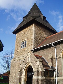
Woolsthorpe by Belvoir, also known as Woolsthorpe is a village and civil parish in the South Kesteven district of Lincolnshire, England. The population of the civil parish at the 2011 census was 415. It is situated approximately 5 miles (8 km) west from Grantham, and adjoins the county border with Leicestershire. The neighbouring village of Belvoir lies on the other side of the border. Grantham Canal is situated 1 mile (1.6 km) to the north-east at its closest point.

Slapton is a village and also a civil parish within Aylesbury Vale district in Buckinghamshire, England. It is located between the Grand Union Canal and the boundary with Bedfordshire, about 3 mi (5 km) south of Leighton Buzzard and 3 mi (5 km) west of Edlesborough.

Oxspring is a village and civil parish in the Metropolitan Borough of Barnsley in South Yorkshire, England. At the 2001 census it had a population of 1,048, increasing to 1,225 at the 2011 Census. The civil parish includes the hamlets of Clays-Green, Roughbirchworth and Storrs. It is situated on the River Don with the main village being between the Sheffield Road (B6462) and the route of the Trans Pennine Trail. On the other (NE) side of the river is the A629, part of which is called Oxspring Lane, indicating the position of the original hamlet . The parish has a post office, a combined C of E church and community hall, St Aidan's, a primary school and two public houses, the Waggon and Horses on the B6462 and the Travellers Inn on the A629. There is a small amount of industry at the north west end.

Ab Kettleby is a village and civil parish in the Melton district of Leicestershire, England, located 3 miles (4.8 km) north of Melton Mowbray, on the A606 road. It had a population of 501 in 2001; at the 2011 census this had increased to 529.

Molesworth is a village in the civil parish of Brington and Molesworth in Cambridgeshire, England. Molesworth is 10 miles (16 km) north-west of Huntingdon. The neighbouring village of Brington is 0.7 miles (1.1 km) from Molesworth. Molesworth is situated within Huntingdonshire which is a non-metropolitan district of Cambridgeshire as well as being a historic county of England. The civil parish covers an area of 2,842 acres. Just to the north of Molesworth and within the civil parish is RAF Molesworth. The village of Molesworth was designated a conservation area by Huntingdon District Council largely due to its typically rural English character that includes several listed buildings.

Barlestone is a village and civil parish in the Hinckley and Bosworth district of Leicestershire, England, adjoining the village of Osbaston. The UK Census reported Barlestone's population as 2,471 in 2001, and 2,481 in 2011.
Newbold Verdon is a village and civil parish in the county of Leicestershire, England. The parish includes Newbold Heath to the north and Brascote to the south. Originally an agricultural centre Newbold Verdon grew in size during the 1850s with the expansion of coal mining in the area. That industry has now ceased leaving Newbold Verdon as a commuter village primarily serving Leicester and Hinckley. The 2001 census recorded a population of 3,193, which had reduced to 3,012 at the 2011 census.
Winwick is a village and civil parish in Cambridgeshire, England. Winwick lies approximately 10 miles (16 km) north-west of Huntingdon. It is a crossroads village on the B660 near Hamerton. Winwick is situated within Huntingdonshire which is a non-metropolitan district of Cambridgeshire as well as being a historic county of England.

Catworth is a village and civil parish in Cambridgeshire, England. Catworth lies approximately 9 miles (14 km) west of Huntingdon. The civil parish covers an area of 3,094 acres. Catworth village has two parts, Catworth, at the top of the hill, and Little Catworth, at the bottom. Catworth is situated within Huntingdonshire which is a non-metropolitan district of Cambridgeshire as well as being a historic county of England.

Ainderby Steeple is a village and civil parish in the Hambleton District of North Yorkshire, England. Ainderby Steeple is situated on the A684 approximately 2.6 miles (4.2 km) south-west of the County Town of Northallerton, and to the immediate east of Morton-on-Swale.

Mowsley, pronounced "mowzley" is a small village in the south part of Leicestershire. The modern village has just under 100 dwellings. The population at the 2011 census was 302.

Beeby is a village and civil parish in the Charnwood district of Leicestershire, England, with a population of 115 according to the 2011 census. It is situated north-east of Leicester, nearer to the villages of Keyham and Hungarton in the neighbouring district of Harborough and lies along the Barkby Brook. This small rural hamlet can be succinctly described as "a series of scattered houses that remain of the shrunken medieval village". The parish also includes the hamlet of Little Beeby, which consists of several houses within the settlement and is located 200m south east of the All Saints Church.

Stretton en le Field is a small village and civil parish in the North West Leicestershire district of Leicestershire, England, about 7 miles/11 km south-west of Ashby de la Zouch, historically an exclave of Derbyshire. According to the 2001 census, the parish had a population of 36. At the 2011 census the population remained under 100 and so was included in the civil parish of Chilcote. Stretton Bridge carries the A444 road across the River Mease, which forms the northern parish boundary. It is among the Thankful Villages, suffering no Great War fatalities in 1914–1918: eleven men went from the village to fight and all returned.

Stanton-under-Bardon is a village and civil parish about 4 miles (6.4 km) southeast of Coalville, Leicestershire, England. The 2011 Census recorded the parish's population as 634.
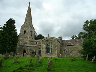
Rushton is a village and civil parish in Northamptonshire. It is about 2 miles (3.2 km) north-east of Rothwell and 3 miles (4.8 km) north-west of Kettering. The parish covers 3,200 acres (1,300 ha) and is situated on both sides of the River Ise. It contains the sites of three deserted settlements, details of which are set out below.
South Kilworth is a village and civil parish in the southern part of Leicestershire, England, south of North Kilworth. The parish has a population of 430, according to the 2001 Census, and is part of the district of Harborough. The population had risen to 513 at the 2011 census.
Tur Langton is a small village and civil parish in the Harborough district, in the heart of Leicestershire in England. Tur Langton is home to St Andrews Church and The Crown Inn, situated in the centre of the village. The next nearest settlement of significant size is the civil parish Kibworth Harcourt, found approximately 2 km west of Tur Langton. According to the 2011 census, Tur Langton had a population of 316.

Loddington is a village and civil parish about 3 miles (5 km) west of Kettering, Northamptonshire, England.

Brington is a village in Cambridgeshire, England. Brington lies approximately 9 miles (14 km) north-west of Huntingdon. Brington is in the civil parish of Brington and Molesworth. Brington is situated within Huntingdonshire which is a non-metropolitan district of Cambridgeshire as well as being a historic county of England.

Standon is a village and civil parish in the Stafford district, in the county of Staffordshire, England. Standon has a church called Church of All Saints and one school called All Saints C of E First School. In 2001 the population of the civil parish of Standon was 823, and in the 2011 census it had a population of 879.

