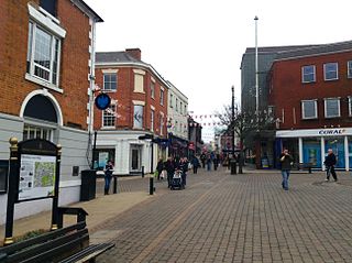
Hinckley and Bosworth is a local government district with borough status in Leicestershire, England. The council is based in Hinckley, the largest town. The borough also includes the town of Earl Shilton and numerous villages and surrounding rural areas. The Bosworth in the borough's name refers to the small market town of Market Bosworth, near which the Battle of Bosworth Field was fought in 1485.

Market Bosworth is a market town and civil parish in Leicestershire, England. At the 2001 Census, it had a population of 1,906, increasing to 2,097 at the 2011 census. It is most famously near to the site of the decisive final battle of the Wars of the Roses.

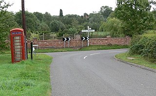
Carlton is a small rural parish located East of the river Sence in Leicestershire, England, around 2.2 miles North of Market Bosworth. According to the 2011 Census, Carlton has a population of 305 However, from 2014 it is estimated that there are around 330 people living there with a total of 283 registered electors. There are four roads in Carlton:

Sutton Cheney is a village and former civil parish, now in the parish of Dadlington and Sutton Cheney, in the borough of Hinckley and Bosworth, in the county of Leicestershire, England, near the county border with Warwickshire. In addition to the village of Sutton Cheney itself, the civil parish also contains the villages of Dadlington and Shenton, a number of farms, and the location of the Battle of Bosworth. Its closest large towns are Nuneaton and Hinckley. Its closest market town is Market Bosworth.

Hinckley and Bosworth is a constituency represented in the House of Commons of the UK Parliament since 2019 by Luke Evans, a Conservative.

Stapleton is a village and former civil parish, now in the parish of Kirkby Mallory, Peckleton and Stapleton, in the Hinckley and Bosworth district, in south-west Leicestershire, England, about ten miles south-west of Leicester city centre. Its population was 427 people at the 2001 census. In 1931 the parish had a population of 252. Stapleton was formerly a chapelry in Barwell parish, from 1866 Stapleton was a civil parish in its own right until it was abolished on 1 April 1935 and merged with Peckleton.
Markfield is a large village in both the National Forest and Charnwood Forest and in the Hinckley and Bosworth district of Leicestershire, England. The settlement dates back to at least the time of the Norman conquest and is mentioned in Domesday Book under the name Merchenefeld. A variant of this is still used as the name for the village primary school, Mercenfeld. It is to the south-east of Junction 22 of the M1, and to the south of the A50. The highest point in Markfield is shown on OS sheet 129 at 222 metres above sea level. Nearby places are Newtown Linford, Groby, Field Head, and Stanton under Bardon. In the 1841 census its population was recorded at 1,203. In the 2011 census the parish had a population of 5681. In 2012 Hinckley & Bosworth Borough Council published an overview of the Markfield conservation area.

Newbold Verdon is a village and civil parish in the county of Leicestershire, England. The parish includes Newbold Heath to the north and Brascote to the south. Originally an agricultural centre Newbold Verdon grew in size during the 1850s with the expansion of coal mining in the area. That industry has now ceased leaving Newbold Verdon as a commuter village primarily serving Leicester and Hinckley. The 2001 census recorded a population of 3,193, which had reduced to 3,012 at the 2011 census.
Snarestone is a small rural village in North West Leicestershire, England.

Higham on the Hill is a village and civil parish in the Hinckley and Bosworth district of Leicestershire, England. The population at the 2011 census was 840.

Shackerstone is a village and civil parish in the Hinckley and Bosworth district of Leicestershire, England. It is situated on the Ashby-de-la-Zouch Canal and the River Sence. According to the 2001 census the parish, which also includes the village of Barton in the Beans, had a population of 811, including Odstone which had risen to 921 at the 2011 census.
Shenton is a village and former civil parish, now in the parish of Dadlington and Sutton Cheney, in the Hinckley and Bosworth district, in the county of Leicestershire, England, situated 2.20 miles (3.54 km) south-west of Market Bosworth. Shenton was formerly a chapelry and township of the parish of Market Bosworth. The settlement is almost entirely agricultural, containing several farms. Much of the land has been in the same family since William Wollaston purchased the manor in 1625. It is essentially a privately owned estate village and has seen comparatively little modern development. It has been designated a conservation area. The settlement lies either side of the Sence Brook, which is crossed by a picturesque Victorian bridge. The area is fairly flat, and subject to flooding. In 1931 the parish had a population of 154.
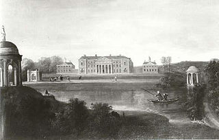
Gopsall is a former civil parish, now in the parish of Twycross, in the Hinckley and Bosworth district, in the county of Leicestershire, England. It is located between the villages of Appleby Magna, Shackerstone, Twycross and Snarestone. In 1931 the parish had a population of 13. Gopsall was formerly an extra-parochial tract, from 1858 Gopsall was a civil parish in its own right, on 1 April 1935 the parish was abolished and merged with Twycross.

Ashby Folville is a village and former civil parish, now in the parish of Gaddesby, in the Melton district of Leicestershire, England, south west of Melton Mowbray. In 1931 the parish had a population of 123.

Bagworth is a village and former civil parish, now in the parish of Bagworth and Thornton, in the Hinckley and Bosworth district, in Leicestershire, England, 9 miles (14 km) west of Leicester. In 1931 the parish had a population of 1568.

Odstone is a hamlet and former civil parish, now in the parish of Shackerstone, in the Hinckley and Bosworth district of Leicestershire, England. It stands on a marked promontory of high ground between two river valleys. In 1931 the parish had a population of 142.

The River Sence is a river which flows in Leicestershire, England. The tributaries of the Sence, including the Saint and Tweed, fan out over much of western Leicestershire from Charnwood Forest and Coalville in the north-east to Hinckley and almost to Watling Street in the south and south-west. Its watershed almost coincides with Hinckley and Bosworth Borough of Leicestershire, which was formed in 1974 by amalgamation of Market Bosworth Rural District and Hinckley Urban District. It flows into the Anker, which in turn flows into the River Tame. It is part of the wider River Trent catchment, which covers much of central England. In 1881, Sebastian Evans wrote that the usual names for this river were Shenton Brook and Sibson Brook.

Congerstone is a village and former civil parish, now in the parish of Shackerstone, in the Hinckley and Bosworth district, in Leicestershire, England. It is three miles north west of Market Bosworth, of which it was historically a daughter parish. It is near the Ashby-de-la-Zouch Canal and the A444 road. In 1931 the parish had a population of 209.
Bilstone is a small village and former civil parish, now in the parish of Shackerstone, in the Hinckley and Bosworth district of Leicestershire, England. It is approximately 12 miles (19 km) west from the county town and city of Leicester, and 2 miles (3.2 km) east from Twycross and the A444 road. In 1931 the parish had a population of 68.


