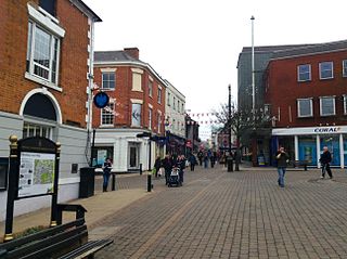
Hinckley and Bosworth is a local government district with borough status in Leicestershire, England. The council is based in Hinckley, the largest town. The borough also includes the town of Earl Shilton and numerous villages and surrounding rural areas. The Bosworth in the borough's name refers to the small market town of Market Bosworth, near which the Battle of Bosworth Field was fought in 1485.

Barwell is a civil parish and large village in Leicestershire, England, with a population of 8,750 residents, Increasing to 9,022 at the 2011 census, the name literally translates as "Stream of the Boar" and is said to originate from a boar that used to drink from the well near a brook in Barwell. It was originally known as Borewell, but later became "Barwell", the name in use today. The brook is now called the River Tweed, and is a tributary of the River Trent.

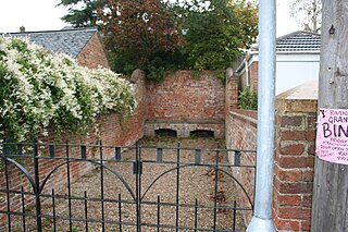
Dadlington is a village and former civil parish, now in the parish of Dadlington and Sutton Cheney, in the Hinckley and Bosworth district, in Leicestershire, England. It is situated between Hinckley, Market Bosworth and Nuneaton. In 1931 the parish had a population of 200.

Sutton Cheney is a village and former civil parish, now in the parish of Dadlington and Sutton Cheney, in the borough of Hinckley and Bosworth, in the county of Leicestershire, England, near the county border with Warwickshire. In addition to the village of Sutton Cheney itself, the civil parish also contains the villages of Dadlington and Shenton, a number of farms, and the location of the Battle of Bosworth. Its closest large towns are Nuneaton and Hinckley. Its closest market town is Market Bosworth.
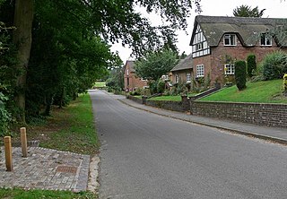
Desford is a village and civil parish in the Hinckley and Bosworth district of England, 7 miles (11 km) west of the centre of Leicester and around 7 miles north east of Hinckley. Situated on a hill approximately 400 feet above sea level, the parish includes the hamlets of Botcheston and Newtown Unthank and a scattered settlement at Lindridge. The population at the 2021 census had increased to 4,592. Desford is in the Doomsday Book of 1086 but the name itself is older than that meaning Deor's Ford suggesting an Anglo Saxon origin. Another suggestion is that it means 'ford frequented with wild animals'.

Hinckley and Bosworth is a constituency represented in the House of Commons of the UK Parliament since 2019 by Luke Evans, a Conservative.
Kirkby Mallory is a village and former civil parish, now in the parish of Kirkby Mallory, Peckleton and Stapleton, in the Hinckley and Bosworth district of Leicestershire, England. In 1931 the parish had a population of 231.
Ravenstone is a village and former civil parish, now in the parish of Ravenstone with Snibstone, in the North West Leicestershire district, in the county of Leicestershire, England. It is within the National Forest, just off the A511 road between Coalville and Ashby-de-la-Zouch, in 2001 it had a population of 2,149.

Ratcliffe Culey is a village and former civil parish, now in the parish of Witherley, in the Hinckley and Bosworth district, in Leicestershire, England, near the county boundary with Warwickshire. In 1931 the parish had a population of 184.

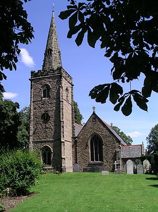
Peckleton is a small village and former civil parish, now in the parish of Kirkby Mallory, Peckleton and Stapleton, in the Hinckley and Bosworth district of Leicestershire, England. The villages of Kirkby Mallory and Stapleton also form part of the parish. Thus, according to the 2001 census, the parish had a population of 1,077, falling slightly to 1,067 at the 2011 census. Due east of the village is Peckleton Common, adjacent to The Glebe Fisheries, an angling centre of excellence completed in 1996. The local church, St Mary Magdalene, is located just south of the village centre.

Upton, is a small hamlet and former civil parish, now in the parish of Sheepy, in the Hinckley and Bosworth district, in the county of Leicestershire, England. It is on the Leicestershire and Warwickshire border west of Shenton and south-east of Sibson. In 1931 the parish had a population of 104.
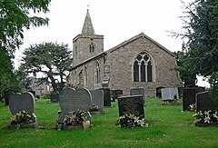
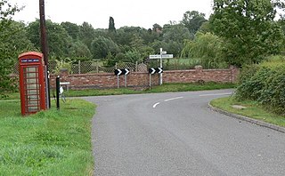
Shenton is a village and former civil parish, now in the parish of Dadlington and Sutton Cheney, in the Hinckley and Bosworth district, in the county of Leicestershire, England, situated 2.20 miles (3.54 km) south-west of Market Bosworth. Shenton was formerly a chapelry and township of the parish of Market Bosworth. The settlement is almost entirely agricultural, containing several farms. Much of the land has been in the same family since William Wollaston purchased the manor in 1625. It is essentially a privately owned estate village and has seen comparatively little modern development. It has been designated a conservation area. The settlement lies either side of the Sence Brook, which is crossed by a picturesque Victorian bridge. The area is fairly flat, and subject to flooding. In 1931 the parish had a population of 154.

Odstone is a hamlet and former civil parish, now in the parish of Shackerstone, in the Hinckley and Bosworth district of Leicestershire, England. It stands on a marked promontory of high ground between two river valleys. In 1931 the parish had a population of 142.

The River Sence is a river which flows in Leicestershire, England. The tributaries of the Sence, including the Saint and Tweed, fan out over much of western Leicestershire from Charnwood Forest and Coalville in the north-east to Hinckley and almost to Watling Street in the south and south-west. Its watershed almost coincides with Hinckley and Bosworth Borough of Leicestershire, which was formed in 1974 by amalgamation of Market Bosworth Rural District and Hinckley Urban District. It flows into the Anker, which in turn flows into the River Tame. It is part of the wider River Trent catchment, which covers much of central England. In 1881, Sebastian Evans wrote that the usual names for this river were Shenton Brook and Sibson Brook.
Newton Harcourt is a village and former civil parish, now in the parish of Wistow, in the Harborough district, in the English county of Leicestershire, and lies 7 miles south-east of the city of Leicester on the northern ridge of the River Sence valley. In 1931 the parish had a population of 142.

The River Tweed is a short tributary of the River Sence. It rises around the west of the village of Barwell, Leicestershire, England and flows westwards, crossing the A447 at Abraham's Bridge.

Foston is a deserted medieval village and former civil parish, now in the parish of Kilby, in the Blaby district of Leicestershire and lies approximately 6.1 miles (9.8 km) south of the city of Leicester, England. The settlement name Foston means "Fotr's farm/settlement": "Fotr" is an Old Norse personal name, and "tūn" in Old English means an enclosure, farmstead, village or estate. In 1931 the parish of Foston had a population of 36. On 1 April 1935 the parish was abolished and merged with Kilby.
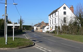
Bilstone is a small village and former civil parish, now in the parish of Shackerstone, in the Hinckley and Bosworth district of Leicestershire, England. It is approximately 12 miles (19 km) west from the county town and city of Leicester, and 2 miles (3.2 km) east from Twycross and the A444 road. In 1931 the parish had a population of 68.