Bolsover District | |
|---|---|
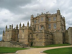 Bolsover Castle | |
 Shown within Derbyshire | |
| Sovereign state | United Kingdom |
| Constituent country | England |
| Region | East Midlands |
| Ceremonial county | Derbyshire |
| Admin. HQ | Clowne |
| Government | |
| • Type | Bolsover District Council |
| • Leadership: | Leader & Cabinet |
| • Executive: | Labour |
| • MPs: | Natalie Fleet (L) |
| Area | |
• Total | 60 sq mi (160 km2) |
| • Rank | 162nd |
| Population (2022) | |
• Total | 81,553 |
| • Rank | Ranked 278th |
| • Density | 1,300/sq mi (510/km2) |
| Ethnicity (2021) | |
| • Ethnic groups | |
| Religion (2021) | |
| • Religion | List
|
| Time zone | UTC+0 (Greenwich Mean Time) |
| • Summer (DST) | UTC+1 (British Summer Time) |
| Postcode | |
| ONS code | 17UC (ONS) E07000033 (GSS) |
| Ethnicity | 99.1% White[ citation needed ] |
Bolsover District is a local government district in Derbyshire, England. It is named after the town of Bolsover, which is near the geographic centre of the district, but the council is based in the large village of Clowne to the north. The district also includes the town of Shirebrook and several villages and surrounding rural areas.
Contents
- History
- Governance
- Political control
- Leadership
- Composition
- Elections
- Premises
- Media
- Building developments
- Parishes
- References
The neighbouring districts are Amber Valley, North East Derbyshire, Chesterfield, Rotherham, Bassetlaw, Mansfield, and Ashfield.

