The modern district was formed on 1 April 1974 under the Local Government Act 1972. The new district covered the whole area of three former districts, which were all abolished at the same time:[4]
The new district was named Mansfield after its main town.[5][6] Unusually for a district taking the same name as a former borough, the new Mansfield district was not granted borough status. Instead charter trustees were established for the area of the former borough of Mansfield, with responsibility for looking after the civic regalia of the town.[7]
The first election to the modern district council was held in 1973, initially operating as a shadow authority alongside the outgoing authorities until coming into its powers on 1 April 1974. Since 1974 political control of the council has been as follows:[13][14]
Following the 2023 election,[22] and subsequent by-elections and changes of allegiance up to May 2025, the composition of the council (excluding the elected mayor's seat) was:[23][24]
The Manor House, former headquarters of Mansfield Woodhouse Urban District Council, in the second-largest settlement of the districtWarsop old Town Hall, in the third-largest settlement of the district
Since the last boundary changes in 2023 the district has been divided in 36 wards, each of which elects one councillor. Elections are held every four years.[27]
Premises
The council is based at the Civic Centre on Chesterfield Road South in Mansfield.[28] The building was purpose-built for the council at a cost of £6.7million and opened on 1 September 1986.[29][30]
In 2023, Mansfield District Council was awarded £20 million of funding from the UK Government for the Mansfield Connect Project, which aims to regenerate the former Beales Department store into a multi-agency and community hub for Mansfield District Council employees amongst other agencies.[31]
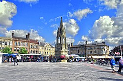
Geography
Mansfield and Mansfield Woodhouse form a single urban area, which also includes Forest Town. The only civil parish in the district is Warsop; the rest of the district, corresponding to the combined area of the pre-1974 borough of Mansfield and Mansfield Woodhouse urban district, is an unparished area.[12] The parish of Warsop contains the settlements of Market Warsop, Church Warsop and Meden Vale plus surrounding rural areas, including areas of woodland which form part of Sherwood Forest. Part of the urban area of Pleasley, most of which is in the Bolsover district of Derbyshire, extends across the boundary into Mansfield district.
On a wreath Or and Azure on a mount Vert an oak tree Proper between two lions rampant combatant Or armed and langued Gules the dexter lion supporting by its sinister paw a pickaxe passing behind the tree in bend the haft Or the sinister lion supporting by its sinister paw a pickaxe passing in front of the tree in bend sinister its haft also Or and the blades of both Sable resting upon the ground.
Escutcheon
Quarterly Or and Azure in dexter chief and in sinister chief a Roman helmet proper lined Gules and in base the attires of a stag conjoined at their burrs Proper over all a cross flory per cross counterchanged of the field.
Supporters
On the dexter side a stag per fesse Verte and Or semée of oak Leaves counterchanged attired and unguled Gold langued Gules and gorged with a duke's coronet Or and on the sinister side a lion per fesse Vert and Or semée of oak leaves counterchanged armed and langued Gules and gorged with a duke's coronet Gold.
Motto
Sicut Quercus Virescit Industria (Industry Flourishes Like The Oak)
Badge
The attires of a stag conjoined at their burrs Proper braced at their beams with a cross flory per cross Azure and Or.
↑"Compositions Calculator". The Elections Centre. University of Exeter. Retrieved 21 May 2025. (Put "Mansfield" in search box to see specific results.)
This page is based on this Wikipedia article Text is available under the CC BY-SA 4.0 license; additional terms may apply. Images, videos and audio are available under their respective licenses.