List of places of interest in Nottinghamshire

Last updated

This is a list of places of interest in the British county of Nottinghamshire. See List of places in Nottinghamshire for a list of settlements in Nottinghamshire.

Contents

1 Rushcliffe, 2 Broxtowe, 3 Ashfield, 4 Gedling, 5 Newark and Sherwood, 6 Mansfield, 7 Bassetlaw, 8 Nottingham. Nottinghamshire Ceremonial Numbered.png
1 Rushcliffe, 2 Broxtowe, 3 Ashfield, 4 Gedling, 5 Newark and Sherwood, 6 Mansfield, 7 Bassetlaw, 8 Nottingham.

Ashfield

NameImageLocationTypeDescriptionNotes
Annesley Old Church Annesley Old Church - geograph.org.uk - 1830919.jpg Annesley Church Medieval church built in 1356 by the Annesley family. Grade I listed building [1]
Scheduled Ancient Monument

Bassetlaw

NameImageLocationTypeDescriptionNotes
Chesterfield Canal Chesterfield Canal near renishaw.JPG West Stockwith Canal Shared with Derbyshire and South Yorkshire
46 mile-long canal, built in 1777, running 46 miles from West Stockwith to Chesterfield.
Site of Special Scientific Interest
Clumber Park Limetree Avenue, Clumber Park - geograph.org.uk - 1052852.jpg The Dukeries Country park Former seat of the Earl of Lincoln. Site of Special Scientific Interest
National Trust property
Creswell Crags Caves Creswell Crags - geograph.org.uk - 90873.jpg Cresswell Gorge Shared with Derbyshire
Limestone gorge containing the northernmost cave art in Europe.
Site of Special Scientific Interest
Idle Valley Nature Reserve Bug Arch at Idle Valley Nature Reserve.jpg Retford Nature reserve Site of Special Scientific Interest
Mattersey Priory Mattersey Priory ruins.jpg Mattersey Priory English Heritage property
Mr Straw's House Mr Straws House.jpg Worksop Historic House Edwardian house built in 1905 with an interior that has remained largely unchanged since the 1920s. National Trust property
River Idle RiverIdleAtIdleStop.jpg Markham Moor River 26 mile-long river running from Markham Moor to Misterton. Site of Special Scientific Interest
Serlby Hall Hall Through the Trees - geograph.org.uk - 194752.jpg Blyth Country house 18th century Country house built in 1740 by James Paine for John Monckton, 1st Viscount Galway. Grade I listed building
St. Mary and St. Martin's Church Blyth Church - geograph.org.uk - 53326.jpg Blyth Church Medieval church built in 1088, with a priory that is one of the oldest examples of Norman architecture in the country. Grade I listed building
St. Peter's Church St Peters Church Clayworth Notts - geograph.org.uk - 92797.jpg Clayworth Church 11th century church with parts dating from a substantial restoration by John Oldrid Scott in 1874. Grade I listed building

Other

Broxtowe

NameImageLocationTypeDescriptionNotes
Attenborough Nature Reserve Attenborough Nature Reserve Visitor Centre - geograph.org.uk - 763738.jpg Attenborough Nature reserve Site of Special Scientific Interest
D. H. Lawrence Birthplace Museum DH Lawrence birthplace museum - geograph-1814503.jpg Museum Eastwood Museum dedicated to the life of D. H. Lawrence.
Durban House Heritage Centre Durban House Heritage Centre 2013-05-05 16-37.jpg Museum Eastwood Museum dedicated to the history of Eastwood.

Gedling

NameImageLocationTypeDescriptionNotes
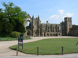
Newstead Abbey Newstead Abbey 02.jpg Newstead Priory Augustinian priory founded in 1170, best known as the home of Lord Byron. Grade I listed building
Papplewick Pumping Station Papplewick Pumping Station.jpg Papplewick Pumping station Victorian pumping station built in 1881 to provide water for the city of Nottingham. Grade II* listed building
Scheduled Ancient Monument

Mansfield

Other

Newark and Sherwood

NameImageLocationTypeDescriptionNotes
British Horological Institute Upton Hall - geograph.org.uk - 4563.jpg Upton Museum
Newark Air Museum Newark Air Museum, Shackleton MR.3 (4229180808).jpg Winthorpe Museum
Newark Castle Newark Castle, 2008.jpg Newark-on-Trent Castle Grade I listed building
Rufford Abbey Rufford Hall from SW.JPG Rufford Abbey English Heritage property
The Workhouse Workhouse268.jpg Southwell Museum National Trust property

Other

Nottingham

NameImageLocationTypeDescriptionNotes
Colwick Cutting View from Colwick Woods park - geograph.org.uk - 861161.jpg Sneinton Woodland Site of Special Scientific Interest
Galleries of Justice Museum Galleries of Justice Museum Building.jpg Nottingham Museum
Green's Mill Green's windmill.jpg Sneinton Windmill Grade II listed building
Nottingham Castle Nottingham Castle Gate 2009.jpg Nottingham Castle Grade I listed building
Nottingham Contemporary Nottingham Contemporary - geograph-1825342.jpg Nottingham Museum
Nottingham Transport Heritage Centre Three operatuion NTHC buses.JPG Ruddington Museum Museum dedicated to transport, housed in the northern terminus of the Great Central Railway.
Wollaton Hall Wollaton Hall Nov2010.jpg Nottingham Country house Elizabethan country house built in 1580, now a museum dedicated to natural history. Grade I listed building

Other

Rushcliffe

NameImageLocationTypeDescriptionNotes
Holme Pierrepont Hall Holme Pierrepont Hall Nottinghamshire.JPG Holme Pierrepont Historic House Grade I listed building

Related Research Articles

<span class="mw-page-title-main">Nottinghamshire</span> County of England

Nottinghamshire is a ceremonial county in the East Midlands of England. The county borders South Yorkshire to the north-west, Lincolnshire to the east, Leicestershire to the south, and Derbyshire to the west. The largest settlement is the city of Nottingham (323,632), which is also the county town.

<span class="mw-page-title-main">Hucknall</span> Market town in Nottinghamshire, England

Hucknall, formerly Hucknall Torkard, is a market town in the Ashfield district of Nottinghamshire, England. It lies 7 miles (11 km) north of Nottingham, 7 miles (11 km) southeast of Kirkby-in-Ashfield, 9 miles (14 km) from Mansfield and 10 miles (16 km)south of Sutton-in-Ashfield. It is the second-largest town in the Ashfield district after Sutton-in-Ashfield.

<span class="mw-page-title-main">Sutton-in-Ashfield</span> Market town in Nottinghamshire, England

Sutton-in-Ashfield is a market town in Nottinghamshire, England, with a population of 48,527 in 2019. It is the largest town in the district of Ashfield, four miles west of Mansfield, 2 miles (3 km) from the Derbyshire border and 12 miles (19 km) north of Nottingham.

<span class="mw-page-title-main">Blidworth</span> Village and civil parish in Nottinghamshire, England

Blidworth is a village and civil parish approximately five miles east of Mansfield, Nottinghamshire, England. The population of the civil parish at the 2011 census was 4,457, this dropped to 4,295 in the 2021 census. Its history can be traced back to the 10th century, although many of the current houses were built in the first half of the 20th century to provide housing for workers at Blidworth Colliery (1926–1989). These are mainly in estates north of Dale Lane, known as New Blidworth. The area around Main Street, west of Beck Lane and including the church, is Old Blidworth, containing some of the oldest buildings. Blidworth Bottoms is a hamlet about 0.5 km south of Old Blidworth, while Haywood Oaks is the portion of the village south of Dale Lane and the south eastern rural area of the parish surrounding Haywood Oaks Lane.

<span class="mw-page-title-main">Kirkby-in-Ashfield</span> Town in Nottinghamshire, England

Kirkby-in-Ashfield is a market town in the Ashfield District of Nottinghamshire, England. With a population of 25,265, it is a part of the wider Mansfield Urban Area. The Head Offices of Ashfield District Council are located on Urban Road in the town centre.

<span class="mw-page-title-main">Ashfield (UK Parliament constituency)</span> Parliamentary constituency in the United Kingdom, 1955 onwards

Ashfield is a constituency represented in the House of Commons of the UK Parliament. It is in the English county of Nottinghamshire, East Midlands, to the north west of the city of Nottingham in the Erewash Valley along the border with neighbouring county Derbyshire.

<span class="mw-page-title-main">Ashfield cum Thorpe</span> Human settlement in England

Ashfield cum Thorpe is a civil parish in the Mid Suffolk district of Suffolk, England, between the town of Framlingham to the East and the village of Debenham to the West.

<span class="mw-page-title-main">Charles Eamer Kempe</span> English designer and manufacturer of stained glass

Charles Eamer Kempe was a British Victorian era designer and manufacturer of stained glass. His studios produced over 4,000 windows and also designs for altars and altar frontals, furniture and furnishings, lychgates and memorials that helped to define a later nineteenth-century Anglican style. The list of English cathedrals containing examples of his work includes: Chester, Gloucester, Hereford, Lichfield, Wells, Winchester and York. Kempe's networks of patrons and influence stretched from the Royal Family and the Church of England hierarchy to the literary and artistic beau monde.

<span class="mw-page-title-main">Hidden Valleys</span> Rural area in Nottinghamshire

Hidden Valleys is a name, coined in 2004, used to describe an area of interesting historical and scenic value between the city of Nottingham and the town of Mansfield in the English ceremonial county of Nottinghamshire. Promotional literature and tourist information for the Hidden Valleys were created to encourage tourism in an area that had been blighted by industrial decline. Partners in the project were: Ashfield District Council; Gedling Borough Council; the East Midlands Development Agency; Nottinghamshire County Council; and the Coalfields Regeneration Trust. It was intended by the partners that the name would help the Ashfield area compete with the Peak District and Sherwood Forest.

<span class="mw-page-title-main">Skegby</span> Human settlement in England

Skegby is a village in the Ashfield district of Nottinghamshire, England. It lies on the B6014 road, two miles west of Mansfield and one mile north of Sutton-in-Ashfield, close to Stanton Hill. Skegby sits on both sides of a deep valley near the source of the River Meden. It was a civil parish until 1935, when it was absorbed into Sutton-in-Ashfield.

Richard Charles Sutton was an architect based in Nottingham. He was born 1834 and died on 18 October 1915.

<span class="mw-page-title-main">All Saints' Church, Annesley</span> Church

All Saints' Church, Annesley is a parish church in the Church of England in Annesley, Nottinghamshire.

<span class="mw-page-title-main">Church of St Mary Magdalene, Sutton-in-Ashfield</span> Church

The Church of St Mary Magdalene, Sutton-in-Ashfield is a parish church in the Church of England in Sutton-in-Ashfield, Nottinghamshire.

<span class="mw-page-title-main">St Helen's Church, Selston</span> Church

St. Helen's Church, Selston is a parish church in the Church of England in Selston, Nottinghamshire.

The Church of St Peter and St Paul, Hucknall is a parish church in the Church of England in the Westville suburb of Hucknall, Nottinghamshire.

<span class="mw-page-title-main">C. Hodgson Fowler</span>

Charles Hodgson Fowler was a prolific English ecclesiastical architect who specialised in building and, especially, restoring churches.

<span class="mw-page-title-main">James Fowler (architect)</span> English church architect

James Fowler, known as 'Fowler of Louth', is best known as a Victorian English church architect and associated with the restoration and renovation of churches. However, he was also the architect of a wide variety of other buildings. A listing of his work compiled in 1991 traced over 210 buildings that he designed or restored. He is known to be the architect for 24 new churches and his work also included 40 vicarages or rectories, 13 schools, four almshouses, a Savings Bank, a convalescent home and hospital as well as country houses and estate housing. Most of Fowler’s work was in Lincolnshire and particularly around Louth, but he also worked in the East Riding of Yorkshire, Nottinghamshire, Staffordshire, Suffolk, London, Sussex and Devon.

<span class="mw-page-title-main">Mansfield</span> Market town in Nottinghamshire, England

Mansfield is a market town and the administrative centre of the Mansfield District in Nottinghamshire, England. It is the largest town in the wider Mansfield Urban Area and the second largest settlement in Nottinghamshire. It gained the Royal Charter of a market town in 1227. The town lies in the Maun Valley, 12 miles (19 km) north of Nottingham. It had a population of 110,500 at the 2021 census, according to the Office for National Statistics. Mansfield is the one local authority in Nottinghamshire with a publicly elected mayor.

<span class="mw-page-title-main">Louis Ambler</span> English architect (1862–1946)

Louis Ambler FSA FRIBA was an English architect.

References

  1. "Ashfield District Council - Annesley Old Church". www.ashfield.gov.uk. Retrieved 2024-07-30.