Idle Valley Nature Reserve

Last updated

Idle Valley Nature Reserve
Bug Arch at Idle Valley Nature Reserve.jpg
Bug Arch at the entrance of the nature reserve, with Bellmoor Lake in the distance.
Nottinghamshire UK location map.svg
Red pog.svg
Location Retford, Nottinghamshire, England
Coordinates 53°20′21″N0°57′56″W / 53.33928°N 0.96543°W / 53.33928; -0.96543
Area320 hectares (790 acres)
Created2002 (2002)
Operated by Nottinghamshire Wildlife Trust
Status SSSI (for map see Map )

The Idle Valley Nature Reserve, also known as Lound Gravel Pits or Sutton and Lound Gravel Pits, is a wetland Site of Special Scientific Interest (SSSI) situated north-west of the town of Retford in the Bassetlaw district of north Nottinghamshire. The nature reserve is situated along the western bank of the River Idle and east of the villages of Sutton cum Lound and Lound. The nature reserve is managed by the Nottinghamshire Wildlife Trust.

Contents

History

The area that now forms the nature reserve was quarried for sand and gravel from the mid-1940s onwards. Tarmac Limited acquired the quarries in 1981. Bellmore Quarry was at the southern end of the site, and around 350,000 tonnes of sand and gravel were extracted every year until extraction ceased in 2005. Lound Quarry was to the north of Bellmore, and produced around 500,000 tonnes of agregate every year, until its closure in 2011. It has been estimated that the quarries supplied some 30 million tonnes of sand and gravel to the local construction industry, during the lifetime of the quarrying operation. The mineral extraction consent under which the quarry operated required that the land should be restored for agricultual use once it ceased to be a quarry. This required huge volumes of fill, as between 2 and 3 metres (6.6 and 9.8 ft) of material had been removed over the entire site. Initially, pulverised fuel ash (PFA) from Cottam power station was turned into a slurry and pumped to the site by Powergen, but Powergen ceased to supply the PFA in the early 1990s, and the large voids that were still left filled with water. They gradually regenerated naturally, providing habitat for breeding, wintering and passage birds. [1] [2] [3]

In 2002, Natural England designated the site, formally known as the Sutton And Lound Gravel Pits, as an SSSI. [4] Tarmac subsequently agreed to donate all of its land within the SSSI to the Nottinghamshire Wildlife Trust, to ensure its long-term care and management. [5] The Idle Valley Learning Centre which offers diploma courses in environmental conservation from North Nottinghamshire College was opened in 2008 and is owned by the college. [1] The nature reserve received £1 million in Lottery funding in 2008. [2] [6] Paths, fencing and clearing of land has also taken place since the handover of the land, [5] the efforts of which in 2011 won Tarmac the Mineral Products Association Cooper-Heyman Cup double award. [7] In 2017, a new boardwalk was constructed adjacent to the visitor centre in order to improve access to the reserve, as part of a partnership between the Nottinghamshire Wildlife Trust and the Rotary club of Retford. [8]

Geography

The reserve is over 3 miles (4.8 km) long from the northernmost tip to the southern base of the site and covers over 1,100 acres (450 ha). [1] It is the largest wetland in Nottinghamshire and the fifth largest SSSI in the county, covering 790 acres (320 ha). [1]

Access and facilities

Idle Valley Nature Reserve is next to the A638 road and buses stop outside the reserve. Multiple public rights-of-way cross the reserve, including one around the majority of Bellmoor Lake. The reserve is open all year, and access is free, although visitors are asked to donate for using the car park. The main part of the reserve is accessed from the visitor centre. The northern end of the reserve can be accessed by walking from the visitor centre, although it is also accessible via Lound village.

The visitor centre and shop are open daily except Christmas Day. Most of the reserve and its facilities are wheelchair accessible, but some areas can be muddy and unsuitable for wheelchairs at times. [9]

Fauna and flora

Birds

The site contains a rich number of breeding wetland birds and a nationally important population of wintering gadwall, one of 17 species of wildfowl that can be regularly found at the site each year. Key breeding species include shoveler, great crested grebe and tufted duck, along with locally scarce breeding species such as wigeon and pochard. A number of breeding waders are also present, such as lapwing, Eurasian oystercatcher, little ringed plover and redshank. [10] The gravel pits contain a large winter population of coot. [11] 259 bird species have been recorded across the site, including nationally rare species. Recently, these have included a gull-billed tern in 2015 and blue-winged teal and lesser scaup in 2014. [12] [13]

Mammals

In 2021, Nottinghamshire Wildlife Trust announced it had plans to reintroduce beavers into the reserve, after the species had been absent from Nottinghamshire for over 400 years. [14] A licence application for the reintroduction of beavers submitted by the Trust to Natural England was approved in June 2021. [15]

Related Research Articles

Derbyshire Wildlife Trust is one of 46 local Wildlife Trusts around the UK working to promote and protect local wildlife. It covers the whole of Derbyshire and was founded in 1962 in response to environmental threats to the local countryside, since when it has continued to grow. The trust is now based at East Mill on the River Derwent in the town of Belper, Derbyshire. It is a registered charity, supported by more than 14,000 members and over 500 volunteers.

<span class="mw-page-title-main">River Idle</span> River in Nottinghamshire, England

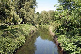
The River Idle is a river in Nottinghamshire, England whose source is the confluence of the River Maun and River Meden near Markham Moor. The Idle flows north from its source through Retford and Bawtry before entering the River Trent at West Stockwith. Its main tributaries are the River Poulter and the River Ryton. The river is navigable to Bawtry, and there is a statutory right of navigation to Retford. Most of the land surrounding the river is a broad flood plain and the river is important for conservation, with Sites of Special Scientific Interest being designated along its course.

<span class="mw-page-title-main">Cotswold Water Park</span> Lake system and park in England

The Cotswold Water Park is the United Kingdom's largest marl lake system, straddling the Wiltshire–Gloucestershire border, north-west of Cricklade and south of Cirencester. There are 180 lakes, spread over 42 square miles (110 km2).

<span class="mw-page-title-main">Brandon Marsh nature reserve</span> Nature reserve in Warwickshire, England

Brandon Marsh is a Site of Special Scientific Interest (SSSI) and nature reserve in Warwickshire, England. It is situated adjacent to the River Avon, near the village of Brandon, a few miles east of Coventry.

<span class="mw-page-title-main">Sevenoaks Gravel Pits</span>

Sevenoaks Gravel Pits is a 73.7-hectare (182-acre) biological Site of Special Scientific Interest on the northern outskirts of Sevenoaks in Kent. It is managed by Kent Wildlife Trust as the Sevenoaks Wildlife Reserve and Jeffery Harrison Visitor Centre.

Sutton Cum Lound is a village located in Bassetlaw, north Nottinghamshire. It is located 3 miles from Retford. The civil parish is called Sutton. According to the 2001 census it has a population of 687, including Tithby and falling slightly to 673 at the 2011 census. The parish church of St Bartholomew is Norman, rebuilt in the Perpendicular style, with "unbridled curvilinear tracery" in the chancel windows. The village has a primary school. It borders the village of Barnby Moor which is about 1 mile away and is also very close to the village of Lound. The village has a number of public footpaths and walks such as those on Mire Hill.

Lound is a village in Nottinghamshire, England, four miles north of Retford. It has a population of 493, reducing to 471 at the 2011 census. The village is of Danish origin dating from the 8th century with a street running along the spine of the village, leading on to Lound Low Road. The oldest houses are tofts which are endways on to the street with strips of land running back from the road. Nearby villages are Sutton cum Lound and Mattersey.

<span class="mw-page-title-main">Lackford Lakes</span>

Lackford Lakes is a 105.8-hectare (261-acre) biological Site of Special Scientific Interest (SSSI) north and east of Lackford in Suffolk. The SSSI is part of the 131-hectare (320-acre) Lackford Lakes nature reserve, which is managed by the Suffolk Wildlife Trust.

<span class="mw-page-title-main">Attenborough Nature Reserve</span> Nature reserve in Nottinghamshire, England

Attenborough Nature Reserve is a nature reserve at Attenborough, Nottinghamshire, England, located 5 mi (8 km) south west of Nottingham city centre. It is owned and managed by Nottinghamshire Wildlife Trust, supported by Broxtowe Borough Council, following the completion of purchase from Cemex UK in December 2020.

<span class="mw-page-title-main">Mid Colne Valley</span>

Mid Colne Valley is a 132 hectare biological Site of Special Scientific Interest in Harefield in the London Borough of Hillingdon and Denham in South Buckinghamshire. Its main importance lies in its extensive diversity of birdlife in lakes in former gravel pits.

<span class="mw-page-title-main">Summer Leys</span>

Summer Leys is a local nature reserve at Wollaston in the Upper Nene Valley, in Northamptonshire, England. It is owned by the Wildlife Trust for Bedfordshire, Cambridgeshire and Northamptonshire.

<span class="mw-page-title-main">Amwell Quarry</span>

Amwell Quarry or Amwell Nature Reserve is a 37 hectare biological Site of Special Scientific Interest in Great Amwell in Hertfordshire. The planning authority is East Hertfordshire District Council. It is also part of the Lee Valley Ramsar Site and Special Protection Area, and is owned and managed by the Hertfordshire and Middlesex Wildlife Trust.

<span class="mw-page-title-main">Fingringhoe Wick</span>

Fingringhoe Wick is a 48.6-hectare (120-acre) nature reserve in Fingringhoe in Essex. It is managed by the Essex Wildlife Trust, which runs a visitor centre on the site. It is part of the Colne Estuary Site of Special Scientific Interest, Ramsar site and Nature Conservation Review site.

<span class="mw-page-title-main">Upper Nene Valley Gravel Pits</span>

Upper Nene Valley Gravel Pits is a 1,382.4 hectare biological Site of Special Scientific Interest in a chain of flooded gravel pits along 35 kilometres of the valley of the River Nene between Northampton and Thorpe Waterville in Northamptonshire. It is a Ramsar wetland site of international importance, a Special Protection Area under the European Communities Birds Directive and part of the Nene Valley Nature Improvement Area. It is also part of the River Nene Regional Park. Two areas are managed by the Wildlife Trust for Bedfordshire, Cambridgeshire and Northamptonshire, Summer Leys and Titchmarsh Nature Reserve.

<span class="mw-page-title-main">Ditchford Lakes and Meadows</span> Nature reserve in the United Kingdom

Ditchford Lakes and Meadows is a 31.1-hectare (77-acre) nature reserve Northamptonshire. It is managed by the Wildlife Trust for Bedfordshire, Cambridgeshire and Northamptonshire. It is part of the Upper Nene Valley Gravel Pits Site of Special Scientific Interest, Ramsar wetland site of international importance, and Special Protection Area under the European Communities Birds Directive.

<span class="mw-page-title-main">Higham Ferrers Pits</span>

Higham Ferrers Pits is a 10 hectare nature reserve Northamptonshire. It is managed by the Wildlife Trust for Bedfordshire, Cambridgeshire and Northamptonshire. It is part of the Upper Nene Valley Gravel Pits Site of Special Scientific Interest, Ramsar internationally important wetland site and Special Protection Area under the EC Birds Directive.

<span class="mw-page-title-main">Hay-a-Park Gravel Pit</span> Site of Special Scientific Interest in North Yorkshire, England

Hay-a-Park Gravel Pit is a Site of Special Scientific Interest, or SSSI, adjacent to the east side of the town of Knaresborough, North Yorkshire, England. Having been a disused and flooded quarry since the 1970s, it now consists of the large Hay-a-Park Lake and three smaller ponds, besides associated reedbeds, scrub, woodland and grassland. It was designated as a SSSI in 1995 because it supports a number of wintering birds, including a large flock of goosander. This site is "one of the most northerly inland breeding populations of reed warbler in Britain." Hay-a-Park was once part of a royal park, an early landowner being Edward II.

<span class="mw-page-title-main">Deeping Lakes Nature Reserve</span>

Deeping Lakes Nature Reserve, also known as Deeping Gravel Pits is a local nature reserve with an area of over 160 acres located south-east of Deeping St James in Lincolnshire, England. It includes part of the Deeping Gravel Pits SSSI and is placed within a Higher Level Stewardship scheme.

References

  1. 1 2 3 4 "Busy Learning In The Idle Valley" (PDF). Climate Nottinghamshire. Archived from the original (PDF) on 17 November 2010. Retrieved 17 June 2012.
  2. 1 2 "Grant helps wetlands development". BBC News. 23 November 2009. Retrieved 17 June 2012.
  3. "Restoration success at Tarmac Quarry". Tarmac Limited. 25 March 2011. Archived from the original on 20 May 2011. Retrieved 17 June 2012.{{cite web}}: CS1 maint: unfit URL (link)
  4. "Sutton and Lound Gravel Pits SSSI". Natural England. Retrieved 6 May 2020.
  5. 1 2 "Partnering key to restoration success". Aggregates Business News. Archived from the original on 18 December 2014. Retrieved 17 June 2012.
  6. "In pictures: Idle Valley Nature Reserve". BBC News. 23 November 2009. Retrieved 17 June 2012.
  7. "MPA COOPER-HEYMAN CUP". Tarmac Limited. Archived from the original on 29 July 2012. Retrieved 17 June 2012.
  8. "New Boardwalk at Idle Valley". Lincolnshire Live. Retrieved 2 June 2019.
  9. "Idle Valley". Nottinghamshire Wildlife Trust. Retrieved 6 July 2020.
  10. "Sutton and Lound Gravel Pits- Reasons for Designation" (PDF). Natural England. Retrieved 6 July 2020.
  11. Catley, Graham P. (1996). Where to watch birds in the East Midlands. Helm Books. pp. 258–264. ISBN   0713644605.
  12. "Rare birds in Britain 2014" (PDF). British Birds. Retrieved 6 July 2020.
  13. "Idle Valley Notts Birders". Nottinghamshire Birdwatchers. Retrieved 28 April 2019.
  14. "Beavers set to return to north Nottinghamshire after 400 years". ITV News. 23 February 2021. Retrieved 8 July 2021.
  15. "Beavers will be reintroduced at nature reserve after licence granted". Lincolnshire Live. Retrieved 8 July 2021.