Essex Wildlife Trust

Last updated

View from Blue House Farm bird hide View from Blue House Farm bird hide 7.jpg
View from Blue House Farm bird hide

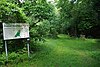
The Essex Wildlife Trust (EWT) is one of 46 wildlife trusts which cover the United Kingdom. The EWT was founded in 1959, and it describes itself as Essex's leading conservation charity, which aims to protect wildlife for the future and the people of the county. As of January 2017, it has over 34,000 members and runs 87 nature reserves, 2 nature parks and 11 visitor centres. [1] [lower-alpha 1]

Contents

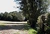
Essex has one of the longest coastlines of any English county, with saltmarshes, lagoons, mudflats, grazing marshes, reedbeds and shingle. Its ancient forests were formerly important to the local economy, with wood being used for fuel, construction and bark in the tanning industry. Coppicing is being re-introduced by the EWT to encourage woodland grasses, flowers, invertebrates and birds. A few grasslands on the heavy clays of south- and mid-Essex are still grazed according to traditional methods, supporting a mixture of pasture and fen. Some brownfield sites, often on contaminated soil, have populations of nationally scarce species, particularly invertebrates. [3]

The EWT's first site was Fingringhoe Wick, which was established in 1961; its visitor centre has views over the Colne Estuary. [4] The largest site is the 400-hectare (990-acre) Hanningfield Reservoir, which has nationally important numbers of gadwalls and a rare moss. The smallest is Horndon Meadow at 0.8 hectares (2.0 acres); it is an unimproved hay meadow which has 80 flower species. The whole or part of 6 sites are Ramsar internationally important wetland sites, 29 are Sites of Special Scientific Interest, 3 are national nature reserves, 4 are Special Protection Areas, 2 are Special Areas of Conservation, 7 are Nature Conservation Review sites, 2 are a Geological Conservation Review sites, 2 are scheduled monuments and 7 are local nature reserves.

Map all coordinates using: OpenStreetMap  
Download coordinates as: KML

Nature reserves

Key

SitePhotographArea [lower-alpha 2] Location [lower-alpha 2] Access [lower-alpha 2] ClassificationsDescription
Abberton Reservoir [5] Abberton Reservoir - geograph.org.uk - 218063.jpg 24.2 hectares (60 acres) Colchester
51°49′23″N0°50′46″E / 51.823°N 0.846°E / 51.823; 0.846 (Abberton Reservoir)
TL 962 177
YESEWTVC, [5] NCR, [6] Ramsar, [7] SPA, [8] SSSI [9] 
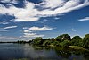
The EWT runs the visitor centre for Essex and Suffolk Water's 716 hectare reservoir, which is internationally important for wintering wigeon, and nationally important for twelve other bird species. The small area run by the trust has new woodland with a bird hide, and there are two more hides over the reservoir. [5] [9]
Abbotts Hall Farm [10] An Abbots Hall Hide - geograph.org.uk - 551729.jpg 282.0 hectares (697 acres) Colchester
51°47′46″N0°50′42″E / 51.796°N 0.845°E / 51.796; 0.845 (Abbotts Hall Farm)
TL 963 146
PP NNR, [11] Ramsar, [12] SAC, [13] SM, [14] SPA, [15] SSSI [16] This is the headquarters of the EWT, as well as a working farm which is managed to encourage wildlife. New seawalls have been built to create marshland, which has many fish, providing food for migrating birds. A new lake has also been constructed, and fields provide additional habitats for fauna such as skylarks. [10]
Aubrey Buxton [17] Aubrey Buxton nature reserve 7.JPG 9.7 hectares (24 acres) Elsenham
51°54′54″N0°12′36″E / 51.915°N 0.210°E / 51.915; 0.210 (Aubrey Buxton)
TL 521 264
YESThe site is woodland on a sandy and gravel soil, with meadows and six man-made ponds. Grassland plants include wild strawberries and common spotted orchids. There are birds such as nuthatches and woodpeckers. Black poplars, which are the county's rarest native tree, have been planted to replace trees lost to storm damage. [17]
Bedfords Park [18] Bedfords Park Visitor Centre - geograph.org.uk - 1320114.jpg 87.0 hectares (215 acres) Havering-atte-Bower
51°36′29″N0°11′38″E / 51.608°N 0.194°E / 51.608; 0.194 (Bedfords Park)
TQ 520 922
YESEWTVC, [18] LNR [19] The London Borough of Havering owns and manages Bedfords Park, while the EWT manages the visitor centre. [18] The site has wildflower meadows, diverse woodland, several ponds and a lake, as well as a herd of red deer. There are flora such as cuckoo flowers and ragged robins. [19]
Belfairs Woodland Centre [20] The Prittle Brook - geograph.org.uk - 1289210.jpg 36.8 hectares (91 acres) [21] Leigh-on-Sea
51°33′22″N0°38′24″E / 51.556°N 0.640°E / 51.556; 0.640 (Belfairs Woodland Centre)
TQ 831 874
YESEWTVC, [20] LNR, [22] SSSI [21] This is a small remnant of the ancient Hadleigh Great Wood. It is coppiced oak woodland on sands, gravels and clay, and one of the largest areas of old woodland in the south of the county. Plants include the rare broad-leaved helleborine. [21]
Blue House Farm [23] View from Blue House Farm bird hide 1.jpg 242.8 hectares (600 acres) North Fambridge
51°38′31″N0°40′52″E / 51.642°N 0.681°E / 51.642; 0.681 (Blue House Farm)
TQ 856 971
FP SSSI [24] This site has been grassland for the last 100 years, and it is grazed by cows and sheep. The site has ponds, creeks and ditches, and a 20 hectare field is flooded during the winter, providing feeding grounds for large numbers of wildfowl and wading birds, including around 2000 Brent geese. [23]
Bradwell Shell Bank [25] Bradwell Cockle Spit - geograph.org.uk - 242277.jpg N/Av Bradwell-on-Sea
51°44′06″N0°56′46″E / 51.735°N 0.946°E / 51.735; 0.946 (Bradwell Shell Bank)
TM 035 081
PP NCR, [26] [27] Ramsar, [28] SAC, [25] SPA, [25] SSSI [25] The site is a large area of saltmarsh, together with some 12 hectares (30 acres) of shell bank. Birds which breed on the shell bank include little terns and ringed plovers, and there are many species on the saltmarsh. There are flora such as yellow-horned poppies, grass-leaved oraches and rock samphires. [25]
Brookes Nature Reserve [29] Bridleway through Brookes Nature Reserve - geograph.org.uk - 402069.jpg 24.3 hectares (60 acres) Halstead
51°54′36″N0°37′37″E / 51.910°N 0.627°E / 51.910; 0.627 (Brookes Nature Reserve)
TL 808 268
YES SSSI [29] The site is coppice woodland on chalky boulder clay. There is a variety of woodlands types, such as wet ash and maple, pedunculate Oak and hornbeam, and acid birch, ash and lime. The ground flora includes species which are locally uncommon, including greater butterfly-orchid and bird's-nest orchid. [30] There is also a variety of butterflies, and ponds which have frogs and newts. [29]
Chafford Gorges Nature Park [31] Chafford Gorge - geograph.org.uk - 39653.jpg 80.9 hectares (200 acres) Grays
51°29′24″N0°17′10″E / 51.490°N 0.286°E / 51.490; 0.286 (Chafford Gorges)
TQ 588 793
YESEWTVC, [31] GCR, [32] SSSI [31] [33] This site has lakes, woodland and meadows. There are common spotted, bee and bird's nest orchids, and long-eared and common pipistrelle bats. [31] Two areas are Sites of Special Scientific Interest: Grays Thurrock Chalk Pit has been designated for its biological interest, and Lion Pit for geological interest. [33]
Chigborough Lakes [34] Gadwall Lake - geograph.org.uk - 1323704.jpg 18.6 hectares (46 acres) Maldon
51°44′42″N0°43′01″E / 51.745°N 0.717°E / 51.745; 0.717 (Chigborough Lakes)
TL 876 086
YESThis area of former gravel pits has diverse habitats, lakes, marshes, willow carr, grazed grassland and scrub. More than 120 species of bird have been recorded, out of which more than 40 have bred, including great crested grebes, grey herons and little egrets. There are eleven species of willow and several of orchid. [34]
Cockaynes Wood [35] Cockaynes Wood 13.jpg 20.2 hectares (50 acres) Wivenhoe
51°51′22″N0°58′52″E / 51.856°N 0.981°E / 51.856; 0.981 (Cockaynes Wood)
TM 054 217
PPCockaynes Wood is ancient, and was listed in the Domesday Book. The nature reserve also includes Villa Wood and more open areas, with heathland, meadows, and water-filled former quarries. Wildlife includes a rare weevil and birds including barn owls. [35]
Colne Point [36] View to Sandy Point - geograph.org.uk - 218962.jpg 276.4 hectares (683 acres) St Osyth
51°46′16″N1°03′14″E / 51.771°N 1.054°E / 51.771; 1.054 (Colne Point)
TM 108 125
YES NCR, [27] NNR, [37] Ramsar, [38] SSSI [37] The site is shingle surrounding saltmarsh, and Ray Creek flows through it. It is a breeding ground for many birds, and a feeding area for migrants. There are many invertebrates which are on the IUCN Red List of Threatened Species, and flora include the nationally rare golden samphire and small cord-grass. [36]
Copperas Wood [39] Copperas Wood - geograph.org.uk - 1364454.jpg 13.8 hectares (34 acres) Harwich
51°56′20″N1°12′00″E / 51.939°N 1.200°E / 51.939; 1.200 (Copperas Wood)
TM 200 315
YES SSSI [40] This is ancient sweet chestnut and hornbeam coppice. The Great Storm of 1987 caused severe damage, and some areas have been left to regenerate naturally. Around 100 bird species have been observed, out of which 43 are nesting, and there are 23 butterfly species and over 300 of moths. [39]
Cranham Marsh [41] Cranham Marsh 1.JPG 13.0 hectares (32 acres) Cranham
51°32′49″N0°15′29″E / 51.547°N 0.258°E / 51.547; 0.258 (Cranham Marsh)
TQ 567 856
YES LNR [42] The habitats on the site are woodland, wet meadow, marsh and fen. There are three small woods, including Spring Wood, which has species indicative of ancient woodland. Insects include a rare bee, Macropis europaea, and 23 species of butterfly have been recorded. [43]
Crowsheath Wood [44] Crowsheath Wood 2.jpg 8.1 hectares (20 acres) Downham
51°38′28″N0°29′38″E / 51.641°N 0.494°E / 51.641; 0.494 (Crowsheath Wood)
TQ 727 964
YESThe wood has many mature oak trees, with coppiced areas mainly of hornbeam, together with other trees such as ash and field maple. There are ponds in the centre of the site where lesser spearwort grows. Flowers include bluebell and wood anemone, and there are birds typical of broadleaved woodland. [44]
Danbury Ridge [45] Gorse in The Backwarden - geograph.org.uk - 1282157.jpg 101.2 hectares (250 acres) Danbury
51°43′44″N0°35′24″E / 51.729°N 0.590°E / 51.729; 0.590 (Danbury Ridge)
TL 790 065
YES SSSI [46] [47] The site includes several areas in two different SSSIs, Danbury Common [46] and Woodham Walter Common. [47] Habitats include woodland, a bog area which has sphagnum moss, marsh, a pond and heathland. Dormice are common in the reserves. [45]
Fingringhoe Wick [4] Sand martin cliff at Fingringhoe Wick nature reserve - geograph.org.uk - 1520777.jpg 48.6 hectares (120 acres) Fingringhoe
51°50′06″N0°58′16″E / 51.835°N 0.971°E / 51.835; 0.971 (Fingringhoe Wick)
TM 048 193
YESEWTVC, [4] NCR, [27] Ramsar, [48] SSSI [37] These former gravel quarries were the Trust's first reserve, established in 1961. Habitats are the Colne Estuary, gorse heathland, grassland, reedbeds and ponds. There are nearly 200 species of birds and 350 of flowering plants, together with many dragonflies, damselflies and butterflies. [4]
Fobbing Marsh [49] Fobbing Marsh SSSI - geograph.org.uk - 60039.jpg 75.7 hectares (187 acres) Fobbing
51°32′02″N0°29′42″E / 51.534°N 0.495°E / 51.534; 0.495 (Fobbing Marsh)
TQ 731 846
YESThe site is mainly grazing marshes, but there are also areas of rough grassland, saltmarsh, seawalls and reedbed. Flowering plants include hairy buttercup, knotted hedge-parsley and the nationally rare least lettuce. There are breeding birds such as corn buntings and yellow wagtails. [49]
Gernon Bushes [50] Boggy Place in Gernon Bushes - geograph.org.uk - 1317526.jpg 32.0 hectares (79 acres) Epping
51°42′22″N0°08′17″E / 51.706°N 0.138°E / 51.706; 0.138 (Gernon Bushes)
TL 478 030
YES SSSI, [51] NCR [52] 
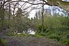
This site is ancient coppice, with old hornbeam pollards, and many ponds which were created for gravel extraction. There are areas of marsh with large patches of the unusual marsh fern, and other plants include marsh marigold and ragged robin. [50]
Great Holland Pits [53] Great Holland Pits - geograph.org.uk - 1336458.jpg 16.2 hectares (40 acres) Great Holland
51°49′34″N1°11′49″E / 51.826°N 1.197°E / 51.826; 1.197 (Great Holland Pits)
TM 204 190
YESThis area of former gravel pits has grassland, ancient woodland, ponds and wet depressions. There are water birds such as kingfishers, coots and little grebes, and flowering plants include moschatels and carline thistles. [53]
Gunners Park and Shoebury Ranges [54] Across the old Range - geograph.org.uk - 1363042.jpg 25.0 hectares (62 acres) Shoeburyness
51°31′23″N0°47′06″E / 51.523°N 0.785°E / 51.523; 0.785 (Gunners Park and Shoebury Ranges)
TQ 932 841
PP LNR, [55] SM, [56] SSSI [57] 
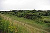
Gunners Park, which is named for its former military use, has over twelve habitats, including coastal grassland and ancient sand dunes. Rare insects include sandwich click beetles, while there are unusual plants such as bulbous meadow-grass. There is a wide range of migrating birds. [54]
Hanningfield Reservoir [58] Fishing Boats for Hire on Hanningfield Reservoir - geograph.org.uk - 72938.jpg 400 hectares (990 acres) Chelmsford
51°38′46″N0°29′31″E / 51.646°N 0.492°E / 51.646; 0.492 (Hanningfield Reservoir)
TQ 725 971
YESEWTVC, [58] SSSI [59] The reservoir has a nationally important population of gadwalls, and it also has significant numbers of pochards, teal, tufted ducks and pintails. The chalk sludge lagoon has several unusual plants, and there is a rare moss Brachythecium mildeanum at the foot of the southern dam. [59]
Horndon Meadow [60] Horndon Meadow - geograph.org.uk - 1251470.jpg 0.8 hectares (2.0 acres) Stanford-le-Hope
51°32′24″N0°24′36″E / 51.540°N 0.410°E / 51.540; 0.410 (Horndon Meadow)
TQ 672 851
YESThis site is an unimproved hay meadow, which has around eighty flower species, such as green-winged orchids, yellow rattles, musk mallows and black knapweeds. Other plants include adder's tongue ferns. [60]
Howlands Marsh [61] Flag Creek - geograph.org.uk - 1356529.jpg 29.9 hectares (74 acres) St Osyth
51°48′40″N1°04′01″E / 51.811°N 1.067°E / 51.811; 1.067 (Howlands Marsh)
TM 115 169
YES NCR, [27] Ramsar, [38] SPA, [62] SSSI [37] This site is marshy grassland, which is low lying and hummocky, and divided by water channels. There are also areas of saltmarsh, which have sea wormwood and golden samphire. Breeding birds include reed warblers, skylarks, lapwings and reed buntings. [61]
Hunsdon Mead [63] [lower-alpha 3] River Stort and its wetlands at Hunsdon Mead, Hertfordshire.jpg 27.5 hectares (68 acres) Harlow
51°46′59″N0°03′32″E / 51.783°N 0.059°E / 51.783; 0.059 (Hunsdon Mead)
TL 421 114
YES SSSI [64] This is unimproved grassland which is subject to winter flooding. Notable grass species include meadow brome and the quaking grass Briza media , and there are other unusual flora such as pepper saxifrage and green-winged orchid. [64]
Ingrebourne Valley [65] Ingrebourne Valley 1.JPG 261 hectares (640 acres) Hornchurch
51°31′48″N0°12′29″E / 51.530°N 0.208°E / 51.530; 0.208 (Ingrebourne Valley)
TQ 532 835
YESEWTVC, [65] LNR, [66] SSSI [67] The EWT manages the visitor centre for this site, which is run by Havering Council. [65] The site has a wide range of habitats, rough grassland, woodland, marshes, river, reedbeds and wet grazing. There are fauna such as great crested newts, slowworms and harvest mice. [67]
Iron Latch [68] Iron Latch 1.jpg 4.3 hectares (11 acres) Eight Ash Green
51°53′49″N0°49′58″E / 51.897°N 0.8328°E / 51.897; 0.8328 (Iron Latch)
TL 950 259
YESThe site consists of areas of species-rich grassland and ash woodland. Bird's foot trefoil provides food for common blue butterflies, purple hairstreaks, and other butterflies. Nightingales nest in the trees and hedges. [68]
John Weston Nature Reserve [69] Across John Weston - geograph.org.uk - 1390150.jpg 3.6 hectares (8.9 acres) Walton-on-the-Naze
51°52′23″N1°17′25″E / 51.873°N 1.2903°E / 51.873; 1.2903 (John Weston Nature Reserve)
TM 266 245
YESThis site is named after its former warden, who died in 1984. It has rough grassland, blackthorn and bramble scrub and four ponds. Nesting birds include the lesser and common whitethroat, and there are flora such as slender thistle, pepper saxifrage and fenugreek. [69]
Langdon Nature Reserve [70] Ruined Hawthorn in Dunton Plotlands - geograph.org.uk - 1375134.jpg 210.0 hectares (519 acres) Basildon
51°33′43″N0°23′39″E / 51.562°N 0.3942°E / 51.562; 0.3942 (Langdon Nature Reserve)
TQ 660 875
YESEWTVC, [70] SSSI [71] This site has a wildlife garden, woodland, meadows and lakes. Over 350 species of flowering plants have been recorded, and 30 butterflies including white admirals, green hairstreaks, marbled whites and grizzled skippers. [70]
Lexden Gathering Grounds [72] Lexden Gathering Grounds 9.jpg 8.9 hectares (22 acres) Colchester
51°53′35″N0°51′20″E / 51.893°N 0.8555°E / 51.893; 0.8555 (Lexden Gathering Grounds)
TL 965 254
YESThe site is mainly woodland with some marsh, meadow and open rides. One area has semi-natural birch and ash woods, and the marsh has moschatel and mature hazel and alder coppice. There are badgers and foxes, and butterflies including common browns and small coppers. [72]
Lion Creek and Lower Raypits [73] View From Garon Hide - geograph.org.uk - 1445511.jpg 65.2 hectares (161 acres) Canewdon
51°37′08″N0°46′34″E / 51.619°N 0.776°E / 51.619; 0.776 (Lion Creek and Lower Raypits)
TQ 923 948
YES SSSI [74] [75] The former creek has been cut off from the Crouch Estuary by a seawall, and it has salt marsh plants such as golden samphire and sea-spurrey. Lower Raypits has a variety of pasture, salt marsh and intertidal habitats, with nationally scarce plants such as beaked tasselweed, sea barley, grass vetchling and curved hard-grass. Invertebrates include Roesel's bush-cricket. [73]
Little Haven [76] Little Haven 5.jpg 37.2 hectares (92 acres) Thundersley
51°34′16″N0°36′27″E / 51.571°N 0.6075°E / 51.571; 0.6075 (Little Haven)
TQ 808 890
YESThis site has diverse habitats of woodland, meadows, scrub and hedges. The main trees are sessile oaks, hornbeams and sweet chestnut, and plants such as wood sorrel and are indicators of ancient woodland. The reserve is one of only 25 in the county where the rare heath fritillary is well established. [76]
Little Waltham Meadows [77] Little Waltham Meadows - geograph.org.uk - 1284637.jpg 8.9 hectares (22 acres) Little Waltham
51°46′44″N0°28′54″E / 51.779°N 0.4818°E / 51.779; 0.4818 (Little Waltham Meadows)
TL 713 119
YESThe site is wet and dry meadows on the bank of the River Chelmer, which are grazed to restore them to their previous state. There are grassland plants such as saxifrage, bee orchids and yellow oat-grass. Tawny owls and sparrowhawks hunt in the meadows and ancient hedgerows. [77]
Maldon Wick [78] Pond at Wycke Meadow - geograph.org.uk - 973707.jpg 6.1 hectares (15 acres) Maldon
51°43′12″N0°39′55″E / 51.720°N 0.6653°E / 51.720; 0.6653 (Maldon Wick Meadow)
TL 842 057
YESThis is a 2.4-kilometre (1.5-mile) linear site along the route of the former railway line between Maldon and Woodham Ferrers, and it is mainly on embankment. There are many breeding birds, and 28 species of butterflies and 17 of dragonfly have been recorded. Flowering plants include moschatels and sweet violets. [78]
The Naze [79] Cliffs at the Naze - geograph.org.uk - 1187867.jpg 45 hectares (110 acres) Walton-on-the-Naze
51°52′05″N1°17′17″E / 51.868°N 1.288°E / 51.868; 1.288 (The Naze)
TM 264 238
YESEWTVC, [79] GCR, [80] SSSI [81] This coastal site has a variety of terrestrial and marine habitats, and many migrating and nesting birds, such as dark bellied brent geese, sedge warblers, barn owls and common whitethroats. The cliff is eroding at one to two metres a year. [79]
Newland Grove [82] Newland Grove in the snow - geograph.org.uk - 1612334.jpg 3.2 hectares (7.9 acres) Chelmsford
51°46′12″N0°29′08″E / 51.770°N 0.4856°E / 51.770; 0.4856 (Newland Grove)
TL 716 108
YESThe site is rough grassland on the bank of the River Chelmer, with areas of woodland and thorn thicket. More than 230 plant species have been recorded, including St John's wort, hairy violet and musk mallow. Birds include several species of warbler, and 23 of butterflies. [82]
Oakfield Wood [83] Oakfield Wood - geograph.org.uk - 1364448.jpg 2.8 hectares (6.9 acres) Wrabness
51°56′24″N1°09′04″E / 51.940°N 1.151°E / 51.940; 1.151 (Oakfield Wood)
TM 167 315
YESThis is former farmland which is being converted into a "green burial ground", overlooking the Stour Estuary. A native broadleaved tree is planted for each burial with a wooden plaque at the base. When the burial ground is full, it will be managed by the trust as a nature reserve. [83]
Oxley Meadow [84] Oxley Meadow 5.jpg 3.2 hectares (7.9 acres) Tiptree
51°48′04″N0°46′44″E / 51.801°N 0.779°E / 51.801; 0.779 (Oxley Meadow)
TL 917 149
YESThe site has two meadows which are rich in flowers, including many green winged orchids and adderstongue ferns. There is also a variety of common butterfly species, and hedgerows provide nesting sites for birds such as the lesser whitethroat. [84]
Phyllis Currie [85] Phillis's Lake - geograph.org.uk - 1284770.jpg 8.9 hectares (22 acres) Great Leighs
51°50′10″N0°29′56″E / 51.836°N 0.499°E / 51.836; 0.499 (Phyllis Currie)
TL 723 182
YESThis site is named after Mrs Phyllis Currie, who bequeathed it to the trust. It has diverse habitats, with grassland, a lake, woodland and ditches. Birds include kingfishers and grey herons, and 23 species of butterflies and 13 of dragonflies and damselflies have been recorded. [85]
Pound Wood [86] Pound Wood 2.jpg 22.3 hectares (55 acres) Thundersley
51°34′08″N0°37′08″E / 51.569°N 0.619°E / 51.569; 0.619 (Pound Wood)
TQ 816 888
YES
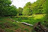
Much of this site is ancient woodland, with some old secondary woodland. Trees include sweet chestnut, aspen and the wild service tree. There are a number of dells and ponds. [86]
Roding Valley Meadows [87] Roding Valley Meadows 4.JPG 64.6 hectares (160 acres) Chigwell
51°37′44″N0°03′54″E / 51.629°N 0.065°E / 51.629; 0.065 (Roding Valley Meadows)
TQ 430 943
YES LNR, [88] SSSI [89] The meadows are bordered by the River Roding. They form one of the largest areas of grassland in Essex which are traditionally managed as hay meadows, flood meadows and marshland. Plants include the largest beds in Essex of the rare brown sedge. [89]
Roman River Valley [90] Roman River Reserve - geograph.org.uk - 142671.jpg 17.8 hectares (44 acres) Layer de la Haye
51°51′11″N0°51′58″E / 51.853°N 0.866°E / 51.853; 0.866 (Roman River Valley)
TL 975 211
YESThis wetland site along the Roman River has ancient woodland and marshes. Aquatic plants include the uncommon small teasel, and there are flowering plants such as yellow archangel and moschatel. [90]
Rushy Mead [91] Rushy Mead nature reserve 6.JPG 4.6 hectares (11 acres) Bishop's Stortford
51°51′18″N0°10′19″E / 51.855°N 0.172°E / 51.855; 0.172 (Rushy Mead)
TL 497 196
YESThe site has areas of sedges and reeds with water near the surface all year. They provide protection for snipe and water rails in the winter, and sedge and reed warblers in the summer. The northern part is alder woodland with some ash and willow. In drier areas there is chalk grassland which supports a wide variety of wild flowers. [91]
Sandylay and Moat Woods [92] Sandlay and Moat Woods Reserve - geograph.org.uk - 1305840.jpg 7.5 hectares (19 acres) Great Leighs
51°49′44″N0°30′50″E / 51.829°N 0.514°E / 51.829; 0.514 (Sandylay and Moat Woods)
TL 733 175
YESThese adjacent woods are mainly coppiced small-leaved lime, with a small stream and many flowering plants, including wood anemones, sweet violets, spurge laurel, stinking iris and early purple orchid. [92]
Sawbridgeworth Marsh [93] Sawbridgeworth Marsh 5.JPG 8.9 hectares (22 acres) Sawbridgeworth
51°49′16″N0°09′49″E / 51.821°N 0.1635°E / 51.821; 0.1635 (Sawbridgeworth Marsh)
TL 492 158
YES SSSI [94]

The site is a river valley marsh close to the River Stort, which has a varied wetland flora. Grazing and cutting of the marsh in rotation maintains biological diversity. [94] Uncommon plants include marsh willowherb, marsh valerian and marsh arrow-grass, and drainage ditches and two ponds have a rich aquatic life. [93]

Sergeants Orchard [95] Sergeants Orchard old orchard 1.jpg 3.2 hectares (7.9 acres) Mount Bures
51°56′35″N0°46′30″E / 51.943°N 0.775°E / 51.943; 0.775 (Sergeants Orchard)
TL 908 308
PPThe site consists of an old orchard in a long narrow field, another narrow field to the west and a larger one to the east. The western field has been planted with fruit trees and the eastern one with a conservation grass mix. A rare bee, bombus muscorum, has been found on the site. [95] [96]
Shadwell Wood [97] Shadwell Wood - geograph.org.uk - 1414033.jpg 7.1 hectares (18 acres) Saffron Waldon
52°02′53″N0°17′31″E / 52.048°N 0.292°E / 52.048; 0.292 (Shadwell Wood)
TL 572 413
YES SSSI [98] This is oak and ash woodland, interspersed with coppiced hazel and maple. Diverse flowering plants include oxlips, wood anemones, herb paris, and early purple and common spotted orchids. [97]
Shotgate Thickets [99] Shotgate Pond - geograph.org.uk - 1253349.jpg 3.2 hectares (7.9 acres) Wickford
51°37′05″N0°33′11″E / 51.618°N 0.553°E / 51.618; 0.553 (Shotgate Thickets)
TQ 768 940
YESThis site on the north bank of the River Crouch has oak woodland, two ponds, rough grassland and thorn thickets. Fauna include great crested newts, water voles, and over seventy bird species. More than a hundred plant species have been recorded, such as golden dock and dyer's greenweed. [99]
Shut Heath Wood [100] Twisted Oaks - geograph.org.uk - 1324983.jpg 20.2 hectares (50 acres) Great Totham
51°47′17″N0°41′06″E / 51.788°N 0.685°E / 51.788; 0.685 (Shut Heath Wood)
TL 853 133
YESOver half this site is managed as farmland, and the rest is ancient oak woodland with coppiced sweet chestnut and hornbeam. The understorey is ash, elder and hazel. Invertebrates include damselflies, dragonflies, glow-worms and wood ants. [100]
Skippers Island [101] Island to Mainland - geograph.org.uk - 1443816.jpg 94.3 hectares (233 acres) Walton-on-the-Naze
51°52′19″N1°13′16″E / 51.872°N 1.221°E / 51.872; 1.221 (Skippers Island)
TM 218 242
BPA

The highest part of the island has thorn thickets, separated by grassy rides. The lowest land is saltmarsh, and there is also extensive rough pasture with brackish pools. Flora include sea hog's fennel and lax-flowered sea-lavender, and there are breeding birds such as shelducks and oystercatchers. [101]

Stanford Warren [102] Stanford Phragmites - geograph.org.uk - 1252028.jpg 16.6 hectares (41 acres) Stanford-le-Hope
51°30′18″N0°25′44″E / 51.505°N 0.429°E / 51.505; 0.429 (Stanford Warren)
TQ 687 812
YES

This former gravel quarry is bisected by the River Hassenbrook. It has one of the largest reedbeds in the county, together with rough grassland and marshes. The bird life is diverse, including water rails, grey wagtails and bearded tits. [102]

Stow Maries Halt [103] Stow Maries Halt.jpg 2.2 hectares (5.4 acres) Stow Maries
51°39′40″N0°39′07″E / 51.661°N 0.652°E / 51.661; 0.652 (Stow Maries Halt)
TQ 835 991
YESThe former Stow St Mary Halt railway station has marshes, a pond and scrub, together with adjoining pasture which is also part of the reserve. Butterflies include purple and white-letter hairstreaks, and there are flowers such as common fleabane and wild carrot. [103]
Thorndon Countryside Centre [104] Thorndon Countryside Centre, Spring 1990 - geograph.org.uk - 1491379.jpg 200 hectares (500 acres) [105] Brentwood
51°33′36″N0°18′58″E / 51.560°N 0.316°E / 51.560; 0.316 (Thorndon Countryside Centre)
TQ 605 915
YESEWTVC, [104] SSSI [106] The EWT runs the visitor centre for Thorndon Country Park, which is managed by Essex County Council. The park has diverse habitats, with ancient woodland, a meadow, a marsh, parkland and ponds. Mature trees include large oak and hornbeam pollards. [104]
Thrift Wood [107] Thrift Wood, Woodham Mortimer - geograph.org.uk - 230542.jpg 19.4 hectares (48 acres) Bicknacre
51°41′06″N0°35′17″E / 51.685°N 0.588°E / 51.685; 0.588 (Thrift Wood)
TL 790 017
YES SSSI [108] The site is an ancient semi-natural wood on acid soil. Wild service trees and elders are found in the shrub layer, and a pond has a raised sphagnum bog. Twenty species of butterfly have been recorded. [108]
Thurrock Thameside Nature Park [109] Cory Environmental Centre.jpg 50 hectares (120 acres) [lower-alpha 4] Stanford-le-Hope
51°29′56″N0°26′31″E / 51.499°N 0.442°E / 51.499; 0.442 (Thurrock Thameside Nature Park)
TQ 696 806
YESEWTVC [109] The park is next to the River Thames and it has internationally important numbers of ringed plovers and avocets, and nationally important numbers of grey plovers and dunlins. Mammals include water voles, Britain's fastest declining species, and there are amphibians such as the great crested newt. [109]
Tile Wood [110] Tile Wood 6.jpg 6.5 hectares (16 acres) Thundersley
51°34′16″N0°37′08″E / 51.571°N 0.619°E / 51.571; 0.619 (Tile Wood)
TQ 816 890
YESThe wood is ancient, having been mentioned in the Anglo-Saxon period. The main trees are sessile oak, hornbeam and sweet chestnut. Ground flora include wood sorrel, bluebells and wood-rush. [110]
Tiptree Heath [111] Tiptree Heath - geograph.org.uk - 153919.jpg 24.3 hectares (60 acres) Tiptree
51°47′56″N0°43′44″E / 51.799°N 0.729°E / 51.799; 0.729 (Tiptree Heath)
TL 883 147
YES SSSI [112] This is the largest surviving area of heathland in Essex, and has a number of plants rare in the county. It is dominated by heather and bent grass. [112] A small herd of Dexter cattle help to control the growth of invasive scrub. [111]
Tollesbury Wick [113] View to Great Cob Island - geograph.org.uk - 218950.jpg 242.9 hectares (600 acres) Tollesbury
51°45′25″N0°51′11″E / 51.757°N 0.853°E / 51.757; 0.853 (Tollesbury Wick)
TL 970 103
FP

This is coastal freshwater marsh which is grazed by sheep, and is worked by traditional methods which encourage wildlife. Areas of ungrazed rough pasture have badgers, and field voles and pygmy shrews are hunted by hen harriers and short-eared owls. [113]

Two Tree Island [114] Lagoon on Two Tree Island - geograph.org.uk - 41419.jpg 259 hectares (640 acres) Leigh-on-Sea
51°32′10″N0°37′44″E / 51.536°N 0.629°E / 51.536; 0.629 (Two Tree Island)
TQ 824 852
YES NCR, [115] [116] NNR, [117] SSSI [116] Mudflats provide food for wildfowl such as Brent geese, and waders such as dunlins and grey plovers. There are also areas of saltmarsh, grassland, lagoons, scrub and reedbeds. Butterflies include the marbled white, small skipper and Essex skipper. [114]
Warley Place [118] Path Through Daffodils, Warley Place - geograph.org.uk - 1218636.jpg 10.1 hectares (25 acres) Brentwood
51°35′31″N0°17′02″E / 51.592°N 0.284°E / 51.592; 0.284 (Warley Place)
TQ 583 906
YESIn the late nineteenth and early twentieth centuries this site was the garden of the leading horticulturalist, Ellen Willmott, who planted many plants from all over the world, some of which still survive. There is a line of mature sweet chestnuts, and flowers including daffodils, snowdrops and crocuses. [118]
Weeleyhall Wood [119] Path Through Weeley Hall Wood - geograph.org.uk - 1335023.jpg 13.6 hectares (34 acres) Weeley
51°50′42″N1°07′55″E / 51.845°N 1.132°E / 51.845; 1.132 (Weeleyhall Wood)
TM 158 209
YES SSSI [120] This site has a variety of woodland types, reflecting diverse soils. It is mainly pedunculate oak over a layer of coppice hazel and sweet chestnut planted in the nineteenth century. There are two ponds and species-rich damp, grassy rides. [120]
West Wood [121] West Wood 5.jpg 23.5 hectares (58 acres) Thaxted
51°58′30″N0°21′47″E / 51.975°N 0.363°E / 51.975; 0.363 (West Wood)
TL 623 333
YES SSSI [122] The site is ancient woodland on chalky boulder clay and sandy loam. It was mainly elm, but this has died and the wood regenerated naturally with ash. Bramble and dog's mercury dominate the ground layer, with a rich variety of plants in wetter areas, such as oxlip and meadow-sweet. [122] There are many species of birds and butterflies, and four ponds which have great crested newts, dragonflies and damselflies. [121]
Westhouse Wood [123] Westhouse Wood - geograph.org.uk - 1249970 cropped.jpg 2.8 hectares (6.9 acres) Colchester
51°54′29″N0°52′08″E / 51.908°N 0.869°E / 51.908; 0.869 (Westhouse Wood)
TL 974 271
YES

The wood is mainly coppiced hazel, and other tree include small-leaved lime, crab apple, oak, ash, sweet chestnut, field maple and rowan. There are flowering plants such as wood anemones and foxgloves. [123]

Woodham Fen [124] Woodham Fen - geograph.org.uk - 130012.jpg 8.1 hectares (20 acres) South Woodham Ferrers
51°38′49″N0°35′49″E / 51.647°N 0.597°E / 51.647; 0.597 (Woodham Fen)
TQ 798 975
YES SSSI [74] [75]

The site lies between two tidal creeks which run into the River Crouch. It has saltmarsh and rough grassland with an unusual transition zone between them. Birds include reed buntings, yellow wagtails and meadow pipits, and there are common lizards and slowworms. [124]

Wrabness [125] River Stour - geograph.org.uk - 1364434.jpg 24.3 hectares (60 acres) Wrabness
51°56′24″N1°09′04″E / 51.940°N 1.151°E / 51.940; 1.151 (Wrabness)
TM 167 315
YES LNR [126] This site has grassland, marsh, scrub and woodland. It has a diverse bird life, such as yellowhammers, common whitethroats, song thrushes and short-eared owls. There are also winter visitors including black-tailed godwits, grey plovers and turnstones. [125]

See also

Notes

  1. The EWT states that it runs 87 nature reserves but only lists 55 on its web site. However, some sites listed as visitor centres are also nature reserves, and the EWT may also run other sites which are not listed. [2]
  2. 1 2 3 Unless stated otherwise, the area, location and public access are taken from the Essex Wildlife Trust page for each site.
  3. Hunsdon Mead is managed jointly by the Essex and Herts and Middlesex Wildlife Trusts. [63]
  4. As of May 2016, the Trust states that Thurrock Thameside Nature Park is being expanded from 120 to 845 acres. [109]

Citations

  1. "About us". Essex Wildlife Trust. Archived from the original on 14 February 2017. Retrieved 5 January 2017.
  2. "Visitor Centres and Nature Reserves". Essex Wildlife Trust. Archived from the original on 14 February 2017. Retrieved 5 January 2017.
  3. "Essex habitats". Essex Wildlife Trust. Archived from the original on 16 October 2016. Retrieved 14 November 2016.
  4. 1 2 3 4 "Fingringhoe Wick". Essex Wildlife Trust. Archived from the original on 22 May 2016. Retrieved 22 May 2016.
  5. 1 2 3 "Abberton Reservoir Visitor Centre". Essex Wildlife Trust. Archived from the original on 17 October 2015. Retrieved 19 May 2016.
  6. Ratcliffe, 1977, p. 171
  7. "Information Sheet on Ramsar Wetlands (RIS): Abberton Reservoir" (PDF). Joint Nature Conservation Committee. Archived (PDF) from the original on 27 January 2017. Retrieved 3 November 2016.
  8. "Abberton Reservoir". Joint Nature Conservation Committee. Archived from the original on 18 August 2016. Retrieved 6 December 2015.
  9. 1 2 "Abberton Reservoir citation" (PDF). Sites of Special Scientific Interest. Natural England. Archived from the original (PDF) on 3 March 2016. Retrieved 30 October 2015.
  10. 1 2 "Abbotts Hall Farm". Essex Wildlife Trust. Archived from the original on 29 August 2016. Retrieved 19 May 2016.
  11. "Essex's National Nature Reserves". Natural England. Archived from the original on 9 December 2015. Retrieved 13 September 2016.
  12. "Information Sheet on Ramsar Wetlands (RIS): Blackwater Estuary (Mid-Essex Coast Phase 4)" (PDF). Joint Nature Conservation Committee. Archived (PDF) from the original on 4 March 2016. Retrieved 28 November 2015.
  13. "Essex Estuaries". Joint Nature Conservation Committee. Archived from the original on 20 February 2016. Retrieved 6 December 2015.
  14. "Great Wigborough henge". Historic England. Archived from the original on 29 November 2017. Retrieved 13 September 2016.
  15. "Blackwater Estuary (Mid-Essex Coast Phase 4)". Joint Nature Conservation Committee. Archived from the original on 8 December 2015. Retrieved 28 November 2015.
  16. "Blackwater Estuary citation" (PDF). Sites of Special Scientific Interest. Natural England. Archived from the original (PDF) on 8 December 2015. Retrieved 28 November 2015.
  17. 1 2 "Aubrey Buxton Nature Reserve". Essex Wildlife Trust. Archived from the original on 5 May 2016. Retrieved 19 May 2016.
  18. 1 2 3 "Bedfords Park Visitor Centre". Essex Wildlife Trust. Archived from the original on 17 April 2016. Retrieved 19 May 2016.
  19. 1 2 "Bedford's Park". Local Nature Reserves. Natural England. 18 December 2013. Archived from the original on 4 March 2016. Retrieved 22 January 2014.
  20. 1 2 "Belfairs Woodland Centre". Essex Wildlife Trust. Archived from the original on 31 March 2016. Retrieved 19 May 2016.
  21. 1 2 3 "Great Wood and Dodd's Grove citation" (PDF). Sites of Special Scientific Interest. Natural England. Archived from the original (PDF) on 3 March 2016. Retrieved 18 March 2016.
  22. "Belfairs". Local Nature Reserves. Natural England. 20 January 2016. Archived from the original on 4 March 2016. Retrieved 12 June 2016.
  23. 1 2 "Blue House Farm". Essex Wildlife Trust. Archived from the original on 1 June 2016. Retrieved 19 May 2016.
  24. "Map of Crouch and Roach Estuaries". Sites of Special Scientific Interest. Natural England. Archived from the original on 22 December 2015. Retrieved 17 May 2016.
  25. 1 2 3 4 5 "Bradwell Shell Bank". Essex Wildlife Trust. Archived from the original on 3 March 2016. Retrieved 19 May 2016.
  26. "Dengie citation" (PDF). Sites of Special Scientific Interest. Natural England. Archived from the original (PDF) on 4 March 2016. Retrieved 2 November 2016.
  27. 1 2 3 4 Ratcliffe, 1977, pp. 7–8
  28. "Dengie (Mid-Essex Coast Phase 1)" (PDF). Joint Nature Conservation Committee. Archived (PDF) from the original on 27 January 2017. Retrieved 4 October 2016.
  29. 1 2 3 "Brookes Nature Reserve". Essex Wildlife Trust. Archived from the original on 4 June 2016. Retrieved 19 May 2016.
  30. "Belcher's and Broadfield Woods citation" (PDF). Sites of Special Scientific Interest. Natural England. Archived from the original (PDF) on 4 March 2016. Retrieved 26 May 2016.
  31. 1 2 3 4 "Chafford Gorges". Essex Wildlife Trust. Archived from the original on 23 February 2016. Retrieved 19 May 2016.
  32. "Lion Pit Tramway Cutting (West Thurrock) (Quaternary of the Thames)". Joint Nature Conservation Committee. Archived from the original on 6 August 2016. Retrieved 3 August 2016.
  33. 1 2 "Map of Chafford Gorges Nature Park" (PDF). Healthy Life Essex. Archived from the original (PDF) on 14 January 2017. Retrieved 19 May 2016.
  34. 1 2 "Chigborough Lakes". Essex Wildlife Trust. Archived from the original on 6 May 2016. Retrieved 19 May 2016.
  35. 1 2 "Cockaynes Wood". Essex Wildlife Trust. Archived from the original on 3 June 2016. Retrieved 20 May 2016.
  36. 1 2 "Colne Point". Essex Wildlife Trust. Archived from the original on 31 May 2016. Retrieved 20 May 2016.
  37. 1 2 3 4 "Colne Estuary citation" (PDF). Sites of Special Scientific Interest. Natural England. Archived from the original (PDF) on 8 December 2015. Retrieved 23 May 2016.
  38. 1 2 "Information Sheet on Ramsar Wetlands (RIS): Colne Estuary (Mid-Essex Coast Phase 2)" (PDF). Joint Nature Conservation Committee. Archived (PDF) from the original on 4 March 2016. Retrieved 2 November 2016.
  39. 1 2 "Copperas Wood". Essex Wildlife Trust. Archived from the original on 19 August 2016. Retrieved 20 May 2016.
  40. "Stour and Copperas Woods, Ramsey citation" (PDF). Sites of Special Scientific Interest. Natural England. Archived from the original (PDF) on 5 October 2015. Retrieved 5 October 2015.
  41. "Cranham Marsh". Essex Wildlife Trust. Archived from the original on 11 June 2016. Retrieved 20 May 2016.
  42. "Cranham Marsh". Local Nature Reserves. Natural England. 4 March 2013. Archived from the original on 29 October 2013. Retrieved 25 October 2013.
  43. "Cranham Marsh". Greenspace Information for Greater London. 2013. Archived from the original on 29 October 2013. Retrieved 25 October 2013.
  44. 1 2 "Crowsheath Wood". Essex Wildlife Trust. Archived from the original on 5 June 2016. Retrieved 22 May 2016.
  45. 1 2 "Danbury Ridge". Essex Wildlife Trust. Archived from the original on 22 December 2015. Retrieved 22 May 2016.
  46. 1 2 "Danbury Common citation" (PDF). Sites of Special Scientific Interest. Natural England. Archived from the original (PDF) on 22 December 2015. Retrieved 3 November 2016.
  47. 1 2 "Woodham Walter Common citation" (PDF). Sites of Special Scientific Interest. Natural England. Archived from the original (PDF) on 22 December 2015. Retrieved 3 November 2016.
  48. "Information Sheet on Ramsar Wetlands (RIS): Colne Estuary (Mid-Essex Coast Phase 2)" (PDF). Joint Nature Conservation Committee. Archived (PDF) from the original on 4 March 2016. Retrieved 3 November 2016.
  49. 1 2 "Fobbing Marsh". Essex Wildlife Trust. Archived from the original on 5 June 2016. Retrieved 22 May 2016.
  50. 1 2 "Gernon Bushes". Essex Wildlife Trust. Archived from the original on 3 June 2016. Retrieved 22 May 2016.
  51. "Epping Forest citation" (PDF). Sites of Special Scientific Interest. Natural England. Archived from the original (PDF) on 24 October 2012. Retrieved 30 May 2016.
  52. Ratcliffe, 1977, pp. 60–61
  53. 1 2 "Great Holland Pits". Essex Wildlife Trust. Archived from the original on 5 June 2016. Retrieved 22 May 2016.
  54. 1 2 "Gunners Park and Shoebury Ranges". Essex Wildlife Trust. Archived from the original on 24 December 2015. Retrieved 22 May 2016.
  55. "Shoeburyness Old Ranges". Local Nature Reserves. Natural England. 16 March 2016. Archived from the original on 25 June 2016. Retrieved 22 May 2016.
  56. "Defended prehistoric settlement at Shoeburyness, known as the Danish Camp". Historice England. Archived from the original on 11 September 2016. Retrieved 30 August 2016.
  57. "Unit List, Foulness SSSI". Sites of Special Scientific Interest. Natural England. Archived from the original on 14 September 2016. Retrieved 30 August 2016.
  58. 1 2 "Hanningfield Reservoir". Essex Wildlife Trust. Archived from the original on 15 January 2016. Retrieved 23 May 2016.
  59. 1 2 "Hanningfield Reservoir citation" (PDF). Sites of Special Scientific Interest. Natural England. Archived (PDF) from the original on 4 March 2016. Retrieved 1 August 2016.
  60. 1 2 "Horndon Meadow". Essex Wildlife Trust. Archived from the original on 11 June 2016. Retrieved 23 May 2016.
  61. 1 2 "Howlands Marsh". Essex Wildlife Trust. Archived from the original on 3 June 2016. Retrieved 23 May 2016.
  62. "Colne Estuary (Mid-Essex Coast Phase 2)". Joint Nature Conservation Committee. Archived from the original on 4 November 2016. Retrieved 3 November 2016.
  63. 1 2 "Hunsdon Mead". Essex Wildlife Trust. Archived from the original on 11 June 2016. Retrieved 23 May 2016.
  64. 1 2 "Hunsdon Mead citation" (PDF). Sites of Special Scientific Interest. Natural England. Archived from the original (PDF) on 4 March 2016. Retrieved 23 May 2016.
  65. 1 2 3 "Ingrebourne Valley". Essex Wildlife Trust. Archived from the original on 17 July 2016. Retrieved 23 May 2016.
  66. "Ingrebourne Valley". Local Nature Reserves. Natural England. 25 March 2015. Archived from the original on 29 October 2013. Retrieved 3 November 2016.
  67. 1 2 "Ingrebourne Marshes citation" (PDF). Sites of Special Scientific Interest. Natural England. Archived from the original (PDF) on 3 March 2016. Retrieved 26 October 2013.
  68. 1 2 "Iron Latch". Essex Wildlife Trust. Archived from the original on 11 May 2016. Retrieved 23 May 2016.
  69. 1 2 "John Weston Nature Reserve". Essex Wildlife Trust. Archived from the original on 1 April 2016. Retrieved 23 May 2016.
  70. 1 2 3 "Langdon Nature Reserve". Essex Wildlife Trust. Archived from the original on 31 May 2016. Retrieved 23 May 2016.
  71. "Langdon Ridge citation" (PDF). Sites of Special Scientific Interest. Natural England. 29 June 2018. Retrieved 29 December 2020.
  72. 1 2 "Lexden Gathering Grounds". Essex Wildlife Trust. Archived from the original on 13 May 2016. Retrieved 23 May 2016.
  73. 1 2 "Lion Creek and Lower Raypits". Essex Wildlife Trust. Archived from the original on 6 March 2016. Retrieved 24 May 2016.
  74. 1 2 "Crouch and Roach estuaries citation" (PDF). Sites of Special Scientific Interest. Natural England. Archived from the original (PDF) on 22 December 2015. Retrieved 12 December 2015.
  75. 1 2 "Map of The Cliff, Burnham-on-Crouch". Sites of Special Scientific Interest. Natural England. Archived from the original on 12 August 2016. Retrieved 4 November 2016.
  76. 1 2 "Little Haven". Essex Wildlife Trust. Archived from the original on 5 June 2016. Retrieved 24 May 2016.
  77. 1 2 "Little Waltham Meadows". Essex Wildlife Trust. Archived from the original on 5 June 2016. Retrieved 24 May 2016.
  78. 1 2 "Maldon Wick". Essex Wildlife Trust. Archived from the original on 5 June 2016. Retrieved 24 May 2016.
  79. 1 2 3 "The Naze". Essex Wildlife Trust. Archived from the original on 10 May 2016. Retrieved 24 May 2016.
  80. "Walton-on-the-Naze (Aves)". Joint Nature Conservation Committee. Archived from the original on 4 August 2016. Retrieved 24 May 2016.
  81. "The Naze citation" (PDF). Sites of Special Scientific Interest. Natural England. Archived from the original (PDF) on 4 March 2016. Retrieved 24 May 2016.
  82. 1 2 "Newland Grove". Essex Wildlife Trust. Archived from the original on 11 June 2016. Retrieved 24 May 2016.
  83. 1 2 "Oakfield Wood". Essex Wildlife Trust. Archived from the original on 11 June 2016. Retrieved 24 May 2016.
  84. 1 2 "Oxley Meadow". Essex Wildlife Trust. Archived from the original on 23 May 2016. Retrieved 24 May 2016.
  85. 1 2 "Phyllis Currie". Essex Wildlife Trust. Archived from the original on 5 June 2016. Retrieved 24 May 2016.
  86. 1 2 "Pound Wood". Essex Wildlife Trust. Archived from the original on 9 April 2016. Retrieved 24 May 2016.
  87. "Roding Valley Meadows". Essex Wildlife Trust. Archived from the original on 11 June 2016. Retrieved 24 May 2016.
  88. "Roding Valley Meadows". Local Nature Reserves. Natural England. Archived from the original on 14 October 2013. Retrieved 12 October 2013.
  89. 1 2 "Roding Valley Meadows citation" (PDF). Sites of Special Scientific Interest. Natural England. Archived (PDF) from the original on 14 October 2013. Retrieved 12 October 2013.
  90. 1 2 "Roman River Valley". Essex Wildlife Trust. Archived from the original on 9 May 2016. Retrieved 24 May 2016.
  91. 1 2 "Rushy Mead". Essex Wildlife Trust. Archived from the original on 5 June 2016. Retrieved 24 May 2016.
  92. 1 2 "Sandylay and Moat Woods". Essex Wildlife Trust. Archived from the original on 5 June 2016. Retrieved 24 May 2016.
  93. 1 2 "Sawbridgeworth Marsh". Essex Wildlife Trust. Archived from the original on 11 June 2016. Retrieved 24 May 2016.
  94. 1 2 "Sawbridgeworth Marsh citation" (PDF). Sites of Special Scientific Interest. Natural England. Archived (PDF) from the original on 3 March 2016. Retrieved 28 December 2014.
  95. 1 2 "Sergeants Orchard". Essex Wildlife Trust. Archived from the original on 5 June 2016. Retrieved 24 May 2016.
  96. "Sergeants Orchard". Mount Bures Community Web Site. Archived from the original on 5 August 2016. Retrieved 15 August 2016.
  97. 1 2 "Shadwell Wood". Essex Wildlife Trust. Archived from the original on 1 April 2016. Retrieved 24 May 2016.
  98. "Hales and Shadwell Woods citation" (PDF). Sites of Special Scientific Interest. Natural England. Archived from the original (PDF) on 4 March 2016. Retrieved 27 May 2016.
  99. 1 2 "Shotgate Thickets". Essex Wildlife Trust. Archived from the original on 25 March 2016. Retrieved 24 May 2016.
  100. 1 2 "Shut Heath Wood". Essex Wildlife Trust. Archived from the original on 31 May 2016. Retrieved 24 May 2016.
  101. 1 2 "Skippers Island". Essex Wildlife Trust. Archived from the original on 24 November 2015. Retrieved 24 May 2016.
  102. 1 2 "Stanford Warren". Essex Wildlife Trust. Archived from the original on 3 June 2016. Retrieved 25 May 2016.
  103. 1 2 "Stow Maries Halt". Essex Wildlife Trust. Archived from the original on 1 April 2016. Retrieved 25 May 2016.
  104. 1 2 3 "Thorndon Countryside Centre". Essex Wildlife Trust. Archived from the original on 10 May 2016. Retrieved 25 May 2016.
  105. "Thorndon Country Park". Essex County Council. Archived from the original on 13 November 2016. Retrieved 11 November 2016.
  106. "Thorndon Park citation" (PDF). Sites of Special Scientific Interest. Natural England. Archived (PDF) from the original on 4 March 2016. Retrieved 7 August 2016.
  107. "Thrift Wood". Essex Wildlife Trust. Archived from the original on 2 April 2016. Retrieved 25 May 2016.
  108. 1 2 "Thrift Wood, Woodham Ferrers citation" (PDF). Sites of Special Scientific Interest. Natural England. Archived (PDF) from the original on 4 March 2016. Retrieved 7 August 2016.
  109. 1 2 3 4 "Thurrock Thameside Nature Park". Essex Wildlife Trust. Archived from the original on 31 May 2016. Retrieved 25 May 2016.
  110. 1 2 "Tile Wood". Essex Wildlife Trust. Archived from the original on 5 June 2016. Retrieved 25 May 2016.
  111. 1 2 "Tiptree Heath". Essex Wildlife Trust. Archived from the original on 7 July 2016. Retrieved 25 May 2016.
  112. 1 2 "Tiptree Heath citation" (PDF). Sites of Special Scientific Interest. Natural England. Archived (PDF) from the original on 4 March 2016. Retrieved 8 August 2016.
  113. 1 2 "Tollesbury Wick". Essex Wildlife Trust. Archived from the original on 1 June 2016. Retrieved 25 May 2016.
  114. 1 2 "Two Tree Island". Essex Wildlife Trust. Archived from the original on 29 September 2015. Retrieved 25 May 2016.
  115. Ratcliffe, 1977, p. 12
  116. 1 2 "Benfleet & Southend Marshes citation" (PDF). Sites of Special Scientific Interest. Natural England. Archived from the original (PDF) on 4 March 2016. Retrieved 11 November 2016.
  117. "Essex's National Nature Reserves". Natural England. Archived from the original on 9 December 2015. Retrieved 19 November 2015.
  118. 1 2 "Warley Place". Essex Wildlife Trust. Archived from the original on 8 May 2016. Retrieved 25 May 2016.
  119. "Weeleyhall Wood". Essex Wildlife Trust. Archived from the original on 20 July 2016. Retrieved 25 May 2016.
  120. 1 2 "Weeleyhall Wood citation" (PDF). Sites of Special Scientific Interest. Natural England. Archived (PDF) from the original on 4 March 2016. Retrieved 8 August 2016.
  121. 1 2 "West Wood". Essex Wildlife Trust. Archived from the original on 9 June 2016. Retrieved 25 May 2016.
  122. 1 2 "West Wood, Little Sampford citation" (PDF). Sites of Special Scientific Interest. Natural England. Archived (PDF) from the original on 3 March 2016. Retrieved 29 May 2016.
  123. 1 2 "Westhouse Wood". Essex Wildlife Trust. Archived from the original on 5 June 2016. Retrieved 25 May 2016.
  124. 1 2 "Woodham Fen". Essex Wildlife Trust. Archived from the original on 3 June 2016. Retrieved 25 May 2016.
  125. 1 2 "Wrabness". Essex Wildlife Trust. Archived from the original on 19 June 2016. Retrieved 25 May 2016.
  126. "Wrabness". Local Nature Reserves. Natural England. Archived from the original on 8 August 2014. Retrieved 2 August 2013.

Sources

Related Research Articles

<span class="mw-page-title-main">Kent Wildlife Trust</span> Conservation charity in the UK

Kent Wildlife Trust (KWT) is a conservation charity in the United Kingdom that was founded in 1958, previously known as the Kent Trust for Nature Conservation. It aims to "work with people to restore, save and improve our natural spaces" and to "ensure that 30% of Kent and Medway – land and sea – is managed to create a healthy place for wildlife to flourish". In 2016 it had thirty-one thousand members and an annual income of £4 million. KWT manages over sixty-five nature reserves, of which twenty-four are Sites of Special Scientific Interest, two are national nature reserves, nine are Nature Conservation Review sites, seven are Special Areas of Conservation, three are Special Protection Areas, seven are local nature reserves, one is a Geological Conservation Review site, thirteen are in Areas of Outstanding Natural Beauty and one is a scheduled monument.

<span class="mw-page-title-main">Suffolk Wildlife Trust</span>

Suffolk Wildlife Trust (SWT) describes itself as the county's "nature charity – the only organisation dedicated wholly to safeguarding Suffolk's wildlife and countryside." It is a registered charity, and its headquarters is at Brooke House in Ashbocking, near Ipswich. It was founded in 1961, and is one of 46 wildlife trusts covering the Great Britain and Northern Ireland. As of March 2017, it has 13,200 members, and it manages 3,120 hectares of land in 60 nature reserves, most of which are open to the public. It had an income of £3.9 million in the year to 31 March 2017.

<span class="mw-page-title-main">Wildlife Trust for Bedfordshire, Cambridgeshire and Northamptonshire</span> Charity in Bedfordshire, Cambridgeshire and Northamptonshire

The Wildlife Trust for Bedfordshire, Cambridgeshire and Northamptonshire (WTBCN) is a registered charity which manages 126 nature reserves covering 3,945 hectares. It has over 35,000 members, and 95% of people in Bedfordshire, Cambridgeshire and Northamptonshire live within five miles of a reserve. In the year to 31 March 2016 it employed 105 people and had an income of £5.1 million. It aims to conserve wildlife, inspire people to take action for wildlife, offer advice and share knowledge. The WTBCN is one of 36 wildlife trusts covering England, and 46 covering the whole of the United Kingdom.

<span class="mw-page-title-main">Berkshire, Buckinghamshire and Oxfordshire Wildlife Trust</span> Wildlife conservation charity

The Berkshire, Buckinghamshire and Oxfordshire Wildlife Trust (BBOWT), is a wildlife trust covering the counties of Berkshire, Buckinghamshire and Oxfordshire in England.

<span class="mw-page-title-main">Blackwater Estuary</span> Estuary in Essex, England

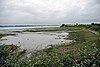
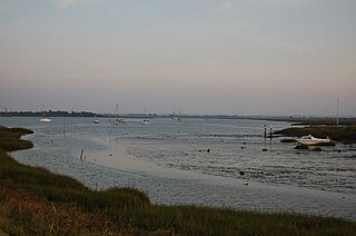
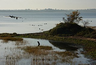
The Blackwater Estuary is the estuary of the River Blackwater between Maldon and West Mersea in Essex. It is a 5,538 hectare biological Site of Special Scientific Interest (SSSI). An area of 4,395 hectares is also designated a Ramsar Wetland of International Importance, and a Special Protection Area 1,099 hectares is a National Nature Reserve. Tollesbury Wick and part of Abbotts Hall Farm, both nature reserve managed by the Essex Wildlife Trust, are in the SSSI.

<span class="mw-page-title-main">Dengie nature reserve</span>

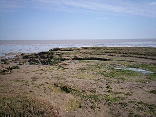
Dengie nature reserve is a 12 sq. mi. biological and geological Site of Special Scientific Interest between the estuaries of the Blackwater and Crouch near Bradwell-on-Sea in Essex. It is also a National Nature Reserve, a Special Protection Area, a Nature Conservation Review site, a Geological Conservation Review site and a Ramsar site. It is part of the Essex estuaries Special Area of Conservation. An area of 30 acres is the Bradwell Shell Bank nature reserve, which is managed by the Essex Wildlife Trust.

<span class="mw-page-title-main">Crouch and Roach Estuaries</span>

The Crouch and Roach Estuaries are a 1729 hectare biological Site of Special Scientific Interest (SSSI) at the mouth of the Crouch and Roach rivers in Essex. The Crouch part of the SSSI stretches from near Battlesbridge to Foulness Island, and the Roach from Rochford to the junction with the Crouch. Part of the site is in the Mid-Essex Coast Special Protection Area under the EC Directive on the Conservation of Wild Birds, and a Ramsar wetland site of international importance. It is also part of the Essex Estuaries Special Area of Conservation. An area of 65 hectares is managed by the Essex Wildlife Trust as the Lion Creek and Lower Raypits nature reserve and 8 hectares at Woodham Fen, both of which are managed by the Essex Wildlife Trust. A small area is also a geological SSSI, The Cliff, Burnham-on-Crouch.

<span class="mw-page-title-main">Abbotts Hall Farm</span>

Abbotts Hall Farm is a 282 hectare nature reserve in Great Wigborough in Essex. It is the head office of the Essex Wildlife Trust, which manages the site. It is also part of the Blackwater Estuary National Nature Reserve, Site of Special Scientific Interest, Ramsar site, Special Protection Area and Special Area of Conservation, It is an important archaeological site, and includes a Scheduled Monument, Great Wigborough henge.

<span class="mw-page-title-main">Bradwell Shell Bank</span>

Bradwell Shell Bank is a nature reserve on the coast of the Dengie Peninsula near Bradwell-on-Sea in Essex. It is managed by the Essex Wildlife Trust. It is part of the Dengie Site of Special Scientific Interest, Special Protection Area and Ramsar site, and the Essex Estuaries Special Area of Conservation. It is also part of the Blackwater Flats and Marshes, a Grade I site in the Nature Conservation Review.

<span class="mw-page-title-main">Colne Point</span>

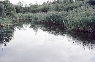
Colne Point is a 276.4-hectare (683-acre) nature reserve south-west of St Osyth in Essex. It is managed by the Essex Wildlife Trust. It is part of the Colne Estuary Site of Special Scientific Interest, national nature reserve, Ramsar site, Nature Conservation Review site and Special Protection Area. It is also part of the Essex Estuaries Special Area of Conservation.

<span class="mw-page-title-main">Fingringhoe Wick</span>

Fingringhoe Wick is a 48.6-hectare (120-acre) nature reserve in Fingringhoe in Essex. It is managed by the Essex Wildlife Trust, which runs a visitor centre on the site. It is part of the Colne Estuary Site of Special Scientific Interest, Ramsar site and Nature Conservation Review site.

<span class="mw-page-title-main">Howlands Marsh</span>

Howlands Marsh is a 29.9-hectare (74-acre) nature reserve north-east of St Osyth in Essex. It is managed by the Essex Wildlife Trust. It is part of the Colne Estuary Site of Special Scientific Interest Special Protection Area and Ramsar site, and the Blackwater Flats and Marshes Nature Conservation Review site.