
The Essex Wildlife Trust (EWT) is one of 46 wildlife trusts which cover the United Kingdom. The EWT was founded in 1959, and it describes itself as Essex's leading conservation charity, which aims to protect wildlife for the future and the people of the county. As of January 2017, it has over 34,000 members and runs 87 nature reserves, 2 nature parks and 11 visitor centres.

Ingrebourne Valley is a local nature reserve (LNR) in Hornchurch in the London Borough of Havering. It is owned and managed by Havering Council, and has a visitor centre managed by the Essex Wildlife Trust. Most of it is in Hornchurch Country Park west of the River Ingrebourne, but there are also areas north and south of the park which are part of the LNR. It has a wide range of habitats, including woodland, grassland, the river and marshes. It is an important site for a range of species of plants, animals and birds, including great crested newts, slow worms, the harvest mouse and the water vole.
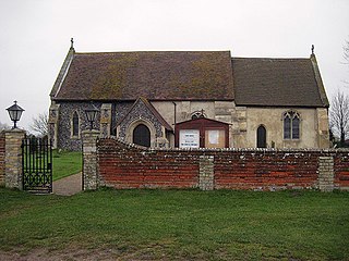
Wrabness is a small village and civil parish near Manningtree, Essex, England. The village is located six miles (10 km) west of Harwich. Wrabness railway station is served by trains on the Mayflower Line. Wrabness had a population of approximately 400.

Ingrebourne Marshes are a 74.8 hectare biological Site of Special Scientific Interest in Hornchurch in the London Borough of Havering. Ingrebourne Valley Local Nature Reserve includes a small part of the SSSI west of the River Ingrebourne. The site is managed by the Essex Wildlife Trust

Roding Valley Meadows is an 18.9 hectare biological Site of Special Scientific Interest in Buckhurst Hill in Essex. It is part of a 65.2 hectare Local Nature Reserve with the same name, which is owned by Epping Forest District Council and Grange Farm Trust, and managed by the Essex Wildlife Trust.
Benfleet and Southend Marshes is an 8.1-square-mile (21 km2) Site of Special Scientific Interest (SSSI) in Essex. It consists of mudflats, salt marshes, scrub and wild grassland, and includes the Southend-on-Sea foreshore. It has been so recognised for its biological value, rather than geological. A definition five percent larger forms the Benfleet and Southend Marshes Ramsar site and Special Protection Area. In the centre-west, more than ten percent of the Site is the Leigh National Nature Reserve (NNR), which has been appraised in detail in A Nature Conservation Review as a site of national importance. The SSSI and NNR include the eastern half of Two Tree Island, in Leigh on Sea which is managed by the Essex Wildlife Trust. A narrow majority of the Site is the Southend on Sea Foreshore Local Nature Reserve.

Great Wood and Dodd's Grove is a 36.8 hectare biological Site of Special Scientific Interest in Leigh-on-Sea in Essex. It is also a Local Nature Reserve called Belfairs. Essex Wildlife Trust runs the Belfairs Woodland Centre and manages the site together with Southend-on-Sea Borough Council.

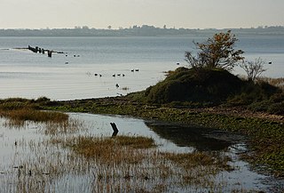
Hamford Water is a 2,185.8-hectare (5,401-acre) biological Site of Special Scientific Interest between Walton-on-the-Naze and Harwich in Essex. The site is a tidal inlet which has marsh grasslands, creeks, mud and sand flats, salt marshes, islands and beaches. It is described by Natural England as "of international importance for breeding little terns and wintering dark-bellied brent geese, wildfowl and waders, and of national importance for many other bird species." Rare plants include hog's fennel and slender hare's-ear. The main invertebrates are worms and thin-shelled molluscs. The largest island, Horsey Island, can be reached on foot at low tide across The Wade from Kirby-le-Soken.

Blue House Farm is a 242.8 hectare nature reserve and farm in North Fambridge, on the north bank of the River Crouch between Burnham-on-Crouch and South Woodham Ferrers in Essex. It is managed by the Essex Wildlife Trust. Most of the site is in of the Crouch and Roach Estuaries Site of Special Scientific Interest.

Fenn Washland is a 4.9 hectare Local Nature Reserve in South Woodham Ferrers in Essex, England. It is owned by Essex County Council and managed by the Council as a part of the nearby Marsh Farm Country Park.
Copperas Wood is a 13.8 hectare nature reserve between Ramsey and Wrabness in Essex. It is owned and managed by the Essex Wildlife Trust, and is part of the Stour and Copperas Woods, Ramsey Site of Special Scientific Interest.
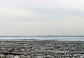
Stour Estuary is a 2,523 hectare biological and geological Site of Special Scientific Interest which stretches from Manningtree to Harwich in Essex and Suffolk. It is also an internationally important wetland Ramsar site, a Special Protection Area and a Nature Conservation Review site. It is part of the Suffolk Coast and Heaths Area of Outstanding Natural Beauty, and there are Geological Conservation Review sites in Wrabness, Stutton, and Harwich Part of the site is managed by the Royal Society for the Protection of Birds, and a small area is Wrabness Nature Reserve, a Local Nature Reserve managed by the Essex Wildlife Trust.

Grove House Wood is a 2.2 hectare Local Nature Reserve in Stanford-le-Hope in Essex. According to Natural England, it is owned by Thurrock Council and managed by Essex Wildlife Trust but it is not listed on the web site of either body.

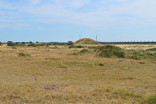
Hilly Fields is a 37.5 hectare Local Nature Reserve in Colchester, Essex. It is owned and managed by Colchester Borough Council. It is also a scheduled monument as it is in a late Iron Age site and Roman Camulodunum.
Shoeburyness Old Ranges or Shoebury Ranges is a 6.4 hectare Local Nature Reserve in Shoeburyness in Essex. It is part of the Foulness Site of Special Scientific Interest, and of the Gunners Park and Shoebury Ranges nature reserve, which is managed by the Essex Wildlife Trust.

Gunners Park and Shoebury Ranges is a 25 hectare nature reserve in Shoeburyness in Essex. It is managed by the Essex Wildlife Trust (EWT). Part of Gunners Park is Shoeburyness Old Ranges Local Nature Reserve, which is itself part of the Foulness Site of Special Scientific Interest. At the eastern end of Gunners Park is the Danish Camp, a Scheduled Monument.
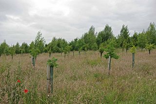
Oakfield Wood is a 2.8 hectare nature reserve west of Wrabness in Essex. It is managed by the Essex Wildlife Trust.

Woodham Fen is an 8.1 hectare nature reserve in South Woodham Ferrers in Essex. It is managed by the Essex Wildlife Trust. It is part of the Crouch and Roach Estuaries Site of Special Scientific Interest.

