
Moat Mount Open Space is a 110-hectare park and nature reserve in Mill Hill in the London Borough of Barnet. It is part of Moat Mount Open Space and Mote End Farm Site of Borough Importance for Nature Conservation, Grade II, which includes Barnet Gate Wood and Scratchwood Countryside Park, but is separate from Scratchwood itself, which is a neighbouring park and nature reserve. Most of the site is open to the public, but Mote End Farm and some other areas are private. Scratchwood and Moat Mount are a Local Nature Reserve.

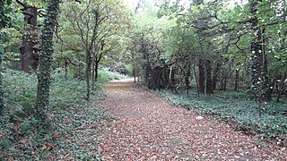
Woodridge Nature Reserve or Woodridge School Nature Reserve is a 0.7-hectare (1.7-acre) Site of Local Importance for Nature Conservation in Woodside Park, London, owned and managed by the London Borough of Barnet. It was designed as a nature trail for local primary schools, but is now very neglected.
Hainault Lodge is a Local Nature Reserve in Hainult, northeast London, England and is the only one in the London Borough of Redbridge. It is owned and managed by Redbrige Council.

Mayesbrook Park is a 43 hectare public park in the London Borough of Barking and Dagenham and in the post town of Dagenham and the pre-1965 borough of Barking. It is owned and managed by the borough council. The southern end, which is mainly a large lake, is a Local Nature Reserve.[broken link] The area covered by the park was once part of the historic Manor of Jenkins, seat of the Fanshawe family. For reasons which remain obscure, the park is nicknamed "Matchstick Island".

Parsloes Park is a 58 hectare public park in Dagenham in the London Borough of Barking and Dagenham. It is owned and managed by the borough council. A small area opposite the Wren Road entrance is managed for wildlife and designated as a Local Nature Reserve called Parsloes Park Squatts.

Perivale Wood is an 11.6 hectare Local Nature Reserve (LNR) and Site of Metropolitan Importance for Nature Conservation in Perivale in the London Borough of Ealing. It is one of the oldest nature reserves in Britain. The Selborne Society has managed it since 1902, at first as a bird sanctuary. In 1914 it leased the site and in 1923 it purchased it. The wood was designated an LNR in 1974.

Anton Crescent Wetland is a one hectare Local Nature Reserve in Sutton in the London Borough of Sutton. It is owned by Sutton Council and managed by the council together with Sutton Nature Conservation Volunteers.

Belmont Pastures is a 1.3 hectare Local Nature Reserve and Site of Borough Importance for Nature Conservation, Grade II, in Belmont in the London Borough of Sutton. It is owned by Sutton Council and managed by the council together with Sutton Nature Conservation Volunteers.

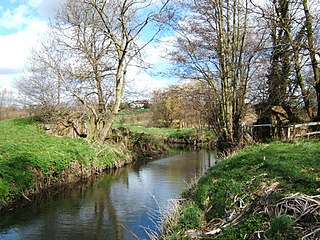
Derwent Floodwash is a 1.8 hectare Local Nature Reserve and Site of Borough Importance for Nature Conservation, Grade II, in Morden Park in the London Borough of Merton. It is owned by the London Borough of Wandsworth and managed by Merton Council. The site borders Pyl Brook, and it is designed to store flood waters when the brook overflows, preventing flooding of properties downstream.

Gutteridge Wood and Meadows is a Local Nature Reserve (LNR) in Yeading in the London Borough of Hillingdon, which is owned by Hillingdon Council and managed by the London Wildlife Trust (LWT). It is also part of the Yeading Brook Meadows Site of Metropolitan Importance for Nature Conservation, which includes two neighbouring reserves managed by the LWT, Ten Acre Wood and Yeading Brook Meadows LNRs.

Ten Acre Wood is a Local Nature Reserve (LNR) in Yeading in the London Borough of Hillingdon, which is owned by Hillingdon Council and managed by the London Wildlife Trust (LWT). It is also part of the Yeading Brook Meadows Site of Metropolitan Importance for Nature Conservation (SINC), which includes two neighbouring LNRs managed by the LWT, Gutteridge Wood and Meadows and Yeading Brook Meadows LNR.

Yeading Brook Meadows is a 17 hectare Local Nature Reserve (LNR) in Yeading in the London Borough of Hillingdon. It is owned by Hillingdon Council and managed by the London Wildlife Trust (LWT). In the north it adjoins Ten Acre Wood across the Golden Bridge and Charville Lane; it then stretches south along the banks of the Yeading Brook to Yeading Lane. The reserve is also part of the Yeading Brook Meadows Site of Metropolitan Importance for Nature Conservation, which includes two neighbouring LNRs managed by the London Wildlife Trust, Ten Acre Wood and Gutteridge Wood and Meadows.

Vange Hill is an 11.5 hectare Local Nature Reserve in Vange, a suburb of Basildon in Essex. It is owned and managed by Basildon Borough Council.

Bull Neadow is a 1.4 hectare Local Nature Reserve in Colchester in Essex, owned and managed by Colchester Borough Council.

Welsh Wood is a 3.2 hectare Local Nature Reserve in Colchester in Essex. It is owned and managed by Colchester Borough Council.

Spring Lane Meadows or Lexden Springs is a 2-hectare (4.9-acre) Local Nature Reserve in Lexden, a suburb of Colchester in Essex. It is owned and managed by Colchester Borough Council.

Colne Local Nature Reserve is a 34.7 hectare Local Nature Reserve in Wivenhoe in Essex. It is owned and managed by Colchester Borough Council.
Colne Valley is a 5.1 hectare Local Nature Reserve north and east of Earls Colne in Essex. It is owned and managed by Colchester Borough Council.

Hilly Fields is a 37.5 hectare Local Nature Reserve in Colchester, Essex. It is owned and managed by Colchester Borough Council. It is also a scheduled monument as it is in a late Iron Age site and Roman Camulodunum.

