Borough of Brentwood

Last updated

Borough of Brentwood
High Street Brentwood Essex - geograph.org.uk - 19540.jpg
High Street in Brentwood, the largest town in the borough
Brentwood UK locator map.svg
Brentwood shown within Essex
Sovereign state United Kingdom
Constituent country England
Region East of England
Non-metropolitan county Essex
Status Non-metropolitan district, Borough
Admin HQ Brentwood
Incorporated1 April 1974
Government
  TypeNon-metropolitan district council
  BodyBrentwood Borough Council
  LeadershipAlternative - Sec. 31 (Liberal Democrat (council NOC))
   MPs Alex Burghart
Area
  Total59.12 sq mi (153.12 km2)
  Rank165th (of 296)
Population
 (2021)
  Total77,103
  Rank282nd (of 296)
  Density1,300/sq mi (500/km2)
  Ethnicity
93.4% White
2.9% S.Asian (Mainly from Mauritius)
1.4% Black
1.3% Mixed
1.0% Chinese or Other
Time zone UTC0 (GMT)
  Summer (DST) UTC+1 (BST)
ONS code 22UD (ONS)
E07000068 (GSS)
OS grid reference TQ595938
Brentwood Borough Council
Brentwood Borough Council logo.png
Type
Type
Leadership
Gareth Barrett,
Labour
since 17 May 2023 [1]
Barry Aspinell,
Liberal Democrat
since 17 May 2023
Jonathan Stephenson
since 2019 [2]
Structure
Seats37 [3]
Political groups
Administration (19)
  Liberal Democrats (17)
  Labour (2)

Opposition (18)

  Conservatives (18)
Elections
Last election
4 May 2023
Next election
2024
Meeting place
Brentwood Town Hall 2023.jpg
Town Hall, Ingrave Road, Brentwood, CM15 8AY
Website
www.brentwood.gov.uk
Ingatestone, one of the settlements of the borough Ingatestone Sign.jpg
Ingatestone, one of the settlements of the borough

The Borough of Brentwood is a local government district with borough status in Essex, England. The borough is named after its main town of Brentwood, where the council is based; it includes several villages and the surrounding rural area.

Contents

The neighbouring districts are Epping Forest, Chelmsford, Basildon, Thurrock and the London Borough of Havering.

History

The former Brentwood Urban District had been created in 1899. [4] Urban districts were abolished in 1974 under the Local Government Act 1972. A new non-metropolitan district was created on 1 April 1974 covering the whole of the former Brentwood Urban District plus parts of another two districts, which were all abolished at the same time: [5]

The new district was named Brentwood after its main town. [6] The district was awarded borough status on 10 March 1993, allowing the chair of the council to take the title of mayor. [7]

Governance

Brentwood Borough Council provides district-level services. County-level services are provided by Essex County Council. Parts of the borough are also covered by civil parishes, which form a third tier of local government. [8]

Political control

The council went under no overall control at the 2023 Brentwood Borough Council election. A Liberal Democrat and Labour coalition subsequently formed an administration. [9]

The first election to the council was held in 1973, initially operating as a shadow authority alongside the outgoing authorities until the new arrangements came into effect on 1 April 1974. Political control of the council since 1974 has been as follows: [10] [11] [12]

Party in controlYears
Conservative 1974–1990
No overall control 1990–1991
Liberal Democrats 1991–2003
No overall control 2003–2004
Conservative 2004–2014
No overall control 2014–2015
Conservative 2015–2023
No overall control 2023–present

Leadership

The role of mayor is largely ceremonial in Brentwood. Political leadership is instead provided by the leader of the council. The leaders since 1991 have been: [13]

CouncillorPartyFromTo
Chris Dale Liberal Democrats 19911996
David Gottesmann Liberal Democrats 19965 May 2002
Vicky Cook Liberal Democrats 22 May 200223 Jun 2004
Brandon Lewis Conservative 23 Jun 200418 Mar 2009
Louise McKinlay Conservative 13 May 200911 Jun 2014
Barry Aspinell Liberal Democrats 11 Jun 201420 May 2015
Louise McKinlay Conservative 20 May 201515 May 2019
Chris Hossack Conservative 15 May 20197 May 2023
Barry Aspinell Liberal Democrats 17 May 2023

Composition

Following the 2023 election, the composition of the council was: [14]

PartyCouncillors
Conservative 18
Liberal Democrats 17
Labour 2
Total37

The next election is due in 2024.

Premises

The council is based at Brentwood Town Hall on Ingrave Road, which had been built in 1957 for the former Brentwood Urban District Council. [15]

Elections

Since the last boundary changes in 2002, the council has comprised 37 councillors representing 15 wards; each ward elects one, two or three councillors. Elections are held three years out of every four, with roughly a third of the council being elected each time for a four-year term. In the fourth year of the cycle, when there are no elections for the borough council, elections for Essex County Council are held instead. [16]

Geography

Mountnessing, one of the settlements of the borough St Giles, Mountnessing - geograph.org.uk - 3152009.jpg
Mountnessing, one of the settlements of the borough

There are still large areas of woodland including Shenfield Common, Hartswood (named after its last private owner, a Mr. Hart), Weald Country Park, and Thorndon Country Park.

Transport

The main transport links run through the borough in a south-west to north-east direction, with other important links running west to east.

Railway

Railway stations at Shenfield and Ingatestone facilitate services along the Great Eastern Main Line to Colchester, Clacton, Ipswich and London Liverpool Street; these are operated by Greater Anglia. [17]

Brentwood and Shenfield stations are served by Greater Anglia trains between Liverpool Street, Billericay, Southend Airport and Southend Victoria; some peak hour services run to Southminster. [17] Elizabeth line stopping trains run between London Paddington, Brentwood and Shenfield; this route is operated by MTR. [18]

Also within the borough is West Horndon station, on the London, Tilbury & Southend line; c2c provides direct trains to London Fenchurch Street, Basildon, Southend Central and Shoeburyness. [19]

Roads

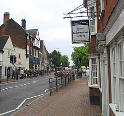
A major trunk road running through the borough is the A12 dual-carriageway, running from East London to Chelmsford, Colchester, the ports of Harwich and Felixstowe, Ipswich and Lowestoft. The old Roman road (A1023) passes through the centre of Brentwood and joins the A12, which by-passes the town. Within different parts of Brentwood, the A1023 is called (from west to east) Brook Street, London Road, High Street, Shenfield Road, and Chelmsford Road.

The other main road in the borough is the A127 Southend Arterial Road, which separates from the A12 near Romford and then proceeds easterly to Southend-on-Sea.

Media

The borough is served by a dedicated community radio stations, Phoenix FM.

Education

Secondary schools

Primary schools

Special schools

Civil parishes and settlements in the borough

There are nine civil parishes in the borough. The former Brentwood Urban District is an unparished area, directly administered by Brentwood Borough Council. [20] [21]

Twinning

Brentwood is twinned with Roth bei Nürnberg in Germany and Montbazon in France.

Arms

Coat of arms of Borough of Brentwood
Brentwood Coat of Arms.jpg
Notes
Originally granted to Brentwood Urban District Council on 1 August 1951.
Crest
On a wreath of the colours rising from the battlements of a tower Azure a demi stag Or.
Escutcheon
Per fesse rayonée Argent and Gules in chief a Cornish chough Proper between two pilgrim's staves erect Sable in base three ancient crowns two and one Or.
Motto
Ardens Fide (Burning Faith) [22]

Related Research Articles

<span class="mw-page-title-main">Billericay</span> Town and civil parish in Essex, England

Billericay is a town and civil parish in the Borough of Basildon in Essex, England. It lies within the London Basin and is 25 miles (40 km) east of Central London. The town has a wide variety of open spaces and the town is thought to have been occupied since the Bronze Age.

<span class="mw-page-title-main">Borough of Basildon</span> Place in England

The Borough of Basildon is a local government district with borough status in Essex, England. The borough is named after its largest town, Basildon, where the council is based. The borough also includes the towns of Billericay and Wickford and surrounding rural areas.

<span class="mw-page-title-main">Ingatestone</span> Commuter village in Essex, England

Ingatestone is a village and former civil parish in Essex, England, with a population of 5,409 inhabitants according to the 2021 census. Just north lies the village of Fryerning, the two now forming the parish of Ingatestone and Fryerning, in the Borough of Brentwood. Ingatestone lies in the Metropolitan Green Belt 20 miles north-east of London. Its built-up area straddles the A12 trunk road and the Great Eastern Main Railway Line. It has become an affluent commuter village, seen as one of the UK's best places to live by the Sunday Times in 2020.

<span class="mw-page-title-main">History of Essex</span> Aspect of history

Essex is a county in the East of England which originated as the ancient Kingdom of Essex and one of the seven kingdoms, or heptarchy, that went on to form the Kingdom of England.

<span class="mw-page-title-main">Shenfield railway station</span> National Rail station in Essex, England

Shenfield railway station is on the Great Eastern Main Line in the East of England, serving the town of Shenfield, Essex. As well as being a key interchange for medium- and long-distance services on the main line, it is also the western terminus of a branch line to Southend Victoria and one of the two eastern termini of the Elizabeth line. It is 20 miles 16 chains (32.51 km) down the line from Liverpool Street and is situated between Brentwood and either Ingatestone on the main line or Billericay on the branch line. Its three-letter station code is SNF.

<span class="mw-page-title-main">Shenfield</span> Town in Essex, England

Shenfield is a town in the Borough of Brentwood in Essex, England. In 2020, the ward was estimated to have a population of 5,396.

<span class="mw-page-title-main">Mountnessing</span> Human settlement in England

Mountnessing is a village and civil parish in the Borough of Brentwood in south Essex, England. It is situated to the north-east of Brentwood, south-west of Ingatestone. A large proportion of the houses are situated on the Roman Road between Brentwood and Ingatestone. The village is approximately equidistant between the two closest railway stations of Shenfield and Ingatestone. It Main Attractions is the Mountnessing Windmill and the local pub opposite called the Prince of Wales Pub.

<span class="mw-page-title-main">Hutton, Essex</span> Human settlement in England

Hutton is an area of Brentwood, Essex, England. It has good links to Central London via Shenfield train station which is just 1 mile (1.6 km) from Hutton. Brentwood town centre lies 3 miles to the west. The area can be split between modest housing estates and the largely affluent Hutton Mount. There are two wards named "Hutton". Hutton was formerly a civil parish, which was abolished in 1934 and absorbed into Brentwood.

<span class="mw-page-title-main">West Horndon</span> Human settlement in England

West Horndon is a village and civil parish in the south of the Borough of Brentwood in Essex, England. It is located 20 miles (32 km) east-northeast of Charing Cross in Central London. West Horndon civil parish was abolished in 1934 and created again in 2003 with new boundaries following a petition by residents in 2002. With a population of 1,650 in 2021, it is a predominantly rural parish with some residential and light industrial development. The civil parish includes the village of East Horndon. Dunton Hills, also within the civil parish, is planned to be the location of a new 3,700 home garden village. The local council of the parish is West Horndon Parish Council.

<span class="mw-page-title-main">Chelmsford (UK Parliament constituency)</span> Parliamentary constituency in the United Kingdom (1885-1997 and 2010 onwards)

Chelmsford is a constituency in Essex represented in the House of Commons of the UK Parliament since 2017 by Vicky Ford of the Conservative Party.

<span class="mw-page-title-main">Stock, Essex</span> Village in Essex, England

Stock is a village and civil parish in south Essex, England. It is about 6 miles (10 km) south of Chelmsford, the county town. The village is in the borough of Chelmsford and in the parliamentary constituency of Maldon.

<span class="mw-page-title-main">A128 road</span> Road in Essex, England

The A128 is an A-road in Essex, England.

<span class="mw-page-title-main">Ramsden Heath</span> Village in Essex, England

Ramsden Heath is a village in Essex in the east of England. It is located approximately 8 mi (13 km) south of the county town of Chelmsford; the closest towns are Billericay, approximately 3 mi (4.8 km) west-south-west, and Wickford, approximately 3.5 mi (5.6 km) south-east. The village is close to Hanningfield Reservoir and the smaller village of Downham lies immediately to the east.

<span class="mw-page-title-main">Brentwood, Essex</span> Human settlement in England

Brentwood is a town in Essex, England, in the London commuter belt 20 miles (30 km) north-east of Charing Cross and close to the M25 motorway. The population of the built-up area was 55,340 in 2021.

Chelmsford Rural District was a local government district in Essex, England from 1894 to 1974. It surrounded, but did not include, the town of Chelmsford; which formed a municipal borough.

Margaretting is a village and civil parish in the Chelmsford district, in the county of Essex, England. The population of the village taken at the 2011 Census was 847.

<span class="mw-page-title-main">Essex</span> Ceremonial county in the East of England

Essex is a ceremonial county in the East of England and one of the home counties. It is bordered by Cambridgeshire and Suffolk to the north, the North Sea to the east, Kent across the Thames Estuary to the south, Greater London to the south-west, and Hertfordshire to the west. The largest settlement is Southend-on-Sea, and the county town is Chelmsford.

References

  1. "Introducing the new Mayor of Brentwood". Brentwood Borough Council. 19 May 2023. Retrieved 23 May 2023.
  2. Ferris, Mick (10 September 2019). "New CEO for Brentwood Council". Yellow Advertiser. Retrieved 2 June 2023.
  3. "Councillors". Brentwood Borough Council. Retrieved 23 March 2022.
  4. "Brentwood Urban District". A Vision of Britain through Time. GB Historical GIS. Retrieved 2 June 2023.
  5. "The English Non-metropolitan Districts (Definition) Order 1972", legislation.gov.uk , The National Archives, SI 1972/2039, retrieved 31 May 2023
  6. "The English Non-metropolitan Districts (Names) Order 1973", legislation.gov.uk , The National Archives, SI 1973/551, retrieved 31 May 2023
  7. "Bulletin of Changes of Local Authority Status, Names and Areas 1 April 1992 – 31 March 1993" (PDF). Department of The Environment. Archived from the original (PDF) on 13 December 2011. Retrieved 15 January 2012.
  8. "Local Government Act 1972", legislation.gov.uk , The National Archives, 1972 c. 70, retrieved 31 May 2023
  9. Dedman, Simon (19 May 2023). "Brentwood Council: Lib Dems to run authority with Labour". BBC News. Retrieved 23 May 2023.
  10. "Compositions calculator". The Elections Centre. Retrieved 1 June 2023.
  11. "Brentwood". BBC News Online . 19 April 2009. Retrieved 7 May 2010.
  12. "Lib Dems gain two seats from Tories in local election". Brentwood Weekly News. 7 May 2010. Retrieved 7 May 2010.
  13. "Council minutes". Brentwood Borough Council. Retrieved 10 June 2022.
  14. "Local elections 2023: live council results for England". The Guardian.
  15. Bettley, J.; Pevsner, N. (2007). The Buildings of England Series: Essex. Yale University Press. ISBN   978-0300116144.
  16. "The Borough of Brentwood (Electoral Changes) Order 2001", legislation.gov.uk , The National Archives, SI 2001/2441, retrieved 3 June 2023
  17. 1 2 "Timetables". Greater Anglia. 21 May 2023. Retrieved 30 September 2023.
  18. "Elizabeth line timetables". Transport for London. 21 May 2023. Retrieved 30 September 2023.
  19. "Timetables". c2c. 21 May 2023. Retrieved 30 September 2023.
  20. "Election Maps". Ordnance Survey. Retrieved 3 June 2023.
  21. "Parish Council contact details". Brentwood Borough Council. Retrieved 3 June 2023.
  22. "East of England Region". Civic Heraldry of England. Retrieved 8 March 2021.

51°36′N0°18′E / 51.6°N 0.3°E / 51.6; 0.3