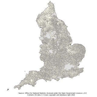
A parish council is a civil local authority found in England, which is the lowest tier of local government. Parish councils are elected corporate bodies, with variable tax raising powers, and they carry out beneficial public activities in geographical areas known as civil parishes. There are about 10,480 parish and town councils in England. Parish councils may be known by different styles, they may resolve to call themselves a town council, village council, community council, neighbourhood council, or if the parish has city status, it may call itself a city council. However their powers and duties are the same whatever name they carry.
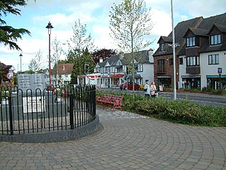
Verwood is a town and civil parish in eastern Dorset, England. The town lies 10 miles (16 km) north of Bournemouth and 13 miles (21 km) north east of Poole as the crow flies. The civil parish comprises the town of Verwood together with the extended village of Three Legged Cross, and in 2014 had a population of 15,170. Verwood is the largest town in Dorset without an upper school.

Polegate is a town and civil parish in the Wealden District of East Sussex, England, United Kingdom. It is located five miles (8 km) north of the seaside resort of Eastbourne and is part of the greater area of that town. Although once a railway settlement, its rail links were closed as part of the Beeching cuts. The 2011 census put the civil parish of Polegate at a population of 8,586, with 41.2% aged 65 and over.

The City of Chelmsford is a local government district with borough and city status in Essex, England. It is named after its main settlement, Chelmsford, which is also the county town of Essex. As well as the settlement of Chelmsford itself, the district also includes the surrounding rural area and the town of South Woodham Ferrers.
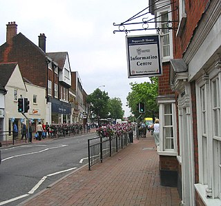
The Borough of Brentwood is a local government district with borough status in Essex, England. The borough is named after its main town of Brentwood, where the council is based; it includes several villages and the surrounding rural area.

Ingatestone is a village and former civil parish in Essex, England, with a population of 5,409 inhabitants at the 2021 Census. Just north lies the village of Fryerning; the two now forming the parish of Ingatestone and Fryerning, in the Borough of Brentwood. Ingatestone lies in the Metropolitan Green Belt 20 miles north-east of London. Its built-up area straddles the A12 trunk road and the Great Eastern Main Line railway.

Hoo St Werburgh, commonly known as Hoo, is a large village and civil parish in the Medway district of Kent, England. It is one of several villages on the Hoo Peninsula to bear the name Hoo, a Saxon word believed to mean "spur of land" or to refer to the "distinct heel-shape of the ridge of hills" through the settlement. Hoo features in Domesday Book, and had a population of 7,356 at the 2001 census, rising to 8,945 at the 2011 census. The civil parish includes Chattenden to the west.

Thornley is a village and civil parish in County Durham, England, about 5 miles (9 km) to the east of Durham and 5 miles (7 km) west of Peterlee. The community grew around a coal mine established in 1835, which remained open until 1970.

A Local Council (LC) is a form of local elected government within the districts of Uganda.
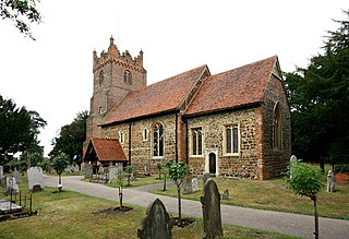
Fryerning is a small village and former civil parish, now in the parish of Ingatestone and Fryerning, in the Brentwood district, in the county of Essex, England. It is situated approximately 2 miles (3.2 km) north of Ingatestone. The parish church of St. Mary the Virgin, on Blackmore Road, dates back from the 11th century, with a 15th-century brick tower. It has a memorial stained glass window to the murdered politician Airey Neave, which was unveiled by his cousin Penelope in 1985. An ancient English Yew, found to the west of the church and is over a millennium old, is thought to be one of Essex's oldest trees. In 1881, the parish had a population of 704.

Caddington is a village and civil parish in the Central Bedfordshire district of Bedfordshire, England.
A parish meeting is a meeting all the electors in a civil parish in England are entitled to attend.

Chelmsford is a constituency in Essex represented in the House of Commons of the UK Parliament since 2024 by Marie Goldman of the Liberal Democrats.

Staines Rural District was a rural district of Middlesex in England from 1894 to 1930.

Maulden is a village and civil parish located in the county of Bedfordshire. The village is located 1.5 miles east of Ampthill and about 8 miles (13 km) south of Bedford. It has about 1,250 homes and 3130 residents.

Little Bowden is an area on the edge of Market Harborough and former civil parish in the Harborough district, in the county of Leicestershire, England. As a village it was formerly part of Northamptonshire. The River Jordan runs through part of the area.
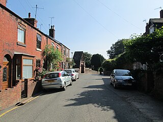
Cheddleton is an ancient parish and village in the Staffordshire Moorlands, near to the town of Leek, England.
Chelmsford Rural District was a local government district in Essex, England from 1894 to 1974. It surrounded, but did not include, the town of Chelmsford; which formed a municipal borough.

Kensworth is a village and civil parish located in the Central Bedfordshire district of Bedfordshire, England. The parish is located on the edge of Dunstable Downs, and includes the hamlets of California and Kensworth Lynch.
Margaretting is a village and civil parish in the Chelmsford district, in the county of Essex, England. The population of the village taken at the 2011 Census was 847.


