South Benfleet

Last updated

South Benfleet
High Rd Benfleet - geograph.org.uk - 98722.jpg
High Road, Benfleet
Essex UK location map.svg
Red pog.svg
South Benfleet
Location within Essex
OS grid reference TQ782860
District
Shire county
Region
Country England
Sovereign state United Kingdom
Post town BENFLEET
Postcode district SS7
Dialling code 01268
Police Essex
Fire Essex
Ambulance East of England
UK Parliament
List of places
UK
England
Essex
51°33′N0°34′E / 51.55°N 0.56°E / 51.55; 0.56 [1]

South Benfleet is a town and former civil parish, in the Castle Point district of Essex, England, 30 miles east of London. It is adjacent to the village of North Benfleet. The Benfleet (SS7) post town includes South Benfleet, Thundersley, New Thundersley and Hadleigh. The Battle of Benfleet took place here between the Vikings and Saxons in 894. [2] In 1951 the parish had a population of 8191. [3]

Contents

The community is directly north of Canvey Island and is served by Benfleet railway station. It hosts South Benfleet Primary School, which was used temporarily to house local residents during the widespread flooding of 1953.

At the junction of Saint Mary's Church and The Anchor pub is the site of the UK's first "overrunable" mini roundabout. [4]

History

In Roman times the reclaimed area which is now Canvey Island was joined to the mainland by a road providing access from Benfleet at low tides to Camulodunum (Colchester) and Londinium (London). The A130 road from Sadlers Farm roundabout to Canvey Island follows the route of the original Roman road. Its construction in 1971 brought to light a number of artifacts dating back to the early settlements in the area.

The name of the town originates from the time of the Saxon settlers in the 5th century, when the area was largely marshland. They named the area Beamfleote, meaning "tree stream", being the area where the creeks from the River Thames adjoined the wooded area to the north. The current spelling was adopted at the time the railway service was brought to the area and a railway station built for the town. Throughout the intervening period various documented versions of the names has been 'Benfleota', 'Beamflet', 'Bemflet', 'Bienflet' and 'Bemfleet'. The last was used on John Norden's maps in the 17th century.

In Saxon times the village became known as South Benfleet when a new settlement, which became known as Little Benfleet, developed to the north of the original settlement. The new settlement did not last, and its site, which has since become known as North Benfleet, is now largely rural.

The railway was brought to the town in 1855. The new Benfleet railway station connected the town with Southend-on-Sea to the east and London Fenchurch Street station.

In July 2002, Castle Point District Council named a 6-mile cycle way, from near Benfleet railway station to near Leigh-on-Sea railway station, the "de Neumann Way" after Captain Peter de Neumann, GM.

Battle of Benfleet

The Battle of Benfleet took place between the Saxons and Danish Vikings in 894. This was towards the end of the Saxon period, and the Thames and other waterways made the area vulnerable to Viking attacks. Benfleet was used as a Viking base. However, the Vikings were defeated in the battle by the army of King Alfred under the command of his son Edward the Elder and his son-in-law Earl Aethelred of Mercia. Subsequently, a church was built by the Saxons in thanksgiving for the victory over the Vikings.[ citation needed ] St Mary's is the most recent church building occupying this site and is a Grade I listed building. [5]

In December 2008 a sculpture commemorating the battle was erected in Ferry Road, South Benfleet. [6]

Geography

Local towns

Governance

There are two tiers of local government covering South Benfleet, at district and non-metropolitan county level: Castle Point Borough Council, based in Thundersley, and Essex County Council, based in Chelmsford.

South Benfleet was an ancient parish. In 1929 the parish was merged with the neighbouring parishes of Hadleigh and Thundersley to become Benfleet Urban District. The three parishes were thereafter classed as urban parishes and so no longer had separate parish councils, instead being directly administered by Benfleet Urban District Council. [8] [9]

Benfleet Urban District was abolished on 1 April 1974 under the Local Government Act 1972, becoming part of the new district of Castle Point. No successor parish was created for the former urban district and so it became an unparished area. [10]

Transport

Benfleet railway station is served by the London, Tilbury and Southend railway line, currently run by c2c rail. By road the A13 and A12/A127/A130 connect the town to London.

Notable people

Landmarks

Saint Mary's Parish Church StMary'sChurchBenfleet SouthEast.JPG
Saint Mary's Parish Church

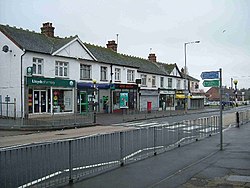
The Church of England in Benfleet is served by the Church of St Mary the Virgin. The public houses located in the Monument and St Mary's area of the town include The Anchor, The Hoy and Helmet and the Half Crown. Further north is the Benfleet Tavern. There is also a range of restaurants in the South Benfleet conservation area.

Benfleet Water Tower ( TQ 790 867 ) is a brick built structure built in 1903, which is 30m high with a 22m mast sited on the roof. All radio equipment is housed within the tower. Being on a prominent hilltop, some 137m amsl, this is an exceptional radio transmission and reception site. Coverage includes the whole estuary, including the Isle of Grain, Medway Towns, Southend, Bradwell, Danbury etc. This site provides both Highband and Lowband CBS systems.

Sport

Benfleet FC are members of the Essex Olympian Football League.[ citation needed ] The First Team play in Senior Division 1 and Seconds in the Reserve Division 2.[ citation needed ] There is also a third team who compete in the Mid-Essex Division 3. The club play their home fixtures at Woodside Park Extension at the top of Manor Road. Fixtures are organised on a Saturday afternoon, with some mid-week fixtures towards the end of the season.

Benfleet is the home to Sceptre League Division 1 Sunday team Benfleet FC, who finished 8th in 2010/2011 season.[ citation needed ]

Benfleet FC (Sunday) managed to win the Mike Wigget Cup in 2009/2010 season, beating Shoebury Boys 4–2 in the final at Burroughs Park, Great Wakering.[ citation needed ]

Benfleet Vikings RFC are the town's local rugby club, formed in 2013, with Senior, Youth, and Minis sides.[ citation needed ] The senior side currently compete in the Shepherd Neame Essex Merit League 6 East and play their home fixtures on Saturdays at Richmond Park, off of Brook Road.

Benfleet is also home to South Benfleet United F.C., a football club formed in 1978 for youth football but is now a men's and veterans' (over 35s) club.[ citation needed ] Their men's team currently play in the Sceptre League and their veterans teams are in the Premier Division and Division 3 of the Southend Borough Combination Veterans League.

Benfleet Cricket Club (established 1948) currently play their home matches at Woodside Park at the top of Manor Road. Members of the Hambro Financial Cricket League (formerly Shepherd Neame Essex League), they currently field five adult teams on a Saturday, two adult teams on a Sunday, and teams at u9, u11, u13 and u15 age groups in competitions organised by the South Essex Cricket Participation Group.

Benfleet was referred to as Beamfleot in The Saxon Stories by Bernard Cornwell.

Images

See also

Related Research Articles

<span class="mw-page-title-main">Castle Point</span> Non-metropolitan district and borough in England

Castle Point is a local government district with borough status in south Essex, England, lying 30 miles (48 km) east of central London. The borough comprises an area on the mainland and the adjoining Canvey Island in the Thames Estuary, which is connected to the mainland by bridges. The council is based in Thundersley. The borough's other main settlements are Canvey Island, Hadleigh and South Benfleet.

<span class="mw-page-title-main">A13 road (England)</span> Major road in England

The A13 is a major road in England linking Central London with east London and south Essex. Its route is similar to that of the London, Tilbury and Southend line via Rainham, Grays, Tilbury, Stanford-Le-Hope & Pitsea,and runs the entire length of the northern Thames Gateway area, terminating on the Thames Estuary at Shoeburyness. It is a trunk road between London and the Tilbury junction, a primary route between there and Sadlers Hall Farm near South Benfleet, and a non-primary route between there and Shoeburyness.

<span class="mw-page-title-main">Canvey Island</span> Human settlement in England

Canvey Island is a town, civil parish and reclaimed island in the Thames estuary, near Southend-on-Sea, in the Castle Point district, in the county of Essex, England. It has an area of 7.12 square miles (18.44 km2) and a population of 38,170. It is separated from the mainland of south Essex by a network of creeks. Lying only just above sea level, it is prone to flooding at exceptional tides and has been inhabited since the Roman conquest of Britain.

<span class="mw-page-title-main">Borough of Basildon</span> Place in England

The Borough of Basildon is a local government district with borough status in Essex, England. The borough is named after its largest town, Basildon, where the council is based. The borough also includes the towns of Billericay and Wickford and surrounding rural areas.

<span class="mw-page-title-main">Castle Point (UK Parliament constituency)</span> Parliamentary constituency in the United Kingdom since 1983

Castle Point is a constituency in Essex represented in the House of Commons of the UK Parliament since 2010 by Rebecca Harris, a Conservative.

<span class="mw-page-title-main">A127 road</span> Road in Essex, England

The A127, also known as the Southend Arterial Road, is a major road in Essex, England. It was constructed as a new arterial road project in the 1920s, linking Romford with Southend-on-Sea, replacing the older A13. Formerly classified as a trunk road, it was "de-trunked" in 1997. It is known as the Southend Arterial Road except for part of its length in Southend-on-Sea. It is also streetlit for its whole length despite its majority coverage through rural land.

<span class="mw-page-title-main">Thundersley</span> Town in Essex, England

Thundersley is a town and former civil parish, in the Castle Point borough, in southeast Essex, England. It sits on a clay ridge shared with Basildon and Hadleigh, 31 miles (50 km) east of Charing Cross, London. In 2011 it had a population of 24,800.

Benfleet Urban District was an urban district in the county of Essex, England. It was created on 1 October 1929 from the parts of Rochford Rural District containing the civil parishes of Hadleigh, South Benfleet and Thundersley.

Rochford Rural District was a rural district with an area of 146.01 square kilometres in the county of Essex, England. It was created in 1894, in 1897 the parish of Leigh was removed to create the Leigh-on-Sea Urban District. In 1926 the parish of Canvey Island was removed to create the Canvey Island Urban District. In 1929 the parishes of Hadleigh, South Benfleet and Thundersley were removed to create the Benfleet Urban District, at the same time the parishes of Rayleigh and Rawreth were removed to create the Rayleigh Urban District.

<span class="mw-page-title-main">Prittle Brook</span> Stream in south Essex, England

The Prittle Brook is a 7.2 mile (11.59 km) watercourse in south Essex, England. A tributary of the River Roach, the brook rises in Thundersley and passes through Hadleigh, Leigh-on-Sea, Westcliff, Prittlewell, Rochford and discharges into the Roach and then into the North Sea via the Roach and Crouch estuaries.

<span class="mw-page-title-main">Daws Heath</span>

Daws Heath contains a large area of woodland in eastern Thundersley, part of Castle Point near Southend-on-Sea in Essex, England. It is traversed by the Daws Heath Road and St Michael's Road. Daws Heath provides a semi-rural escape for local towns and villages and their residents as they walk, cycle or drive out of Castle Point, as Daws Heath Road has fields and woodland on both sides of the road with a small scattering of houses. Going down Daws Heath Road it is not uncommon to see rare-breed cattle, sheep and horses. Daws Heath is surrounded by Greenbelt and Woodland which are a buffer to stop the local villages merging by development. West Woods, nearly 80 acres (320,000 m2) of mixed woodland, was purchased from the Church of England in 2009, securing continued public access to these woods; public support in the Daws Heath area is very strong especially on green belt and woodland preservation. The area has established neighbourhood watch schemes, Church Groups and Greenbelt Protection Groups. Daws Heath contains The Deanes,, and is linked to a local Sixth Form College in Thundersley (SEEVIC), now part of USP College.

<span class="mw-page-title-main">Pitsea</span> Human settlement in England

Pitsea is a town and former civil parish in the Borough of Basildon in south Essex, England. It comprises five sub-districts: Eversley, Northlands Park Neighbourhood, Chalvedon, Pitsea Mount and Burnt Mills. It is part of the town of Basildon.

<span class="mw-page-title-main">Eastwood, Essex</span> Human settlement in England

Eastwood is a suburb of the city of Southend-on-Sea, in the ceremonial county of Essex, England. Eastwood is sometimes called Eastwood Park, particularly for local elections. It was formerly a civil parish, the main part of which was absorbed into the municipal borough of Southend-on-Sea in 1933.

<span class="mw-page-title-main">Hadleigh, Essex</span> Human settlement in England

Hadleigh is a town and former civil parish, in the borough of Castle Point, in southeast Essex, England, on the A13 between Thundersley, Benfleet and Leigh-on-Sea with a population of 18,300. It has a squared bypass to the north.

<span class="mw-page-title-main">South East Essex (UK Parliament constituency)</span> Parliamentary constituency in the United Kingdom, 1885-1950 & 1955–1983

South East Essex was a parliamentary constituency in Essex in the East of England. It returned one Member of Parliament (MP) to the House of Commons of the Parliament of the United Kingdom.

<span class="mw-page-title-main">Corringham, Essex</span> Human settlement in England

Corringham is a town and former civil parish in the unitary authority area of Thurrock, in the ceremonial county of Essex, England, located directly next to the town of Stanford-le-Hope, about 24 miles (39 km) east of London and 3 miles (4.8 km) south of Basildon. Corringham lies on a hill overlooking the Thames between Canvey Island and Tilbury Fort. It is 6 miles (9.7 km) north-east of Grays, the administrative centre of Thurrock.

<span class="mw-page-title-main">A130 road</span> Road in Essex, England

The A130 is a major road in England linking Howe Green, near Chelmsford, the county town of Essex, with Canvey Island in the south of that county. It is a primary route for some of its length, only losing that status south of the A13 junction at Sadlers Farm roundabout as it nears its terminus on Canvey Island. It was originally a much longer cross-country route.

<span class="mw-page-title-main">Essex</span> Ceremonial county in the East of England

Essex is a ceremonial county in the East of England, and one of the home counties. It is bordered by Cambridgeshire and Suffolk to the north, the North Sea to the east, Kent across the Thames Estuary to the south, Greater London to the south-west, and Hertfordshire to the west. The largest settlement is Southend-on-Sea, and the county town is Chelmsford.

<span class="mw-page-title-main">Bowers Gifford and North Benfleet</span> Civil parish in Basildon, England

Bowers Gifford and North Benfleet is a civil parish in the Basildon district, located within the county of Essex, England. The parish includes the villages of Bowers Gifford and North Benfleet. The parish was formed on 1 April 2010. In 2021 the parish had a census recorded population of 1962. There are 7 listed buildings in Bowers Gifford and North Benfleet. The local council is Bowers Gifford and North Benfleet Parish Council.

References

  1. Map of South Benfleet manor (and later parish)
  2. Holland, Julian (2007). Exploring the Islands of England and ... - Google Books. Frances Lincoln Limited. ISBN   9780711227439 . Retrieved 2 April 2010.
  3. "Population statistics South Benfleet AP/CP through time". A Vision of Britain through Time . Retrieved 25 December 2021.
  4. Lawrence Goldman (7 March 2013). Oxford Dictionary of National Biography 2005-2008. OUP Oxford. p. 108. ISBN   978-0-19-967154-0.
  5. "CHURCH OF ST MARY THE VIRGIN, Non Civil Parish - 1123690 | Historic England". historicengland.org.uk. Retrieved 18 January 2022.
  6. "Battle memorial's stylish fence". Echo. 9 February 2009. Retrieved 18 January 2022.
  7. "History of New Thundersley, in Castle Point and Essex | Map and description".
  8. "South Benfleet Ancient Parish / Civil Parish". A Vision of Britain through Time. GB Historical GIS / University of Portsmouth. Retrieved 22 August 2023.
  9. "Rochford Registration District". UKBMD. Retrieved 25 December 2021.
  10. "The English Non-metropolitan Districts (Definition) Order 1972", legislation.gov.uk , The National Archives, SI 1972/2039, retrieved 31 May 2023
  11. "Gymnastics: Nicola's the UK number one". Daily Gazette. 1 November 2001. Retrieved 4 February 2019.

Commons-logo.svg Media related to South Benfleet at Wikimedia Commons