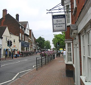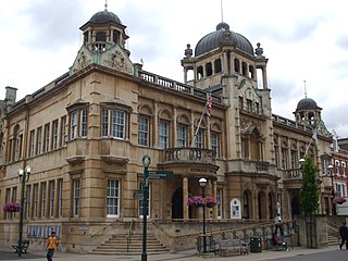
Romford is a large town in East London and the administrative centre of the London Borough of Havering. It is located 14 miles northeast of Charing Cross and is one of the major metropolitan centres identified in the London Plan. Historically, Romford was a market town in the county of Essex, and formed the administrative centre of the liberty of Havering before that liberty was dissolved in 1892. Good road links to London and the opening of the railway station in 1839 were key to the development of the town. The economic history of Romford is characterised by a shift from agriculture to light industry and then to retail and commerce. As part of the suburban growth of London throughout the 20th century, Romford significantly expanded and increased in population, becoming a municipal borough in 1937 and was incorporated into Greater London in 1965. Today, it is one of the largest commercial, retail, entertainment and leisure districts in London and has a well-developed night-time economy. Its population, as of 2011, was 122,854.

Harold Hill is a suburban area in the London Borough of Havering, East London. 16.6 miles (26.7 km) northeast of Charing Cross. It is a district centre in the London Plan. The name refers to King Harold II, who held the manor of Havering-atte-Bower, and who was killed at the Battle of Hastings in 1066. The suburb is peripheral to London, forming an eastern edge of the urban sprawl.

The A12 is a major road in Eastern England. It runs north-east/south-west between London and the coastal town of Lowestoft in the north-eastern corner of Suffolk, following a similar route to the Great Eastern Main Line until Ipswich. A section of the road between Lowestoft and Great Yarmouth became part of the A47 in 2017. Between the junctions with the M25 and the A14, the A12 forms part of the unsigned Euroroute E30. Unlike most A roads, this section of the A12, together with the A14 and the A55, has junction numbers as if it were a motorway.

The Borough of Brentwood is a local government district with borough status in Essex, England. The borough is named after its main town of Brentwood, where the council is based. The borough also includes several villages and the surrounding rural area.

Brentwood is a town in the Borough of Brentwood, in the county of Essex in the East of England. It is in the London commuter belt, situated 20 miles (30 km) east-north-east of Charing Cross and close by the M25 motorway. In 2017, the population of the town was estimated to be 54,885.

Waltham Forest Town Hall is a municipal building located in Walthamstow, East London. The town hall, which is the headquarters of Waltham Forest London Borough Council, is a Grade II Listed Building.

Barking Town hall is a municipal building in Clockhouse Avenue, Barking, London, England. The town hall, which is the headquarters of Barking and Dagenham London Borough Council, is a locally listed building.

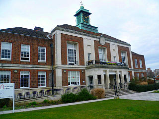
Havering Town Hall is a municipal building in Main Road, Romford, London. The town hall, which is the headquarters of Havering London Borough Council, is a Grade II listed building.

Newham Town Hall, formerly East Ham Town Hall, is a municipal building in Barking Road, East Ham, London. The town hall, which is the headquarters of Newham London Borough Council, is a Grade II* listed building.

Stratford Town Hall is a municipal building in Stratford, London. It is a Grade II listed building.

Redbridge Town Hall is a municipal building in High Road, Ilford, London. The town hall, which is the headquarters of Redbridge London Borough Council, is a Grade II listed building.

Leyton Town Hall is a municipal building in Adelaide Road, Leyton, London. The building, which includes Leyton Great Hall, is a Grade II listed building.

Wallington Town Hall is a municipal building in Woodcote Road, Wallington, London. It is a Grade II listed building.

Colchester Town Hall is a municipal building in the High Street in Colchester, Essex, England. The town hall, which is the headquarters of Colchester City Council, is a Grade I listed building.

Preston Town Hall is a municipal building in Lancaster Road in Preston, Lancashire, England. The town hall, which is the headquarters of Preston City Council, is a Grade II listed building.

Worthing Town Hall, or New Town Hall, is a municipal building in Chapel Road, Worthing, West Sussex, England. The town hall, which is a meeting place of Worthing Borough Council, is a Grade II listed building. Located at Chapel Road in the centre of Worthing, it was opened in 1933 and built in a neo-Georgian style to designs by Charles Cowles-Voysey. Containing offices and a Council chamber it replaced Worthing's Old Town Hall as the administrative centre, a building that had been the home of Worthing's local authority from 1835 and was demolished in 1966. To the rear and west lies the Assembly Hall, built in 1935, also to designs by Cowles-Voysey. To the south lies the Worthing Museum and Art Gallery, originally built as a Carnegie Library.

Dudley Council House is a municipal building in Priory Road, Dudley, West Midlands, England. The Council House, which is the meeting place of Dudley Metropolitan Borough Council is a Grade II listed building.

Farnham Town Hall is a municipal building in South Street, Farnham, Surrey, England. It provides the offices and the meeting place of Farnham Town Council.

The Municipal Buildings are based on the north side of High East Street in Dorchester, Dorset, England. The structure, which was the headquarters of Dorchester Borough Council, is a Grade II* listed building.

Woking Civic Offices is a municipal building in Gloucester Walk, Woking, Surrey, England. It is in use as the headquarters of Woking Borough Council.


