
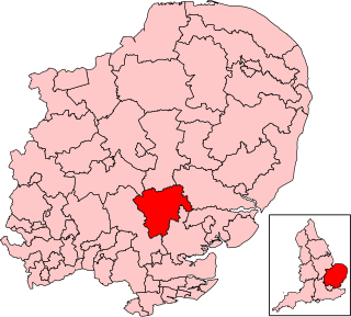
Witham is a town and civil parish in the Braintree district, in the county of Essex, England. In the 2011 census, it had a population of 25,353. It is twinned with the town of Waldbröl, Germany. Witham stands on the Roman road between the cities of Chelmsford and Colchester. The River Brain runs through the town and joins the River Blackwater on the outskirts.

Braintree District is a local government district in Essex, England. The district is named after the town of Braintree, where the council is based. The district also includes the towns of Halstead and Witham and surrounding rural areas.

The Essex Wildlife Trust (EWT) is one of 46 wildlife trusts which cover the United Kingdom. The EWT was founded in 1959, and it describes itself as Essex's leading conservation charity, which aims to protect wildlife for the future and the people of the county. As of January 2017, it has over 34,000 members and runs 87 nature reserves, 2 nature parks and 11 visitor centres.

The River Blackwater is a river in Essex, England. It rises as the River Pant in the northwest of the county, just east of Saffron Walden, and flows in a generally southeast direction to Bocking, near Braintree, via Great Sampford and Great Bardfield. At Bocking, it becomes the River Blackwater, and veers east to flow past Bradwell Juxta Coggeshall and Coggeshall. It then veers south, flowing past Kelvedon and Witham, before reaching Maldon. There, it veers east again and empties into the Blackwater Estuary, which in turn meets the North Sea at Mersea Island.
Braintree is a constituency in Essex represented in the House of Commons of the UK Parliament since 2015 by James Cleverly, a member of the Conservative Party.
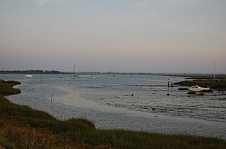
The Blackwater Estuary is the estuary of the River Blackwater between Maldon and West Mersea in Essex. It is a 5,538 hectare biological Site of Special Scientific Interest (SSSI). An area of 4,395 hectares is also designated a Ramsar Wetland of International Importance, and a Special Protection Area 1,099 hectares is a National Nature Reserve. Tollesbury Wick and part of Abbotts Hall Farm, both nature reserve managed by the Essex Wildlife Trust, are in the SSSI.

The River Brain is a tributary of the River Blackwater in Essex, England. It is claimed to have given its name to the town of Braintree, although it seems that the name ‘Braintree’ is older, and that the river name is a back formation from the town name; Braintree lies on a low ridge between the Brain and the River Blackwater. To the north of Braintree it is known as Pods Brook. The brook rises near the village of Bardfield Saling. Below Braintree the Brain joins the Blackwater in Whet Mead in Witham. In 2001, a "flood park" was planned to reduce the risk of overflow from the river.

Ingrebourne Valley is a local nature reserve (LNR) in Hornchurch in the London Borough of Havering. It is owned and managed by Havering Council, and has a visitor centre managed by the Essex Wildlife Trust. Most of it is in Hornchurch Country Park west of the River Ingrebourne, but there are also areas north and south of the park which are part of the LNR. It has a wide range of habitats, including woodland, grassland, the river and marshes. It is an important site for a range of species of plants, animals and birds, including great crested newts, slow worms, the harvest mouse and the water vole.
Braintree is a town in Essex, England, and is the principal settlement of Braintree District. It is located 10 miles (16 km) north-east of Chelmsford, 15 miles (24 km) west of Colchester and 35 miles (56 km) north-west of Southend-on-Sea. According to the 2021 Census, the town had a population of 43,492; the urban area, which includes Great Notley, Rayne, Tye Green and High Garrett, had a population of 55,793.

Roding Valley Meadows is an 18.9-hectare (47-acre) biological Site of Special Scientific Interest in Buckhurst Hill in Essex. It is part of a 65.2 hectare Local Nature Reserve with the same name, which is owned by Epping Forest District Council and Grange Farm Trust, and managed by the Essex Wildlife Trust.

Hunsdon Mead is a 34 hectare biological Site of Special Scientific Interest (SSSI) west of Harlow and east of Roydon in Essex. The site is partly in Essex and partly in Hertfordshire, and it is jointly owned and managed by the Essex Wildlife Trust and the Herts and Middlesex Wildlife Trust. The SSSI also includes part of the neighbouring Roydon Mead. The planning authorities are East Hertfordshire District Council and Epping Forest District Council. Hunsdon Mead is registered common land.

Bocking Blackwater is a 13.1 hectare Local Nature Reserve in Braintree in Essex. It is owned and managed by Braintree District Council. In 2016 the council proposed to extend the boundaries of the site.

Cuckoo Wood is a 2.5 hectare Local Nature Reserve in Braintree in Essex. It is owned by Braintree District Council and managed by Essex County Council as an educational resource.

Gosfield Sandpits is an 8.3 hectare Local Nature Reserve in Gosfield, north of Braintree in Essex. It is owned by Gosfield Parish Council, and managed by the Parish Council and Braintree District Council.

Hoppit Mead is a 9.2 hectare Local Nature Reserve in Braintree in Essex. It is owned and managed by Braintree District Council.

Brockwell Meadows is a 4.3 hectare Local Nature Reserve in Kelvedon in Essex. It is owned by Kelevdon Parish Council and managed by the Council together with a group of local residents called the Brockwell Group.
Home Mead is a 1.8 hectare Local Nature Reserve in Loughton in Essex. It is owned and managed by Epping Forest District Council.

Abbotts Hall Farm is a 282 hectare nature reserve in Great Wigborough in Essex. It is the head office of the Essex Wildlife Trust, which manages the site. It is also part of the Blackwater Estuary National Nature Reserve, Site of Special Scientific Interest, Ramsar site, Special Protection Area and Special Area of Conservation, It is an important archaeological site, and includes a Scheduled Monument, Great Wigborough henge.
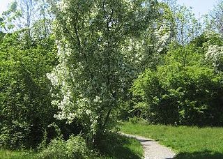
The John Ray Walk is a linear footpath from Braintree to Witham in Essex, England. The 9-mile (14.4 km) footpath follows the valley of the River Brain.

