Lexden Park

Last updated
Lexden Park
Lexden Park 9.jpg
Type Local Nature Reserve
Location Lexden, Colchester, Essex
OS grid TL972250
Area 8.1 hectares
Managed by Colchester Borough Council

Lexden Park is an 8.1 hectare Local Nature Reserve in Lexden, a suburb of Colchester in Essex. It is owned and managed by Colchester Borough Council. [1] [2]

Lexden village in United Kingdom

Lexden is a suburb of Colchester, Essex, England. It was formerly a village, and has previously been called Lessendon, Lassendene and Læxadyne. Lexden is mentioned in the Domesday Book.

Colchester town in Essex, United Kingdom

Colchester is a historic market town and the largest settlement within the borough of Colchester in the county of Essex. Colchester was the first Roman-founded city in Britain, and Colchester lays claim to be regarded as Britain's oldest recorded town. It was for a time the capital of Roman Britain, and is a member of the Most Ancient European Towns Network.

Essex County of England

Essex is a county in the south-east of England, north-east of London. One of the home counties, it borders Suffolk and Cambridgeshire to the north, Hertfordshire to the west, Kent across the estuary of the River Thames to the south, and London to the south-west. The county town is Chelmsford, the only city in the county. For government statistical purposes Essex is placed in the East of England region.

The site has grassland with a wide variety of plant species such as lady's bedstraw, lesser stitchwort and greater bird's-foot-trefoil. There is also oak woodland and an ornamental lake with wildfowl. [1]

There is access to the site from Church Lane. It is open to the public apart from the lake and wildlife areas.

Related Research Articles

Fairburn Ings RSPB reserve RSPB nature reserve in the United Kingdom

Fairburn Ings Nature Reserve is a protected area in Yorkshire, England, which is noted for its avian biodiversity. The reserve has recorded around 280 bird species, remarkable for an inland site in the United Kingdom. This is explained by the site being on migration routes as well as the diversity of habitats.

Essex Wildlife Trust one of 47 wildlife trusts which cover the United Kingdom

The Essex Wildlife Trust (EWT) is one of 47 wildlife trusts which cover the United Kingdom. The EWT was founded in 1959, and it describes itself as Essex's leading conservation charity, which aims to protect wildlife for the future and the people of the county. As of January 2017, it has over 34,000 members and runs 87 nature reserves, 2 nature parks and 11 visitor centres.

Whitbarrow mountain in United Kingdom

Whitbarrow is a hill in Cumbria, England. Designated a biological Site of Special Scientific Interest and national nature reserve, it forms part of the Morecambe Bay Pavements Special Area of Conservation due to its supporting some of the best European examples of natural limestone habitats. Also known as Whitbarrow Scar, the hill lies about 9 kilometres (5.6 mi) south-west of Kendal, just north of the A590 road, close to the village of Witherslack. Part of the site is a local nature reserve called Whitbarrow Scar.

Wildlife Trust for Bedfordshire, Cambridgeshire and Northamptonshire registered charity which manages 126 nature reserves covering 3,945 hectares across Bedfordshire, Cambridgeshire and Northamptonshire in the United Kingdom

The Wildlife Trust for Bedfordshire, Cambridgeshire and Northamptonshire (WTBCN) is a registered charity which manages 126 nature reserves covering 3,945 hectares. It has over 35,000 members, and 95% of people in Bedfordshire, Cambridgeshire and Northamptonshire live within five miles of a reserve. In the year to 31 March 2016 it employed 105 people and had an income of £5.1 million. It aims to conserve wildlife, inspire people to take action for wildlife, offer advice and share knowledge. The WTBCN is one of 36 wildlife trusts covering England, and 47 covering the whole of the United Kingdom.

Herts and Middlesex Wildlife Trust

Herts and Middlesex Wildlife Trust manages over 40 nature reserves covering nearly 810 hectares north of London, in Hertfordshire and the former county of Middlesex, which is now divided between the London boroughs of Barnet, Enfield, Harrow and Hillingdon. It has over 21,000 members, and is one of 47 Wildlife Trusts across the UK. It is a Registered Charity, with its Registered Office in St Albans, and had an income in the year to 31 March 2014 of over £1.5 million.

Salary Brook Local Nature Reserve

Salary Brook Local Nature Reserve is a 17.1 hectare Local Nature Reserve covering a stretch of Salary Brook and its banks on the south-east outskirts of Colchester in Essex. It is owned and managed by Colchester Borough Council.

Welsh Wood

Welsh Wood is a 3.2 hectare Local Nature Reserve in Colchester in Essex. It is owned and managed by Colchester Borough Council.

Spring Lane Meadows

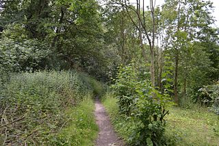
Spring Lane Meadows or Lexden Springs is a 2 hectare Local Nature Reserve in Lexden, a suburb of Colchester in Essex. It is owned and managed by Colchester Borough Council.

Lexden Gathering Grounds Essex Wildlife Trust Nature reserve

Lexden Gathering Grounds is an 8.9 nature reserve in Lexden, a suburb of Colchester in Essex. It is owned by Anglian Water and managed by the Essex Wildlife Trust.

Colne Valley, Essex

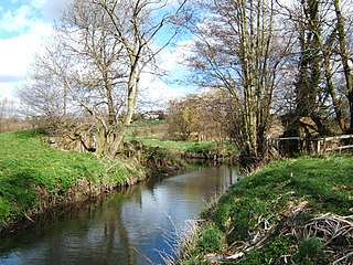
Colne Valley is a 5.1 hectare Local Nature Reserve north and east of Earls Colne in Essex. It is owned and managed by Colchester Borough Council.

Hilly Fields, Colchester

Hilly Fields is a 37.5 hectare Local Nature Reserve in Colchester, Essex. It is owned and managed by Colchester Borough Council. It is also a scheduled monument as it is in a late Iron Age site and Roman Camulodunum.

References

  1. 1 2 "Lexden Park". Local Nature Reserves. Natural England. 28 January 2016. Retrieved 6 July 2016.
  2. "Map of Lexden Park". Local Nature Reserves. Natural England. Retrieved 6 July 2016.

Coordinates: 51°34′05″N0°10′02″W / 51.5680°N 0.16709°W / 51.5680; -0.16709

Geographic coordinate system Coordinate system

A geographic coordinate system is a coordinate system that enables every location on Earth to be specified by a set of numbers, letters or symbols. The coordinates are often chosen such that one of the numbers represents a vertical position and two or three of the numbers represent a horizontal position; alternatively, a geographic position may be expressed in a combined three-dimensional Cartesian vector. A common choice of coordinates is latitude, longitude and elevation. To specify a location on a plane requires a map projection.