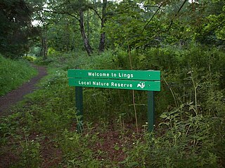
Lings Wood is a 20.1 hectare Local Nature Reserve in eastern Northampton. It is owned by Northampton Borough Council and managed by the Wildlife Trust for Bedfordshire, Cambridgeshire and Northamptonshire.

Linder's Field is a 3.6 hectare Local Nature Reserve in Buckhurst Hill in Essex. It is owned and managed by Epping Forest District Council.

Ripple Nature Reserve is an 8.3 hectare Site of Metropolitan Importance for Nature Conservation and Local Nature Reserve in Dagenham in the London Borough of Barking and Dagenham. It is owned by the borough council.

Fishpond Wood and Beverley Meads is a 5.8 hectare local nature reserve adjacent to Wimbledon Common in the London Borough of Merton. It is owned by Merton Council and managed by the London Wildlife Trust.

Brush Hill is a 14.7 hectare Local Nature Reserve east of Princes Risborough in Buckinghamshire. It has been managed since 2013 by the Chiltern Society, and it is part of the Chilterns Area of Outstanding Natural Beauty.

Chairborough Road is a 3.9 hectare Local Nature Reserve in High Wycombe in Buckinghamshire. It is owned and managed by Wycombe District Council.
Gomm's Wood is an 18.1 hectare Local Nature Reserve in High Wycombe in Buckinghamshire. It is owned and managed by Wycombe District Council.

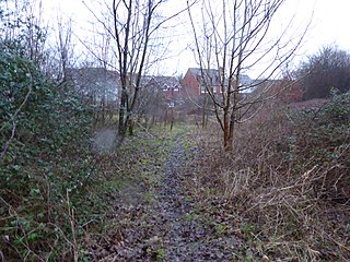
Vange Hill is an 11.5 hectare Local Nature Reserve in Vange, a suburb of Basildon in Essex. It is owned and managed by Basildon Borough Council.

Bocking Blackwater is a 13.1 hectare Local Nature Reserve in Braintree in Essex. It is owned and managed by Braintree District Council. In 2016 the council proposed to extend the boundaries of the site.

Hoppit Mead is a 9.2 hectare Local Nature Reserve in Braintree in Essex. It is owned and managed by Braintree District Council.

Whet Mead is a 10.1 hectare Local Nature Reserve in Witham in Essex. It is owned and managed by Braintree District Council.
Chelmer Valley Riverside is a 17.6 hectare Local Nature Reserve along the banks of the River Chelmer in Chelmsford in Essex. It is owned and managed by Chelmsford Borough Council.

Colne Local Nature Reserve is a 34.7 hectare Local Nature Reserve in Wivenhoe in Essex. It is owned and managed by Colchester Borough Council.

Galleywood Common is a 44.6 hectare Local Nature Reserve in Chelmsford in Essex, near the village of Galleywood. It is owned and managed by Chelmsford City Council.

Hilly Fields is a 37.5 hectare Local Nature Reserve in Colchester, Essex. It is owned and managed by Colchester Borough Council. It is also a scheduled monument as it is in a late Iron Age site and Roman Camulodunum.

Wrabness Nature Reserve is a 27 hectare Local Nature Reserve on the south bank of the River Stour, west of Wrabness in Essex. It is managed by the Essex Wildlife Trust.
Coldham's Common is a 49.3 hectare Local Nature Reserve in Cambridge. It is owned and managed by Cambridge City Council.
Ashford Community Woodland is a 13.8-hectare (34-acre) Local Nature Reserve on the western outskirts of Ashford in Kent. It is owned and managed by Ashford Borough Council.

Wouldham to Detling Escarpment is a 311.2-hectare (769-acre) biological and geological Site of Special Scientific Interest which stretches from Wouldham to Detling, north of Maidstone in Kent. Part of it is a Geological Conservation Review site, and it is part of the North Downs Woodlands Special Area of Conservation and the Kent Downs Area of Outstanding Natural Beauty. It is a Nature Conservation Review site, Grade I and it includes three Kent Wildlife Trust nature reserves and a Local Nature Reserve,

Darland Banks is a 29.1-hectare (72-acre) Local Nature Reserve on the southern outskirts of Gillingham in Kent. It is owned by Medway Council and managed by Kent Wildlife Trust.


