
The Essex Wildlife Trust (EWT) is one of 46 wildlife trusts which cover the United Kingdom. The EWT was founded in 1959, and it describes itself as Essex's leading conservation charity, which aims to protect wildlife for the future and the people of the county. As of January 2017, it has over 34,000 members and runs 87 nature reserves, 2 nature parks and 11 visitor centres.

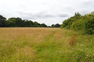
Roding Valley Meadows is an 18.9-hectare (47-acre) biological Site of Special Scientific Interest in Buckhurst Hill in Essex. It is part of a 65.2 hectare Local Nature Reserve with the same name, which is owned by Epping Forest District Council and Grange Farm Trust, and managed by the Essex Wildlife Trust.

Cranham Marsh is a 15.3 hectare Local Nature Reserve and a Site of Metropolitan Importance for Nature Conservation in Cranham in the London Borough of Havering. It is owned by Havering Council and managed by the Essex Wildlife Trust.

The Crouch and Roach Estuaries are a 1729 hectare biological Site of Special Scientific Interest (SSSI) at the mouth of the Crouch and Roach rivers in Essex. The Crouch part of the SSSI stretches from near Battlesbridge to Foulness Island, and the Roach from Rochford to the junction with the Crouch. Part of the site is in the Mid-Essex Coast Special Protection Area under the EC Directive on the Conservation of Wild Birds, and a Ramsar wetland site of international importance. It is also part of the Essex Estuaries Special Area of Conservation. An area of 65 hectares is managed by the Essex Wildlife Trust as the Lion Creek and Lower Raypits nature reserve and 8 hectares at Woodham Fen, both of which are managed by the Essex Wildlife Trust. A small area is also a geological SSSI, The Cliff, Burnham-on-Crouch.

Aubrey Buxton Nature Reserve is a 9.7-hectare (24-acre) nature reserve west of Elsenham in Essex. It was donated to the Essex Wildlife Trust by Aubrey Buxton and his wife in 1976.

Crowsheath Wood is an 8.1-hectare (20-acre) nature reserve in Downham, between Billericay and South Woodham Ferrers in Essex. It is managed by the Essex Wildlife Trust.

Fenn Washland is a 4.9 hectare Local Nature Reserve in South Woodham Ferrers in Essex, England. It is owned by Essex County Council and managed by the council as a part of the nearby Marsh Farm Country Park.

Little Haven is a 37.2-hectare (92-acre) nature reserve in Thundersley in Essex. It is owned by the Little Haven Children's Hospice, and leased to the Essex Wildlife Trust (EWT).

Pound Wood is a 22.3 nature reserve in Thundersley in Essex. It is owned and managed by the Essex Wildlife Trust.

Tile Wood is a 6.5-hectare (16-acre) nature reserve in Thundersley in Essex. It is managed by the Essex Wildlife Trust.
Oxley Meadow is a 3.2-hectare (7.9-acre) nature reserve in Tolleshunt Knights, near Tiptree in Essex. It is managed by the Essex Wildlife Trust.

Cockaynes Wood is a 20.2-hectare (50-acre) nature reserve between Wivenhoe and Alresford in Essex, United Kingdom. It is managed by the Essex Wildlife Trust and the Cockaynes Wood Trust.
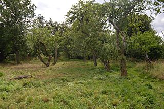
Sergeants Orchard is a 3.2-hectare (7.9-acre) nature reserve in Mount Bures and north of Chappel in Essex. It is owned and managed by the Essex Wildlife Trust.

Grove House Wood is a 2.2 hectare Local Nature Reserve in Stanford-le-Hope in Essex. According to Natural England, it is owned by Thurrock Council and managed by Essex Wildlife Trust but it is not listed on the web site of either body.

Abbotts Hall Farm is a 282 hectare nature reserve in Great Wigborough in Essex. It is the head office of the Essex Wildlife Trust, which manages the site. It is also part of the Blackwater Estuary National Nature Reserve, Site of Special Scientific Interest, Ramsar site, Special Protection Area and Special Area of Conservation, It is an important archaeological site, and includes a Scheduled Monument, Great Wigborough henge.

Langdon Nature Reserve is a 210 hectare nature reserve west of Basildon in Essex. It is managed by the Essex Wildlife Trust, and forms part of the Langdon Ridge Site of Special Scientific Interest.
Newland Grove is a 3.2-hectare (7.9-acre) nature reserve north of Chelmsford in Essex. It is managed by the Essex Wildlife Trust.

Roman River Valley is a 17.8-hectare (44-acre) nature reserve north of Layer de la Haye in Essex. It is managed by the Essex Wildlife Trust.

Shotgate Thickets is a 3.2-hectare (7.9-acre) nature reserve east of Wickford in Essex. It is managed by the Essex Wildlife Trust.

Westhouse Wood is a 2.8-hectare (6.9-acre) nature reserve north-west of Colchester in Essex. It is managed by the Essex Wildlife Trust.

