The Suffolk & Essex Coast & Heaths National Landscape is an Area of Outstanding Natural Beauty in Suffolk and Essex, England.
The River Stour is a major river in East Anglia, England. It is 47 miles (76 km) long and forms most of the county boundary between Suffolk to the north, and Essex to the south. It rises in eastern Cambridgeshire, passes to the east of Haverhill, through Cavendish, Sudbury, Bures, Nayland, Stratford St Mary and Dedham. It becomes tidal just before Manningtree in Essex and joins the North Sea at Harwich.
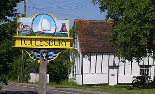
Tollesbury is a village in England, located on the Essex coast at the mouth of the River Blackwater. It is situated nine miles east of the historic port of Maldon and twelve miles south of Colchester.

Shoeburyness, or simply Shoebury, is a coastal town in the City of Southend-on-Sea, in the ceremonial county of Essex, England; it lies 3 miles (5 km) east of the city centre. It was formerly a separate town until it was absorbed into Southend in 1933.

The Essex Wildlife Trust (EWT) is one of 46 wildlife trusts which cover the United Kingdom. The EWT was founded in 1959, and it describes itself as Essex's leading conservation charity, which aims to protect wildlife for the future and the people of the county. As of January 2017, it has over 34,000 members and runs 87 nature reserves, 2 nature parks and 11 visitor centres.

Suffolk Wildlife Trust (SWT) describes itself as the county's "nature charity – the only organisation dedicated wholly to safeguarding Suffolk's wildlife and countryside." It is a registered charity, and its headquarters is at Brooke House in Ashbocking, near Ipswich. It was founded in 1961, and is one of 46 wildlife trusts covering the Great Britain and Northern Ireland. As of March 2017, it has 13,200 members, and it manages 3,120 hectares of land in 60 nature reserves, most of which are open to the public. It had an income of £3.9 million in the year to 31 March 2017.
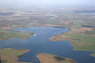
Abberton Reservoir is a pumped storage freshwater reservoir in eastern England near the Essex coast, with an area of 700 hectares. Most of its water is pumped from the River Stour. It is the largest body of freshwater in Essex.

Brantham is a village and civil parish in the Babergh district of Suffolk, England. It is located close to the River Stour and the border with Essex, around 2 miles (3 km) north of Manningtree, and around 9 miles (14 km) southwest of Ipswich.
Bures St Mary is a civil parish in the Babergh district of the English county of Suffolk. In 2005 it had a population of 940, reducing to 918 at the 2011 Census. The parish covers the eastern part of the village of Bures, the western part being in the Bures Hamlet parish in Essex divided by the River Stour.

Towan is found in many placenames in Cornwall. However, The Towans usually refers to the three-mile (5 km) stretch of coastal dunes which extends north-east from the estuary of the River Hayle to Gwithian beach with a midpoint near Upton. The South West Coast Path crosses the towans.

Bicknacre is a village in the civil parish of Woodham Ferrers and Bicknacre, in the county of Essex, England. It is approximately 4.0 mi (6.5 km) north of South Woodham Ferrers and 5.7 mi (9.2 km) southeast of the city of Chelmsford. The village is in the borough of Chelmsford and in the parliamentary constituency of Maldon. In 2018 it had an estimated population of 2,263.

Tolleshunt D'Arcy is a village situated on the Blackwater estuary in the Maldon District of Essex, England. The village is 12 miles (19 km) southwest of Colchester, 19 miles (31 km) east of Chelmsford and 30 miles (48 km) north of Southend-on-Sea.

Little Cornard is a village and civil parish in Suffolk, England. Located around 0.5 miles (0.8 km) from its larger sibling, Great Cornard, on the B1508 road between Sudbury and Colchester, it is part of Babergh district, and has a population of 305, reducing to 286 at the 2011 Census. The parish also includes the hamlet of Workhouse Green.
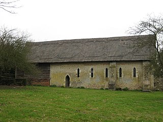
Stour Wood is a woodland in Essex, England, near the village of Wrabness. It covers a total area of 54.07 hectares. It is owned by the Woodland Trust, and managed by the Royal Society for the Protection of Birds. It is part of the Stour and Copperas Woods, Ramsey Site of Special Scientific Importance.
Copperas Wood is a 13.8-hectare (34-acre) nature reserve between Ramsey and Wrabness in Essex. It is owned and managed by the Essex Wildlife Trust, and is part of the Stour and Copperas Woods, Ramsey Site of Special Scientific Interest.

Stour and Copperas Woods, Ramsey is a 77.1-hectare (191-acre) biological Site of Special Scientific Interest between Wrabness and Ramsey in Essex. It is two separate areas, Stour Wood, which is owned by the Woodland Trust and managed by the Royal Society for the Protection of Birds, and Copperas Wood, which is owned and managed by the Essex Wildlife Trust. It is in the Suffolk Coast and Heaths Area of Outstanding Natural Beauty.
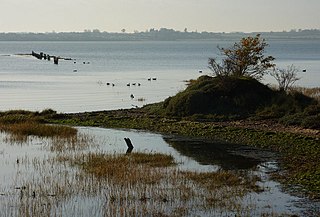
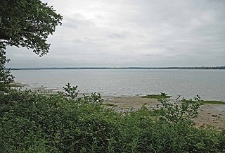
Stour Estuary is a 2,523 hectare biological and geological Site of Special Scientific Interest which stretches from Manningtree to Harwich in Essex and Suffolk. It is also an internationally important wetland Ramsar site, a Special Protection Area and a Nature Conservation Review site. It is part of the Suffolk Coast and Heaths Area of Outstanding Natural Beauty, and there are Geological Conservation Review sites in Wrabness, Stutton, and Harwich Part of the site is managed by the Royal Society for the Protection of Birds, and a small area is Wrabness Nature Reserve, a Local Nature Reserve managed by the Essex Wildlife Trust.

Wrabness Nature Reserve is a 27 hectare Local Nature Reserve on the south bank of the River Stour, west of Wrabness in Essex. It is managed by the Essex Wildlife Trust.
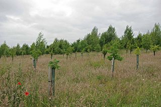
Oakfield Wood is a 2.8-hectare (6.9-acre) nature reserve west of Wrabness in Essex. It is managed by the Essex Wildlife Trust.