Pentwyn Farm Grasslands

Last updated
Pentwyn Farm Grasslands
Site of Special Scientific Interest
Pentwyn Farm Meadow, Penallt.jpg
Meadow of flowers in Pentwyn Farm Grasslands
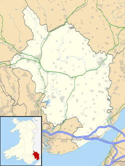
Monmouthshire UK location map.svg
Red pog.svg
Location within Monmouthshire
Location Monmouthshire
Grid reference SO523093
Coordinates 51°46′51″N2°41′31″W / 51.7808°N 2.6920°W / 51.7808; -2.6920 Coordinates: 51°46′51″N2°41′31″W / 51.7808°N 2.6920°W / 51.7808; -2.6920
InterestBiological
Area11 hectares (0.110 km2; 0.0425 sq mi)
Notification 1993 (1993)

Pentwyn Farm Grasslands is a nature reserve, and a series of agricultural fields, in Monmouthshire, southeast Wales. It was designated a Site of Special Scientific Interest (SSSI) in 1993, noted for its biological characteristics. [1]
Contents

Geography

The 7.6-hectare (19-acre) SSSI, spread over 3 separate enclosed spaces, is located within the community of Mitchel Troy, 2.5 miles (4.0 km) south of the town of Monmouth. They are centred on Pentwyn Farm, to the north of the village of Penallt. [2] [3]

The site is owned by the Gwent Wildlife Trust as well as private individuals. [4] [5] The grasslands lie on top of the local red sandstone and brown earth soils. The ground generally slopes in a southerly direction, but one field does slope to the north. [1]

Wildlife and ecology

The traditionally-managed, unimproved neutral grassland, that Pentwyn Farm supports, is one of the largest in the area and is of importance as this type of grassland is in decline within Britain. The flora that dominates this reserve is the common knapweed ( Centaurea nigra ), common bent ( Agrostis capillaris ), meadow vetchling ( Lathyrus pratensis ), red fescue ( Festuca rubra ) and sweet vernal grass ( Anthoxanthum odoratum ), with cock's-foot ( Dactylis glomerata ) and crested dog's-tail ( Cynosurus cristatus ) preferring low-lying areas. Also present are red clover ( Trifolium pratense ) and common bird's-foot trefoil ( Lotus corniculatus ), the latter having a more sporadic distribution on the site. [1]

Green-winged orchids ( Anacamptis morio ) are also present on the site, in one of the largest populations within the vice-county of Monmouthshire. This orchid is becoming increasingly uncommon within Monmouthshire as well as nationally. [1] Other orchids found on the reserve include the common spotted ( Dactylorhiza fuchsii ), common twayblade ( Neottia ovata ) and the greater butterfly ( Platanthera chlorantha ). [5]

The hedgerows of the field system provide an ideal habitat for dormice and also offer food for overwintering fieldfares and redwings. [5]

Related Research Articles

Cotswold Water Park

The Cotswold Water Park is the United Kingdom's largest marl lake system, straddling the Wiltshire–Gloucestershire border, northwest of Cricklade and south of Cirencester. There are 180 lakes, spread over 42 square miles (110 km2).

Lower Woods

Lower Woods is a 280.1-hectare (692-acre) biological and geological Site of Special Scientific Interest near the village of Wickwar, South Gloucestershire, notified in 1966 and renotified in 1985. The site area has increased at last revision in 1974 to a 284.1-hectare (702-acre) site. The site is a nature reserve managed by the Gloucestershire Wildlife Trust.

Midger

Midger is a 65.7-hectare (162-acre) biological Site of Special Scientific Interest straddling the border of Gloucestershire and South Gloucestershire, notified in 1966 and renotified in 1984. Since the last revision in 1974, the size has been reduced to a 56-hectare (140-acre) site. It lies east of Hillesley, Gloucestershire and north of Hawkesbury Upton, South Gloucestershire. It is at the head of the Kilcott Valley.

Strawberry Banks Biological Site of Special Scientific Interest in Gloucestershire, England

Strawberry Banks is a 5.06-hectare (12.5-acre) biological Site of Special Scientific Interest in Gloucestershire, notified in 1993.

Fiddlers Elbow National Nature Reserve

Fiddler's Elbow National Nature Reserve is a steep sided, woodland national nature reserve of 45 hectares in the Upper Wye Valley to the north of Monmouth in Wales, close to the Wales–England border. It is designated as a Site of Special Scientific Interest (SSSI) for its biological characteristics, containing a wide variety of flora.

Gwent Wildlife Trust (GWT) is a wildlife trust covering the area between the lower Wye and Rhymney rivers which forms the vice county of Monmouthshire in south-east Wales. It is a registered charity and a member of the Wildlife Trusts Partnership.

Cefn Blaenau

Cefn Blaenau is a 23-hectare Site of Special Scientific Interest in a small upland valley in Carmarthen and Dinefwr, Wales. It was designated an SSSI in 1989, primarily for its flush and spring vegetation as well as the diverse mosaic of unimproved pasture, ‘ffridd’ land, marshy grassland, wet heath, acid grassland, broadleaved woodland, streams, and small rock outcrops. These habitats, which are well represented at this site, have been greatly reduced in north Carmarthenshire due to land improvement, agricultural intensification, and afforestation. Only about 140 hectares of flush and spring vegetation remain in the county.

Croes Robert Wood

Croes Robert Wood is a nature reserve and Site of Special Scientific Interest (SSSI), noted for its biological characteristics, in Monmouthshire, south east Wales. Gwent Wildlife Trust, the owners of the site, manage the woodland through methods of coppicing and charcoal burning to encourage its notable flora and fauna.

Graig Wood Site of Special Scientific Interest in Monmouthshire, south east Wales

Graig Wood is a Site of Special Scientific Interest (SSSI), noted for its biological characteristics, in Monmouthshire, south east Wales. It forms part of the wider Hael Woods complex.

Daneway Banks SSSI Biological Site of Special Scientific Interest in Gloucestershire, England

Daneway Banks is a 17-hectare (42-acre) biological Site of Special Scientific Interest in Gloucestershire, notified in 1954 and renotified in 1983. It lies half a mile west of Sapperton and is part of a group of wildlife sites in the Frome Valley that includes Siccaridge Wood and Sapperton Canal reserves. The site is in the Cotswold Area of Outstanding Natural Beauty.

Clarkes Pool Meadow SSSI Biological Site of Special Scientific Interest in Gloucestershire, England

Clarke's Pool Meadow is a 1.8-hectare (4.4-acre) biological Site of Special Scientific Interest in Gloucestershire, notified in 1997. It lies on the flat top of 'Old Hill' about half a mile south of Blakeney. The site consists of two fields which were purchased by the Gloucestershire Wildlife Trust in 1997. The site was designated an SSSI in the same year and it is one of the finest surviving traditional hay meadows in Gloucestershire.

Upper Wye Gorge

Upper Wye Gorge is a Site of Special Scientific Interest (SSSI), noted for its biological and geological characteristics, around Symonds Yat in the Wye Valley on the Wales–England border. The site is listed in the 'Forest of Dean Local Plan Review' as a Key Wildlife Site (KWS).

Swifts Hill SSSI

Swift's Hill is a 9.15-hectare (22.6-acre) biological and geological Site of Special Scientific Interest in Gloucestershire, notified in 1966 and renotified in 1984.

Range Farm Fields Biological Site of Special Scientific Interest in Gloucestershire, England

Range Farm Fields is a 12.8-hectare (32-acre) biological Site of Special Scientific Interest in Gloucestershire, near to Gloucester City, notified in 1996.

Ridley Bottom, Tidenham Nature reserve in Gloucestershire, England

Ridley Bottom is a 1.1-hectare (2.7-acre) nature reserve in Gloucestershire. The site is listed in the 'Forest of Dean Local Plan Review' as a Key Wildlife Site (KWS).

Alpine Meadow, Berkhamsted

Alpine Meadow is a 0.4 hectare nature reserve near Berkhamsted in Hertfordshire in the United Kingdom. It is a designated biological Site of Special Scientific Interest (SSSI), managed by the Hertfordshire and Middlesex Wildlife Trust and the planning authority is Dacorum Borough Council.

Grangelands and Pulpit Hill

Grangelands and Pulpit Hill is a 25.5 hectare biological Site of Special Scientific Interest in Cadsden in Buckinghamshire. It lies within the Chilterns Area of Outstanding Natural Beauty, and the planning authorities are Wycombe District Council and Buckinghamshire County Council.

Ron Ward's Meadow With Tadley Pastures is a site of Site of Special Scientific Interest (SSSI). It is based on the edge of Tadley in Hampshire, England. It is managed by the Hampshire and Isle of Wight Wildlife Trust.

Quarry Moor Site of Special Scientific Interest in North Yorkshire, England

Quarry Moor is a Site of Special Scientific Interest, or SSSI, at the south edge of Ripon, North Yorkshire, England, and adjacent to the A61 road. It contains an outcrop of Magnesian Limestone, exposed by former quarrying. 255 million years ago this limestone was the peripheral sediment of a tropical sea. The land was donated in 1945 to the people of Ripon by the town's mayor, Alderman Thomas Fowler Spence, a varnish manufacturer. The land was notified as an SSSI in 1986 because its calcareous grassland supported a large diversity of plant species. The site features a Schedule 8 protected plant, thistle broomrape. The land is protected as a nature reserve, and it is also managed as a recreational area. Therefore, its calcareous grass area is fenced off for protection and study, but it also contains a car park, information signs, a children's play area, accessible paths, benches, and dog waste bins.

References

  1. 1 2 3 4 "Pentwyn Farm Grasslands" (pdf). Countryside Council for Wales . Retrieved 26 June 2012.[ permanent dead link ]
  2. "Pentwyn Farm Grasslands map". Countryside Council for Wales. Archived from the original (pdf) on 20 October 2014. Retrieved 27 June 2012.
  3. Ordnance Survey: Explorer map sheet OL14 Wye Valley & Forest of Dean ISBN   9780319240953
  4. "Pentwyn Farm Grasslands". Countryside Council for Wales. Archived from the original on 23 December 2012. Retrieved 27 June 2012.
  5. 1 2 3 "Pentwyn Farm Reserve". Gwent Wildlife Trust. Archived from the original on 15 March 2012. Retrieved 27 June 2012.