Bettws Newydd

Last updated

Bettws Newydd
St Aeddan's churchyard cross, Bettws Newydd - geograph.org.uk - 645007.jpg
St Aeddan's church
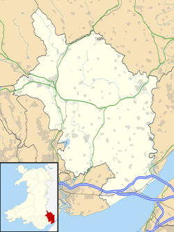
Monmouthshire UK location map.svg
Red pog.svg
Bettws Newydd
Location within Monmouthshire
OS grid reference SO361061
Principal area
Ceremonial county
Country Wales
Sovereign state United Kingdom
Post town USK
Postcode district NP15
Dialling code 01291
Police Gwent
Fire South Wales
Ambulance Welsh
UK Parliament
List of places
UK
Wales
Monmouthshire
51°45′00″N2°55′37″W / 51.74993°N 2.92704°W / 51.74993; -2.92704 Coordinates: 51°45′00″N2°55′37″W / 51.74993°N 2.92704°W / 51.74993; -2.92704

Bettws Newydd (Welsh : Betws Newydd) is a small village in Monmouthshire, in southeast Wales located about 3+12 miles (5.6 km) north of Usk, a few miles south of Clytha near Raglan, Monmouthshire.
Contents

Etymology

The first part of the name of the village comes from the Middle English word bedhus, meaning "prayer house", which became betws in Welsh. [1] Bettws Newydd translates therefore to the new prayer house.

History

The site was originally an oratory or place of prayer and was founded by Saint Aedan of Ferns, who founded several churches in Wales and was also known as St Aidan of Llawhaden. As it was largely reconstructed in the 15th century as a new oratory it was referred to as Bettws Newydd.

An old early Norman motte and bailey tump sits behind trees in the village next to the public house. St Aeddan's is 15th century and a Grade I listed building. [2] It has a rare late medieval rood screen and rood loft carved from oak. In the churchyard are two yew trees estimated to be 1,000 years old. The trees are amongst the oldest yews in Wales.

On the surrounding hills are many tumuli or prehistoric burial mounds and at Coed-y-bwnydd meaning "the wood of the gentry" in Welsh (pronounced locally as 'Coed Bonnet'), is a large Iron Age hillfort with a massive mound protecting the entrance at the east and multi-vallate earthworks and entrenchments at that side, the other side being defended by a very steep incline. The wood and hillfort are in the care of the National Trust.

Black Bear pub The Black Bear, Bettws Newydd - geograph.org.uk - 1432569.jpg
Black Bear pub

Amenities

The village has a selection of property and a public house and restaurant with accommodation. A golf course is sited behind the pub.

Notes

  1. Welsh Place Names Dictionary
  2. "Bettws Newydd Church, Llanarth, Monmouthshire".

Related Research Articles

Betws-y-Coed Human settlement in Wales

Betws-y-coed ; English: prayer house in the wood) is a village and community in the Conwy valley in Conwy County Borough, Wales, located in the historic county of Caernarfonshire, right on the boundary with Denbighshire, in the Gwydir Forest. It is now a very popular visitor destination in the Snowdonia National Park.

Llanfoist

Llanfoist is both a village near Abergavenny, in Monmouthshire, Wales, and the community of Llanfoist Fawr. Llanfoist derives from Ffwyst, an early Christian Welsh saint, although the anglicised version of the church patron is Saint Faith. The population was 1,228 in 2011.

Bettws Cedewain Human settlement in Wales

Bettws Cedewain, also known as Bettws Cedewen, is a small village and community in Montgomeryshire, Powys, Wales. It lies in a sheltered valley on the banks of the Nant Bechan, some 3 miles (5 km) north of Newtown, on the B4389 road. The community is known as just Bettws, and includes the hamlets of Highgate and Brooks.

Betws, Carmarthenshire Human settlement in Wales

Betws is a small village and community on the River Amman, some 15 miles north of Swansea, Wales; it is part of the ecclesiastical parish of Betws and Ammanford, and the urban area of Ammanford. The nearby mountain, at the western end of the Black Mountain, is named after the village, and has a large area of common land.

Bettws-y-Crwyn Human settlement in England

Bettws-y-Crwyn is a small, remote village and civil parish in south-west Shropshire, England. It is close to the England–Wales border and is one of a number of English villages to have a Welsh language placename.

Bettws, Newport Human settlement in Wales

Bettws is a large modern housing estate, electoral ward and coterminous community (parish) of the city of Newport, South Wales.

Kemeys Commander

Kemeys Commander is a village in Monmouthshire, in South East Wales.

Shirenewton Village and community in Monmouthshire, Wales, UK

Shirenewton is a village and community in Monmouthshire, south east Wales. It is located 3 miles due west of Chepstow, 5 miles (8 km) by road. The village stands around 500 feet above sea level, and has extensive views of the Severn Estuary and Bristol Channel. The population of the village and the conjoined village of Mynydd-bach was 657 in 2011.

Llanvair Discoed Human settlement in Wales

Llanvair Discoed is a small village in Monmouthshire, south-east Wales, 6 miles west of Chepstow and 10 miles east of Newport.

Betws Ifan Human settlement in Wales

Betws Ifan is a small village located in Ceredigion, Wales.

Betws yn Rhos Human settlement in Wales

Betws yn Rhos is a village and community in Conwy County Borough, Wales.

Beddoe is a surname of Welsh origin. It originates from Bettws or Betws, a Welsh name that is derived from the Anglo-Saxon Old English bed-hus—i.e. a bead-house: a house of prayer, or oratory. At the time of the British Census of 1881, its frequency was highest in Pembrokeshire, followed by Cambridgeshire, Shropshire, Glamorgan, Monmouthshire, Herefordshire, Carmarthenshire, Staffordshire, Cardiganshire and Warwickshire.

Bettws, Bridgend Human settlement in Wales

Bettws, is a small ex-mining and farming village in the South Wales Valleys in the county borough of Bridgend, Wales. Bettws is also an electoral ward to the county council.

Llanelidan Human settlement in Wales

Llanelidan is a small village and community in the county of Denbighshire in north-east Wales. The community also includes the hamlet of Rhyd-y-Meudwy.

Llansoy Human settlement in Wales

Llansoy is a small village in Monmouthshire, south east Wales, United Kingdom, located about 3 miles (4.2 km) south east of Raglan.

Newchurch, Monmouthshire Human settlement in Wales

Newchurch is an extensive rural parish and small hamlet in Monmouthshire, south east Wales. It is located 6 miles south east of Usk and 6 miles north west of Chepstow, between the B4235 and B4293 roads.

Church of St Aeddan, Bettws Newydd Church in Monmouthshire, Wales

The Church of St Aeddan, Bettws Newydd, Monmouthshire, Wales, is a fifteenth-century church of twelfth-century origin. It is a Grade I listed building as of 1 September 1956.

Grade I listed buildings in Monmouthshire

Monmouthshire is a county and principal area of Wales. It borders Torfaen and Newport to the west; Herefordshire and Gloucestershire to the east; and Powys to the north. The largest town is Abergavenny, with other large settlements being Chepstow, Monmouth, and Usk. The present county was formed under the Local Government (Wales) Act 1994, and comprises some sixty percent of the historic county. Between 1974 and 1996, the county was known by the ancient title of Gwent, recalling the medieval Welsh kingdom. The county is 850 km2 in extent, with a population of 95,200 as of 2020.

Banc y Betws or Betws Castle, is a motte and scheduled ancient monument in Wales. It is located in Llangyndeyrn, in the Gwendraith Valley in Carmarthenshire, Wales; map grid SN458154. All that is visible of the structure nowadays is a mound capped with trees and the remains of the ditch that surrounded it.

References

Commons-logo.svg Media related to Bettws Newydd at Wikimedia Commons