Graig Wood

Last updated
Graig Wood
Site of Special Scientific Interest
Graig Wood view near Penallt.jpg
View towards wood over other side of River Wye
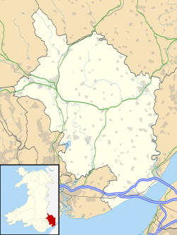
Monmouthshire UK location map.svg
Red pog.svg
Location within Monmouthshire
Area of Search Monmouthshire
Grid reference SO533087
Coordinates 51°46′31″N2°40′39″W / 51.7754°N 2.6776°W / 51.7754; -2.6776 Coordinates: 51°46′31″N2°40′39″W / 51.7754°N 2.6776°W / 51.7754; -2.6776
InterestBiological
Area14.3 hectares (0.143 km2; 0.0552 sq mi)
Notification 1981 (1981)

Graig Wood is a Site of Special Scientific Interest (SSSI), noted for its biological characteristics, in Monmouthshire, south east Wales. [1] It forms part of the wider Hael Woods complex.
Site of Special Scientific Interest Conservation designation denoting a protected area in the United Kingdom

A Site of Special Scientific Interest (SSSI) in Great Britain or an Area of Special Scientific Interest (ASSI) in the Isle of Man and Northern Ireland is a conservation designation denoting a protected area in the United Kingdom and Isle of Man. SSSI/ASSIs are the basic building block of site-based nature conservation legislation and most other legal nature/geological conservation designations in the United Kingdom are based upon them, including national nature reserves, Ramsar sites, Special Protection Areas, and Special Areas of Conservation. The acronym "SSSI" is often pronounced "triple-S I".

Monmouthshire County

Monmouthshire is a county in south-east Wales. The name derives from the historic county of Monmouthshire of which it covers the eastern 60%. The largest town is Abergavenny. Other towns and large villages are Caldicot, Chepstow, Monmouth, Magor and Usk. It borders Torfaen and Newport to the west; Herefordshire and Gloucestershire to the east; and Powys to the north.

Wales Country in northwest Europe, part of the United Kingdom

Wales is a country that is part of the United Kingdom and the island of Great Britain. It is bordered by England to the east, the Irish Sea to the north and west, and the Bristol Channel to the south. It had a population in 2011 of 3,063,456 and has a total area of 20,779 km2 (8,023 sq mi). Wales has over 1,680 miles (2,700 km) of coastline and is largely mountainous, with its higher peaks in the north and central areas, including Snowdon, its highest summit. The country lies within the north temperate zone and has a changeable, maritime climate.

Contents

Geography

The 14.3-hectare (35-acre) SSSI, notified in 1981, is located within the community of Trellech United, on the banks of the River Wye, 3 miles (4.8 km) south-east of the town of Monmouth. It is 0.5 miles (0.80 km) north of another SSSI, Lower Hael Wood. [2] [3]

A community is a division of land in Wales that forms the lowest tier of local government in Wales. Welsh communities are analogous to civil parishes in England. In 2016 there were 870 communities in Wales.

Trellech village in Trellech United, Monmouthshire, Wales

Trellech is a village and parish in Monmouthshire, south-east Wales. It is in the community of Trellech United and located 5 miles (8 km) south of Monmouth and 4 miles (6.4 km) north-north-west of Tintern on a plateau above the Wye and Usk Valleys in an Area of Outstanding Natural Beauty. There are three Bronze Age standing stones in the village, known as Harold's Stones. The church of St Nicholas is a Grade I listed building.

River Wye river in Wales and England

The River Wye is the fifth-longest river in the UK, stretching some 215 kilometres from its source on Plynlimon in mid Wales to the Severn estuary. For much of its length the river forms part of the border between England and Wales. The Wye Valley is an Area of Outstanding Natural Beauty. The Wye is important for nature conservation and recreation.

The wood is jointly owned and managed by Gwent Wildlife Trust and the Forestry Commission. [4]

Gwent Wildlife Trust (GWT) is a wildlife trust covering the area between the lower Wye and Rhymney rivers which forms the vice county of Monmouthshire in south-east Wales. It is a registered charity and a member of the Wildlife Trusts Partnership.

The Forestry Commission is a non-ministerial government department responsible for forestry in England. It was formerly also responsible for Forestry in Wales and Scotland, however on 1 April 2013 Forestry Commission Wales merged with other agencies to become Natural Resources Wales, whilst two new bodies were established in Scotland on 1 April 2019. The commission was set up in 1919 to expand Britain's forests and woodland after depletion during the First World War. To do this, the commission bought large amounts of former agricultural land, eventually becoming the largest land owner in Britain. The Commission is divided into three divisions: Forestry England, Forestry Commission and Forest Research.

Wildlife and ecology

As with other woodland in the Wye Valley Area of Outstanding Natural Beauty, Graig Wood contains many local and rare tree species. The predominant species within the wood are ash ( Fraxinus excelsior ) and wych elm ( Ulmus glabra ), although other species present include black alder ( Alnus glutinosa ), common beech ( Fagus sylvatica ) and small-leaved lime ( Tilia cordata ). [1]

Wye Valley valley straddling the border between England and Wales

The Wye Valley Area of Outstanding Natural Beauty is an internationally important protected landscape straddling the border between England and Wales. It is one of the most dramatic and scenic landscapes in Britain.

Area of Outstanding Natural Beauty Designated area of countryside in England, Wales or Northern Ireland

An Area of Outstanding Natural Beauty (AONB) is an area of countryside in England, Wales or Northern Ireland which has been designated for conservation due to its significant landscape value. Areas are designated in recognition of their national importance, by the relevant public body: Natural England, Natural Resources Wales, or the Northern Ireland Environment Agency. In place of AONB, Scotland uses the similar national scenic area (NSA) designation. Areas of Outstanding Natural Beauty enjoy levels of protection from development similar to those of UK national parks, but unlike with national parks the responsible bodies do not have their own planning powers. They also differ from national parks in their more limited opportunities for extensive outdoor recreation.

<i>Fraxinus excelsior</i> species of plant

Fraxinus excelsior, known as the ash, or European ash or common ash to distinguish it from other types of ash, is a flowering plant species in the olive family Oleaceae. It is native throughout mainland Europe east to the Caucasus and Alborz mountains. The northernmost location is in the Trondheimsfjord region of Norway. The species is widely cultivated and reportedly naturalised in New Zealand and in scattered locales in the United States and Canada.

The stream banks and old buildings within the wood are home to rich bryophyte colonies. Hart's-tongue fern ( Asplenium scolopendrium ) and snowdrops ( Galanthus ) also grow on the site. [1] [5]

Bryophyte terrestrial plants that lack vascular tissue

Bryophytes are an informal group consisting of three divisions of non-vascular land plants (embryophytes): the liverworts, hornworts and mosses. They are characteristically limited in size and prefer moist habitats although they can survive in drier environments. The bryophytes consist of about 20,000 plant species. Bryophytes produce enclosed reproductive structures, but they do not produce flowers or seeds. They reproduce via spores. Bryophytes are usually considered to be a paraphyletic group and not a monophyletic group, although some studies have produced contrary results. Regardless of their status, the name is convenient and remains in use as an informal collective term. The term "bryophyte" comes from Greek βρύον, bryon "tree-moss, oyster-green" and φυτόν, phyton "plant".

<i>Asplenium scolopendrium</i> species of plant

Asplenium scolopendrium, known as hart's-tongue or hart's-tongue fern is a fern in the genus Asplenium, of the Northern Hemisphere.

<i>Galanthus</i> genus of plants

Galanthus is a small genus of approximately 20 species of bulbous perennial herbaceous plants in the family Amaryllidaceae. The plants have two linear leaves and a single small white drooping bell shaped flower with six petal-like (petaloid) tepals in two circles (whorls). The smaller inner petals have green markings.

Dormice have been reported within the woodland. [5]

Related Research Articles

Gloucestershire Wildlife Trust organization

The Gloucestershire Wildlife Trust is the Gloucestershire local partner in a conservation network of 47 Wildlife Trusts. The Wildlife Trusts are local charities with the specific aim of protecting the United Kingdom's natural heritage. The Gloucestershire Wildlife Trust is managed by a Board of Trustees elected from its membership who provide overall direction for the development of the Trust and there are Advisory Committees. The work of the trust is carried out through staff and volunteers.

Bowdown and Chamberhouse Woods

Bowdown and Chamberhouse Woods is a 66.8 hectares biological Site of Special Scientific Interest at Crookham in Berkshire, notified in 1983. It is an area of ancient woodland lying on the scarp slope north of Greenham Common, close to the eastern edge of Newbury, most of which is a Nature Reserve open to the public.

Fiddlers Elbow National Nature Reserve nature reserve in Monmouth, Wales

Fiddler’s Elbow National Nature Reserve is a steep sided, woodland national nature reserve of 45 hectares in the Upper Wye Valley to the north of Monmouth in Wales, close to the Wales–England border. It is designated as a Site of Special Scientific Interest (SSSI) for its biological characteristics, containing a wide variety of flora.

Lancaut human settlement in United Kingdom

Lancaut is a deserted village in Gloucestershire, England, located alongside the River Wye, around two miles north of Chepstow. It occupies a narrow-necked promontory formed by a curve of the river, which acts as the border between England and Wales. Little remains of the village today, except for the roofless church of St. James.

Caer Llan is a field studies centre, conference centre and former country house located at Lydart within the community of Mitchel Troy, Monmouthshire, south east Wales, about 3 miles (4.8 km) south-west of Monmouth. It is close to the top of a scarp slope with extensive views westwards over the valley of the River Trothy, and is accessed from the B4293 road.

Croes Robert Wood

Croes Robert Wood is a nature reserve and Site of Special Scientific Interest (SSSI), noted for its biological characteristics, in Monmouthshire, south east Wales. Gwent Wildlife Trust, the owners of the site, manage the woodland through methods of coppicing and charcoal burning to encourage its notable flora and fauna.

Gaer Wood

Gaer Wood is a Site of Special Scientific Interest (SSSI), noted for its biological characteristics, in Monmouthshire, south east Wales.

Harpers Grove – Lords Grove

Harper's Grove – Lord's Grove is a Site of Special Scientific Interest (SSSI), noted for its biological characteristics, in Monmouthshire, south east Wales.

Lydart village in United Kingdom

Lydart is a dispersed hamlet within the community of Mitchel Troy, Monmouthshire, Wales. It is located about 3 miles (4.8 km) south-west of Monmouth, 3 miles (4.8 km) north of Trellech, and 1 mile (1.6 km) south-east of Mitchel Troy village, on the top of an escarpment which slopes steeply down to the valley of the River Trothy. The B4293 road passes through the area.

Livox Wood

Livox Wood is a woodland and Site of Special Scientific Interest (SSSI), noted for its biological characteristics, in Monmouthshire, south east Wales.

Lower Hael Wood

Lower Hael Wood is a semi-ancient woodland and Site of Special Scientific Interest (SSSI), noted for its biological characteristics, in Monmouthshire, south east Wales. It is part of the wider Hael Woods complex. The wood is on the side of the River Wye which is the border between Wales and England.

Maes-yr-Uchaf Wood

Maes-yr-Uchaf Wood is a small woodland and Site of Special Scientific Interest (SSSI), noted for its biological characteristics, in Monmouthshire, south east Wales.

Newton Court building in Monmouth, Wales

Newton Court is a neoclassical house, completed in 1802, situated on the hillside above Dixton, 1 mi (1.6 km) north-east of the town on Monmouth, in Monmouthshire, Wales. It is a Grade II* listed building. The stable block is listed as a Site of Special Scientific Interest (SSSI), noted for as a breeding site for lesser horseshoe bats.

Pentwyn Farm Grasslands

Pentwyn Farm Grasslands is a nature reserve, and a series of agricultural fields, in Monmouthshire, southeast Wales. It was designated a Site of Special Scientific Interest (SSSI) in 1993, noted for its biological characteristics.

Upper Wye Gorge

Upper Wye Gorge is a Site of Special Scientific Interest (SSSI), noted for its biological and geological characteristics, around Symonds Yat in the Upper Wye Valley on the Wales–England border. The site is listed in the 'Forest of Dean Local Plan Review' as a Key Wildlife Site (KWS).

Shorn Cliff and Caswell Woods

Shorn Cliff And Caswell Woods is a 69.2-hectare (171-acre) biological Site of Special Scientific Interest in Gloucestershire, notified in 1986. The site is listed in the 'Forest of Dean Local Plan Review' as a Key Wildlife Site (KWS).

References

  1. 1 2 3 "Graig Wood" (pdf). Countryside Council for Wales . Retrieved 19 March 2012.[ permanent dead link ]
  2. "Graig Wood map" (pdf). Countryside Council for Wales . Retrieved 19 March 2012.[ permanent dead link ]
  3. Ordnance Survey: Explorer map sheet OL14 Wye Valley & Forest of Dean ISBN   9780319240953
  4. "Graig Wood". Countryside Council for Wales . Retrieved 19 March 2012.[ permanent dead link ]
  5. 1 2 "Gwent Wildlife Trust's Nature Reserves" (PDF). Gwent Wildlife Trust. p. 25. Archived from the original (PDF) on 30 October 2011. Retrieved 19 March 2012.