Lower Hael Wood

Last updated
Lower Hael
Site of Special Scientific Interest

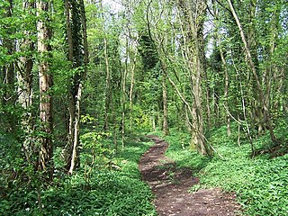
That means you can't get in^ - geograph.org.uk - 1402664.jpg

View of the wood from the English side of River Wye
Monmouthshire UK location map.svg
Red pog.svg
Location within Monmouthshire
Area of Search Monmouthshire
Grid reference SO533075
Coordinates 51°45′51″N2°40′49″W / 51.7643°N 2.6802°W / 51.7643; -2.6802 Coordinates: 51°45′51″N2°40′49″W / 51.7643°N 2.6802°W / 51.7643; -2.6802
Interest Biological
Area 17.6 hectares (0.176 km2; 0.0680 sq mi)
Notification 1981

Lower Hael Wood is a semi-ancient woodland and Site of Special Scientific Interest (SSSI), noted for its biological characteristics, in Monmouthshire, south east Wales. [1] It is part of the wider Hael Woods complex. The wood is on the side of the River Wye which is the border between Wales and England.

Ancient woodland term used in the United Kingdom

In the United Kingdom, an ancient woodland is a woodland that has existed continuously since 1600 or before in England, Wales and Northern Ireland. Before those dates, planting of new woodland was uncommon, so a wood present in 1600 was likely to have developed naturally.

Site of Special Scientific Interest Conservation designation denoting a protected area in the United Kingdom

A Site of Special Scientific Interest (SSSI) in Great Britain or an Area of Special Scientific Interest (ASSI) in the Isle of Man and Northern Ireland is a conservation designation denoting a protected area in the United Kingdom and Isle of Man. SSSI/ASSIs are the basic building block of site-based nature conservation legislation and most other legal nature/geological conservation designations in the United Kingdom are based upon them, including national nature reserves, Ramsar sites, Special Protection Areas, and Special Areas of Conservation. The acronym "SSSI" is often pronounced "triple-S I".

Monmouthshire County

Monmouthshire is a county in south-east Wales. The name derives from the historic county of Monmouthshire of which it covers the eastern 60%. The largest town is Abergavenny. Other towns and large villages are Caldicot, Chepstow, Monmouth, Magor and Usk. It borders Torfaen and Newport to the west; Herefordshire and Gloucestershire to the east; and Powys to the north.

Contents

History

There is evidence of early human activity on the woodland site, with Bronze Age barrows having been found. [2] Early industry was also present on the site, with a grist mill on the southern slope and evidence of quarries also found. [3]

Bronze Age Prehistoric period and age studied in archaeology, part of the Holocene Epoch

The Bronze Age is a historical period characterized by the use of bronze, and in some areas proto-writing, and other early features of urban civilization. The Bronze Age is the second principal period of the three-age Stone-Bronze-Iron system, as proposed in modern times by Christian Jürgensen Thomsen, for classifying and studying ancient societies.

Tumulus Mound of earth and stones raised over graves

A tumulus is a mound of earth and stones raised over a grave or graves. Tumuli are also known as barrows, burial mounds or kurgans, and may be found throughout much of the world. A cairn, which is a mound of stones built for various purposes, may also originally have been a tumulus.

Quarry A place from which a geological material has been excavated from the ground

A quarry is a type of open-pit mine in which dimension stone, rock, construction aggregate, riprap, sand, gravel, or slate is excavated from the ground.

Geography

The 17.6-hectare (43-acre) SSSI, notified in 1981, is located within the community of Trellech United, on the banks of the River Wye, 3.5 miles (5.6 km) south-east of the town of Monmouth. It is 0.5 miles (0.80 km) south of another SSSI, Graig Wood. [4] [5]

A community is a division of land in Wales that forms the lowest tier of local government in Wales. Welsh communities are analogous to civil parishes in England. In 2016 there were 870 communities in Wales.

Trellech village in Trellech United, Monmouthshire, Wales

Trellech is a village and parish in Monmouthshire, south-east Wales. It is in the community of Trellech United and located 5 miles (8 km) south of Monmouth and 4 miles (6.4 km) north-north-west of Tintern on a plateau above the Wye and Usk Valleys in an Area of Outstanding Natural Beauty. There are three Bronze Age standing stones in the village, known as Harold's Stones. The church of St Nicholas is a Grade I listed building.

River Wye river in Wales and England

The River Wye is the fifth-longest river in the UK, stretching some 215 kilometres from its source on Plynlimon in mid Wales to the Severn estuary. For much of its length the river forms part of the border between England and Wales. The Wye Valley is an Area of Outstanding Natural Beauty. The Wye is important for nature conservation and recreation.

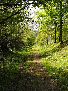
The wood is owned and managed by the Forestry Commission. [6] The Wye Valley Walk which is a long distance footpath, runs along the edge of the woodland, [5] the River Wye and the border with England.

The Forestry Commission is a non-ministerial government department responsible for forestry in England. It was formerly also responsible for Forestry in Wales and Scotland, however on 1 April 2013 Forestry Commission Wales merged with other agencies to become Natural Resources Wales, whilst two new bodies were established in Scotland on 1 April 2019. The commission was set up in 1919 to expand Britain's forests and woodland after depletion during the First World War. To do this, the commission bought large amounts of former agricultural land, eventually becoming the largest land owner in Britain. The Commission is divided into three divisions: Forestry England, Forestry Commission and Forest Research.

Wye Valley Walk

The Wye Valley Walk is a long distance footpath in Wales and England following the course of the River Wye.

Wildlife and ecology

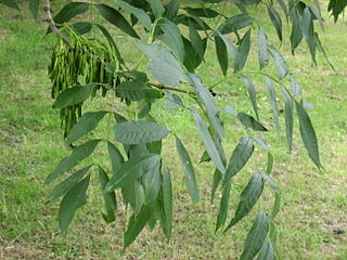
As with other woodland in the Wye Valley Area of Outstanding Natural Beauty, Lower Hael Wood contains many local and rare tree species. The main tree species found on the site include ash ( Fraxinus excelsior ), common beech ( Fagus sylvatica ), small-leaved lime ( Tilia cordata ) and wych elm ( Ulmus glabra ), as well as English oak ( Quercus robur ) and sessile oak ( Quercus petraea ). [1]

Area of Outstanding Natural Beauty Designated area of countryside in England, Wales or Northern Ireland

An Area of Outstanding Natural Beauty (AONB) is an area of countryside in England, Wales or Northern Ireland which has been designated for conservation due to its significant landscape value. Areas are designated in recognition of their national importance, by the relevant public body: Natural England, Natural Resources Wales, or the Northern Ireland Environment Agency. In place of AONB, Scotland uses the similar national scenic area (NSA) designation. Areas of Outstanding Natural Beauty enjoy levels of protection from development similar to those of UK national parks, but unlike with national parks the responsible bodies do not have their own planning powers. They also differ from national parks in their more limited opportunities for extensive outdoor recreation.

<i>Fraxinus excelsior</i> species of plant

Fraxinus excelsior, known as the ash, or European ash or common ash to distinguish it from other types of ash, is a flowering plant species in the olive family Oleaceae. It is native throughout mainland Europe east to the Caucasus and Alborz mountains. The northernmost location is in the Trondheimsfjord region of Norway. The species is widely cultivated and reportedly naturalised in New Zealand and in scattered locales in the United States and Canada.

<i>Fagus sylvatica</i> species of plant

Fagus sylvatica, the European beech or common beech, is a deciduous tree belonging to the beech family Fagaceae.

Several insect, bird and other animals have been recorded on the site. Birds include Eurasian sparrowhawks, common sandpipers, long-tailed tits, red-legged partridges, Eurasian skylarks, mallards, greater white-fronted geese and meadow and tree pipits. However the only amphibian found is the common frog. [7]

Insect class of invertebrates

Insects or Insecta are hexapod invertebrates and the largest group within the arthropod phylum. Definitions and circumscriptions vary; usually, insects comprise a class within the Arthropoda. As used here, the term Insecta is synonymous with Ectognatha. Insects have a chitinous exoskeleton, a three-part body, three pairs of jointed legs, compound eyes and one pair of antennae. Insects are the most diverse group of animals; they include more than a million described species and represent more than half of all known living organisms. The total number of extant species is estimated at between six and ten million; potentially over 90% of the animal life forms on Earth are insects. Insects may be found in nearly all environments, although only a small number of species reside in the oceans, which are dominated by another arthropod group, crustaceans.

Bird Warm-blooded, egg-laying vertebrates with wings, feathers and beaks

Birds, also known as Aves, are a group of endothermic vertebrates, characterised by feathers, toothless beaked jaws, the laying of hard-shelled eggs, a high metabolic rate, a four-chambered heart, and a strong yet lightweight skeleton. Birds live worldwide and range in size from the 5 cm (2 in) bee hummingbird to the 2.75 m (9 ft) ostrich. They rank as the world's most numerically-successful class of tetrapods, with approximately ten thousand living species, more than half of these being passerines, sometimes known as perching birds. Birds have wings which are more or less developed depending on the species; the only known groups without wings are the extinct moa and elephant birds. Wings, which evolved from forelimbs, gave birds the ability to fly, although further evolution has led to the loss of flight in flightless birds, including ratites, penguins, and diverse endemic island species of birds. The digestive and respiratory systems of birds are also uniquely adapted for flight. Some bird species of aquatic environments, particularly seabirds and some waterbirds, have further evolved for swimming.

Eurasian sparrowhawk species of bird

The Eurasian sparrowhawk, also known as the northern sparrowhawk or simply the sparrowhawk, is a small bird of prey in the family Accipitridae. Adult male Eurasian sparrowhawks have bluish grey upperparts and orange-barred underparts; females and juveniles are brown above with brown barring below. The female is up to 25% larger than the male – one of the greatest size differences between the sexes in any bird species. Though it is a predator which specialises in catching woodland birds, the Eurasian sparrowhawk can be found in any habitat and often hunts garden birds in towns and cities. Males tend to take smaller birds, including tits, finches, and sparrows; females catch primarily thrushes and starlings, but are capable of killing birds weighing 500 g (18 oz) or more.

Related Research Articles

Fiddlers Elbow National Nature Reserve nature reserve in Monmouth, Wales

Fiddler’s Elbow National Nature Reserve is a steep sided, woodland national nature reserve of 45 hectares in the Upper Wye Valley to the north of Monmouth in Wales, close to the Wales–England border. It is designated as a Site of Special Scientific Interest (SSSI) for its biological characteristics, containing a wide variety of flora.
Lady Park Wood National Nature Reserve

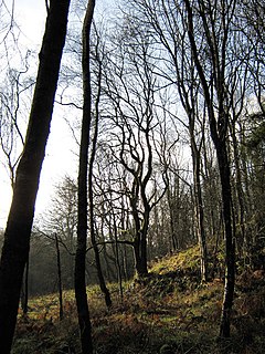
Lady Park Wood National Nature Reserve is a 45-hectare (110-acre) nature reserve straddling the borders of Gloucestershire in England and Monmouthshire in Wales. Most of the wood is in Wales but it is managed under agreement with Natural England.

Protected areas of Wales

Many parts of Wales are protected areas, according to a number of designations. They include three national parks, and five Areas of Outstanding Natural Beauty.

Clyde Valley Woodlands National Nature Reserve

The Clyde Valley Woodlands National Nature Reserve (NNR) comprises six separate woodland sites in the Clyde Valley region of South Lanarkshire, Scotland. These six sites are located along a 12 km section of the River Clyde and its tributaries, and lie close to built-up areas such as Hamilton and Lanark on the southern outskirts of Greater Glasgow. The sites can be easily accessed by about two million people living in the surrounding urban areas, making the reserve unique amongst Scotland's NNRs, most of which tend to be located in more remote areas. The six sites are:

Caer Llan is a field studies centre, conference centre and former country house located at Lydart within the community of Mitchel Troy, Monmouthshire, south east Wales, about 3 miles (4.8 km) south-west of Monmouth. It is close to the top of a scarp slope with extensive views westwards over the valley of the River Trothy, and is accessed from the B4293 road.

Croes Robert Wood

Croes Robert Wood is a nature reserve and Site of Special Scientific Interest (SSSI), noted for its biological characteristics, in Monmouthshire, south east Wales. Gwent Wildlife Trust, the owners of the site, manage the woodland through methods of coppicing and charcoal burning to encourage its notable flora and fauna.

Gaer Wood

Gaer Wood is a Site of Special Scientific Interest (SSSI), noted for its biological characteristics, in Monmouthshire, south east Wales.

Graig Wood

Graig Wood is a Site of Special Scientific Interest (SSSI), noted for its biological characteristics, in Monmouthshire, south east Wales. It forms part of the wider Hael Woods complex.
Lower Wye Gorge SSSI

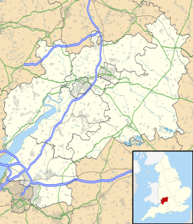
Lower Wye Gorge is a 65-hectare (160-acre) biological and geological Site of Special Scientific Interest in Gloucestershire, notified in 1954 and renotified 1987. The site includes two Gloucestershire Wildlife Trust nature reserves being Ban-y-gor Wood and Lancaut. The Natural England citation states a revision for Lancaut inclusion.
Livox Wood

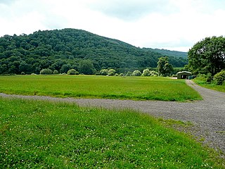
Livox Wood is a woodland and Site of Special Scientific Interest (SSSI), noted for its biological characteristics, in Monmouthshire, south east Wales.

Maes-yr-Uchaf Wood

Maes-yr-Uchaf Wood is a small woodland and Site of Special Scientific Interest (SSSI), noted for its biological characteristics, in Monmouthshire, south east Wales.

Upper Wye Gorge

Upper Wye Gorge is a Site of Special Scientific Interest (SSSI), noted for its biological and geological characteristics, around Symonds Yat in the Upper Wye Valley on the Wales–England border. The site is listed in the 'Forest of Dean Local Plan Review' as a Key Wildlife Site (KWS).

Astridge Wood

Astridge Wood is a 19.42-hectare (48.0-acre) biological Site of Special Scientific Interest in Gloucestershire, England, notified in 1985. The site is listed in the 'Forest of Dean Local Plan Review' as a Key Wildlife Site (KWS).

Bigsweir Woods

Bigsweir Woods is a 48.16-hectare (119.0-acre) biological Site of Special Scientific Interest in Gloucestershire, notified in 1984. The site is listed in the 'Forest of Dean Local Plan Review' as a Key Wildlife Site (KWS).

Highbury Wood

Highbury Wood is a 50.74-hectare (125.4-acre) biological Site of Special Scientific Interest in Gloucestershire, notified in 1983.
Shorn Cliff and Caswell Woods

Shorn Cliff And Caswell Woods is a 69.2-hectare (171-acre) biological Site of Special Scientific Interest in Gloucestershire, notified in 1986. The site is listed in the 'Forest of Dean Local Plan Review' as a Key Wildlife Site (KWS).

The Hudnalls

The Hudnalls is a 94.4-hectare (233-acre) biological Site of Special Scientific Interest in Gloucestershire, notified in 1972. The site is listed in the 'Forest of Dean Local Plan Review' as a Key Wildlife Site (KWS).

References

  1. 1 2 "Lower Hael Wood" (pdf). Countryside Council for Wales . Retrieved 31 May 2012.
  2. "Archaeological Heritage". Wye Valley Area of Outstanding Natural Beauty. Retrieved 1 June 2012.
  3. "Lower Wye Valley: Hael Woods". Glamorgan-Gwent Archaeological Trust . Retrieved 1 June 2012.
  4. "Lower Hael Wood map" (pdf). Countryside Council for Wales . Retrieved 31 May 2012.
  5. 1 2 Ordnance Survey: Explorer map sheet OL14 Wye Valley & Forest of Dean ISBN   9780319240953
  6. "Lower Hael Wood". Countryside Council for Wales . Retrieved 31 May 2012.
  7. "Species records at 10km or better that fall within or overlap Lower Hael Wood (SSSI)". National Biodiversity Network . Retrieved 1 June 2012.