Kenfig

Last updated • 3 min readFrom Wikipedia, The Free Encyclopedia

The Prince of Wales Inn The Prince of Wales, Kenfig - geograph.org.uk - 2314180.jpg
The Prince of Wales Inn

Kenfig (Welsh : Cynffig) is a village and former borough in Bridgend, Wales. It is situated 1 mile (1.6 km) inland on the north bank of the Bristol Channel, and just south-west of the M4 motorway. To the east is the town of Bridgend, at approximately 6 miles (10 km), and the capital city of Cardiff, at 24 miles (40 km). To the west lies Port Talbot, at approximately 7 miles, and Swansea at approximately 18 miles.

Contents

Geography

Kenfig Burrows Kenfig Burrows - geograph.org.uk - 161888.jpg
Kenfig Burrows
Kenfig Pool Kenfig Pool, Bridgend.jpg
Kenfig Pool

The area of sand dunes and the pool at Kenfig are managed by Bridgend County Borough Council as Kenfig Pool National Nature Reserve, the area designated a Site of Special Scientific Interest. The reserve has a visitor and interpretation centre, and a car park. The dunes are home to a variety of rare and endangered species of plants and animals, including a high concentration of fen orchid (or Liparis loeselii). The current village, built further inland, is a continuation of the mediaeval one. Landmarks include ruins of Kenfig Castle. [1]

The Kenfig Burrows beach is used by naturists. [2]

History

The village was established in the 12th century [3] and was situated around Kenfig Castle. [4] The encroaching sand caused by intensive cattle grazing and declining temperature due to the Medieval Warm Period made habitation of the area difficult and by the 14th century most of the fields and buildings were unusable. The village was abandoned by 1650. [3] The church was moved from the original village stone by stone and currently stands in the village of Pyle, where the relocation is evident by smaller stones at the bottom of the church, with larger ones above. The earlier settlement was the subject of an episode of the archaeological television programme Time Team , screened on 11 March 2012. [5]

The borough contributed with other Glamorgan towns to sending a member of parliament to Westminster until the Reform Act of 1832. The municipal ceremonial mace is in the National Museum of Wales, [6] but a pewter copy is held in the Prince of Wales Inn, a pub and Grade II-listed inn, which was built in the 17th century and over the years has served as town hall, courthouse, and a mortuary for sailors whose bodies washed ashore on nearby beaches. [7]

In 1940, work commenced on a calcium carbide plant at Kenfig, built for the Ministry of Supply and operated by British Industrial Solvents, a subsidiary of the Distillers Company. Calcium carbide was a vital raw material for acetylene production. The Kenfig plant closed in 1966, overtaken by cheaper methods of producing acetylene from the catalytic cracking of oil and foreign competitors lower electricity costs. [8]

In 1968, BorgWarner opened a plant at Kenfig for the manufacture of automatic transmissions. [9] In January 1976 the plant completed its two millionth gearbox, which was 'presented' to A B Volvo. [9] At that time a press release stated that Borg-Warner's UK plants at Letchworth and at Kenfig were producing transmissions for use in more than fifty different car models, and that more than half the gearboxes produced were exported outside the UK. [9] In 2001 the factory faced the threat of closure but was saved by a new contract from Korean car company Kia. In December 2008 Borg-Warner announced that the plant would finally close by mid-2010 with the loss of all 110 jobs at the site; a statement from the company blamed the economic downturn for the decision. [10]

In 2009, two Grob Tutor T1 aircraft collided in mid-air and crashed in the nature reserve, killing both pilots and two teenage air cadets. [11]

In literature

Kenfig local legend, folklore, and Sker House inspired the novel The Maid of Sker by R. D. Blackmore. [12]

See also

Related Research Articles

<span class="mw-page-title-main">Vale of Glamorgan</span> County borough in Wales

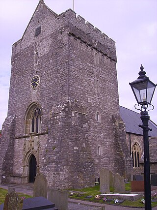
The Vale of Glamorgan, locally referred to as The Vale, is a county borough in the south-east of Wales. It borders Bridgend County Borough to the west, Cardiff to the east, Rhondda Cynon Taf to the north, and the Bristol Channel to the south. With an economy based largely on agriculture and chemicals, it is the southernmost unitary authority in Wales. Attractions include Barry Island Pleasure Park, the Barry Tourist Railway, Medieval wall paintings in St Cadoc's Church, Llancarfan, Porthkerry Park, St Donat's Castle, Cosmeston Lakes Country Park and Cosmeston Medieval Village. The largest town is Barry. Other towns include Penarth, Llantwit Major, and Cowbridge. There are many villages in the county borough.

<span class="mw-page-title-main">Bridgend</span> Town in South Wales

Bridgend is a town in the Bridgend County Borough of Wales, 20 miles (32 km) west of Cardiff and 20 miles (32 km) east of Swansea. The town is named after the medieval bridge over the River Ogmore. The River Ewenny also flows through the town. The population was 49,597 in 2021. Bridgend is within the Cardiff Capital Region which in 2019 had a population of approximately 1.54 million.

<span class="mw-page-title-main">Porthcawl</span> Human settlement in Wales

Porthcawl ( ) is a town and community in the Bridgend County Borough of Wales. It is on the south coast of Wales, 25 miles (40 km) west of Cardiff and 19 miles (31 km) southeast of Swansea.

<span class="mw-page-title-main">Bridgend County Borough</span> County borough in Wales

Bridgend County Borough is a county borough in the south-east of Wales. The county borough has a total population of 139,200 people, and contains the town of Bridgend, after which it is named. Its members of the Senedd are Sarah Murphy MS, representing the Bridgend Constituency, and Huw Irranca-Davies MS representing the Ogmore Constituency, and its members of the UK parliament are Jamie Wallis and Chris Elmore.

<span class="mw-page-title-main">Pyle</span> Human settlement in Wales

Pyle is a village and community in Bridgend county borough, Wales. This large village is served by the A48 road, and lies less than one mile from Junction 37 of the M4 motorway, and is therefore only a half-hour journey from the capital city of Wales, Cardiff. The nearest town is the seaside resort of Porthcawl. Within the Community, to the northeast of Pyle, is the adjoining settlement of Kenfig Hill, North Cornelly also adjoins Pyle and the built-up area had a population of 13,701 in 2011.

<span class="mw-page-title-main">Newton, Porthcawl</span> Human settlement in Wales

Newton is a village located near the seaside resort town of Porthcawl, in Bridgend County Borough, Wales.

<span class="mw-page-title-main">Cornelly</span>

Cornelly is a community and electoral ward in Bridgend County Borough, South Wales. As of 2011 the population of the Cornelly ward was 7,059.

North Cornelly is a village in Cornelly, Bridgend county borough, Wales. The village is close to South Cornelly, adjoins Pyle and Porthcawl, and junction 37 of the M4 motorway, which runs along its southern side.

<span class="mw-page-title-main">Kenfig Castle</span> Ruins of castle in Wales, UK

Kenfig Castle is a ruined castle in Bridgend County Borough in Wales that came to prominence after the Anglo-Norman invasion of Wales in the late 11th century.

<span class="mw-page-title-main">Kenfig Pool</span>

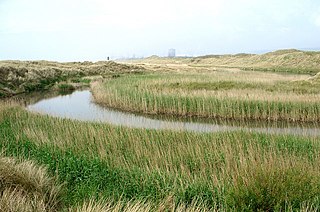
Kenfig Pool is a national nature reserve situated near Porthcawl, Bridgend. Wild storms and huge tides between the 13th and 15th centuries are mainly responsible for creating the Kenfig dunes near Porthcawl, as they threw vast quantities of sand up over the Glamorgan coast. This buried the nearby borough of Kenfig, and its castle, of which only the ruined keep survives. At 70 acres the second largest freshwater lake in south Wales. Kenfig Pool lies at the heart of the national nature reserve and is a valuable stopping point for migrating birds. The lake's maximum depth is about 12 feet. An island, built by the aristocrats living in nearby Margam to encourage wildfowl to nest there, has long since sunk beneath the waters.

Cynffig was a community in the west of Bridgend County Borough, bordering Neath Port Talbot, Wales. The community included the villages of North Cornelly, South Cornelly, Kenfig and Pyle.

<span class="mw-page-title-main">Cefn Cribwr</span> Human settlement in Wales

Cefn Cribwr is a village and community in Bridgend County Borough in south Wales. The village is located about 5 miles (8 km) from the centre of Bridgend town, and in-between Bridgend and Pyle.

<span class="mw-page-title-main">Merthyr Mawr Sand Dunes</span>

Merthyr Mawr Sand Dunes are sand dunes and a Site of Special Scientific Interest in Bridgend, south Wales. The village of Merthyr Mawr is nearby.

<span class="mw-page-title-main">Cynffig/Kenfig SSSI</span>

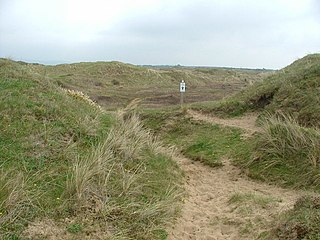
Cynffig/Kenfig is a Site of Special Scientific Interest which includes Kenfig Sands and its sand dunes near Kenfig in Bridgend County Borough, South Wales. The Kenfig National Nature Reserve is also situated at the site and contains the largest lake in Glamorgan, Kenfig Pool.

<span class="mw-page-title-main">River Kenfig</span> River in United Kingdom, Wales

The River Kenfig is a river in Wales, straddling the county boroughs of Neath Port Talbot and Bridgend. It is approximately 18 kilometres long.

<span class="mw-page-title-main">Kenfig Hill</span> Human settlement in Wales

Kenfig Hill is a village in Bridgend County Borough, South Wales. It is bordered by Pyle to the south-west, Cefn Cribwr to the north-east, North Cornelly to the south and Moel Ton-Mawr mountain to the north.

<span class="mw-page-title-main">South Wales Coast and Severn Estuary Coastal Path</span> Coastal long-distance footpath in south Wales

The South Wales Coast and Severn Estuary Coastal Path covers Region H of the larger Wales Coast Path, an 870-mile (1,400 km) long-distance walking route around the whole coast of Wales which opened on 5 May 2012. The South Wales Coast and Severn Estuary stretch is a 109-mile (176 km) in length running from Kenfig Dunes near Port Talbot, South Wales to Chepstow. With five local councils involved in its creation and maintenance, the route goes through a heritage coast, three national nature reserves and three heritage landscapes.

Kenfig is a village and former borough in Bridgend, Wales.

<span class="mw-page-title-main">Prince of Wales Inn</span> Public house in Kenfig, Wales

The Prince of Wales Inn, formerly Kenfig Town Hall, is a public house in Heol Gorllewin, Kenfig, Bridgend County Borough, Wales. The structure, which used to be a municipal building, is a Grade II listed building.

References

  1. Thomas, Jeffrey L. (2009). "Kenfig Castle". Castles of Wales. Retrieved 5 April 2016.
  2. Mears, Tyler (20 July 2016). "The nudist beaches where people are really cooling off this summer". walesonline. Archived from the original on 21 July 2016. Retrieved 21 July 2016.
  3. 1 2 Green, Matthew (2022). Shadowlands : a journey through lost Britain. London: Faber & Faber Limited. p. 34. ISBN   978-0-571-33802-3.
  4. Breverton, Terry (15 October 2009). Wales A Historical Companion. Amberley Publishing Limited. p. 256. ISBN   978-1-4456-0990-4.
  5. "Digging with the Time Team". Current Archaeology. 17 February 2012. Retrieved 6 September 2022.
  6. "Mace". National Museum of Wales. Retrieved 24 May 2024.
  7. "Halloween: Haunted house 'reduced a rugby player to tears'". BBC News. 31 October 2018. Retrieved 31 October 2018.
  8. "KenfigCarbideFactory1940-66".
  9. 1 2 3 "News: Two million Borg-Warner boxes". Autocar . 144. Vol. (nbr 4133). 24 January 1976. p. 43.
  10. "110 jobs to go as car plant shuts", BBC News
  11. Thomas, Gavin (1 December 2011). "RAF completes safety upgrade after Kenfig crash tragedy". BBC News . Retrieved 12 May 2019.
  12. "Halloween: Haunted house 'reduced a rugby player to tears'". BBC Wales News. BBC Wales. Retrieved 31 October 2018.

51°30′55″N3°43′38″W / 51.5153°N 3.7272°W / 51.5153; -3.7272