Prince of Wales Inn

Last updated

The Prince of Wales Inn
Native name
Tafarn y Tywysog Cymru (Welsh)
The Prince of Wales, Kenfig - geograph.org.uk - 2314180.jpg
The Prince of Wales Inn
LocationWest Road, Kenfig
Coordinates 51°31′21″N3°43′33″W / 51.5224°N 3.7258°W / 51.5224; -3.7258
Built1808
Architectural style(s) Medieval style
Listed Building – Grade II
Official namePrince of Wales Inn, also known as Ty Newydd
Designated6 June 1952
Reference no.11219
Bridgend UK location map.svg
Red pog.svg
Shown in Bridgend

The Prince of Wales Inn (Welsh : Tafarn y Tywysog Cymru), formerly Kenfig Town Hall (Welsh : Neuadd y Dref Cynffig), is a public house in Heol Gorllewin, Kenfig, Bridgend County Borough, Wales. The structure, which used to be a municipal building, is a Grade II listed building. [1]

History

The first municipal building was in the old town, which was itself centred round Kenfig Castle. [2] Following coastal erosion, civic leaders decided to relocate the town further inland. The new building was commissioned with the benefit of monies left by a former portreeve of the borough, Evan Griffith, in the early 17th century. The site they selected was on the east side of the West Road (Welsh : Heol Gorllewin). [3]

The building was designed in the medieval style, built in rubble masonry and was completed in around 1605. The building originally faced east. Internally, the principal room was the courtroom, where the portreeve and 12 aldermen of the borough met, on the first floor. The room also served as the venue for the bi-annual meetings of the court leet, [1] and, on occasion, was used as a mortuary for sailors whose bodies had washed ashore on nearby beaches following shipwrecks. [4] [5]

The building also incorporated the local public house, which was known as the New House Tavern (Welsh : Ty Newydd) until the late 18th century, when it was renamed The Prince of Wales Inn (Welsh : Tafarn y Tywysog Cymru), in honour of the then Prince of Wales. The building was remodelled at a cost of £400, so that it faced south, in 1808. [6] [7]

The new design involved an asymmetrical main frontage of three bays. There was a doorway to the left of the central bay. The building was fenestrated by paned casement windows with voussoirs on both floors. The new courtroom was accessed using an external staircase at the east end of the building. Sunday School classes were held in the courtroom from 1864. The borough council, which had met in the courtroom, was abolished under the Municipal Corporations Act 1883. [8] Its assets, including the building, were transferred to a specially-formed entity, the Kenfig Corporation Trust, in 1886. [9] By the late 19th century, the building was in a dilapidated state, [10] but it has since been restored and the whole building now operates as a public house. [11]

Objects of interest in the building include a pewter copy of the municipal ceremonial mace, the original of which was acquired in 1714 and is now kept in the Amgueddfa Cymru – Museum Wales. [12]

Related Research Articles

<span class="mw-page-title-main">Bangor, Gwynedd</span> City and community in Wales

Bangor is a cathedral city and community in Gwynedd, North Wales. It is the oldest city in Wales. Historically part of Caernarfonshire, it had a population of 15,100 at the 2021 census. Landmarks include Bangor Cathedral, Bangor University and Garth Pier. The Britannia and Menai Suspension bridges connect the city to the Isle of Anglesey.

<span class="mw-page-title-main">Ammanford</span> Town and community in Carmarthenshire, Wales

Ammanford is a town and community in Carmarthenshire, Wales, with a population of 5,411 at the 2011 census. It is a former coal mining town. The built-up area had a population of 7,945.
<span class="mw-page-title-main">Criccieth</span> Town and community in Gwynedd, Wales

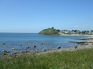
Criccieth, also spelled Cricieth ( ), is a town and community in Gwynedd, Wales, on the boundary between the Llŷn Peninsula and Eifionydd. The town is 5 miles (8 km) west of Porthmadog, 9 miles (14 km) east of Pwllheli and 17 miles (27 km) south of Caernarfon. It had a population of 1,826 in 2001, reducing to 1,753 at the 2011 census.

<span class="mw-page-title-main">Kenfig</span> Village in Bridgend, Wales

Kenfig is a village and former borough in Bridgend, Wales. It is situated 1 mile (1.6 km) inland on the north bank of the Bristol Channel, and just south-west of the M4 motorway. To the east is the town of Bridgend, at approximately 6 miles (10 km), and the capital city of Cardiff, at 24 miles (40 km). To the west lies Port Talbot, at approximately 7 miles, and Swansea at approximately 18 miles.

<span class="mw-page-title-main">Llanystumdwy</span> Human settlement in Wales

Llanystumdwy is a predominantly Welsh-speaking village, community and electoral ward in the Eifionydd area of Gwynedd in Wales. The village lies on the southern coast of the Llŷn Peninsula, with a beach facing Cardigan Bay, between Criccieth and Pwllheli at the point where the A497 road crosses the Afon Dwyfor.
<span class="mw-page-title-main">St Fagans National Museum of History</span> Open-air museum in St Fagans, Cardiff, Wales

St Fagans National Museum of History, commonly referred to as St Fagans after the village where it is located, is an open-air museum in Cardiff chronicling the historical lifestyle, culture, and architecture of the Welsh people. The museum is part of the wider network of Amgueddfa Cymru – Museum Wales.

<span class="mw-page-title-main">New Inn</span> Human settlement in Wales

New Inn is a village and community directly south east of Pontypool, within the County Borough of Torfaen in Wales, within the historic boundaries of Monmouthshire. It had a population of 5,986 at the 2011 Census.

<span class="mw-page-title-main">Pyle</span> Human settlement in Wales

Pyle is a village and community in Bridgend county borough, Wales. This large village is served by the A48 road, and lies less than one mile from Junction 37 of the M4 motorway, and is therefore only a half-hour journey from the capital city of Wales, Cardiff. The nearest town is the seaside resort of Porthcawl. Within the Community, to the northeast of Pyle, is the adjoining settlement of Kenfig Hill, North Cornelly also adjoins Pyle and the built-up area had a population of 13,701 in 2011.

<span class="mw-page-title-main">Aberkenfig</span> Human settlement in Wales

Aberkenfig is a village located in the County Borough of Bridgend, Wales to the north of Bridgend town. It is in the community of Newcastle Higher.

<span class="mw-page-title-main">Tŷ Newydd</span> Grade II* listed building in Gwynedd. National Centre for Writing in Wales

Tŷ Newydd is a historic house in Llanystumdwy, near Criccieth, in Gwynedd, north-west Wales. Since 1990 it has housed the National Writing Centre of Wales. The centre specialises in residential creative writing and retreats. The courses are in both the English and Welsh languages, and cover many genres, forms and styles. The centre also holds regular seminars and forums.

Tycroes is a village in Carmarthenshire, Wales. As measured in the 2011 Census, the population of Tycroes electoral ward was 2,438 persons.

<span class="mw-page-title-main">Timeline of Cardiff history</span>

The timeline of Cardiff history shows the significant events in the history of Cardiff which transformed it from a small Roman fort into the modern capital city of Wales.

<span class="mw-page-title-main">St Mary Street/High Street</span> Streets in Cardiff, Wales

St Mary Street and High Street are major commercial streets in the Castle Quarter of Cardiff city centre, Wales, which form a major thoroughfare running south from the gatehouse of Cardiff Castle. High Street begins at the junction of Castle Street on the A4161 and ends at the junction of Church Street and Quay Street, from where St Mary Street begins until the roundabout at Callaghan Square on the A4160.

<span class="mw-page-title-main">Grade II* listed buildings in Bridgend County Borough</span>

In the United Kingdom, the term listed building refers to a building or other structure officially designated as being of special architectural, historical, or cultural significance; Grade II* structures are those considered to be "particularly important buildings of more than special interest". Listing was begun by a provision in the Town and Country Planning Act 1947. Once listed, strict limitations are imposed on the modifications allowed to a building's structure or fittings. In Wales, the authority for listing under the Planning Act 1990 rests with Cadw.

<span class="mw-page-title-main">Llanelli Town Hall</span> Municipal Building in Llanelli, Wales

Llanelli Town Hall is a municipal building in Church Street, Llanelli, Carmarthenshire, South Wales. The town hall, which was the headquarters of Llanelli Borough Council, is a Grade II listed building.

<span class="mw-page-title-main">Langport Town Hall</span> Municipal building in Langport, Somerset, England

Langport Town Hall is a municipal building in Bow Street in Langport, Somerset, England. The building, which is the meeting place of Langport Town Council, is a Grade II listed building.

<span class="mw-page-title-main">Laugharne Town Hall</span> Municipal Building in Laugharne, Wales

Laugharne Town Hall is a municipal building in Market Street in Laugharne, Carmarthenshire, Wales. The structure, which is the meeting place of Laugharne Corporation, is a Grade II* listed building.

<span class="mw-page-title-main">Bala Town Hall</span> Municipal Building in Bala, Wales

Bala Town Hall, known in the late 19th century as the County Hall, is a municipal building in Bala, Gwynedd, Wales. The structure, which is now used as a restaurant, is a Grade II listed building.

<span class="mw-page-title-main">Llantrisant Guildhall</span> Municipal Building in Llantrisant, Wales

Llantrisant Guildhall is a municipal building on Castle Green, Llantrisant, Rhondda Cynon Taf, Wales. The structure, which is used as a visitor centre, is a Grade II listed building.

<span class="mw-page-title-main">Old Town Hall, Loughor</span> Municipal building in Loughor, Wales

The Old Town Hall is a former municipal building in Castle Street in Loughor, a town in Swansea, Wales. The structure, which used to be the neeting place of the local borough council, is a Grade II listed building.

References

  1. 1 2 Cadw. "Prince of Wales Inn, also known as Ty Newydd (11219)". National Historic Assets of Wales. Retrieved 24 May 2024.
  2. Breverton, Terry (15 October 2009). Wales A Historical Companion. Amberley Publishing Limited. p. 256. ISBN   978-1-4456-0990-4.
  3. "Ordnance Survey Map". 1900. Retrieved 24 May 2024.
  4. "Halloween: Haunted house 'reduced a rugby player to tears'". BBC News. 31 October 2018. Retrieved 24 May 2024.
  5. "The Town Hall – Prince of Wales Inn". Kenfig Community Group. 30 November 2015. Retrieved 24 May 2024.
  6. Jones, Mansel (2014). History of Kenfig. Goylake Publishing. ISBN   978-0-9932458-1-7.
  7. Carlisle, Nicholas (1811). "A topographical dictionary of the Dominion of Wales; exhibiting the names of the several cities, towns, parishes, townships, and hamlets, with the county and division of the county, to which they respectively belong". W. Bulmer.
  8. Municipal Corporations Act 1883 (46 & 46 Vict. Ch. 18) (PDF). 1883. Retrieved 26 March 2023.
  9. "Welcome to Kenfig Trust". Kenfig Corporation Trust. Retrieved 24 May 2024.
  10. Archaeologia Cambrensis. W. Pickering. 1898. p. 137.
  11. The Good Beer Guide 2018. The Campaign for Real Ale. 2017. ISBN   978-1-85249-349-3.
  12. "Mace". Amgueddfa Cymru – Museum Wales. Retrieved 24 May 2024.