County Hall, Cardiff

Last updated

County Hall, Cardiff
County Hall, Cardiff Bay.jpg
County Hall
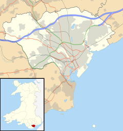
Cardiff UK location map.svg
Red pog.svg
County Hall
Location within Cardiff
General information
AddressBute East Dock, Atlantic Wharf, Butetown, Cardiff
Country United Kingdom
Coordinates 51°28′10″N3°09′48″W / 51.46956°N 3.16326°W / 51.46956; -3.16326
Completed1987
Design and construction
Architect(s)J. R. C. Bethell

The County Hall (Welsh : Neuadd y Sir) is a municipal building located beside the disused Bute East Dock in the Atlantic Wharf area of Butetown, Cardiff. Formerly the home of South Glamorgan County Council, it is now the headquarters of Cardiff Council.
Contents

History

Design and construction

Rear elevation of County Hall County Hall on Atlantic Wharf.jpg
Rear elevation of County Hall

Following the implementation of the Local Government Act 1972, which broke up Glamorgan County Council and established South Glamorgan County Council, the new county council was initially headquartered in a building on Newport Road, Cardiff. [1] After finding this arrangement inadequate for their needs, the new county leaders decided to procure a purpose-built county hall: the site they selected was derelict land on the west side of Bute East Dock. [2]

The building was designed by J. R. C. Bethell, the County Architect for South Glamorgan, and built between 1986 and 1987. [3] This was at a time when the surrounding area consisted mainly of post-industrial dereliction. Hence the construction of the new building has been described in Buildings of Wales: Glamorgan as a "remarkable gesture of faith [by] the South Glamorgan County Council". [4] It is seen as representative of a new form of civic building that does not dominate its surroundings by its size, or formal language, to the extent that it could "even [be] a deliberate abregation of the arrogant assertiveness of the late C19, expressed across the water". [3] It was officially opened by Lord Callaghan in October 1988. [5]

Development

On 1 April 1996, under the Local Government (Wales) Act 1994, South Glamorgan County Council was broken up; Cardiff Council became the local authority in the area and took over County Hall. [6] In September 2007, former Council chief executive Byron Davies unveiled plans for large efficiency improvements and additional funding, which could include selling County Hall, the Cardiff Heliport and up to 40% of Cardiff Bus. [7] In 2013, the potential sale and demolition of County Hall was again raised, as part of Cardiff Council's plans to reduce their property commitments. It was suggested an indoor arena and convention centre could be built on the site. [8] In 2023, the council invited expressions of interest in a mixed-use development of 30 acres (12 ha) in the Atlantic Wharf area, to sit alongside a proposed 17,000-seat arena. [9]

Architecture and use

County Hall is generally three storeys in height, but rises to four and five storeys in places. Its distinctive shallow pitch roofs are of black slate. The building is formed around a central courtyard. [3]

It is the main headquarters of Cardiff Council and is home to many of the council's departments. [10] Internally, the principal rooms are the council chamber and committee rooms. [11] The building also houses the council's Camera Control Room, in which CCTV is used to monitor locations across the city in an attempt to stop fly-tipping and other criminal activity. [12]

County Hall is also marketed as a venue for conferences, weddings and other events. It has an in-house catering team, a bar for refreshments and function suites to accommodate up to 300 people. [13]

Related Research Articles

<span class="mw-page-title-main">Glamorgan</span> Historic county of Wales

Until 1974, Glamorgan, or sometimes Glamorganshire, was an administrative county in the south of Wales, and later classed as one of the thirteen historic counties of Wales. Originally an early medieval petty kingdom of varying boundaries known in Welsh as Morgannwg, which was then invaded and taken over by the Normans as the Lordship of Glamorgan. The area that became known as Glamorgan was both a rural, pastoral area, and a conflict point between the Norman lords and the Welsh princes. It was defined by a large concentration of castles.

<span class="mw-page-title-main">Cardiff Castle</span> Grade I listed castle in Cardiff, Wales

Cardiff Castle is a medieval castle and Victorian Gothic revival mansion located in the city centre of Cardiff, Wales. The original motte and bailey castle was built in the late 11th century by Norman invaders on top of a 3rd-century Roman fort. The castle was commissioned either by William the Conqueror or by Robert Fitzhamon, and formed the heart of the medieval town of Cardiff and the Marcher Lord territory of Glamorgan. In the 12th century the castle began to be rebuilt in stone, probably by Robert of Gloucester, with a shell keep and substantial defensive walls being erected. Further work was conducted by the 6th Earl of Gloucester in the second half of the 13th century. Cardiff Castle was repeatedly involved in the conflicts between the Anglo-Normans and the Welsh, being attacked several times in the 12th century, and stormed in 1404 during the revolt of Owain Glyndŵr.

<span class="mw-page-title-main">Cardiff Bay</span> Area and lake in Cardiff, Wales

Cardiff Bay is an area and freshwater lake in Cardiff, Wales. The site of a former tidal bay and estuary, it is the river mouth of the River Taff and Ely. The body of water was converted into a 500-acre (2.0 km2) lake as part of a pre-devolution UK Government regeneration project, involving the damming of the rivers by the Cardiff Bay Barrage in 1999. The barrage impounds the rivers from the Severn Estuary, providing flood defence and the creation of a permanent non-tidal high water lake with limited access to the sea, serving as a core feature of the redevelopment of the area in the 1990s.

<span class="mw-page-title-main">Castell Coch</span> 19th-century Gothic Revival castle in Tongwynlais, Wales

Castell Coch is a 19th-century Gothic Revival castle built above the village of Tongwynlais, Cardiff in Wales. The first castle on the site was built by the Normans after 1081 to protect the newly conquered town of Cardiff and control the route along the Taff Gorge. Abandoned shortly afterwards, the castle's earth motte was reused by Gilbert de Clare as the basis for a new stone fortification, which he built between 1267 and 1277 to control his freshly annexed Welsh lands. This castle may have been destroyed in the native Welsh rebellion of 1314. In 1760, the castle ruins were acquired by John Stuart, 3rd Earl of Bute, as part of a marriage settlement that brought the family vast estates in South Wales.

<span class="mw-page-title-main">Pontcanna</span> District and community in Cardiff, Wales

Pontcanna is an inner-city district and community in the west of Cardiff, Wales. It is located adjecent to Canton, Cardiff. It is also located a short distance to the city centre, and its borders are approximately indicated by Western Avenue, the River Taff, Cowbridge Road East and Llandaff Road.

<span class="mw-page-title-main">Atlantic Wharf</span> Area of south Cardiff, Wales

Atlantic Wharf is a southern area of the city of Cardiff, Wales. It is primarily an area of new houses and apartments located on the west side of the disused Bute East Dock and to the east of Lloyd George Avenue. It also includes a number of refurbished dock warehouses, modern hotels, the Red Dragon Centre and Cardiff Council's County Hall. Atlantic Wharf lies in the Butetown electoral division of Cardiff and the Cardiff South and Penarth constituency for the UK Parliament and the Senedd.

<span class="mw-page-title-main">Cardiff city centre</span> Central Business District in Wales

Cardiff city centre is the city centre and central business district of Cardiff, Wales. The area is tightly bound by the River Taff to the west, the Civic Centre to the north and railway lines and two railway stations – Central and Queen Street – to the south and east respectively. Cardiff became a city in 1905.

<span class="mw-page-title-main">Cathays Park</span> Civic centre area in Cardiff, Wales

Cathays Park or Cardiff Civic Centre is a civic centre area in the city centre of Cardiff, the capital city of Wales, consisting of a number of early 20th century buildings and a central park area, Alexandra Gardens. It includes Edwardian buildings such as the Temple of Peace, City Hall, the National Museum and Gallery of Wales and several buildings belonging to the Cardiff University campus. It also includes Cardiff Crown Court, the administrative headquarters of the Welsh Government, and the more modern Cardiff Central police station. The Pevsner architectural guide to the historic county of Glamorgan judges Cathays Park to be "the finest civic centre in the British Isles". The area falls within the Cathays electoral ward and forms part of the Cathays Park Conservation Area, which was designated in 1975.

<span class="mw-page-title-main">Bute Park</span> Landscaped garden and parkland in Cardiff, Wales

Bute Park and Arboretum is a park in Cardiff, Wales. It comprises 130 acres (53 ha) of landscaped gardens and parkland that once formed the grounds of Cardiff Castle. The park is named after the 3rd Marquess of Bute, whose family owned the castle.

<span class="mw-page-title-main">Coal Exchange</span> Building in Cardiff, Wales

The Coal Exchange is a historic building in Cardiff, Wales. It is designed in Renaissance Revival style. Built in 1888 as the Coal and Shipping Exchange to be used as a market floor and office building for trading in coal in Cardiff, it later became a hub of the global coal trade. It is situated in Mount Stuart Square in Butetown, and was for many years the hub of the city's prosperous shipping industry.

<span class="mw-page-title-main">Llandough, Penarth</span> Village in Wales

Llandough is a village, community and electoral ward in the Vale of Glamorgan, Wales, approximately 2.3 miles (3.7 km) south west of Cardiff city centre, and approximately 1.3 miles (2 km) north west of Penarth.

<span class="mw-page-title-main">Glamorgan Building</span> County building in Cardiff, Wales

The Glamorgan Building is a former county hall located at King Edward VII Avenue in Cathays Park, Cardiff, Wales. It was the headquarters of Glamorgan County Council from 1912 to 1974 and then of Mid Glamorgan County Council from 1974 to 1996. The building, which was acquired by Cardiff University in 1997 and is now home to the university's School of Social Sciences and the School of Geography and Planning, is a Grade I listed building.

<span class="mw-page-title-main">Animal Wall</span> Grade I listed structure in Cardiff, Wales

The Animal Wall is a sculptured wall depicting 15 animals in the Castle Quarter of the city centre of Cardiff, Wales. It stands to the west of the entrance to Cardiff Castle, having been moved from its original position in front of the castle in the early 1930s. The design for the wall was conceived by William Burges, architect to the third Marquess of Bute, during Burges's reconstruction of the castle in the 1860s, but it was not executed until the late 1880s/early 1890s. This work, which included the original nine animal sculptures, all undertaken by Burges's favourite sculptor, Thomas Nicholls, was carried out under the direction of William Frame, who had previously assisted Burges at both Cardiff Castle and Castell Coch. When the wall was moved in the early 20th century, the fourth Marquess commissioned Alexander Carrick to carve a further six sculptures to sit on the extended wall which now fronted Bute Park. The Animal Wall is a Grade I listed structure.

<span class="mw-page-title-main">Timeline of Cardiff history</span>

The timeline of Cardiff history shows the significant events in the history of Cardiff which transformed it from a small Roman fort into the modern capital city of Wales.

<span class="mw-page-title-main">Architecture of Cardiff</span> Overview of the architecture in the capital city of Wales

Architecture in Cardiff, the capital city of Wales, dates from Norman times to the present day. Its urban fabric is largely Victorian and later, reflecting Cardiff's rise to prosperity as a major coal port in the 19th century. No single building style is associated with Cardiff, but the city centre retains several 19th and early 20th century shopping arcades.

<span class="mw-page-title-main">Listed buildings in Cardiff</span> Protected buildings in Cardiff, Wales

There are around 1,000 listed buildings in Cardiff, the capital city of Wales. A listed building is one considered to be of special architectural, historical or cultural significance, which is protected from being demolished, extended or altered, unless special permission is granted by the relevant planning authorities. The Welsh Government makes decisions on individual cases, taking advice from the heritage agency Cadw, the Royal Commission on the Ancient and Historical Monuments of Wales and local councils.

<span class="mw-page-title-main">South Glamorgan County Council</span> Welsh local governing body (1974–1996)

South Glamorgan County Council was the local government authority that administered the county of South Glamorgan, Wales from its creation in 1974 until its abolition in 1996.

<span class="mw-page-title-main">Royal Hamadryad Hospital</span> Former hospital in Cardiff, Wales

The Royal Hamadryad Hospital was a seamen's hospital and later a psychiatric hospital in the docklands area of Cardiff, Wales. It had replaced a hospital ship, the former HMS Hamadryad, in 1905. After it closed in 2002 the site was redeveloped for residential use.

<span class="mw-page-title-main">Mount Stuart Square</span> City square in Cardiff, Wales

Mount Stuart Square is a residential and commercial square in Cardiff, Wales. It is located in the Butetown area of the city. Originally developed in the late 1800s as a residential location for nearby dock workers, it quickly became a centre for upscale residential properties which revolved around the main square. By 1900, commercial activity had taken its place, dominated by the Coal Exchange, which occupied the once open central space. The square contains a high concentration of listed buildings, which represent a range of architectural styles and some of Cardiff's finest examples of late 19th and early 20th century commercial architecture. Mount Stuart Square area was designated a Conservation Area in July 1980.

<span class="mw-page-title-main">Work of William Burges at Cardiff Castle</span> Reconstruction of Cardiff Castle, Wales

From 1865 until his death in 1881 the Victorian architect William Burges undertook the reconstruction of Cardiff Castle for his patron, John Crichton-Stuart, 3rd Marquess of Bute. The rebuilding saw the creation of some of the most significant Victorian interiors in Britain.

References

  1. "Jack Brooks", South Wales Echo, 25 February 2005. Retrieved 4 May 2013.
  2. "Ordnance Survey Map". 1975. Retrieved 30 October 2020.
  3. 1 2 3 Newman, John (1995). The Buildings of Wales: Glamorgan. University of Wales Press. p. 266. ISBN   978-0140710564.
  4. Newman, John (1995). The Buildings of Wales: Glamorgan. University of Wales Press. p. 263. ISBN   978-0140710564.
  5. County Hall website Weddings: A Venue For All Occasions (Retrieved 14 September 2011)
  6. "The Local Government Reorganisation (Wales) (Property etc.) Order 1996". Legislation.gov.uk. Retrieved 21 October 2019.
  7. "Next stop: The great big sell-off of Cardiff Bus". South Wales Echo. 6 September 2007. Retrieved 14 November 2020.
  8. Law, Peter (8 March 2013). "Cardiff council considers replacing County Hall with new HQ". Wales Online. Retrieved 3 May 2013.
  9. Barry, Sion (3 May 2023). "Plans to transform Cardiff Bay take step forward". Business Live. Retrieved 29 August 2023.
  10. "Office Locations". Cardiff Council Strategic Estates. Retrieved 14 September 2011.
  11. "Visiting County Hall". Cardiff Council. Retrieved 30 October 2020.
  12. "The Big Picture: Cardiff council camera control room". South Wales Echo. Archived from the original on 11 November 2011. Retrieved 15 September 2011. 7 January 2011 (Retrieved 15 September 2011)
  13. "Cardiff County Hall" . Retrieved 13 August 2019.