Twyn Community Centre

Last updated

Twyn Community Centre
Native name
Canolfan Gymunedol Twyn (Welsh)
Twyn Community Centre, Caerphilly - geograph.org.uk - 2925907.jpg
The building in 2018
LocationThe Twyn Square, Caerphilly
Coordinates 51°34′28″N3°13′04″W / 51.5745°N 3.2177°W / 51.5745; -3.2177
Built1791
Architectural style(s) Gothic Revival style
Caerphilly UK location map.svg
Red pog.svg
Shown in Caerphilly

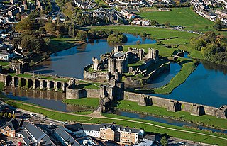
Twyn Community Centre (Welsh : Canolfan Gymunedol Twyn) is a municipal building in The Twyn Square in Caerphilly, Wales. The structure, which was commissioned as a Calvinistic Methodist Chapel, now accommodates the offices and meeting place of Caerphilly Town Council.

History

The building was commissioned as a Calvinistic Methodist Chapel, [1] and erected on a mound (Welsh : twyn) to the southeast of Caerphilly Castle. [2] It was built in rubble masonry and completed in 1791. [3]

The chapel was rebuilt in the Gothic Revival style at a cost of £800 in around 1880. [4] The design involved an asymmetrical main frontage facing to the west. The first bay on the left featured a three-stage hexagon-shaped tower, which was projected forward. There was a doorway in the first stage, a pair of arched windows in the second stage and a clock with a stone surround in the third stage, all surmounted by a mansard roof with cresting and finials. The main block of six bays, located to the south of the tower, was fenestrated by lancet windows on the ground floor and by arched windows on the first floor. These were paired in the second and fifth bays, which were surmounted by gables. [5]

In December 1904, the Welsh prophet and leading figure of the 1904–1905 Welsh revival, Evan Roberts visited the chapel and preached to a large crowd of 2,400 people both in the chapel and in other buildings in the surrounding area. [6] [7]

Meanwhile, following significant population growth, largely associated with the mining industry, a local board was established in Caerphilly in 1893. [8] [9] After the local board was succeeded by Caerphilly Urban District Council in 1894, the new council established its headquarters at a converted house called Bron Rhiw on Mountain Road. [10] [11] [12] Bron Rhiw ceased to be the local seat of government when the enlarged Rhymney Valley District Council was established in 1974. [13]

In the 1980s, after the chapel became disused, the new council decided to acquire and enlarge it. A new canted frontage, with an oriel window on the first floor, was added at the north end, a new section was added at the south end, and the height of the tower was increased by the insertion of some stained glass windows below the mansard roof. [4] The enlargement accommodated a community centre as well as offices and a council chamber for Caerphilly Town Council. [14] Since 2006, the building has also been one of the host venues for the Caerphilly Flower Festival. [15]

Related Research Articles

<span class="mw-page-title-main">Caerphilly</span> Town in South Wales

Caerphilly is a town and community in Wales. It is situated at the southern end of the Rhymney Valley.

<span class="mw-page-title-main">Rhiwbina</span> Suburb and community of Cardiff, Wales

Rhiwbina is a suburb and community in the north of Cardiff, the capital of Wales. Formerly a small hamlet within the parish of Whitchurch, Rhiwbina was developed throughout the twentieth century, and is now a separate ward. It retains aspects of its former character, however, and is given a Welsh village appearance by Beulah United Reformed Church at the village crossroads.

The Presbyterian Church of Wales, also known as the Calvinistic Methodist Church, is a denomination of Protestant Christianity based in Wales.

<span class="mw-page-title-main">Ystrad Mynach</span> Human settlement in Wales

Ystrad Mynach is a town in the Caerphilly County Borough, within the ancient county of Glamorgan, Wales, and is 5 miles (8.0 km) north of the town of Caerphilly. The urban area has a population of 19,204, and stands in the Rhymney Valley. Before the Industrial Revolution and the coming of coal mining in the South Wales Coalfield the valley was rural and farmed. It lies in the community of Gelligaer.

<span class="mw-page-title-main">Blackwood, Caerphilly</span> Town in Caerphilly, Wales

Blackwood is a town, community and an electoral ward on the Sirhowy River in the South Wales Valleys administered as part of Caerphilly County Borough. It is located within the historic county of Monmouthshire.
<span class="mw-page-title-main">Taff's Well</span> Human settlement in Wales

Taff's Well is a semi-rural village, community and electoral ward located at the south-eastern tip of Rhondda Cynon Taf, 6 miles (9.7 km) to the north of Cardiff, the capital city of Wales. Known locally as the 'Gates to the Valleys' by some and considered part of the Valleys by others, it is separated from Gwaelod-y-Garth by the River Taff. Taff's Well is distinguished because it contains the only thermal spring in Wales. The tepid water is thought to rise along a fault-line from the Carboniferous Limestone, in somewhat similar manner to the warm springs at Bristol and Bath. The Welsh myth of the Taff's Well Turtle originates here. Various religious groups regard it as a spiritual site.

<span class="mw-page-title-main">Tregynon</span> Human settlement in Wales

Tregynon is a small village and community in Montgomeryshire, Powys, Wales, to the north of Newtown and south west of Welshpool. The population of the community was 892 at the 2011 Census. It rests on the B4389 road which runs from Bettws Cedewain to New Mills. The country house Gregynog is nearby.

<span class="mw-page-title-main">Bedwellty</span>

Bedwellty is a small village in Caerphilly County Borough in south Wales. The village stands on a ridge of high ground between the Rhymney and Sirhowy valleys. The village comprises St Sannan's parish church, public house and a few houses. The register of St Sannan's Church dates from 1624, which qualifies Bedwellty as an ancient parish. Historically the parish lay in the county of Monmouthshire, the hundred of Wentloog, Tredegar County Court District, the rural deanery of Bedwellty, the archdeaconry of Monmouth and the diocese of Llandaff. Several towns based on the iron industry expanded within the parish boundary, including from west to east, Rhymney, Tredegar and Ebbw Vale, which gradually gained administrative independence from Bedwellty between the 1870s and 1890s. A Bedwellty Local Government District was established for the rest of the parish in 1891, becoming an urban district in 1894.

<span class="mw-page-title-main">Upper Boat</span> Human settlement in Wales

Upper Boat is a village on the southernmost outskirts of the town of Pontypridd, within the electoral ward of Hawthorn, Rhondda Cynon Taf, Wales, and comprises part of the Treforest Industrial Estate. Historically part of Glamorgan, it fell within the parish of Eglwysilan.

<span class="mw-page-title-main">Fochriw</span> Human settlement in Wales

Fochriw is a village in Caerphilly County Borough, Wales. It was well known for its neighbouring collieries, which employed nearly the entire local population in the early 20th century. It lies within the historic county boundaries of Glamorgan. The village appears as the backdrop on the BBC Wales sitcom High Hopes credits. The village's population was 1,250 in 2011.
<span class="mw-page-title-main">Llandecwyn</span> Human settlement in Wales

Llandecwyn is a hamlet near Penrhyndeudraeth in Gwynedd, Wales.

<span class="mw-page-title-main">Penderyn, Rhondda Cynon Taf</span> Village in Rhondda Cynon Taf, Wales

Penderyn is a rural village in the Cynon Valley, Rhondda Cynon Taf, Wales, located near Hirwaun.

<span class="mw-page-title-main">Capel Heol Dŵr, Carmarthen</span> Church in Carmarthenshire, Wales

Capel Heol Dŵr was a Calvinistic Methodist chapel in the town of Carmarthen, Carmarthenshire, Wales. The building dates from 1831 and is located at Water St, Carmarthen. It was designated as a Grade II listed building on 19 May 1981.

<span class="mw-page-title-main">Council Offices, Caernarfon</span> County building in Caernarfon, Wales

The Council Offices is a municipal facility at Shirehall Street in Caernarfon, Wales. The structure, which is the headquarters of Gwynedd Council, is a Grade II listed building.

<span class="mw-page-title-main">Neuadd Dwyfor</span> County Building in Pwllheli, Wales

Pwllheli Town Hall is a municipal building in Penlan Street, Pwllheli, Gwynedd, Wales. The structure, which now operates as an arts centre, is a Grade II listed building.

<span class="mw-page-title-main">Assembly Rooms, Presteigne</span> Municipal Building in Presteigne, Wales

The Assembly Rooms in Presteigne, formerly Presteigne Town Hall, is a municipal building in Broad Street, Presteigne, Powys, Wales. The structure, which accommodates a public library on the ground floor and an arts centre on the first floor, is a Grade II listed building.

<span class="mw-page-title-main">Old Town Hall, Wombwell</span> Municipal building in Wombwell, South Yorkshire, England

The Old Town Hall is a former municipal building in the High Street, Wombwell, South Yorkshire, England. The structure, which is currently used as a public house, is a locally listed building.

References

  1. "Chapels". Genuki. Archived from the original on 16 March 2016.
  2. "Ordnance Survey Map". 1900. Retrieved 24 August 2024.
  3. Parliamentary Papers 1909–1982. Vol. 18. 1910. p. 448. Calvinistic Methodist, Twyn, 1791
  4. 1 2 "Twyn Community Centre". History Points. Retrieved 24 August 2024.
  5. "Black and white acetate negative showing the Twyn area of Caerphilly". Coflein. Retrieved 24 August 2024.
  6. "Caerphilly Roused". The Western Mail. 10 December 1904.
  7. Phillips, D. M. (1923). Evan Roberts, The Great Welsh Revivalist And His Work, Chapter XXX.
  8. "Glamorganshire County Council". South Wales Echo. Cardiff. 13 November 1891. p. 4. Retrieved 15 October 2022.
  9. Annual Report of the Local Government Board. London: Her Majesty's Stationery Office. 1894. p. 296. Retrieved 14 October 2022. The County of Glamorgan (Caerphilly) Confirmation Order, 1893
  10. Ordnance Survey 25-inch maps: 1919 - building labelled "Bron-rhiw" / 1946 - same building labelled "Council Offices"
  11. Planning application 5/5/84/0503: Proposed sub-divisional police station at ex-Rhymney Valley District Council Offices, Mountain Road, Caerphilly, granted 23 November 1984
  12. "Bron Rhiw, Caerphilly". Coflein. Royal Commission on the Ancient and Historical Monuments of Wales. Retrieved 15 October 2022.
  13. Local Government Act 1972. 1972 c.70. The Stationery Office Ltd. 1997. ISBN   0-10-547072-4.
  14. "meetings". Caerphilly Town Council. Retrieved 24 August 2024.
  15. "Hundreds visit floral displays at Caerphilly Flower Festival". Caerphilly Observer. 2 July 2019. Retrieved 24 August 2024.