Powys is a county and preserved county in Wales. It borders Gwynedd, Denbighshire, and Wrexham to the north; the English ceremonial counties of Shropshire and Herefordshire to the east; Monmouthshire, Blaenau Gwent, Merthyr Tydfil, Caerphilly, Rhondda Cynon Taf, and Neath Port Talbot to the south; and Carmarthenshire and Ceredigion to the west. The largest settlement is Newtown, and the administrative centre is Llandrindod Wells.

Until 1974, Montgomeryshire was an administrative county in mid Wales, later classed as one of the thirteen historic counties of Wales. It was named after its county town, Montgomery, which in turn was named after one of William the Conqueror's main counsellors, Roger de Montgomerie, who was the 1st Earl of Shrewsbury.

Newtown is a town in Powys, Wales. It lies on the River Severn in the community of Newtown and Llanllwchaiarn, within the historic boundaries of Montgomeryshire. It was designated a new town in 1967 and saw population growth as firms settled, changing its market town character. Its 2001 population of 10,780 rose to 11,357 in the 2011 census, and rose again to 11,362 in the 2021 census.

Llanidloes is a town and community on the A470 and B4518 roads in Powys, within the historic county boundaries of Montgomeryshire, Wales. The population in 2011 was 2,929, of whom 15% could speak Welsh. It is the third largest settlement in Montgomeryshire, after Newtown and Welshpool.

Montgomery is a town and community in Powys, Wales. It is the traditional county town of the historic county of Montgomeryshire to which it gives its name, and it is within the Welsh Marches border area. The town centre lies about 1 mile (1.6 km) west of the England–Wales border. Montgomery Castle was started in 1223 and its parish church in 1227. Other locations in the town include The Old Bell Museum, the Offa's Dyke Path, the Robber's Grave and the town wall. The large Iron Age hill fort of Ffridd Faldwyn is sited northwest of the town and west of the Castle.
Berriew is a village and community in Montgomeryshire, Powys, Wales. It is on the Montgomeryshire Canal and the Afon Rhiw, near the confluence with the River Severn at grid reference SJ185005, 79 miles (128 km) from Cardiff and 151 miles (243 km) from London. The village itself had a population of 283. and the community also includes Garthmyl Hall and Refail.

Pontrobert is an ecclesiastical parish that was formed in September 1854. It comprises the townships of Teirtref and part of Nantymeichiaid in the parish Meifod, a portion of Cynhinfa which was in the parish of Llangynyw and portions of the townships of Fachwel, Llaethbwlch and Cadwnfa which were in the parish of Llanfihangel. The total area of this parish is 5,000 acres. As a result of this arrangement, Pont Robert is now divided between the present day Community Councils of Meifod, Llangyniew and Mawddwy. Pontrobert was within the historic county of Montgomeryshire, now forming part of Powys. The name Pontrobert is derived from Robert ap Oliver of Cyhinfa, who built the original bridge over the River Vyrnwy around 1700. An alternative Welsh name for Pontrobert is Pont y ddolfeiniog.

The District of Montgomeryshire or Montgomery was one of three local government districts of the county of Powys, Wales, from 1974 until 1996. The district had an identical area to the previous administrative county of Montgomeryshire. The district was abolished in 1996, with Powys County Council taking over its functions.

Powys County Council is the local authority for Powys, one of the 22 principal areas of Wales. The council is based at County Hall in Llandrindod Wells.

Thomas Penson, or Thomas Penson the younger, was the county surveyor of Denbighshire and Montgomeryshire, and an innovative architect and designer of a number of masonry arch bridges over the River Severn and elsewhere.
Poundley and Walker or John Wilkes Poundley and David Walker were a land surveyors and architects’ partnership with offices at Black Hall, Kerry, Montgomeryshire and at Unity Buildings, 22 Lord Street, Liverpool. The partnership was established probably in the mid-1850s and was dissolved in June 1867. The partnership was involved with large country estate building projects, church and civic buildings and some civil engineering. They specialized in building model farms. J. W. Poundley was also the county surveyor for Montgomeryshire from 1861–1872. The architect, canal and railway engineer, T. G. Newnham appears have been associated with the partnership.

Frank Hearn Shayler (1867–1954) was a Shrewsbury-based architect who worked in an Arts and Crafts style. He was in partnership with Thomas Ridge, and they also had offices in Oswestry and Welshpool.

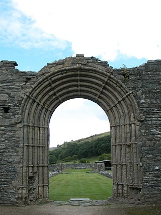
Stephen W Williams or Stephen Williams (1837–1899) was a civil engineer and architect who worked mainly in Radnorshire and Breconshire, Wales. He was county surveyor of Radnorshire from 1864 to 1899. He had offices at Rhayader and lived at Penralley House, Rhayader, He became a noted authority on the archaeology of the Cistercian Monasteries in Wales and undertook excavations at Strata Florida Abbey in Ceredigion, Abbey Cwm Hir in Radnorshire and Strata Marcella near Welshpool in Montgomeryshire. He was appointed High Sheriff of Radnorshire in 1899.

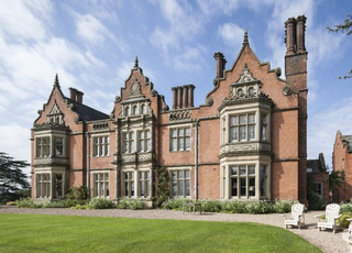
Vaynor Park is a country house in a landscaped park, standing on high ground to the south-west of Berriew village, in the historic county of Montgomeryshire, now Powys. The origins of the house date from the mid-15th century, but the house was extensively re-built in brick about 1640. The house was further re-modelled in 1840–1853 by Thomas Penson. The house is listed Grade II* and the garden and park is on the Cadw/ICOMOS Register of Parks and Gardens of Special Historic Interest in Wales

Penstrowed is a historic Montgomeryshire parish to the west of Newtown, now in the community of Mochdre with Penstrowed, Powys, Wales.

Owain Glyndŵr's Parliament House was traditionally the building where Owain Glyndŵr held a parliament after being crowned Prince of Wales in 1404. However the origin of the building is probably later. The existing building may be 15th century in origin, but has been extensively rebuilt, particularly by David Davies of Llandinam, who purchased it in 1906. It was opened on 20 February 1912 to provide a social centre for the town. The present rubble exterior is an interpretation of its 15th century appearance, probably by the architect Frank Shayler, who may also have designed the adjacent Glyndŵr Institute.

Architecture of Wales is an overview of architecture in Wales from the medieval period to the present day, excluding castles and fortifications, ecclesiastical architecture and industrial architecture. It covers the history of domestic, commercial, and administrative architecture.

Newtown and Llanllwchaiarn is a local government community in mid Powys, Wales. It includes the town of Newtown and the small neighbouring village of Llanllwchaiarn. At the time of the 2011 census the population of the community was 11,357. The community council is called Newtown and Llanllwchaiarn Town Council, often abbreviated to Newtown Town Council.

Montgomery Town Hall is a municipal building in Broad Street, Montgomery, Wales. It served as the meeting place of Montgomery Borough Council and is a Grade II* listed building.

Welshpool Town Hall, is a municipal building in Broad Street, Welshpool, Powys, Wales. The structure, which is the meeting place of Welshpool Town Council, is a Grade II listed building.


