
Powys is a county and preserved county in Wales. It borders Gwynedd, Denbighshire, and Wrexham to the north; the English ceremonial counties of Shropshire and Herefordshire to the east; Monmouthshire, Blaenau Gwent, Merthyr Tydfil, Caerphilly, Rhondda Cynon Taf, and Neath Port Talbot to the south; and Carmarthenshire and Ceredigion to the west. The largest settlement is Newtown, and the administrative centre is Llandrindod Wells.

Until 1974, Montgomeryshire was an administrative county in mid Wales, later classed as one of the thirteen historic counties of Wales. It was named after its county town, Montgomery, which in turn was named after one of William the Conqueror's main counsellors, Roger de Montgomerie, who was the 1st Earl of Shrewsbury.

Welshpool is a market town and community in Powys, Wales, historically in the county of Montgomeryshire. The town is four miles from the Wales–England border and low-lying on the River Severn. The community, which also includes Cloddiau and Pool Quay, has a population of 6,664, with the town having 5,948. There are many examples of Georgian architecture within the town. Powis Castle is located to the north.

Llanidloes is a town and community on the A470 and B4518 roads in Powys, within the historic county boundaries of Montgomeryshire, Wales. The population in 2011 was 2,929, of whom 15% could speak Welsh. It is the third largest settlement in Montgomeryshire, after Newtown and Welshpool.

Montgomery is a town and community in Powys, Wales. It is the traditional county town of the historic county of Montgomeryshire to which it gives its name, and it is within the Welsh Marches border area. The town centre lies about 1 mile (1.6 km) west of the England–Wales border. Montgomery Castle was started in 1223 and its parish church in 1227. Other locations in the town include The Old Bell Museum, the Offa's Dyke Path, the Robber's Grave and the town wall. The large Iron Age hill fort of Ffridd Faldwyn is sited northwest of the town and west of the Castle.

The District of Montgomeryshire or Montgomery was one of three local government districts of the county of Powys, Wales, from 1974 until 1996. The district had an identical area to the previous administrative county of Montgomeryshire. The district was abolished in 1996, with Powys County Council taking over its functions.

Llanfyllin is a market town and community in Powys, Wales. The community population in 2021 was 1,586 and the town's name means church or parish (llan) of St Myllin. The community includes the settlements of Bodfach, Ty Crwyn, Abernaint and several farms.

Thomas Penson, or Thomas Penson the younger, was the county surveyor of Denbighshire and Montgomeryshire, and an innovative architect and designer of a number of masonry arch bridges over the River Severn and elsewhere.
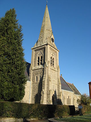
Llandyssil is a village in the community of Abermule with Llandyssil, in Powys, Wales, in the traditional county of Montgomeryshire. It is about two miles from the town of Montgomery.
Poundley and Walker or John Wilkes Poundley and David Walker were a land surveyors and architects’ partnership with offices at Black Hall, Kerry, Montgomeryshire and at Unity Buildings, 22 Lord Street, Liverpool. The partnership was established probably in the mid-1850s and was dissolved in June 1867. The partnership was involved with large country estate building projects, church and civic buildings and some civil engineering. They specialized in building model farms. J. W. Poundley was also the county surveyor for Montgomeryshire from 1861–1872. The architect, canal and railway engineer, T. G. Newnham appears have been associated with the partnership.

Frank Hearn Shayler (1867–1954) was a Shrewsbury-based architect who worked in an Arts and Crafts style. He was in partnership with Thomas Ridge, and they also had offices in Oswestry and Welshpool.
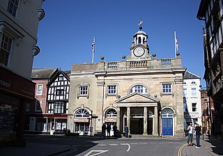
William Baker of Audlem (1705–1771) was an architect, surveyor and building contractor, working in Shropshire and the adjacent counties in the middle years of the 18th century.
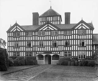
Lymore, or Lymore House or Lodge was demolished in 1931. It stood in Lymore Park, one mile ESE of Montgomery, Powys, Wales. The house was a large half-timbered house built by Edward Herbert, 3rd Baron Herbert of Chirbury, c. 1675, to replace the family residences in Montgomery Castle and Black Hall in Montgomery. The house, which had been uninhabited but maintained for many years, was used for an event in 1921, when one of the floors collapsed with disastrous consequences, resulting in demolition in 1931. The Earls of Powis still own and maintain the park. The park includes the grounds of the Montgomery Cricket Club, which is the oldest cricket pitch in Montgomeryshire and Offa's Dyke forms its eastern boundary. It is listed on the Cadw/ICOMOS Register of Parks and Gardens of Special Historic Interest in Wales.

Christ Church, Welshpool was commissioned by the Earl of Powis to commemorate his son, Edward James, the Viscount Clive, having come of age. It was designed by Thomas Penson and completed 1839–44. The church is characterised by its impressive Romanesque Revival architecture in volcanic Trachyte from the Earl of Powis' Standard quarry in Welshpool. The church consists of a 7-bay nave with offset west tower, aisles, apse and south porch. The west gable of the nave has a wide doorway with triple arches with chevron moulding, while the tower is supported by massive pilaster buttresses. Christ Church was most noted for its interior decoration, and in particular its early use of terracotta. The church was a Chapel of Ease of Welshpool's St Mary's Church and had a separate endowment. It cost £6000 to build and this was raised by public subscription as well as being supported by the Earl. The congregation of Christ Church dropped dramatically during the twentieth century and in 1998 it was closed and sold in 2002 to Karl Meredith and Natalie Bass who are in the process of restoring the church, partly as a house and partly for community use.
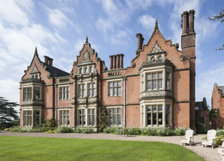
Vaynor Park is a country house in a landscaped park, standing on high ground to the south-west of Berriew village, in the historic county of Montgomeryshire, now Powys. The origins of the house date from the mid-15th century, but the house was extensively re-built in brick about 1640. The house was further re-modelled in 1840–1853 by Thomas Penson. The house is listed Grade II* and the garden and park is on the Cadw/ICOMOS Register of Parks and Gardens of Special Historic Interest in Wales
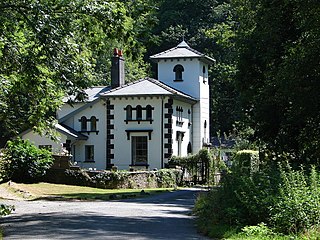
Richard Kyrke Penson or R. K. Penson was a Welsh architect and artist.

Newtown and Llanllwchaiarn is a local government community in mid Powys, Wales. It includes the town of Newtown and the small neighbouring village of Llanllwchaiarn. At the time of the 2011 census the population of the community was 11,357. The community council is called Newtown and Llanllwchaiarn Town Council, often abbreviated to Newtown Town Council.

Oswestry Guildhall is a municipal building in Bailey Head in Oswestry, Shropshire, England. The structure, which was the meeting place of Oswestry Municipal Borough Council, is a Grade II listed building.

Llanidloes Town Hall is a municipal building in Great Oak Street, Llanidloes in Powys, Wales. The structure, which is the meeting place of Llanidloes Town Council as well as the home of the Llanidloes Museum and the Llanidloes Public Library, is a Grade II listed building.

Welshpool Town Hall, is a municipal building in Broad Street, Welshpool, Powys, Wales. The structure, which is the meeting place of Welshpool Town Council, is a Grade II listed building.


