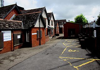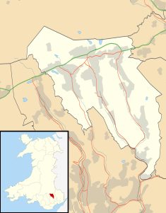
Blaenau Gwent is a county borough in the south-east of Wales. It borders the unitary authority areas of Monmouthshire and Torfaen to the east, Caerphilly to the west and Powys to the north. Its main towns are Abertillery, Brynmawr, Ebbw Vale and Tredegar. Its highest point is Coity Mountain at 1,896 feet (578 m).

Monmouthshire is a county in the south east of Wales. It borders Powys to the north; the English counties of Herefordshire and Gloucestershire to the north and east; the Severn Estuary to the south, and Torfaen, Newport and Blaenau Gwent to the west. The largest town is Abergavenny, and the administrative centre is Usk.

Caerphilly County Borough is a county borough in the south-east of Wales. It is governed by Caerphilly County Borough Council.

Tredegar is a town and community situated on the banks of the Sirhowy River in the county borough of Blaenau Gwent, in the southeast of Wales. Within the historic boundaries of Monmouthshire, it became an early centre of the Industrial Revolution in Wales. The relevant wards collectively listed the town's population as 15,103 in the UK 2011 census.

Blaenau Gwent was a constituency in South Wales, that was represented in the House of Commons of the UK Parliament from 2010 to 2024 by Nick Smith of the Labour Party.

Bedwellty is a small village in Caerphilly County Borough in south Wales. The village stands on a ridge of high ground between the Rhymney and Sirhowy valleys. The village comprises St Sannan's parish church, public house and a few houses. The register of St Sannan's Church dates from 1624, which qualifies Bedwellty as an ancient parish. Historically the parish lay in the county of Monmouthshire, the hundred of Wentloog, Tredegar County Court District, the rural deanery of Bedwellty, the archdeaconry of Monmouth and the diocese of Llandaff. Several towns based on the iron industry expanded within the parish boundary, including from west to east, Rhymney, Tredegar and Ebbw Vale, which gradually gained administrative independence from Bedwellty between the 1870s and 1890s. A Bedwellty Local Government District was established for the rest of the parish in 1891, becoming an urban district in 1894.

Blaenau Gwent County Borough Council is the governing body for Blaenau Gwent, one of the Principal Areas of Wales.

Tredegar General Hospital was a community hospital in Tredegar, Blaenau Gwent, Wales. It was managed by the Aneurin Bevan Local Health Board.

Beaufort is a village and community on the northern edge of the county borough of Blaenau Gwent in Wales. It is located in the historic county of Brecknockshire (Breconshire) and the preserved county of Gwent. According to the 2011 census, the population of the ward and community of Beaufort is 3,866

Bedwellty House is a Grade II-listed house and gardens in Tredegar, in the Sirhowy Valley in south-east Wales. It was built in the early 19th century on the site of an earlier building and subsequently enlarged into its present form by mid-century. The owners donated the house and its grounds to the public at the beginning of the 20th century. They were restored at the beginning of the 21st century. The grounds are included on the Cadw/ICOMOS Register of Parks and Gardens of Special Historic Interest in Wales, the only estate so listed in Blaenau Gwent.

Aneurin Bevan University Health Board (ABUHB) is the local health board of NHS Wales for Gwent, in the south-east of Wales. Headquartered in Caerleon, the local health board (LHB) was launched in October 2009 through the merger of Gwent Healthcare NHS Trust and Blaenau Gwent, Caerphilly, Newport, Torfaen, and Monmouthshire LHBs. It is named after Aneurin Bevan, a Member of Parliament who represented the area and who was the Minister of Health responsible for the foundation of the National Health Service. Aneurin Bevan University Health Board is the operational name of Aneurin Bevan Local Health Board.
Tredegar Iron and Coal Company was an important 19th century ironworks in Tredegar, Wales, which due to its need for coke became a major developer of coal mines and particularly the Sirhowy Valley of South Wales. It is most closely associated with the Industrial Revolution and coal mining in the South Wales Valleys.
The Recreation Ground, Tredegar is a cricket ground and former greyhound racing and speedway stadium in Tredegar, Blaenau Gwent, south-east Wales.
The Bedwellty Union Workhouse was situated in Georgetown, Tredegar. It is 2.9 miles (4.7 km) from the Nanybwtch Junction A465. The building was in existence for approximately 127 years. The workhouse building was also used as a hospital. Today, the site where the building once stood, there is a housing estate known as St James Park.

Badminton is a community and electoral ward in Blaenau Gwent, Wales, with the community being created in 2010.

Waun-Lwyd or Waunlwyd is a village in the Ebbw Valley in Blaenau Gwent. It belongs in the community of Cwm.

Merthyr Tydfil Town Hall is a municipal building in the High Street, Merthyr Tydfil, South Wales. The town hall, which was the headquarters of Merthyr Tydfil County Borough Council, is a Grade II* listed building.

Blaenau Gwent is a county borough in the south-east of Wales. It borders the unitary authority areas of Monmouthshire and Torfaen to the east, Caerphilly to the west and Powys to the north. Its main towns are Abertillery, Brynmawr, Ebbw Vale and Tredegar. It covers an area of 109 km2 (42 sq mi) and in 2023 the population was approximately 66,993.


