Pontypridd Municipal Buildings

Last updated

Pontypridd Municipal Buildings
Native name
Adeiladau Bwrdeistrefol Pontypridd (Welsh)
Municipal Buildings, Pontypridd - geograph.org.uk - 4260756.jpg
The building in November 2014
LocationGelliwastad Road, Pontypridd
Coordinates 51°36′17″N3°20′27″W / 51.6047°N 3.3407°W / 51.6047; -3.3407
Built1906
Architect Henry Hare
Architectural style(s) Baroque style
Listed Building – Grade II*
Official nameMunicipal Buildings
Designated17 January 1990
Reference no.13532
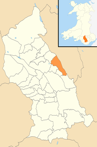
Rhondda Cynon Taf UK location map.svg
Red pog.svg
Shown in Rhondda Cynon Taf

The Municipal Buildings (Welsh : Adeiladau Bwrdeistrefol Pontypridd) is a municipal building located on Gelliwastad Road, Pontypridd in Rhondda Cynon Taf in Wales. The structure, which is currently used as a register office, is a Grade II listed building. [1]

Contents

History

Following significant population growth, largely associated with coal mining and the local ironworks, a local board of health was established in Pontypridd in 1873. [2] After the local board was succeeded by Pontypridd Urban District Council in 1894, the new council decided to commission municipal offices. The site they selected was on the northwest side of Morgan Street. [3]

Henry Hare won a competition to design the new building, and construction started in 1903. It was designed in the Baroque style, built in rubble masonry with ashlar stone dressings, and was officially opened by the member of parliament, Alfred Thomas, in April 1906. [4] [5] Hare's design provided a council chamber and offices at right-angles. [6]

The building continued to serve as the offices of the urban district council for much of the 20th century, [7] and became the headquarters of the enlarged Taff-Ely District Council when it was established in 1974. [8] [9] However, it ceased to be the local seat of government when the new unitary authority, Rhondda Cynon Taf County Borough Council, was formed in 1996, [10] and subsequently became the local register office. [11]

Architecture

The building is constructed of rubble masonry, with stone dressings, and a slate roof. It has two storeys and an attic. The main front is three bays wide and topped by an octagonal bellcote with a weathervane. The ground floor has semicircular arches, within which the main entrance and windows are deeply recessed. There are sculptures designed by John Dudley Forsyth and niches with staircases. The east side has 11 bays, with the end bays brought forward. The interior is well preserved; the main entrance leads to a lobby with a stone staircase, while upstairs are the council chamber, committee room and mayor's parlour, each with original furniture. The chamber is described by CADW as "exceptionally fine", with seating in a "D" formation, stained glass, and a vaulted ceiling on pilasters. The parlour also has an elaborate ceiling, and the committee room has its original chimneypiece. [1] [12] The building was grade II* listed in 1990. [1]

See also

Related Research Articles

<span class="mw-page-title-main">Pontypridd</span> Town in Wales

Pontypridd, colloquially referred to as Ponty, is a town and a community in Rhondda Cynon Taf, South Wales, approximately 10 miles north west of Cardiff city centre.

<span class="mw-page-title-main">Rhondda Cynon Taf</span> County borough in Wales

Rhondda Cynon Taf is a county borough in the south-east of Wales. It consists of five valleys: the Rhondda Fawr, Rhondda Fach, Cynon, Taff and Ely valleys, plus several towns and villages away from the valleys.

<span class="mw-page-title-main">River Taff</span> River in Wales which flows into Cardiff Bay

The River Taff is a river in Wales. It rises in the Brecon Beacons as two rivers, the Taf Fechan and the Taf Fawr before becoming one just north of Merthyr Tydfil. At Cardiff, it empties into the Bristol Channel.

<span class="mw-page-title-main">Pontypridd (UK Parliament constituency)</span> Parliamentary constituency in the United Kingdom, 1918 onwards

Pontypridd is a constituency represented in the House of Commons of the UK Parliament since 2019 by Alex Davies-Jones of the Labour Party.

<span class="mw-page-title-main">Taff-Ely</span> Former district of Mid Glamorgan, Wales

Taff-Ely was a local government district with borough status in Wales from 1974 to 1996.

<span class="mw-page-title-main">District of Rhondda</span> Former district of Mid Glamorgan, Wales

Rhondda was a local government district in the geographical area of the Rhondda Valley, south Wales, from 1877 until 1996, with various statuses through its history.

<span class="mw-page-title-main">Rhondda Cynon Taf County Borough Council</span> Local government of Rhondda Cynon Taf, Wales

Rhondda Cynon Taf County Borough Council is the governing body for Rhondda Cynon Taf, one of the principal areas of Wales. The council headquarters are at the Llys Cadwyn development in Pontypridd.

<span class="mw-page-title-main">Glyntaff</span> Human settlement in Wales

Glyntaff is a small village to the south-east of Pontypridd, in the County Borough of Rhondda Cynon Taf, Wales situated in the Treforest ward along with the village of Trefforest.

<span class="mw-page-title-main">Tonteg</span> Human settlement in Wales

Tonteg is a village in Rhondda Cynon Taf in South Wales. It is 4 miles (6.4 km) from Pontypridd, 9 miles (14.5 km) north west of Cardiff and 4 miles (6.44 km) north east of Llantrisant. The village is within the community of Llantwit Fardre. Tonteg is to the north west of the Garth Mountain, on the west side of the River Taff valley, at the top of a hill known locally as Powerstation Hill. The hill gets its name from the Upper Boat power station which was situated at the bottom of the hill until it was demolished in 1972. Tonteg is next to Church Village and the boundaries between the two villages are blurred. A significant part of the Treforest Industrial Estate falls within the Willowford area of Tonteg.

<span class="mw-page-title-main">Cwm Taf Morgannwg University Health Board</span> NHS local health board in South Wales

Cwm Taf Morgannwg University Health Board (CTMUHB) is the local health board of NHS Wales for Merthyr Tydfil, Rhondda Cynon Taf, and Bridgend in the south of Wales. It was renamed from Cwm Taf University Health Board on 1 April 2019 following the transfer of Bridgend County Borough from the former Abertawe Bro Morgannwg University Health Board.

Hawthorn is a village and electoral ward within the community of the town of Pontypridd in the County Borough of Rhondda Cynon Taf, located 10 miles north west of Cardiff, the capital city of Wales. Historically this fell within the parish of Eglwysilan within Mid Glamorgan.

<span class="mw-page-title-main">Glyncoch</span> Human settlement in Wales

Glyncoch is a village to the north of Pontypridd in Rhondda Cynon Taf, Wales. It is also the name of an electoral ward.

<span class="mw-page-title-main">Old Bridge, Pontypridd</span> Grade I listed bridge in Pontypridd, UK

The Old Bridge, which is now also known as the William Edwards Bridge or Pontypridd Bridge, was originally known as the New Bridge or Newbridge, is an arched single-span footbridge that spans the River Taff at Pontypridd in Wales. The bridge was built by William Edwards and was completed in 1756. The bridge now has statutory protection as a scheduled ancient monument and is grade I listed.

<span class="mw-page-title-main">Graig, Pontypridd</span> Human settlement in Wales

Graig is a historic district of the town of Pontypridd, Rhondda Cynon Taf, South Wales. It is also the name of an electoral ward for the town and county councils.

<span class="mw-page-title-main">Grade I listed buildings in Rhondda Cynon Taf</span> List of buildings in county borough of Wales

Rhondda Cynon Taf is a county borough in South Wales. It is located to the north-west of Cardiff and covers an area of 424 km2 (164 sq mi). In 2021 the population was approximately 237,500.

<span class="mw-page-title-main">Grade II* listed buildings in Rhondda Cynon Taf</span> List of buildings in county borough of Wales

Rhondda Cynon Taf is a county borough in South Wales. It is located to the north-west of Cardiff and covers an area of 424 km2 (164 sq mi). In 2021 the population was approximately 237,500.
<span class="mw-page-title-main">Mountain Ash East</span> Human settlement in Wales

Mountain Ash East is a community and coterminous electoral ward in Rhondda Cynon Taf, Wales. It primarily includes the part of the town of Mountain Ash east of the River Cynon. The community was formed in 2016 when the larger community of Mountain Ash was divided into East and West to match the ward boundaries.

<span class="mw-page-title-main">Mountain Ash Town Hall</span> Municipal Building in Mountain Ash, Wales

Mountain Ash Town Hall is a municipal structure in Ffrwd Crescent, Mountain Ash, Rhondda Cynon Taf, Wales. The town hall, which was the headquarters of Mountain Ash Urban District Council, is a Grade II listed building.

<span class="mw-page-title-main">Registered historic parks and gardens in Rhondda Cynon Taf</span> List of buildings in county borough of Wales

Rhondda Cynon Taf is a county borough in South Wales. It is located to the north-west of Cardiff and covers an area of 424 km2 (164 sq mi). In 2021 the population was approximately 237,500.

<span class="mw-page-title-main">Pontypridd Market and Town Hall</span> Municipal Building in Pontypridd, Wales

Pontypridd Market and Town Hall is a historic building located on Market Street, Pontypridd in Rhondda Cynon Taf in Wales. The structure, which contains a large auditorium which is currently derelict, was built in two parts both of which are Grade II listed buildings.

References

  1. 1 2 3 Cadw. "Old Market Hall (13523)". National Historic Assets of Wales. Retrieved 4 December 2024.
  2. "Pontypridd local board of health". National Archives. Retrieved 4 December 2024.
  3. "Ordnance Survey Map". 1900. Retrieved 5 December 2024.
  4. "History of Pontypridd". Rhondda Cynon Taf Heritage. Retrieved 4 December 2024.
  5. "Pontypridd Town Centre Conservation Area Appraisal and Management Plan" (PDF). Rhondda Cynon Taf County Borough Council. p. 7. Retrieved 5 December 2024.
  6. Hilling, John B. (2018). The Architecture of Wales. University of Wales Press. p. 209. ISBN   978-1786832856.
  7. "No. 45952". The London Gazette . 12 April 1973. p. 4714.
  8. Local Government Act 1972. 1972 c.70. The Stationery Office Ltd. 1997. ISBN   0-10-547072-4.
  9. "No. 46384". The London Gazette . 25 October 1974. p. 10009.
  10. "Local Government (Wales) Act 1994", legislation.gov.uk , The National Archives, 1994 c. 19, retrieved 5 December 2024
  11. "Registrars record office". Rhondda Cynon Taf County Borough Council. Retrieved 5 December 2024.
  12. Newman, John (1995). Glamorgan. The Buildings of Wales. London: Penguin Books. pp. 523–524. ISBN   0-14-071056-6.