List of communities in Bridgend County Borough

Last updated

The communities of Bridgend County Borough in 2024. Bridgend UK community map (blank).svg
The communities of Bridgend County Borough in 2024.

Bridgend County Borough is a county borough in the south-east of Wales. It is one of the 22 principal areas of Wales.

Communities are the lowest tier of local government in Wales. Unlike English counties, which often contain unparished areas, all Welsh principal areas are entirely divided into communities.

There are 20 communities in Bridgend County Borough, with Ogmore Valley being the largest and Porthcawl the most populated. All of them have a community council, with four calling themselves town councils in Bridgend, Maesteg, Pencoed and Porthcawl.

List of communities in Bridgend County Borough

CommunityPopulation (2011)Area (km2, 2011)Pre-1974 districtRemarksRefsLocation map
EnglishWelsh
Brackla Bracla11,7493.21Bridgend Urban District [1] Wales Bridgend Community Brackla map.svg
Bridgend Pen-y-Bont ar Ogwr14,9126.5Bridgend Urban DistrictTown. [2] Wales Bridgend Community Bridgend map.svg
Cefn Cribwr Cefn Cribwr1,4817.48Pen-y-bont Rural District [3] Wales Bridgend Community Cefn Cribwr map.svg
Coity Higher Coety Uchaf6,0786.78Pen-y-bont Rural DistrictIncludes Coity and Litchard. [4] Wales Bridgend Community Coity Higher map.svg
Cornelly Corneli7,05916.61Pen-y-bont Rural DistrictCreated in 2002 from the community of Cynffig. Includes North Cornelly, South Cornelly and Kenfig. [5] [6] Wales Bridgend Community Cornelly map.svg
Coychurch Higher Llangrallo Uchaf88815.19Pen-y-bont Rural DistrictIncludes Heol-y-Cyw. [7] Wales Bridgend Community Coychurch Higher map.svg
Coychurch Lower Llangrallo Isaf1,3656.81Pen-y-bont Rural DistrictIncludes Coychurch. [8] Wales Bridgend Community Coychurch Lower map.svg
Garw Valley Cwm Garw7,78430.9Ogmore and Garw Rural DistrictIncludes Bettws, Blaengarw, Llangeinor and Pontycymer. [9] Wales Bridgend Community Garw Valley map.svg
Laleston Trelales1,3656.81Pen-y-bont Rural DistrictIncludes Broadlands, Cefn Glas and Tythegston. [10] Wales Bridgend Community Laleston map.svg
Llangynwyd Lower Llangynwyd Isaf4408.89Pen-y-bont Rural DistrictIncludes Coytrahen. [11] Wales Bridgend Community Llangynwyd Lower map.svg
Llangynwyd Middle Llangynwyd Ganol3,03213.51Pen-y-bont Rural DistrictIncludes Cwmfelin and Llangynwyd. [12] Wales Bridgend Community Llangynwyd Middle map.svg
Maesteg Maesteg17,58027.21Maesteg Urban DistrictTown. [13] Wales Bridgend Community Maesteg map.svg
Merthyr Mawr Merthyr Mawr26714.67Pen-y-bont Rural DistrictIncludes Tythegston. [14] Wales Bridgend Community Merthyr Mawr map.svg
Newcastle Higher Y Castellnewydd ar Ogwr4,0466.62Pen-y-bont Rural DistrictIncludes Aberkenfig and Pen-y-fai. [15] Wales Bridgend Community Newcastle Higher map.svg
Ogmore Valley Cwm Ogwr7,95438.47Ogmore and Garw Rural DistrictIncludes Nantymoel, Ogmore Vale, Price Town and Wyndham. [16] Wales Bridgend Community Ogmore Valley map.svg
Pencoed Pen-coed9,1668.78Pen-y-bont Rural DistrictTown. [17] Wales Bridgend Community Pencoed map.svg
Porthcawl Porthcawl16,00513.39Porthcawl Urban DistrictTown. [18] Wales Bridgend Community Porthcawl map.svg
Pyle Y Pîl7,4053.23Pen-y-bont Rural DistrictCreated in 2002 from the community of Cynffig. Includes Kenfig Hill. [5] [19] Wales Bridgend Community Pyle map.svg
St Bride's Minor Llansanffraid-ar-Ogwr6,01410.34Pen-y-bont Rural DistrictIncludes Abergarw, Bryncethin and Sarn. [20] Wales Bridgend Community St Bride's Minor map.svg
Ynysawdre Ynysawdre3,3671.91Pen-y-bont Rural DistrictIncludes Brynmenyn and Tondu. [21] Wales Bridgend Community Ynysawdre map.svg

Related Research Articles

<span class="mw-page-title-main">Bridgend</span> Town in South Wales

Bridgend is a town in the Bridgend County Borough of Wales, 20 miles (32 km) west of Cardiff and 20 miles (32 km) east of Swansea. The town is named after the medieval bridge over the River Ogmore. The River Ewenny also flows through the town. The population was 49,597 in 2021. Bridgend is within the Cardiff Capital Region which in 2019 had a population of approximately 1.54 million.

<span class="mw-page-title-main">Maesteg</span> Town and community in Wales

Maesteg is a town and community in Bridgend County Borough, Wales. Maesteg lies at the northernmost end of the Llynfi Valley, close to the border with Neath Port Talbot. In 2011, Maesteg had a population of 20,612. The English translation of Maesteg is 'fair field'.

<span class="mw-page-title-main">Bridgend County Borough</span> County borough in Wales

Bridgend County Borough is a county borough in the south-east of Wales. The county borough has a total population of 139,200 people, and contains the town of Bridgend, after which it is named. Its members of the Senedd are Sarah Murphy MS, representing the Bridgend Constituency, and Huw Irranca-Davies MS representing the Ogmore Constituency, and its members of the UK parliament are Jamie Wallis and Chris Elmore.

<span class="mw-page-title-main">Bridgend (UK Parliament constituency)</span> Parliamentary constituency in the United Kingdom, 1983 onwards

Bridgend is a constituency represented in the House of Commons of the UK Parliament since 2019 by Jamie Wallis, a Conservative.

<span class="mw-page-title-main">Ogmore (UK Parliament constituency)</span> Parliamentary constituency in the United Kingdom, 1918 onwards

Ogmore is a constituency created in 1918 represented in the House of Commons of the UK Parliament by Chris Elmore of the Labour Party.

<span class="mw-page-title-main">Pyle</span> Human settlement in Wales

Pyle is a village and community in Bridgend county borough, Wales. This large village is served by the A48 road, and lies less than one mile from Junction 37 of the M4 motorway, and is therefore only a half-hour journey from the capital city of Wales, Cardiff. The nearest town is the seaside resort of Porthcawl. Within the Community, to the northeast of Pyle, is the adjoining settlement of Kenfig Hill, North Cornelly also adjoins Pyle and the built-up area had a population of 13,701 in 2011.

<span class="mw-page-title-main">Aberkenfig</span> Human settlement in Wales

Aberkenfig is a village located in the County Borough of Bridgend, Wales to the north of Bridgend town. It is in the community of Newcastle Higher.

In 1861 the Llynvi Valley Railway was opened in Glamorganshire, Wales, to convey mineral products to the Bristol Channel at Porthcawl. It adopted an earlier tramroad, the Duffryn Llynvi and Porthcawl Railway. The Llynvi and Ogmore Railway was opened in 1865, and the two companies amalgamated to form the Llynvi and Ogmore Railway in 1866. At first Porthcawl harbour was an important destination for onward transport, but this soon declined.
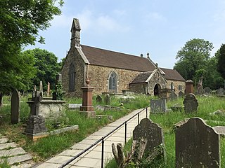
<span class="mw-page-title-main">Sarn, Bridgend</span> Human settlement in Wales

Sarn is a village in Bridgend County Borough, Wales, about three miles north of Bridgend and which lies just east of the confluence of the Ogmore and Llynfi rivers. It is located to the east of Aberkenfig, south of Brynmenyn, and south-east of Tondu. It is around 15 minutes' walk from the M4 and the McArthurGlen Group Bridgend Designer Outlet.

South Cornelly is a village in Cornelly, Bridgend county borough, Wales. The village is close to North Cornelly, Pyle and Porthcawl, and junction 37 of the M4 motorway, which runs along its northern side. It is in the historic county of Glamorgan. The population was 471 in 2011.

<span class="mw-page-title-main">Garw Valley</span> Human settlement in Wales

Garw Valley is a community and coterminous electoral ward in the north of Bridgend County Borough, South Wales. As the name suggests, it follows and encompasses the valley of the River Garw. The community includes the village of Blaengarw at the head of the valley, followed by Pontycymer and Llangeinor on the river, with Bettws between the Garw and the Llynfi in the south. Garw Valley is bordered to the west by Maesteg, Llangynwyd Middle and Llangynwyd Lower; to the east by Ogmore Valley and to the south by Ynysawdre and St Bride's Minor.

<span class="mw-page-title-main">Listed buildings in Wales</span>

This is a list of listed buildings in Wales, which are among the listed buildings of the United Kingdom.

<span class="mw-page-title-main">Coychurch Higher</span> Human settlement in Wales

Coychurch Higher is a community in Bridgend County Borough, south Wales. It covers the westerly area of the county north of Pencoed and south of Ogmore Vale. The community is sparsely populated and contains only one settlement, the small village of Heol-y-Cyw, which is located on the southerly border of the community. The majority of the community is made up of hilly terrain populated by several farm houses. It was once the site of Wern Tarw Colliery, the site of the first major coalminers' strike post-nationalisation of the coal industry. The population of the community in 2011 was 888.

<span class="mw-page-title-main">Llangynwyd Lower</span> Human settlement in Wales

Llangynwyd Lower is a community in Bridgend County Borough, south Wales. It is located to the north west of Bridgend and contains the village of Coytrahen. At the 2001 census, the population of the community was 467, reducing to 440 at the 2011 Census.

<span class="mw-page-title-main">Llangynwyd Middle</span> Human settlement in Wales

Llangynwyd Middle is a community in Bridgend County Borough, south Wales. It is located to the south of Maesteg and contains the villages of Llangynwyd and Cwmfelin. At the 2001 census, the population of the community was 2,843, increasing to 3,032 at the 2011 Census.

The Bridgend & District League is a football league covering the town of Bridgend and surrounding areas in South Wales. The leagues are at the seventh, eighth and ninth levels of the Welsh football league system.

<span class="mw-page-title-main">Aberafan Maesteg (UK Parliament constituency)</span> Proposed United Kingdom parliamentary constituency

Aberafan Maesteg is a proposed constituency of the House of Commons in the UK Parliament. Further to the completion of the 2023 Periodic Review of Westminster constituencies, it will first be contested at the next general election.

References

  1. "Brackla Parish". Nomis. Office for National Statistics. Retrieved 14 May 2024.
  2. "Bridgend Parish". Nomis. Office for National Statistics. Retrieved 14 May 2024.
  3. "Cefn Cribwr Parish". Nomis. Office for National Statistics. Retrieved 14 May 2024.
  4. "Coity Higher Parish". Nomis. Office for National Statistics. Retrieved 14 May 2024.
  5. 1 2 "The Bridgend (Cynffig, Cornelly and Pyle Communities) (Electoral Changes) Order 2002". legislation.gov.uk. 28 March 2002. Retrieved 14 May 2024.
  6. "Cornelly Parish". Nomis. Office for National Statistics. Retrieved 14 May 2024.
  7. "Coychurch Higher Parish". Nomis. Office for National Statistics. Retrieved 14 May 2024.
  8. "Coychurch Lower Parish". Nomis. Office for National Statistics. Retrieved 14 May 2024.
  9. "Garw Valley Parish". Nomis. Office for National Statistics. Retrieved 14 May 2024.
  10. "Laleston Parish". Nomis. Office for National Statistics. Retrieved 14 May 2024.
  11. "Llangynwyd Lower Parish". Nomis. Office for National Statistics. Retrieved 14 May 2024.
  12. "Llangynwyd Middle Parish". Nomis. Office for National Statistics. Retrieved 14 May 2024.
  13. "Maesteg Parish". Nomis. Office for National Statistics. Retrieved 14 May 2024.
  14. "Merthyr Mawr Parish". Nomis. Office for National Statistics. Retrieved 14 May 2024.
  15. "Newcastle Higher Parish". Nomis. Office for National Statistics. Retrieved 14 May 2024.
  16. "Ogmore Valley Parish". Nomis. Office for National Statistics. Retrieved 14 May 2024.
  17. "Pencoed Parish". Nomis. Office for National Statistics. Retrieved 14 May 2024.
  18. "Porthcawl Parish". Nomis. Office for National Statistics. Retrieved 14 May 2024.
  19. "Pyle Parish". Nomis. Office for National Statistics. Retrieved 14 May 2024.
  20. "St Bride's Minor Parish". Nomis. Office for National Statistics. Retrieved 14 May 2024.
  21. "Ynysawdre Parish". Nomis. Office for National Statistics. Retrieved 14 May 2024.