Coity

Last updated

Coity
Gilead Chapel, Coity, Bridgend - geograph.org.uk - 1690859.jpg
Bridgend UK location map.svg
Red pog.svg
Coity
Location within Bridgend
Population2,071 (Ward 2011) [1]
OS grid reference SS923814
Community
Principal area
Preserved county
Country Wales
Sovereign state United Kingdom
Post town BRIDGEND
Postcode district CF35 6xx
Dialling code 01656
Police South Wales
Fire South Wales
Ambulance Welsh
UK Parliament
Senedd Cymru – Welsh Parliament
List of places
UK
Wales
Bridgend
51°31′16″N3°33′09″W / 51.521232°N 3.552489°W / 51.521232; -3.552489

Coity is a village in Bridgend County Borough, south Wales, part of Bridgend town urban area. Coity is part of the community of Coity Higher and is notable for being home to Coity Castle, one of the best-preserved castles in Glamorgan. Other buildings of note in the village include St Mary, a 14th-century church, and Ty Mawr, a fine 16th-century house. [2]

Contents

History

The oldest monument in Coity is a burial chamber near Coed Parc Garw woodland. It consists of a large megalith, tilted upwards and supported by other smaller stones. [3]

The oldest remaining building in Coity is Coity Castle. Now ruinous, but according to John Newman, "(after Caerphilly) ... the most impressive ruined medieval castle in Glamorgan", Coity Castle was built c. 1100 by Payn Turberville. [4] Turberville was one of the Twelve Knights of Glamorgan, and the construction of Coity Castle was part of Robert Fitzhamon's strategy to subjugate the region. [5] The castle remained in the hands of the Tuberville family before passing to Sir Lawrence Berkerolles by 1380. In 1404 Sir Lawrence found himself under siege at Coity by the forces of Owain Glyndŵr, and again in 1405. [5] A few years later ownership of the castle was successfully challenged by William Gamage through a court action. The castle remained in the Gamage family who lived at Coity, and in 1584 Barbara Gamage married Robert Sidney, who took ownership. Sidney did not live at the castle, but family members continued to live there until the 18th century. By the time the castle passed to the Earl of Dunraven in 1833, it was ruinous and was placed into state guardianship in 1929. [5] The castle is listed as a grade 1 building, as it is an example of medieval defensive architecture in Wales. [6]

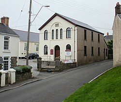
In the 14th century, a church was founded at Coity and dedicated to Saint Mary. The church also underwent 16th-century alterations and was again restored in 1860 by John Prichard and John Pollard Seddon. The church is listed as a grade 1 building as it retains its 14th-century form and character due to 19th-century restorations. [7] The church stands to this day and has several key important features, including an Easter Sepulchre (c. 1500). [4] There is also a war memorial located outside St. Marys church, which commemorates the residents of Coity were either killed or missing during both the first sand second world wars the memorial contains 13 names from the first world war and 8 names from the second world war. [8] Other places of worship included Gilead Welsh Independent Chapel, which saw rebuilding in 1890.

Another historical building in Coity is Tŷ Mawr. A late-16th-century building, with lower wings added in the 19th century. The building also underwent mid 20th-century alterations. It is a grade 2 listed building due to it being a great example of 16th-century Glamorgan architecture. [9]

Bridgend & Coity Golf Club (now defunct) first appeared in 1928. The club disappeared following WW2. [10]

As of 2001, the community of Coity Higher had a population of just 835, which includes the larger village of Litchard. A large housing development, first proposed in the 1990s is seen by some residents of Coity as threatening the smaller village. [11]

Key statistics (c.2011)

All Residents:2,071
Number of households:296
Average household size:2.30
Residents in households:693
Residents in communal living:1,378
Area (hectares):503
Population density (people per hectare):4.10 [12]

Governance

At the local level, Coity is a ward electing community councillors to Coity Higher Community Council. [13] Because of the tenfold increase in number of houses in Coity, the size of the community council increased from May 2022, with Coity's representation increasing from two, to six councillors. [14]

Between 1999 and 2022 Coity was the name of an electoral ward to Bridgend County Borough Council, covering Coity, electing one county councillor. [15] Councillor Ella Dodd, elected as a Labour councillor in 1995, represented the ward as an Independent since 2004. [15] [16]

Notes

  1. "Ward population 2011" . Retrieved 11 April 2015.
  2. Davies, John; Jenkins, Nigel; Menna, Baines; Lynch, Peredur I., eds. (2008). The Welsh Academy Encyclopaedia of Wales. Cardiff: University of Wales Press. p. 160. ISBN   978-0-7083-1953-6.
  3. Daniel, Glynn (1950). The prehistoric chamber tombs of England and Wales. Cambridge: Cambridge University Press. p. 210.
  4. 1 2 Newman, John (1995). Glamorgan. London: Penguin Group. pp. 325–329. ISBN   0140710566.
  5. 1 2 3 Slater, Mike (1991). Castles of Gwent, Glamorgan and Gower. Malvern: Folly Publications. pp. 70–73. ISBN   1-871731-61-5.
  6. "Coity Castle, Coity Higher (Coety Uchaf), Bridgend".
  7. "Church of St Mary, Coity Higher (Coety Uchaf), Bridgend".
  8. "War Memorial Coity". tracesofwar.com.
  9. "Ty Mawr, Coity Higher (Coety Uchaf), Bridgend".
  10. “Bridgend & Coity Golf Club”, “Golf’s Missing Links”.
  11. "£225m Bridgend 'village' planned". BBC News. 26 February 2008. Retrieved 13 May 2012.
  12. "Coity - UK Census Data 2011".
  13. "Welcome to Coity Higher Community Council". Coity Higher Community Council. Retrieved 29 July 2019.
  14. Ted Peskett (21 January 2022). "Plans to increase councillors at Coity Higher Community Council takes big step forward". Wales Online. Retrieved 12 July 2022.
  15. 1 2 "Bridgend County Borough Council Election Results 1995-2012" (PDF). The Elections Centre (Plymouth University). Retrieved 29 July 2019.
  16. Abby Bolter (25 April 2017). "Feisty 81-year-old attacks trolls who said she was too 'senile' to be a councillor". Wales Online. Retrieved 29 July 2019.

Related Research Articles

<span class="mw-page-title-main">Bridgend</span> Town in South Wales

Bridgend is a town in the Bridgend County Borough of Wales, 20 miles (32 km) west of Cardiff and 20 miles (32 km) east of Swansea. The town is named after the medieval bridge over the River Ogmore. The River Ewenny also flows through the town. The population was 49,597 in 2021. Bridgend is within the Cardiff Capital Region which in 2019 had a population of approximately 1.54 million.

<span class="mw-page-title-main">Ewenny</span> Human settlement in Wales

Ewenny is a village and community (parish) on the River Ewenny in the Vale of Glamorgan, Wales.

<span class="mw-page-title-main">St Athan</span> Human settlement in Wales

St Athan is a village and community in the Vale of Glamorgan in South Wales. The village and its parish church are dedicated to Saint Tathan. The church dates to the 13th–14th century, though an earlier church was dated to the Norman period. The village and the adjacent dormitory village of Eglwys Brewis are known primarily for the MOD St Athan RAF base. There are two pubs in the village, as well as a football team at St Athan Football Club and the St Athan Golf Club. The community includes West Aberthaw.

<span class="mw-page-title-main">Nottage</span> Human settlement in Wales

Nottage is a small village part of Porthcawl in Bridgend County Borough, Wales. It is also the name of an electoral ward to the town and county councils.

<span class="mw-page-title-main">Pyle</span> Human settlement in Wales

Pyle is a village and community in Bridgend county borough, Wales. This large village is served by the A48 road, and lies less than one mile from Junction 37 of the M4 motorway, and is therefore only a half-hour journey from the capital city of Wales, Cardiff. The nearest town is the seaside resort of Porthcawl. Within the Community, to the northeast of Pyle, is the adjoining settlement of Kenfig Hill, North Cornelly also adjoins Pyle and the built-up area had a population of 13,701 in 2011.

<span class="mw-page-title-main">St Brides Major</span> Human settlement in Wales

St. Brides Major is a village within the community also called St Brides Major in the Vale of Glamorgan in Wales.

<span class="mw-page-title-main">Coity Castle</span>

Coity Castle in Glamorgan, Wales, is a Norman castle built by Sir Payn "the Demon" de Turberville, one of the legendary Twelve Knights of Glamorgan supposed to have conquered Glamorgan under the leadership of Robert FitzHamon, Lord of Gloucester. Now in ruins, it stands in the community of Coity Higher near the town of Bridgend, in the County Borough of Bridgend. Very close to the castle is the battlemented parish Church of St Mary the Virgin, which dates from the 14th century.

Cornelly is a community and electoral ward in Bridgend County Borough, South Wales. As of 2011 the population of the Cornelly ward was 7,059.

<span class="mw-page-title-main">Pennard</span> Human settlement in Wales

Pennard is a village and community on the south of the Gower Peninsula, about 7 miles south-west of Swansea city centre. It falls within the Pennard electoral ward of Swansea. The Pennard community includes the larger settlements of Southgate and Kittle. the population as of 2011 was 2,688.

<span class="mw-page-title-main">Flemingston</span> Human settlement in Wales

Flemingston is a small village in the Vale of Glamorgan in south Wales. It is located 8.5 miles (13.7 km) northwest by road from the town centre of Barry. It contains the Church of St. Michael the Archangel, the ruins of Flemingston Court, and Flemingston Manor or Grange, all of which are listed buildings. Historically, the parish of Flemingston was a sub-manor of Aberthaw or St Athan.

<span class="mw-page-title-main">Eglwys Brewis</span> Human settlement in Wales

Eglwys Brewis is a village in the Vale of Glamorgan in south Wales. It is located just to the north of the village of St Athan, south of Flemingston and northeast of Llantwit Major. Greenlands and St Mary Church lie to the north by road from Eglwys Brewis. The village consists primarily of residential estates which were originally built in the mid-20th century for service families stationed at nearby RAF St Athan. The estates are regularly used by driving instructors in the Vale of Glamorgan. Nant y Stepsau flows in the vicinity.

Coity Higher is a community in Bridgend County Borough, south Wales. It contains the north western suburbs of Bridgend which includes the villages of Litchard and Coity. The southern boundary of the community adjoins the community of Brackla, while the northern border is defined by the M4 motorway. Notable buildings and landmarks within the community include Coity Castle, Parc Prison, the 14th century Church of St Mary, Pendre Hospital, Ty Mawr House and a burial chamber. At the 2001 census, the community's population was 835, being re-measured at 6,078 t the 2011 Census.

<span class="mw-page-title-main">Laleston</span> Human settlement in Wales

Laleston is a village and a community in Bridgend County Borough, south Wales, directly west of Bridgend town centre. The village takes its name from the Norman Lageles family who settled in the area. Buildings of note in the village include St David's Church, which still possesses features dating back to the 13th and 14th centuries, the Great House which was built in the early 16th century and Horeb Welsh Presbyterian Church (1831).

Newcastle Higher is a community in Bridgend County Borough, south Wales. Located north west of Bridgend town centre it is made up of the townships of Pen-y-fai and Aberkenfig and straddles the M4 motorway. The community is home to several notable buildings, including the Pen-y-fai Hospital, Court Coleman and All Saints Church.

<span class="mw-page-title-main">Newcastle, Bridgend</span>

Newcastle is an area and electoral ward of the town of Bridgend, Wales. The area includes the medieval Newcastle Castle. The ward elects councillors to Bridgend Town Council and Bridgend County Borough Council.

<span class="mw-page-title-main">Grade II* listed buildings in Bridgend County Borough</span>

In the United Kingdom, the term listed building refers to a building or other structure officially designated as being of special architectural, historical, or cultural significance; Grade II* structures are those considered to be "particularly important buildings of more than special interest". Listing was begun by a provision in the Town and Country Planning Act 1947. Once listed, strict limitations are imposed on the modifications allowed to a building's structure or fittings. In Wales, the authority for listing under the Planning Act 1990 rests with Cadw.

Oldcastle is an area and electoral ward of the town of Bridgend, Wales, to the south of the town centre. The ward elects councillors to Bridgend Town Council and Bridgend County Borough Council.

Caerau is the name of an electoral ward in Bridgend County Borough, Wales. It covers part of the town of Maesteg. The ward elects two councillors to Bridgend County Borough Council.

<span class="mw-page-title-main">Litchard</span>

Litchard is a village and residential district north of Bridgend, Wales. It is also an electoral ward in the Coity Higher community, as well as a former ward to Bridgend County Borough Council.