River Colne, Hertfordshire

Last updated

Colne
RiverColneStaines01.JPG
River Colne as it joins the Thames at Staines-upon-Thames
River Colne, Hertfordshire
Location
Country England
Counties Hertfordshire, Greater London, Buckinghamshire, Surrey, Berkshire
Towns Watford, Rickmansworth, Uxbridge, West Drayton, Staines-upon-Thames
Physical characteristics
SourceUnnamed brook
  locationeast of Bell Bar, Brookmans Park
  coordinates 51°43′50″N0°10′47″W / 51.7306°N 0.1798°W / 51.7306; -0.1798
  elevation410 feet (120 m)
2nd source"Water End" brook
  locationeast side of North Mymms Park (coalesence of two streams, liable-to-flood meadow)
Mouth River Thames
  location
Staines-upon-Thames town centre
  coordinates
51°25′58″N0°30′55″W / 51.4329°N 0.5152°W / 51.4329; -0.5152
  elevation
48 feet (15 m)
Length58 km (36 mi)
Discharge 
  location Denham, Buckinghamshire (rate at lower coalescence)
  average4.05 m3/s (143 cu ft/s)
  minimum0.74 m3/s (26 cu ft/s)26  August 1976
  maximum18.4 m3/s (650 cu ft/s)14  October 1993
Discharge 
  locationBerrygrove, Berry Grove Lane, Watford (rate at mid-to-upper coalescence)
  average0.79 m3/s (28 cu ft/s)
Basin features
River system Thames Basin
Tributaries 
  left Mimmshall Brook, Potters Bar Brook, Tyttenhanger Stream, Tykes Water (The Brook (Radlett)), Hillfield Brook, River Pinn
  rightEllen Brook and river: Ver, Gade, Chess, Misbourne
Number of distributaries including namesake:6
River Colne (Hertfordshire)
BSicon uexKHSTa.svg
Source: two subterranean streams
in east of North Mymms Park
BSicon POINTERg@fq.svg
BSicon uexSTR.svg
Colney Heath
BSicon uexSTRq.svg
BSicon uexSTRq.svg
BSicon uexSTRq.svg
BSicon uexSTRq.svg
BSicon uexABZg+r.svg
River Ver
BSicon uxWEIRg.svg
Weir
BSicon uxWEIRg.svg
Weir
BSicon POINTERf@gq.svg
BSicon uexSTR.svg
Watford — on opposite bank: Oxhey
BSicon uxWEIRg.svg
Weir
BSicon uxWEIRg.svg
Weir
BSicon uexSTRq.svg
BSicon uexSTRq.svg
BSicon uexSTR+r.svg
BSicon uexSTR.svg
River Gade
BSicon uSTRq.svg
BSicon uLockl.svg
BSicon uxABZg+r.svg
BSicon uexSTR.svg
Grand Union Canal
BSicon uexSTR+l.svg
BSicon uWEIRl.svg
BSicon uexSTR.svg
side weir
BSicon uexSTR.svg
BSicon ueABZg+l.svg
BSicon uexSTRq.svg
BSicon uexSTRr.svg
BSicon uexSTRq.svg
BSicon uexABZg+r.svg
BSicon uSTR.svg
River Chess
BSicon uSTR+FEATURE@r.svg
BSicon uSTRl.svg
BSicon uSTR+r.svg
Rickmansworth (east of)}
BSicon uxABZgl.svg
BSicon uSTR+r.svg
BSicon ueABZgl.svg
BSicon uexSTR+r.svg
BSicon uxWEIRg.svg
BSicon uLock5.svg
BSicon uLock5.svg
BSicon uexSTR.svg
Batchworth Locks
BSicon POINTERf@gq.svg
BSicon uexSTR.svg
BSicon uSTRl.svg
BSicon uABZg+r.svg
BSicon uxWEIRg.svg
Town Ditch, Rickmansworth
BSicon uexSKRZ-Au.svg
BSicon RAq.svg
BSicon uSKRZ-Au.svg
BSicon uexSKRZ-Au.svg
A404 Riverside Drive/Church Street
BSicon uexABZg+l.svg
BSicon uexSTRq.svg
BSicon ueFABZglr+lr.svg
BSicon uexSTRr.svg
BSicon uxWEIRg.svg
BSicon uLock5.svg
BSicon uexSTR+l.svg
BSicon uexABZgr.svg
BSicon uLock5.svg
BSicon uexSTR.svg
BSicon uexABZgl.svg
BSicon uexSTRq.svg
BSicon ueABZg+r.svg
BSicon uexSTRl.svg
BSicon uexABZql.svg
BSicon uSTR+r.svg
BSicon uSTR.svg
BSicon uxABZgl.svg
BSicon uABZg+r.svg
Short navigable branch of river
BSicon uxWEIRg.svg
BSicon uLock5.svg
BSicon uexSTR+l.svg
BSicon uexFKRZ.svg
BSicon ueFABZgr+r.svg
Troy Cut of the Grand Union Canal
BSicon uexSTR.svg
BSicon uexSTR.svg
BSicon uSTR.svg
BSicon uexABZg+l.svg
BSicon uexSTRr.svg
BSicon uLock5.svg
BSicon CONTgq.svg
BSicon uxmKRZu.svg
BSicon STRq.svg
BSicon umKRZu.svg
BSicon CONTfq.svg
Railway bridge — Chiltern Main Line
BSicon uexABZgl.svg
BSicon uexSTRq.svg
BSicon ueKRZo.svg
BSicon uexSTR+r.svg
Frays River
BSicon uxWEIRg.svg
BSicon uSTR+l.svg
BSicon uSTRr.svg
BSicon uexSTR.svg
BSicon uexSTRq.svg
BSicon uexABZg+r.svg
BSicon uLock5.svg
BSicon uexSTR.svg
River Misbourne
BSicon uexSKRZ-Au.svg
BSicon uSKRZ-Au.svg
BSicon uexSKRZ-Au.svg
A40
BSicon uexSKRZ-Au.svg
BSicon uSKRZ-Au.svg
BSicon uexSKRZ-Au.svg
A4020
BSicon uxWEIRg.svg
BSicon uLock5.svg
BSicon POINTERg@fq.svg
BSicon uexSTR.svg
BSicon uexSTR.svg
Shire Ditch, Uxbridge Park, Denham
BSicon uexSTR.svg
BSicon ueABZg+l.svg
BSicon uexSTRr.svg
BSicon uexSTR.svg
BSicon uexSTR.svg
BSicon uSTR.svg
BSicon POINTERg@fq.svg
BSicon uexSTR.svg
Uxbridge
BSicon uexSKRZ-Au.svg
BSicon uSKRZ-Au.svg
BSicon RAq.svg
BSicon uexSKRZ-Au.svg
A4007
BSicon POINTERf@g.svg
BSicon uexSTR+r.svg
BSicon uexSTR.svg
BSicon uSTR.svg
BSicon uexSTR.svg
Alder Bourne from Fulmer
BSicon uexABZg+l.svg
BSicon uexABZgr.svg
BSicon uSTR.svg
BSicon uexSTR.svg
BSicon uexSKRZ-Bu.svg
BSicon uexSTR.svg
BSicon uLock5.svg
BSicon uexSTR.svg
UK-Motorway-icon.svg M25
BSicon POINTERg@fq.svg
BSicon uexSTR.svg
BSicon uexSTR.svg
BSicon uSTRl.svg
BSicon uSTR+r.svg
BSicon uexSTR.svg
Colne Brook
BSicon uexSKRZ-Bu.svg
BSicon uexSTR.svg
BSicon uexSTR+l.svg
BSicon ueKRZo.svg
BSicon uexSTRr.svg
UK-Motorway-icon.svg M25
BSicon uxKRZu.svg
BSicon uxKRZu.svg
BSicon uxKRZu.svg
BSicon uFABZgr+r.svg
Slough Arm
BSicon uexSTR.svg
BSicon uexSTR.svg
BSicon uexABZg+l.svg
BSicon ueKRZo.svg
River Pinn
BSicon uexSTR.svg
BSicon uexSTR.svg
BSicon uexSTR.svg
BSicon uSTRl.svg
Grand Union Canal towards London
BSicon CONTgq.svg
BSicon uxmKRZu.svg
BSicon uxmKRZu.svg
BSicon uxmKRZu.svg
BSicon STRq.svg
BSicon CONTfq.svg
Great Western Main Line
BSicon uexSKRZ-Bu.svg
BSicon uexABZgl.svg
BSicon uexABZg+r.svg
UK-Motorway-icon.svg M25
BSicon uexSTR.svg
BSicon uexSTR.svg
BSicon uexABZgl.svg
BSicon POINTERf@g.svg
BSicon uexSTR+r.svg
River Colne
BSicon uexSKRZ-Bu.svg
UK-Motorway-icon.svg M4
BSicon uexSTR.svg
BSicon POINTERg@fq.svg
BSicon uexSTR.svg
BSicon uexSTR.svg
BSicon uxWEIRg.svg
Bigley Ditch
BSicon uexSTR.svg
BSicon uexSTRl.svg
BSicon uexABZg+r.svg
BSicon uexABZgl.svg
BSicon uexSTR+r.svg
BSicon uexSKRZ-Au.svg
BSicon RAq.svg
BSicon uexSKRZ-Au.svg
A4 Colnbrook Bypass
BSicon uexSTR.svg
BSicon uexSKRZ-Bu.svg
BSicon uexSTR.svg
BSicon uexSTR.svg
UK-Motorway-icon.svg M25
BSicon uexABZg+l.svg
BSicon POINTERf@g.svg
BSicon uexSTRq.svg
BSicon uexABZgr.svg
BSicon uexSTR.svg
BSicon uexSTR.svg
Poyle Channel
BSicon uexSTR.svg
BSicon uexSTR.svg
BSicon uexSTR.svg
BSicon uexSTRl.svg
Duke of Northumberland's River
BSicon uexSTR.svg
BSicon uexSTR+l.svg
BSicon uexSTRr.svg
BSicon uexABZgl.svg
BSicon uexABZq+r.svg
Longford River to Hampton Court
BSicon uexSTR.svg
BSicon uexSTR.svg
BSicon uexSKRZ-Au.svg
BSicon uexSTR.svg
A3044 Stanwell Moor
BSicon uexSTR.svg
BSicon uexSTR.svg
BSicon uexSKRZ-Bu.svg
UK-Motorway-icon.svg M25 Jn 14 Heathrow Terminal 5 Slip Road
BSicon uexSTR.svg
BSicon uexSTR.svg
BSicon uexSTR.svg
BSicon uexSKRZ-Au.svg
A3044 Stanwell Moor
BSicon uexSTR.svg
BSicon uexSTR.svg
BSicon uexSKRZ-Au.svg
A3113 Airport Way
BSicon uexSTR.svg
BSicon uexSKRZ-Bu.svg
BSicon uexSTR.svg
BSicon uexSTR.svg
UK-Motorway-icon.svg M25
BSicon uexSTR.svg
BSicon uexSTR.svg
BSicon uexABZg+l.svg
BSicon uexSTRr.svg
BSicon uexSTR.svg
BSicon POINTERg@fq.svg
BSicon uexSTR.svg
BSicon uexABZgl.svg
BSicon uexSTR+r.svg
Wraysbury River (Staines Moor)
BSicon uexSTR.svg
BSicon uexSTR.svg
BSicon uexSTR.svg
BSicon POINTERg@fq.svg
BSicon uexSTR.svg
Bonehead Ditch
BSicon POINTERg@fq.svg
BSicon uexSTR.svg
BSicon uexSTR.svg
BSicon uexABZg+l.svg
BSicon uexSTRr.svg
Colne Brook
BSicon CONTgq.svg
BSicon uxmKRZu.svg
BSicon uxmKRZu.svg
BSicon STR+r.svg
BSicon uexSTR.svg
Railway bridges —
Waterloo to Windsor Line
via Staines upon Thames
BSicon uexSTR.svg
BSicon uexSKRZ-Au.svg
BSicon SKRZ-Au.svg
BSicon uexSKRZ-Au.svg
A30 Staines Bypass
BSicon uexSTR.svg
BSicon uexSTR.svg
BSicon STR.svg
BSicon uexABZgl.svg
BSicon uexSTRq.svg
River Ash to Sunbury-on-Thames
BSicon uexSTR.svg
BSicon uexSTR.svg
BSicon STRl.svg
BSicon uxmKRZu.svg
BSicon CONTfq.svg
Railway bridge
BSicon uexSTR.svg
BSicon uexSTRl.svg
BSicon uexSTRq.svg
BSicon uexABZg+r.svg
BSicon uexSTR.svg
BSicon uexSKRZ-Yu.svg
Church Street, Staines-upon-Thames
BSicon uexSTR.svg
BSicon uexSKRZ-Au.svg
A308 Clarence Street
BSicon ueABZql.svg
BSicon uSKRZ-Buq.svg
BSicon uSTRq.svg
BSicon ueABZql.svg
BSicon uCONTfq.svg
River Thames

The Colne is a river and a tributary of the River Thames in England. Just over half its course is in south Hertfordshire. Downstream, it forms the boundary between Buckinghamshire and the London Borough of Hillingdon. The confluence with the River Thames is on the Staines reach (above Penton Hook Lock) at Staines-upon-Thames.

Contents

Two of its distributaries, constructed in the 1600 1750 period largely for aesthetic reasons for Hampton Court and for Syon Park, have been maintained. Their main purpose was not drinking water but these can be likened to the New River in scale and in date. Crossing its route, many viaducts and a canal, the intersecting Grand Union Canal, have been recognised for pioneering engineering during the Industrial Revolution.

Digging for gravel and clay along its lower course near Rickmansworth has created a belt of flooded pits below the water table, as established lakes, many of which are well-adapted habitats for wildlife, protected as nature reserves. The river, meadows and lakes form the Colne Valley regional park covering 43 square miles (110 km2).

Route

The Colne becomes universally so-named after two close subterranean streams converge at a spring, or in very wet weather in the meadows above, all along the east side (Tollgate Road) of North Mymms Park in Hertfordshire. The source streams are long, multi-source, in final, northern stages, partly underground tributaries: a north-eastern, which can be considered the upper Colne; and the Mimmshall Brook. Their main sources are 2.5 to 4 mi (4.0 to 6.4 km): in western Northaw, Brookmans Park, Hadley, London and Borehamwood, draining much of those places. [1] A seasonal, intra-parochial stream runs under the seven-building village of North Mymms draining most of the park, which, with adjoining woods is a small square plateau, sloping down to its corners except the south-west. [2] [3]

Shallow swallow holes of the two brooks are in North Mymms' Water End, centred on so-named combined surface flow. From the Water End Swallow Holes the Colne runs west, longer NNW, then west then receives the Ellen Brook and turns SSW, then meanders south-west, bounding central and residential Watford and Oxhey, also bounding Rickmansworth and Batchworth, then for a similar total stretch bounding Greater London (and Spelthorne), east and (through anabranch ditches) Buckinghamshire, west. Specifically, it passes between West Hyde, near Maple Cross, and Harefield, passes Denham Green then passes Uxbridge, where it parallels the Grand Union Canal and its first main anabranch, the Frays River which is co-fed by the Pinn between Cowley and Yiewsley, Greater London. The Colne Brook splits off as a distributary between New Denham and Uxbridge. After this, at West Drayton, the Frays rejoins and the Wraysbury River, the second main anabranch, and Duke of Northumberland's River divide off.

Soon after, at Longford, the intake is given to the Longford River, a 12-mile (19 km) artificial channel created in 1610 for King Charles I to supply the water features in Bushy Park and the rectangular lakes in Hampton Court Park. [4]

The Colne's drainage basin extends almost as far north again as its northern limit the inflowing Gade, Ver and Misbourne extend well into the Chilterns. Opposite, the other 23 of outer west and north-west London is drained by the Pymmes Brook, Brent, or Crane sub-basins of the Thames. In the north-west, centred on Tring's northern boundary the Chiltern ridge is most noticeable, a watershed of this basin and that of the River Great Ouse, north and east towards the Wash.

Eponymous settlements and indirect reference within a district name

The villages of Colney Heath east of St Albans, London Colney south of St Albans, Colney Street (almost wholly a large business park) north of Radlett and Colnbrook between Slough and Heathrow take their name from the river. Three Rivers District Council covers part of Hertfordshire and is named after the River Colne and its two tributaries, the River Chess and the River Gade.

Use of valley and river for navigation

Among early proposals to link the river to London was one in 1641 by Sir Edward Forde for a navigable canal, the main purpose of which seems to have been the supply of clean water, and two in 1766, for canals from Marylebone to the river at Uxbridge and another from Marylebone to West Drayton. [5]

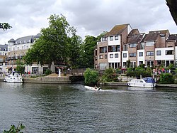
The river underwent considerable change in the 1790s, when the Grand Junction Canal (which became part of the Grand Union Canal in 1929) was routed along the valley and still takes the river channel for part of its course. Construction began from Brentford, where it used for 3 miles (4.8 km) the channel of the River Brent, and progressed westwards then northwards, with it reaching Uxbridge in November 1794. To reach the Midlands it continued along the river channel until its junction with the River Gade, which it ran parallel to, but did not take over the channel. [6] The Slough Arm was built in 1882 which required three aqueducts to carry it close to its junction with the Grand Junction, to cross the Fray's River, the River Colne and the Colne Brook. [7]

Between Croxley Green, where the River Gade joins the Colne, and Thorney/West Drayton, below the Slough Arm, the river channels thread their way between many large lakes, some of which were once watercress beds, some chalk pits, [8] and some of which were the result of brickmaking, an industry that developed over several miles of the valley after 1800, when the Grand Junction Canal company advertised the presence of good brick earth, discovered during the construction of the canal. [5]

Structures

There are two London Coal Duty markers beside the river, which mark points at which duty became payable on coal entering the London area. The first is on the north side of the river in Colney Heath Local Nature Reserve, and is a square-section cast iron pillar made by Henry Grissell at his Regents Canal ironworks and erected in 1861 or 1862. It is 5 feet (1.5 m) high and is painted white. [9] The second is a stone obelisk, 13 feet (4.0 m) high, with a square base, which was erected at Colne Bridge in 1861. It was moved from its original position to the other side of the river in 1984 when it was repaired by Watford Borough Council. [10] It is close to the five-arched Colne Viaduct, which was built in 1837 to carry the London to Birmingham Railway over the river. Each of the arches spans around 40 feet (12 m) and is 45 feet (14 m) high. The structure was designed by Robert Stephenson, and is grade II listed. [11]

At London Colney, there is a seven-arched brick bridge which carries Barnet Road over the river. It dates from 1774 and is called Telford's Bridge, although it is not thought to have been designed by Thomas Telford. It was modified in the 20th century when parapets and railings were added. [12]

There was a long-running dispute over water levels in the Batchford area, following the construction of the Grand Junction Canal, which were resolved in 1825, when an 8.2-foot (2.5 m) obelisk was erected in a pond, to act as a water gauge. The obelisk records the agreement made between the canal company, John Dickinson who was the owner of papermills at Batchworth, and R. Williams of Moor Park, who was the landowner. [13]

Tributaries and distributaries

From its mouth to its source, the Colne's named tributaries, anabranches and to-Thames distributaries are:

See also

Bibliography

References

Next confluence upstream River Thames Next confluence downstream
Colne Brook (north)River Colne Abbey River (south)

51°25′59″N0°30′55″W / 51.43306°N 0.51528°W / 51.43306; -0.51528