Pipp Brook

Last updated

Pipp Brook
Millpond, Dorking, Surrey - geograph.org.uk - 1405478.jpg
Pipp Brook Mill Pond, Dorking
Location
Country England
County Surrey
District Mole Valley
Physical characteristics
SourceMag's Well
  locationLeith Hill, Surrey
  coordinates 51°11′51″N0°21′46″W / 51.1975°N 0.3628°W / 51.1975; -0.3628
  elevation219 m (719 ft)
Mouth River Mole
  location
Pixham
  coordinates
51°14′39″N0°19′08″W / 51.2443°N 0.3189°W / 51.2443; -0.3189 Coordinates: 51°14′39″N0°19′08″W / 51.2443°N 0.3189°W / 51.2443; -0.3189
  elevation
43 m (141 ft)
Length9.5 km (5.9 mi)
Basin features
Tributaries 
  rightMilton Brook

The Pipp Brook is a left-bank tributary of the River Mole, Surrey, England. It rises at two main springs north of Leith Hill on the Greensand Ridge, then descends steeply in a northward direction, before flowing eastwards along the Vale of Holmesdale. It runs to the north of Dorking High Street, before discharging into the Mole at Pixham.

Contents

The Milton Brook, which rises at a tri-forked source lower than that of the Pipp Brook, is the principal tributary.

Course

Sources

The geological varying depth of greensand top layers caused by erosion towards the underlying clay means that there is no uniform spring line in this part of the Greensand Ridge. The tower is the second highest point in the South-East of England. [2] The Pipp Brook's main tributary, the Milton Brook rises at three close points in farmland on the indented north-east edge of the forest.

During the early nineteenth century the sulphate-rich (chalybeate) waters of the Mag's Well spring were attributed by a countryside travel writer as having aided a person's recovery. [3]

Later Course

Both the Pipp Brook and the larger River Tillingbourne drain the northern slopes of Leith Hill and the watershed between the two rivers (which runs roughly north–south, marks the boundary between Westcott (which the brook drains entirely) and much larger Wotton. [4] [5] [note 1]

The Pipp Brook runs almost due east along its Dorking stretch north of much of the town and south of the steep scarp of the North Downs at Ranmore Common before joining the Mole at Pixham. [note 2] The area around the confluence is the subject of occasional riparian (river) flooding as the rate of descent of the Mole decreases significantly and at the Mole Gap becomes or became subterranean, depending on amount of sedimentation. [6]

The Pipp Brook itself has no sewage treatment works, few plains which it drains and as such an extremely narrow and low risk area of riparian flooding. [6] These factors are instead present as to a few parcels of land of east Pixham sometimes considered Dorking by the national media based on a 2010s shorthand by the Environment Agency which has a 'Dorking Flood Area' comprising the sewage works, a handful of properties in Pixham and much of Brockham and Betchworth well upstream along the Mole to the east which are separated by more than a mile from Dorking and are narrowly in its post town. [6] [7]

Watermills

Pippbrook Mill in Dorking Pippbrook Mill.jpg
Pippbrook Mill in Dorking

By the 19th century six grain mills stood on the river: Rookery, Westcott, Milton Court, Parsonage, Pippbrook and Pixham Mills. [8] All were defunct by the mid-20th century when bread production was widely commercialised and the product nationally was transformed to slow its staleness. Pippbrook Mill and Pixham Mill survive and are Grade II listed buildings. [9] [10]

Water quality

The Environment Agency measures the water quality of the river systems in England. Each is given an overall ecological status, which may be one of five levels: high, good, moderate, poor and bad. There are several components that are used to determine this, including biological status, which looks at the quantity and varieties of invertebrates, angiosperms and fish. Chemical status, which compares the concentrations of various chemicals against known safe concentrations, is rated good or fail. [11]

Water quality of the Pipp Brook in 2019:

SectionEcological
Status
Chemical
Status
Overall
Status
LengthCatchmentChannel
Pipp Brook [12] Poor Fail Poor 12.164 km (7.558 mi)20.965 km2 (8.095 sq mi)Heavily modified

Related Research Articles

Dorking Market town in Surrey, England

Dorking is a market town in Surrey in South East England, about 34 km (21 mi) south of London. It is in Mole Valley District and the council headquarters are to the east of the centre. The High Street runs roughly east–west, parallel to the Pipp Brook and along the northern face of an outcrop of Lower Greensand. The town is surrounded on three sides by the Surrey Hills Area of Outstanding Natural Beauty and is close to Box Hill and Leith Hill.

River Mole Tributary of the River Thames in southern England

The River Mole is a tributary of the River Thames in southern England. It rises in West Sussex near Horsham and flows northwest through Surrey for 80 km to the Thames at East Molesey, opposite Hampton Court Palace. The river gives its name to the Surrey district of Mole Valley. The Mole crosses the North Downs between Dorking and Leatherhead, where it cuts a steep-sided valley, known as the Mole Gap, through the chalk. Much of the catchment area lies on impermeable rock, meaning that the river level responds rapidly to heavy rainfall.

Leith Hill Hill in Surrey, England

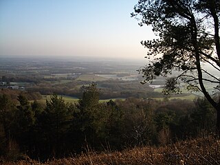
Leith Hill in southern England is the highest summit of the Greensand Ridge, approximately 6.7 km (4 mi) southwest of Dorking, Surrey and 40.5 km (30 mi) southwest of central London. It reaches 294 m (965 ft) above sea level, and is the second highest point in southeast England, after Walbury Hill in southwest Berkshire,. Leith Hill is the highest ground for 79 km (49 mi).

Brockham Human settlement in England

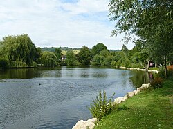
Brockham is a village and civil parish in the Mole Valley district of Surrey, England. It is approximately 1.5 miles (2.4 km) east of Dorking and 4 miles (6.4 km) west of Reigate. The village lies south of Box Hill, with the River Mole flowing west through the village. At the 2011 census, it had a population of 2,868.

Stane Street (Chichester) Roman road in southern England

Stane Street is the modern name of the 91 km-long (57 mi) Roman road in southern England that linked Londinium (London) to Noviomagus Reginorum (Chichester). The exact date of construction is uncertain; however, on the basis of archaeological artefacts discovered along the route, it was in use by 70 AD and may have been built in the first decade of the Roman occupation of Britain.

Mole Valley (UK Parliament constituency) Parliamentary constituency in the United Kingdom, 1983 onwards

Mole Valley is a constituency represented in the House of Commons of the UK Parliament since 1997 by Sir Paul Beresford, a Conservative.

Westcott, Surrey Human settlement in England

Westcott is a semi-rural English village and former civil parish 1.5 miles (2.4 km) west of the centre of Dorking on the A25 between the North Downs and Greensand Ridge, making it one of the 'Vale of Holmesdale' villages and is in Surrey in the direction of Guildford. It is served by a local bus service and is 1 mile (1.6 km) from Dorking West railway station on the North Downs Line.

Greensand Way

The Greensand Way is a long-distance path of 108 miles (174 km) in southeast England, from Haslemere in Surrey to Hamstreet in Kent. It follows the Greensand Ridge along the Surrey Hills and Chart Hills. The route is mostly rural, passing through woods, and alongside fruit orchards and hop farms in Kent and links with the Stour Valley Walk near Pluckley in Kent. The trail was opened on 15 June 1980 and is jointly managed by Surrey and Kent Councils who fully updated it in 2012.

Betchworth Human settlement in England

Betchworth is a village and civil parish in the Mole Valley district of Surrey, England. The village centre is on the north bank of the River Mole and south of the A25 road, almost 3 miles (4.8 km) east of Dorking and 3 miles (4.8 km) west of Reigate. London is 19.5 miles (31.4 km) north of the village.

Chilworth, Surrey Village in England

Chilworth is a village in the Guildford borough of Surrey, England. It is located in the Tillingbourne valley, southeast of Guildford.

River Tillingbourne River in Surrey, England

The River Tillingbourne runs along the south side of the North Downs and joins the River Wey at Guildford. Its source is a mile south of Tilling Springs to the north of Leith Hill at grid reference TQ143437 and it runs through Friday Street, Abinger Hammer, Gomshall, Shere, Albury, Chilworth and Shalford. The source is a semi-natural uninhabited area. The catchment is situated on sandstone which has a low rate of weathering. The Tillingbourne is 24 km (15 mi) in length.

Wotton, Surrey Human settlement in England

Wotton is a well-wooded parish with one main settlement, a small village mostly south of the A25 between Guildford in the west and Dorking in the east. The nearest village with a small number of shops is Westcott. Wotton lies in a narrow valley, collecting the headwaters of the Tilling Bourne which then has its first combined flow in the Vale of Holmesdale. The parish is long north to south, reaching to the North Downs escarpment in the north to the escarpment of the Greensand Ridge at Leith Hill in the south.

Betchworth Castle Castle in Betchworth

Betchworth Castle is a mostly crumbled ruin of a fortified medieval stone house with some tall, two-storey corners strengthened in the 18th century, in the north of the semi-rural parish of Brockham. It is built on a sandstone spur overlooking the western bank of the River Mole in Surrey in England.

Vale of Holmesdale

Holmesdale, also known as the Vale of Holmesdale, is a valley in South-East England that falls between the hill ranges of the North Downs and the Greensand Ridge of the Weald, in the counties of Kent and Surrey. It stretches from Folkestone on the Kent coast, through Ashford, Harrietsham, Maidstone, Riverhead/Sevenoaks, Westerham, Oxted, Godstone, Redhill, Reigate, Dorking, Gomshall, and Guildford – west of which it is also called by the local name of "Puttenham Vale" – as it continues through the village of Puttenham, to the market town of Farnham.

River Wey River in southern England

The River Wey is a tributary of the River Thames in south east England. Its two branches, one of which rises near Alton in Hampshire and the other in West Sussex to the south of Haslemere, join at Tilford in Surrey. Once combined the flow is eastwards then northwards via Godalming and Guildford to meet the Thames at Weybridge. Downstream the river forms the backdrop to Newark Priory and Brooklands. The Wey and Godalming Navigations were built in the 17th and 18th centuries, to create a navigable route from Godalming to the Thames.

Pixham Human settlement in England

Pixham is a chapelry within the parish of Dorking, Surrey on the near side of the confluence of the River Mole and the Pipp Brook to its town, Dorking, which is centred 1 km (0.6 mi) southwest. The town as a whole, uniquely in Surrey, has three railway stations; Pixham adjoins or is the location of two of the three; and is near the junction of the A24 and A25 main roads.

Law Brook, Surrey Stream in Surrey, England

The Law Brook or Postford Brook is a stream in the Surrey Hills AONB which feeds the Tillingbourne which in turn feeds the River Wey. It is notable in its own right chiefly for its industrial vestiges and records.

Friday Street Hamlet in England

Friday Street is a hamlet on the gentle lower north slope of Leith Hill in Surrey, England. It is in a wooded headwater ravine, just to the south of Wotton and the A25, a single rather than dual carriageway road, running between Guildford to the west and Dorking to the east. It is part of the Surrey Hills AONB.

References

  1. Historic England. "Details from listed building database (1391341)". National Heritage List for England . Retrieved 15 April 2015.
  2. Dawson, Alan (1992). "The Marilyns by Height". The Relative Hills of Britain. Milnthorpe, Cumbria, England: Cicerone Press. ISBN   1-85284-068-4. Archived from the original on 22 August 2010.
  3. Thorne, William (1829). The garden of Surrey: or A sketch of Dorking, and of the beautiful country surrounding it. Dorking: Edward Langley. p. 75. Retrieved 11 November 2011.
  4. Ecclesiastical Parishes of Westcott and Wotton (click left for Wotton) Accessed 2015-04-15
  5. Civil Parish of Wotton Accessed 2015-04-15
  6. 1 2 3 Flood Risk Map of all surrounding areas - showing level 3 low risk Accessed 2015-04-15.
  7. "Dorking Flood Risk Area" in Brockham, Betchworth and East Pixham. Accessed 2015-04-15.
  8. A topographical history of Surrey, Brayley EW
  9. Historic England (11 June 1973). "Pippbrook Mill (Grade II) (1287216)". National Heritage List for England .
  10. Historic England (11 June 1973). "Pixham Mill (Grade II) (1229433)". National Heritage List for England .
  11. "Glossary (see Biological quality element; Chemical status; and Ecological status)". Catchment Data Explorer. Environment Agency. 17 February 2016. UKOpenGovernmentLicence.svg Text was copied from this source, which is available under an Open Government Licence v3.0. © Crown copyright.
  12. "Pipp Brook". Catchment Data Explorer. Environment Agency.

Notes

  1. Note that the Tillingbourne flows westwards to meet the River Wey south of Guildford, whereas the Pipp Brook turns eastwards to meet the River Mole at Pixham.
  2. Pixham was a hamlet of Dorking before achieving chapelry status and later full ecclesiastical parish status
Map all coordinates using: OpenStreetMap  
Download coordinates as: KML