Surrey is a ceremonial county in South East England. It is bordered by Greater London to the northeast, Kent to the east, East and West Sussex to the south, and Hampshire and Berkshire to the west. The largest settlement is Woking.

The A3, known as the Portsmouth Road or London Road in sections, is a major road connecting the City of London and Portsmouth passing close to Kingston upon Thames, Guildford, Haslemere and Petersfield. For much of its 67-mile (108 km) length, it is classified as a trunk road and therefore managed by National Highways. Almost all of the road has been built to dual carriageway standards or wider. Apart from bypass sections in London, the road travels in a southwest direction and, after Liss, south-southwest.

The Hog's Back is a hilly ridge, part of the North Downs in Surrey, England. It runs between Farnham in the west and Guildford in the east.

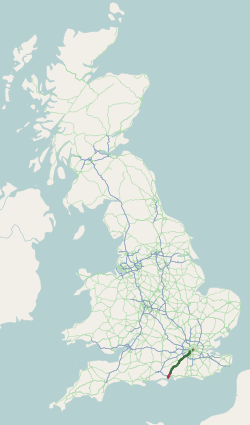
The A25 road is an east–west main road in the South-East of England. Its carries traffic east from Guildford, Surrey, eastward through Surrey and into mid-west Kent, to the town of Sevenoaks, and then on to Wrotham Heath where it connects with the A20.

The A31 is a major trunk road in southern England that runs from Guildford in Surrey to Bere Regis in Dorset. Its best-known section is the Hog's Back, a ridge forming part of the North Downs between Guildford and Farnham in Surrey.

The Borough of Guildford is a local government district with borough status in Surrey, England. With around half of the borough's population, Guildford is its largest settlement and only town, and is where the council is based.

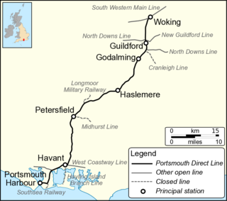
The Portsmouth Direct line is a railway route between Woking in Surrey and Portsmouth Harbour in Hampshire, England. It forms the principal route for passenger trains between London, Guildford and Portsmouth; connections are made to the ferry services which operate between Portsmouth and the Isle of Wight. The final section of line from Havant to Portsmouth is shared with other passenger routes.

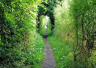
St Swithun's Way is a 34-mile (55 km) long-distance footpath in England from Winchester Cathedral, Hampshire to Farnham, Surrey. It is named after Swithun, a 9th-century Bishop of Winchester, and roughly follows the Winchester to Farnham stretch of the Pilgrims' Way. The route was opened in 2002 to mark the Golden Jubilee of Elizabeth II.
The following are lists of recreational walks in Hampshire, England:
Hampshire Rugby Football Union is the governing body for rugby union in the county of Hampshire, England. It represent clubs sides not just from Hampshire but also from the Isle of Wight and the Channel Islands, who take part in many of the competitions organized by the Hampshire RFU.

Puttenham is a village in Surrey, England, located just south of the Hog's Back which is the narrowest stretch of the North Downs. Puttenham is about midway between the towns of Guildford and Farnham, and can be accessed from the A31 trunk road which runs along the spine of the Hog's Back. Villages nearby include Wanborough, Shackleford and Compton.

Seale is a village in Surrey, England. Seale covers most of the civil parish of Seale and Sands and the steep slope and foot of the south side of the Hog's Back as well as a large hill which exceeds it – as such is part of the Surrey Hills Area of Outstanding Natural Beauty.

Runfold is a village in Surrey, U.K., about 2 mi (3.2 km) ENE of Farnham.

Whitehill is a village and civil parish in the East Hampshire district of Hampshire, England, on the historic route between Petersfield and Farnham. It is 0.7 miles (1.1 km) south of Bordon and covers an area of approximately 8 square miles.

The geology of Surrey is dominated by sedimentary strata from the Cretaceous, overlaid by clay and superficial deposits from the Cenozoic.

South Western Railway is a British train operating company owned by FirstGroup (70%) and MTR Corporation (30%) that operates the South Western franchise.

The Portsmouth line is a secondary main line originally built by the London, Brighton and South Coast Railway and the London and South Western Railway between 1847 and 1868. It leaves the South London Line at Peckham Rye, with connections to the Victoria branch of the Brighton Main Line at Streatham, and continues via Sutton, Epsom and Dorking to join the Mid-Sussex Line at Horsham.

Norton is a hamlet in the civil parish of Freshwater, on the outskirts of Yarmouth, in the Isle of Wight, England. It is situated in the West of the island and has a coast on the Solent. It is located 3.5 miles (5.6 km) southeast of Lymington, Hampshire.


