Perthshire, officially the County of Perth, is a historic county and registration county in central Scotland. Geographically it extends from Strathmore in the east, to the Pass of Drumochter in the north, Rannoch Moor and Ben Lui in the west, and Aberfoyle in the south; it borders the counties of Inverness-shire and Aberdeenshire to the north, Angus to the east, Fife, Kinross-shire, Clackmannanshire, Stirlingshire and Dunbartonshire to the south and Argyllshire to the west. It was a local government county from 1890 to 1930.
Firth is a word in the English and Scots languages used to denote various coastal waters in the United Kingdom, predominantly within Scotland. In the Northern Isles, it more often refers to a smaller inlet. It is linguistically cognate to fjord, which has a more constrained sense in English. Bodies of water named "firths" tend to be more common on the Scottish east coast, or in the southwest of the country, although the Firth of Clyde is an exception to this. The Highland coast contains numerous estuaries, straits, and inlets of a similar kind, but not called "firth" ; instead, these are often called sea lochs. Before about 1850, the spelling "Frith" was more common.
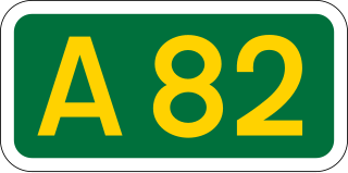
The A82 is a major road in Scotland that runs from Glasgow to Inverness via Fort William. It is one of the principal north-south routes in Scotland and is mostly a trunk road managed by Transport Scotland, who view it as an important link from the Central Belt to the Scottish Highlands and beyond. The road passes close to numerous landmarks, including; Loch Lomond, Rannoch Moor, Glen Coe, the Ballachulish Bridge, Ben Nevis, the Commando Memorial, Loch Ness, and Urquhart Castle.
The Glasgow and South Western Railway (G&SWR) was a railway company in Scotland. It served a triangular area of south-west Scotland between Glasgow, Stranraer and Carlisle. It was formed on 28 October 1850 by the merger of two earlier railways, the Glasgow, Paisley, Kilmarnock and Ayr Railway and the Glasgow, Dumfries and Carlisle Railway. Already established in Ayrshire, it consolidated its position there and extended southwards, eventually reaching Stranraer. Its main business was mineral traffic, especially coal, and passengers, but its more southerly territory was very thinly populated and local traffic, passenger and goods, was limited, while operationally parts of its network were difficult.
The Callander and Oban Railway company was established with the intention of linking the sea port of Oban to the railway network. This involved a long line from Callander through wild and thinly populated terrain, and shortage of money meant that the line was opened in stages from 1866 to 1880.

Balloch is a village in West Dunbartonshire, Scotland, at the foot of Loch Lomond.

The Pass of Drumochter meaning simply 'high ridge' is the main mountain pass between the northern and southern central Scottish Highlands. The A9 road passes through here, as does the Highland Main Line, the railway between Inverness and the south of Scotland. The Sustrans National Cycle Route 7 between Glasgow and Inverness also runs through the pass.
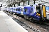
The Scottish Region (ScR) was one of the six regions created on British Railways (BR) and consisted of ex-London, Midland and Scottish Railway (LMS) and ex-London and North Eastern Railway (LNER) lines in Scotland. It existed from the creation of BR in 1948, and was renamed to ScotRail in the mid-1980s.

The Glasgow South Western Line is a mainline railway in Scotland that runs from Glasgow to Kilmarnock, and then either Carlisle via Dumfries, or Stranraer via Ayr, with a branch to East Kilbride.
The Lochearnhead, St Fillans and Comrie Railway company was formed to build a line along the valley of Strathearn, closing the gap between the Callander and Oban line of the Caledonian Railway and Crieff. Tourism was on the increase in the area, and there were ambitious ideas that imported goods traffic at Oban would be routed to the eastern Scotland towns and cities over the line.
The Killin Railway was a locally promoted railway line built to connect the town of Killin to the Callander and Oban Railway main line nearby. It opened in 1886, and carried tourist traffic for steamers on Loch Tay as well as local business. The directors and the majority of the shareholders were local people, and the little company retained its independence until 1923.
The Lanarkshire and Dumbartonshire Railway was a railway company in Scotland. It was promoted independently but supported by the Caledonian Railway, and it was designed to connect Balloch and Dumbarton with central Glasgow, linking in heavy industry on the north bank of the River Clyde. From Dumbarton to Balloch the line would have closely duplicated an existing railway, and negotiation led to the latter being made jointly operated, and the L&DR terminated immediately east of Dumbarton, trains continuing on the joint section.
The Dalry and North Johnstone Line was a branch of the Glasgow and South Western Railway (G&SWR) in Renfrewshire and Ayrshire, Scotland, connecting the stations in Elderslie and Dalry via a route running parallel to the existing line built by the Glasgow, Paisley, Kilmarnock and Ayr Railway. This provided additional line capacity for Ayrshire Coast and Kilmarnock services. The loop line was used for passenger services until the mid-1960s, when it was closed by the Beeching Axe. The majority of the line's trackbed has since been absorbed into the Sustrans National Cycle Network.

The Glasgow, Paisley, Kilmarnock and Ayr Railway (GPK&AR) was a railway in Scotland that provided train services between Glasgow, Kilmarnock and Ayr. It opened its first line, between Glasgow and Ayr, in stages from 1839 to 1840. The section between Glasgow and Paisley was made jointly with the Glasgow, Paisley and Greenock Railway. Later it built a line from Dalry via Kilmarnock to Cumnock, linking there with the Glasgow, Dumfries and Carlisle Railway, and together forming a through route from Glasgow to Carlisle. The two companies merged to form the Glasgow and South Western Railway.
The Caledonian and Dumbartonshire Junction Railway (C&DJR) was a Scottish railway opened in 1850 between Bowling and Balloch via Dumbarton. The company had intended to build to Glasgow but it could not raise the money.
The Forth and Clyde Junction Railway was a railway line in Scotland which ran from Stirling to Balloch.
National Cycle Route 78 runs from Campbeltown to Inverness. It was officially launched as the Caledonia Way in 2016 as part of the wider redevelopment of Scotland's cycle network. It runs from the Kintyre peninsula to the Great Glen and the route varies from on road to traffic-free forest trails and canal paths.

The Rob Roy Way is a Scottish long distance footpath that runs from Drymen in Stirling to Pitlochry in Perth and Kinross. The path was created in 2002, and takes its name from Rob Roy MacGregor, a Scottish folk hero and outlaw of the early 18th century. It traverses countryside that he knew and travelled frequently. The route crosses the Highland Boundary Fault, a geological fault where the Highlands meet the Lowlands. Views from the trail overlook Loch Lubnaig, Loch Earn, Loch Venachar and Loch Tay. The way is 127 kilometres (79 mi) in length if the direct route along the southern shore of Loch Tay and the River Tay is followed between Ardtalnaig and Aberfeldy. An optional loop also links these places via Amulree: choosing this option increases the length by a further 27 kilometres (17 mi) to 154 kilometres (96 mi).