The A9 is a major road in Scotland running from the Falkirk council area in central Scotland to Scrabster Harbour, Thurso in the far north, via Stirling, Bridge of Allan, Perth and Inverness. At 273 miles (439 km), it is the longest road in Scotland and the fifth-longest A-road in the United Kingdom. Historically it was the main road between Edinburgh and John o' Groats, and has been called the spine of Scotland. It is one of the three major north–south trunk routes linking the Central Belt to the Highlands – the others being the A82 and the A90.

The M9 is a major motorway in Scotland. It runs from the outskirts of Edinburgh, bypassing the towns of Linlithgow, Falkirk, Grangemouth and Stirling to end at Dunblane.
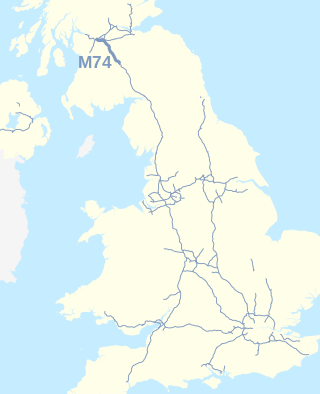
The A74(M) and M74 form a major motorway in Scotland, connecting it to England. The routes connect the M8 motorway in central Glasgow to the Scottish-English border at Gretna. They are part of the unsigned international E-road network E05. Although the entire route is colloquially referred to as the M74, for more than half its length, south of Abington, the road is officially the A74(M); see naming confusion below.

The M90 is a motorway in Scotland. It runs from Junction 1A of the M9 motorway, south of the Queensferry Crossing, to Perth. It is the northernmost motorway in the United Kingdom. The northern point goes to the western suburbs of Perth at Broxden. A small part of the M90 was originally numbered as the M85 motorway.

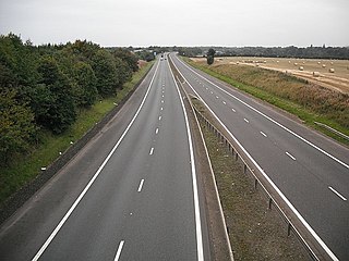
The M80 is a motorway in Scotland's central belt, running between Glasgow and Stirling via Cumbernauld and Denny and linking the M8, M73 and M9 motorways. Following completion in 2011, the motorway is 25 miles (40 km) long. Despite being only a two lane motorway, parts of the M80 Stepps Bypass are used by around 60,000 vehicles per day.
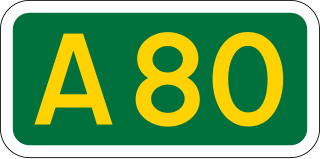
The A80 is a road in Scotland, running from the A8 to Moodiesburn, north east of Glasgow. Prior to the M80 opening, the A80 was one of Scotland's busiest trunk roads.
The M876 motorway is a motorway in Scotland. The motorway runs from Denny to Airth in the Falkirk council area, forming an approach road to the Kincardine Bridge. It was opened in 1980.

The A728 is a route number in Glasgow, Scotland applied to two connected roads.
The B800 is a short road in eastern Scotland, connecting the Forth Road Bridge to Kirkliston. It is a two-way single carriageway road.
Winchburgh is a village in the council area of West Lothian, Scotland. It is located approximately 10 miles (16 km) west of the city-centre of Edinburgh, 6 miles (9.7 km) east of Linlithgow and 3 miles (4.8 km) northeast of Broxburn.

The Forth and Clyde canal pathway runs between the Firth of Forth and the Firth of Clyde and is a 106-kilometre-long (66 mi) footpath and cycleway that runs across Scotland, between Bowling, west of Glasgow, and Lochrin Basin in Edinburgh. The path runs on the towpaths of the Forth & Clyde and Union Canals and is entirely off-road. The path is well maintained and its surface is generally good, although there are some stretches particularly between Falkirk and the outskirts of Edinburgh where wet weather leads to muddy conditions unsuitable for road intended bicycles. It is well used by walkers and cyclists, and designated as one of Scotland's Great Trails by NatureScot. It also forms part of the National Cycle Network, being designated as Route 754. Sustrans advises that the path is best followed from the Clyde to the Forth because the prevailing wind is from the south west. Much of the path is also suitable for experienced horseriders, although in some places low bridges, narrow aqueducts and gates may restrict access for horses.

Linlithgow is a town in West Lothian, Scotland. It was historically West Lothian's county town, reflected in the county's historical name of Linlithgowshire. An ancient town, it lies in the Central Belt on a historic route between Edinburgh and Falkirk beside Linlithgow Loch. The town is situated approximately 20 miles (32 km) west of Edinburgh.

Newbridge is a village in the civil parish of Kirkliston, west of Edinburgh in Scotland. It formerly belonged to Midlothian, but it has been on the western fringe of to the City of Edinburgh since 1975. The original village consists of a small crossroads settlement to the east of the eponymous New Bridge, which spans the River Almond. Around it is a confusion of roads and industrial estates converging on the Newbridge Roundabout, the meeting point of the M8 and M9 motorways.

The A725 road in Scotland is a major route which is a trunk road dual carriageway for almost its whole length, connecting several of the large towns of North Lanarkshire and South Lanarkshire, linking the M8 and M74 motorways; it has been upgraded frequently since its construction, with the most recent major work completed in 2017. In combination with the A726 road which meets the M77 motorway, it forms a southern and eastern bypass for the city of Glasgow.

The A726 road in Scotland is a major route with several distinct sections with different characteristics and names; owing to its stages of construction, since 2005 it has two separate parts, the first running between Strathaven in South Lanarkshire and Junction 5 of the M77 motorway south of Newton Mearns in East Renfrewshire via East Kilbride, and the other running between Junction 3 of the M77 and the M898 motorway near the Erskine Bridge, via Paisley and Junction 29 of the M8 motorway near Glasgow International Airport.

The A730 road in Scotland runs between the centre of Glasgow and the south-eastern edge of the city's urban area at Cathkin.
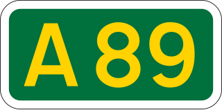
The A89 is a trunk road in Scotland, United Kingdom. It runs from High Street, Glasgow to Newbridge in Edinburgh. It was once the A8, which has now been replaced, mostly by the M8.

The A727 road in Scotland runs from East Kilbride in South Lanarkshire, through East Renfrewshire, to Junction 3 of the M77 motorway in Glasgow.
The Falkirk Braes is a geographical and sociopolitical entity within the Falkirk local authority area in Scotland. The population is approximately 32,000 (2018), about 20% of the total for Falkirk council area.

The A724 road in Scotland runs within South Lanarkshire between Rutherglen and Hamilton. It follows an ancient route which is marked on William Roy's Lowland Map of Scotland (1755) with only minor deviations from its modern course.