
The Forth Road Bridge is a suspension bridge in east central Scotland. The bridge opened in 1964 and at the time was the longest suspension bridge in the world outside the United States. The bridge spans the Firth of Forth, connecting Edinburgh, at South Queensferry, to Fife, at North Queensferry. It replaced a centuries-old ferry service to carry vehicular traffic, cyclists and pedestrians across the Forth; railway crossings are made by the nearby Forth Bridge, opened in 1890.

The Great Britain road numbering scheme is a numbering scheme used to classify and identify all roads in Great Britain. Each road is given a single letter and a subsequent number. Though this scheme was introduced merely to simplify funding allocations, it soon became used on maps and as a method of navigation. There are two sub-schemes in use: one for motorways, and another for non-motorway roads.

The A7 is a major road, partly a trunk road, that connects Edinburgh in Central Scotland to Carlisle in North West England. The A7 meets the M6 motorway close to Carlisle, which connects to the English motorway network.
The A8 is a major road in Scotland, connecting Edinburgh to Greenock via Glasgow. Its importance diminished following the construction of the M8 motorway which also covers the route between Edinburgh and Glasgow.
The A9 is a major road in Scotland running from the Falkirk council area in central Scotland to Scrabster Harbour, Thurso in the far north, via Stirling, Bridge of Allan, Perth and Inverness. At 273 mi (439 km), it is the longest road in Scotland and the fifth-longest A-road in the United Kingdom. Historically it was the main road between Edinburgh and John o' Groats, and has been called the spine of Scotland. It is one of the three major north–south trunk routes linking the Central Belt to the Highlands - the others being the A82 and the A90.

The M8 is the busiest motorway in Scotland. It connects the country's two largest cities, Glasgow and Edinburgh, and serves other large communities including Airdrie, Coatbridge, Greenock, Livingston and Paisley. The motorway is 60 miles (97 km) long. A major construction project to build the final section between Newhouse and Baillieston was completed on 30 April 2017. The motorway has one service station, Heart of Scotland Services, previously named Harthill due to its proximity to the village.
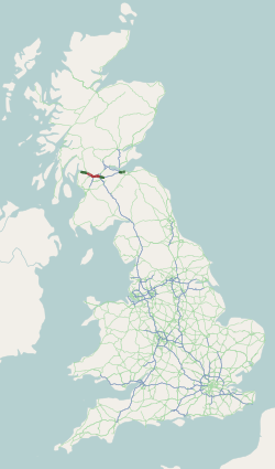
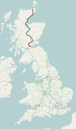
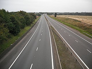
The A90 road is a major north to south road in eastern Scotland, running from Edinburgh to Fraserburgh, through Dundee and Aberdeen. Along with the A9 and the A82 it is one of the three major north–south trunk roads connecting the Central Belt to northern destinations.

The M9 is a major motorway in Scotland. It runs from the outskirts of Edinburgh, bypassing the towns of Linlithgow, Falkirk, Grangemouth and Stirling to end at Dunblane.

The M90 is a motorway in Scotland. It runs from Junction 1A of the M9 motorway, south of the Queensferry Crossing, to Perth. It is the northernmost motorway in the United Kingdom. The northern point goes to the western suburbs of Perth at Broxden. A small part of the M90 was originally numbered as the M85 motorway.

The A92 is a major road that runs through Fife, Dundee, Angus, Aberdeenshire, and Aberdeen City in Scotland. From south to north, it runs from Dunfermline to Blackdog, just north of Aberdeen.

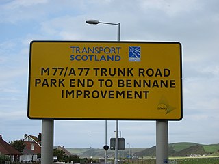
The M77 motorway is a motorway in Scotland. It begins in Glasgow at the M8 motorway at Kinning Park, and terminates near Kilmarnock at Fenwick, becoming the A77 dual carriageway. Changes were made in 2005 segregating a lane on the M8 motorway almost as far as the Kingston Bridge, which in January 2006 was extended further onto the bridge itself. It forms the most northerly part of the A77 trunk road which links Glasgow to Stranraer in the South West of Scotland.

The M80 is a motorway in Scotland's central belt, running between Glasgow and Stirling via Cumbernauld and Denny and linking the M8, M73 and M9 motorways. Following completion in 2011, the motorway is 25 miles (40 km) long. Despite being only a two lane motorway, parts of the M80 Stepps Bypass are used by around 60,000 vehicles per day.

The Edinburgh City Bypass, designated as A720, is one of the most important trunk roads in Scotland. Circling around the south of Edinburgh, as the equivalent of a ring road for the coastal city, it links together the A1 towards north-east England, the A702 towards north-west England, the M8 through the Central Belt towards Glasgow, the A7 through south-east Scotland and north-west England as well as the A8 leading to the M9 for Stirling and the Queensferry Crossing.
The M876 motorway is a motorway in Scotland. The motorway runs from Denny to Airth in the Falkirk council area, forming an approach road to the Kincardine Bridge. It was opened in 1980.

Broxden Junction is one of the busier and more important road junctions in Scotland. It is located on the outskirts of Perth, and is one of the city's two major roundabouts – the other being Inveralmond Roundabout, where the A9 meets the A912 Dunkeld Road, 2.3 miles (3.7 km) to the north-northwest. The roundabout, oval in shape, is an important hub of the Scottish road network, a major junction on the A9 north–south route, and the UK's northernmost motorway junction, being junction 12 of the M90 motorway. Prior to Dunfermline's ascension to city status, all of the seven cities in Scotland were signposted from its exits.
The Forth Estuary Transport Authority (FETA) was the authority responsible for the maintenance of the Forth Road Bridge over the Firth of Forth in eastern central Scotland. FETA was created in 2001 by the Transport (Scotland) Act 2001 - to replace the Forth Road Bridge Joint Board.
The transport system in Scotland is generally well-developed. The Scottish Parliament has control over most elements of transport policy within Scotland, with the Cabinet Secretary for Transport, Net Zero and Just Transition holding portfolio responsibility within the Scottish Government. Transport Scotland is the Executive Agency responsible for the Scottish transport network.

Edinburgh is a major transport hub in east central Scotland and is at the centre of a multi-modal transport network with road, rail and air communications connecting the city with the rest of Scotland and internationally.
The Aberdeen Western Peripheral Route (AWPR), unofficially also the City of Aberdeen Bypass, is a major road that wraps around the city of Aberdeen, Scotland. The road stretches north from Stonehaven through Kincardineshire and crosses both the River Dee and River Don before terminating at Blackdog. The main stretch of the AWPR is 22 miles (35 km) in length.

The Queensferry Crossing is a road bridge in Scotland. It was built alongside the existing Forth Road Bridge and the Forth Bridge. It carries the M90 motorway across the Firth of Forth between Edinburgh, at South Queensferry, and Fife, at North Queensferry.


