 | ||||
|---|---|---|---|---|
 | ||||
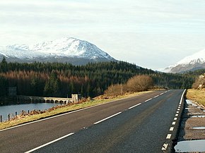 The A86 at Loch Laggan | ||||
| Route information | ||||
| Length | 64.3 km (40.0 mi) | |||
| Major junctions | ||||
| West end | ||||
| East end | ||||
| Location | ||||
| Country | United Kingdom | |||
| Constituent country | Scotland | |||
| Road network | ||||
| ||||
The A86 is a major road in Scotland. It runs from the Great Glen at Spean Bridge to Kingussie and the Cairngorms National Park via Loch Laggan. It is a primary route for its entire length.
The road was built as a parliamentary road by Thomas Telford in 1817 to link Kingussie to Fort William. [1]
The road has a poor safety record, and has been assessed as medium to high risk of a serious or fatal accident by EuroRAP. [2]