
Baleshare is a flat tidal island in the Outer Hebrides of Scotland. Baleshare lies to the south-west of North Uist. Its economics and community were boosted by the building of a causeway in 1962. The 350-metre (380 yd) causeway was built by William Tawse Ltd. The island is extremely flat by Hebridean standards, rising to only 12 metres above sea level and known for its long sandy beach. It has a population of 49 living in two settlements: Samhla and Teananachar.
Sleat is a peninsula and civil parish on the island of Skye in the Highland council area of Scotland, known as "the garden of Skye". It is the home of the clan MacDonald of Sleat. The name comes from the Scottish Gaelic Slèite, which in turn comes from Old Norse sléttr, which well describes Sleat when considered in the surrounding context of the mainland, Skye and Rùm mountains that dominate the horizon all about Sleat.

The A87 is a major road in the Highland region of Scotland.

Trotternish or Tròndairnis is the northernmost peninsula of the Isle of Skye, in Scotland. Its most northerly point, Rubha Hùinis, is the most northerly point of Skye.

The A850 road is a road in the Scottish Isles, off the west coast of mainland Scotland.

The A863 road is one of the principal roads of the Isle of Skye in the Inner Hebrides off the west coast of mainland Scotland.
Aith,, is a village on the Northern coast of the West Shetland Mainland, Scotland at the southern end of Aith Voe, some 21 miles west of Lerwick.
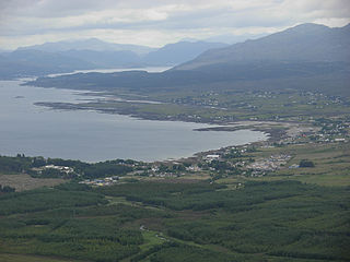
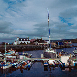
Broadford, together with nearby Harrapool, is the second-largest settlement on the Isle of Skye, Scotland. Lying in the shadow of the Red Cuillin mountains, Broadford is within the parish of Strath. A long meandering village historically consisting of a few buildings on either side of the Broadford River, the many small townships around the wide sweep of the bay have grown together and Broadford now stretches for 1+1⁄2 miles around the southern side of Broadford Bay.

Abune-the-Hill is a place on in the North of the Orkney Mainland and just to the west of the Loch of Swannay.

Bac Mòr is a Scottish island, one of the Treshnish Isles, sometimes referred to as The Dutchman's Cap in English because of its shape.
![<span class="mw-page-title-main">Oronsay, Loch Bracadale</span> Uninhabited tidal island in [[Loch Bracadale]] on the west coast of Skye, Scotland](https://upload.wikimedia.org/wikipedia/commons/thumb/e/e6/Oronsay_.jpg/320px-Oronsay_.jpg)
Oronsay is an uninhabited tidal island in Loch Bracadale on the west coast of Skye, Scotland.

Ardinamir is an anchorage and small settlement on the island of Luing in Argyll and Bute, Scotland.

The A961 is a single-carriageway road on the eastern side of Scapa Flow in the Orkney Islands, connecting the town of Kirkwall on the Orkney Mainland to Burwick at the southern end of South Ronaldsay.

The A970 is a single-carriageway road that runs from south to north of Mainland Shetland, Scotland. The road also spurs to Scalloway and North Roe.

Ordnance Survey (OS) is the national mapping agency for Great Britain. The agency's name indicates its original military purpose, which was to map Scotland in the wake of the Jacobite rising of 1745. There was also a more general and nationwide need in light of the potential threat of invasion during the Napoleonic Wars. Since 1 April 2015 Ordnance Survey has operated as Ordnance Survey Ltd, a government-owned company, 100% in public ownership. The Ordnance Survey Board remains accountable to the Secretary of State for Business, Energy and Industrial Strategy. It was also a member of the Public Data Group.
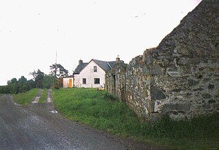
Balbeg is a clachan (hamlet) about 0.5 miles (1 km) north-east of Balnain, 4 miles (6 km) west of Drumnadrochit, Inverness-shire and is in the Scottish council area of Highland.

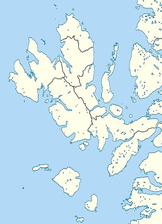
The Isle of Skye, or simply Skye, is the largest and northernmost of the major islands in the Inner Hebrides of Scotland. The island's peninsulas radiate from a mountainous hub dominated by the Cuillin, the rocky slopes of which provide some of the most dramatic mountain scenery in the country. Although Sgitheanach has been suggested to describe a winged shape, no definitive agreement exists as to the name's origins.
Mugeary is a farm or croft and former settlement on the island of Skye, Scotland. Located 4 kilometres southwest of Portree, it is known as the location where the basaltic rock mugearite was first identified. The Gaelic name is derived from Old Norse and probably means "narrow field".
Eilean Mòr is an uninhabited, tidal island opposite Oronsay at the entrance to Loch Sunart, an arm of the sea on the west coast of Scotland. At low tide it is attached to Glenmore on the Ardnamurchan peninsula. The highest elevation is 123 feet (37 m). At low tide it is attached to Glenmore on the Ardnamurchan peninsula. The water around Eilean Mòr contains flame shells.
The Ordnance Survey Great Britain County Series maps were produced from the 1840s to the 1890s by the Ordnance Survey, with revisions published until the 1940s. The series mapped the counties of Great Britain at both a six inch and twenty-five inch scale with accompanying acreage and land use information. Following the introduction of the Ordnance Survey National Grid in the 1930s the County Series maps were replaced by a new series of maps at each scale.
