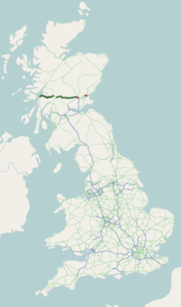
The A90 road is a major north-to-south road in eastern Scotland, running from Edinburgh to Fraserburgh, through Dundee and Aberdeen. Along with the A9 and the A82 it is one of the three major north–south trunk roads connecting the Central Belt to northern destinations.
The A82 is a major road in Scotland that runs from Glasgow to Inverness via Fort William. It is one of the principal north-south routes in Scotland and is mostly a trunk road managed by Transport Scotland, who view it as an important link from the Central Belt to the Scottish Highlands and beyond. The road passes close to numerous landmarks, including Loch Lomond, Rannoch Moor, Glen Coe, the Ballachulish Bridge, Ben Nevis, the Commando Memorial, Loch Ness, and Urquhart Castle. Along with the A9 and the A90 it is one of the three major north–south trunk roads connecting the Central Belt to the North.

The M90 is a motorway in Scotland. It runs from Junction 1A of the M9 motorway, south of the Queensferry Crossing, to Perth. It is the northernmost motorway in the United Kingdom. The northern point goes to the western suburbs of Perth at Broxden. A small part of the M90 was originally numbered as the M85 motorway.

The A92 is a major road that runs through Fife, Dundee, Angus, Aberdeenshire, and Aberdeen City in Scotland. From south to north, it runs from Dunfermline to Blackdog, just north of Aberdeen.

The West Highland Line is a railway line linking the ports of Mallaig and Oban in the Scottish Highlands to Glasgow in Central Scotland. The line was voted the top rail journey in the world by readers of independent travel magazine Wanderlust in 2009, ahead of the notable Trans-Siberian line in Russia and the Cuzco to Machu Picchu line in Peru. The ScotRail website has since reported that the line has been voted the most scenic railway line in the world for the second year running.

Crianlarich is a village in Stirling council area and in the registration county of Perthshire, Scotland, around 6 miles (10 km) north-east of the head of Loch Lomond. The village bills itself as "the gateway to the Highlands".

Tyndrum is a small village in Scotland. Its Gaelic name translates as "the house on the ridge". It lies in Strathfillan, at the southern edge of Rannoch Moor.
The Callander and Oban Railway company was established with the intention of linking the sea port of Oban to the railway network. This involved a long line from Callander through wild and thinly populated terrain, and shortage of money meant that the line was opened in stages from 1866 to 1880.

Broxden Junction is one of the busier and more important road junctions in Scotland. It is located on the outskirts of Perth, and is one of the city's two major roundabouts – the other being Inveralmond Roundabout, where the A9 meets the A912 Dunkeld Road, 2.3 miles (3.7 km) to the north-northwest. The roundabout, oval in shape, is an important hub of the Scottish road network, a major junction on the A9 north–south route, and the UK's northernmost motorway junction, being junction 12 of the M90 motorway. Prior to Dunfermline's ascension to city status, all of the seven cities in Scotland were signposted from its exits.

The Friarton Bridge is a steel box girder bridge with a concrete deck, across the River Tay on the southeastern outskirts of Perth, Scotland. It is located approximately 20 miles (32 km) upstream of the Tay Road Bridge.

Tyndrum Lower railway station is one of two railway stations serving the small village of Tyndrum in Scotland, the other being Upper Tyndrum. This station is on the Oban branch of the West Highland Line, originally part of the Callander and Oban Railway. It is sited 34 miles 70 chains (56.1 km) from Callander via Glen Ogle, between Crianlarich and Dalmally. ScotRail manage the station and operate all services.

Upper Tyndrum railway station is one of two railway stations serving the small village of Tyndrum in Scotland. It is on the Fort William route of the scenic West Highland Line, between Crianlarich and Bridge of Orchy, sited 41 miles 25 chains (66.5 km) from Craigendoran Junction, near Helensburgh. Services are operated by ScotRail - who manage the station - and Caledonian Sleeper.
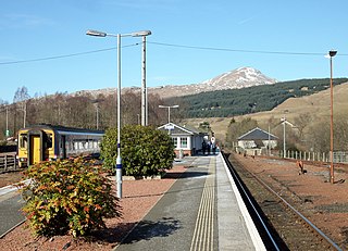
Crianlarich railway station is a railway station serving the village of Crianlarich in Scotland. It is located on the West Highland Line, sited 41 miles 25 chains (66.5 km) from Craigendoran Junction, near Helensburgh, with Ardlui to the south, and Tyndrum Lower and Upper Tyndrum to the north west, on the routes to Oban and Mallaig respectively, which diverge immediately north of the station. ScotRail, who manage the station, operate most services.

Connel is a village in Argyll and Bute, Scotland. It is situated on the southern shore of Loch Etive. The Lusragan Burn flows through the village and into the loch.
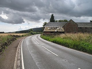
The A912 is a major road in both Perth and Kinross and Fife, Scotland. It runs from the A9 in Perth, in the north, to the A92 at Muirhead, in the south. Part of it was formerly part of the A90.

The Falls of Cruachan derailment occurred on 6 June 2010 on the West Highland Line in Scotland, when a passenger train travelling between Glasgow and Oban hit boulders on the line and derailed near Falls of Cruachan railway station, after a landslide. There was a small fire and one carriage was left in a precarious position on the 50-foot-high (15-metre) embankment. Sixty passengers were evacuated, some with minor injuries; eight of those were hospitalised as a precaution. However, no people were killed. In addition to blocking the line, the incident also caused the closure of the A85 road below the rail line. Both road and rail were closed for a week.
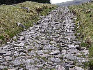
A network of military roads, sometimes called General Wade's Military Roads, was constructed in the Scottish Highlands during the middle part of the 18th century as part of an attempt by the British Government to bring order to a part of the country which had risen up in the Jacobite rebellion of 1715.
The A972 is a major road in Dundee, Scotland. It forms part of the dual carriageway known as the 'Kingsway', that runs through the northern part of Dundee. Its main function is to link the A90 road with the A92.
The A991 is a major road in Dundee, Scotland. It forms the Inner Ringroad that circles the perimeter of Dundee's city centre.

Public transport in Perth and Kinross is available for two main modes of transport—bus and rail—assisting residents of and visitors to the Perth and Kinross council area to travel around much of its 2,041 square miles (5,290 km2).