Ferry Road

Last updated

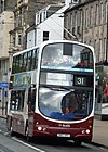
Tenements on Ferry Road at Chancelot Terrace Ferry Road - geograph.org.uk - 305778.jpg
Tenements on Ferry Road at Chancelot Terrace

Ferry Road is one of the major roads of Edinburgh, Scotland, deriving its name from being the road from Queensferry to Leith. It runs from the eastern end of Davidson's Mains village in the west, to Leith in the east, passing through Drylaw, Crewe Toll and Goldenacre on the way. It is classified as the A902 from Leith to Crewe Toll where the A902 continues as Telford Road.

Notable features along the route include, in the west, the former Northern General Hospital's site (now demolished for a supermarket, the Western General Hospital is also nearby), the playing fields of Fettes College, Stewarts Melville and other private schools to the south, a geriatric home of the Salvation Army, Goldenacre stadium etc. Drylaw Police Station is also situated on Ferry Road. Leith public library is located shortly before where Ferry Road meets North Junction Street and Great Junction Street

55°58′19″N3°12′08″W / 55.97207°N 3.20234°W / 55.97207; -3.20234


Related Research Articles

<span class="mw-page-title-main">M77 motorway</span> Motorway in Scotland

The M77 motorway is a motorway in Scotland. It begins in Glasgow at the M8 motorway at Kinning Park, and terminates near Kilmarnock at Fenwick, becoming the A77 dual carriageway. Changes were made in 2005 segregating a lane on the M8 motorway almost as far as the Kingston Bridge, which in January 2006 was extended further onto the bridge itself. It forms the most northerly part of the A77 trunk road which links Glasgow to Stranraer in the South West of Scotland.

Sighthill is a suburb in the west of Edinburgh, Scotland. The area is bordered by Broomhouse and Parkhead to the east, South Gyle to the north, the industrial suburb of Bankhead and the Calders neighbourhood to the west, and Wester Hailes to the south. It is sometimes included in the Wester Hailes area, while the Calders, Bankhead and Parkhead are sometimes considered parts of Sighthill. Administratively it has formed a core part of the City of Edinburgh Council's Sighthill/Gorgie ward since 2007.

<span class="mw-page-title-main">Granton, Edinburgh</span> Edinburgh suburb

Granton is a district in the north of Edinburgh, Scotland. Granton forms part of Edinburgh's waterfront along the Firth of Forth and is, historically, an industrial area having a large harbour. Granton is part of Edinburgh's large scale waterfront regeneration programme.

Goldenacre is an area in Edinburgh, Scotland, lying on and to the south of the Ferry Road, and south of Trinity.

Edinburgh, the capital of Scotland, is traditionally said to have been "built on Seven Hills", in an allusion to the seven hills of Rome. While there is considerable room for debate as to which hills are included and excluded from the seven, seven possibilities are listed in an old rhyme:

<span class="mw-page-title-main">Craigleith, Edinburgh</span>

Craigleith is an area of west Edinburgh, Scotland. Its name comes from various forms of Craig of Inverleith, or rock or hill of Inverleith. The area lies between Ravelston Dykes, to Crewe Toll and the Ferry Road, and Comely Bank on the east. Queensferry Road and Craigleith Road both pass through here. There are also a number of private schools in the area such as Stewart's Melville College and The Mary Erskine School.

<span class="mw-page-title-main">Crewe Toll</span>

Crewe Toll is an area in Edinburgh, the Scottish capital.

<span class="mw-page-title-main">Bonnington, Edinburgh</span>

Bonnington is a district of Edinburgh, the capital of Scotland. The area centres upon an original village which grew up around a ford on the Water of Leith, on the old boundary between Edinburgh and the port of Leith. Before the creation of Leith Walk, the road via the villages of Broughton and Bonnington, or Wester Road as it appears on some old maps, was one of two roads formerly connecting Edinburgh to Leith; the other being Easter Road. The district lies between the districts of Pilrig and Newhaven.

<span class="mw-page-title-main">Drylaw</span> Human settlement in Scotland

Drylaw is an area in the north west of Edinburgh, the capital of Scotland, located between Blackhall and Granton. It forms the community of Drylaw–Telford. Drylaw used to belong to the younger branch of the Foresters of Corstorphine. Formerly the estate of Drylaw House, built in 1718, the home of the Loch family, the area became the site of a major housing scheme in the 1950s designed to rehouse the occupants of Leith. It is on the A902 road. Its name comes from the Scots language and means "hill without a spring".

Easter Road is an arterial road in north Edinburgh, the capital of Scotland. The road is so called as it was known as the "Easter (eastern) road to Leith". As maps of Edinburgh in the late 18th century show, it had a counterpart in "Wester Road". Until the creation of Leith Walk in the middle of the 17th century these were the two main routes from Leith to Edinburgh. Historic personages who have ridden up Easter Road have included Mary, Queen of Scots (1561) and Oliver Cromwell.

<span class="mw-page-title-main">Pilrig</span> Suburb of Edinburgh, Scotland

Pilrig is an area of Edinburgh, the capital of Scotland. The name probably derives from the long field (rig) on which a peel tower (pil/peel) stood. There is evidence of a peel tower situated on an area of higher ground above the Water of Leith.

<span class="mw-page-title-main">A642 road</span> A-road in West Yorkshire, England

The A642 is an A-road in West Yorkshire, England which runs from Huddersfield to the A64 near Leeds. It partly follows the route of a historic turnpike road, which is evidenced by surviving toll houses.

<span class="mw-page-title-main">Great Junction Street</span>

Great Junction Street is a street in Leith, on the northern outskirts of Edinburgh, Scotland. It runs southeast to northwest following approximately the southwestmost line of the old town walls around Leith.

<span class="mw-page-title-main">A727 road</span> Road in Scotland

The A727 road in Scotland runs from East Kilbride in South Lanarkshire, through East Renfrewshire, to Junction 3 of the M77 motorway in Glasgow.

<span class="mw-page-title-main">Leith Walk</span> Street in Edinburgh, Scotland

Leith Walk is one of the longest streets in Edinburgh, Scotland, and is the main road connecting the east end of the city centre to Leith.

<span class="mw-page-title-main">Edinburgh, Leith and Newhaven Railway</span> Former railway line in Scotland

The Edinburgh, Leith and Newhaven Railway was a railway company formed in 1836 to connect the city of Edinburgh with the harbours on the Firth of Forth. When the line connected to Granton, the company name was changed to the Edinburgh, Leith and Granton Railway. It opened part of its route in 1846, but reaching the centre of Edinburgh involved the difficult construction of a long tunnel; this was opened in 1847. It was on a steep incline and was worked by rope haulage.

<span class="mw-page-title-main">Constitution Street</span> Thoroughfare in Leith, Edinburgh

Constitution Street is a thoroughfare in Leith, Edinburgh, Scotland. It runs north from the junction of Leith Walk, Great Junction Street and Duke Street to the Albert Dock in Leith Docks.

<span class="mw-page-title-main">North Leith Parish Church</span>

North Leith Parish Church was a congregation of the Church of Scotland, within the Presbytery of Edinburgh. It served part of Leith, formerly an independent burgh and since 1920 a part of the city of Edinburgh, Scotland.

<span class="mw-page-title-main">Leith Library</span>

Leith Library is one of Edinburgh's 28 freely-accessible libraries. It is a category B listed building. located in Leith, in the northern part of the city, at the foot of Ferry Road shortly before it meets Great Junction Street and North Junction Street.