This article needs additional citations for verification .(July 2018) |


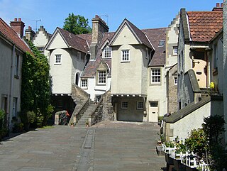
White Horse Close, or "Whitehorse Close", is an enclosed courtyard off the Canongate at the foot of the Royal Mile at the eastern end of the Old Town of Edinburgh, Scotland.
This article needs additional citations for verification .(July 2018) |


White Horse Close, or "Whitehorse Close", is an enclosed courtyard off the Canongate at the foot of the Royal Mile at the eastern end of the Old Town of Edinburgh, Scotland.
It was formerly known as "Ord's Close", after Laurence Ord, the putative builder of the 17th-century inn at its northern end. [1] Because of several conversions to its buildings in the past, the close has been described as "so blatantly fake that it can be acquitted of any intention to deceive". [2] Professor Charles McKean has characterised it as "heritage rather than history". [3]
The origin of the name is obscure. The location has been traditionally associated with a royal mews from the time of Mary, Queen of Scots, the name being said to derive from the fact that her favourite white palfrey was stabled there, [4] near the main entrance to the royal palace. It is more likely, however, that the name derives from the "White Horse Inn" which occupied the northern end of the courtyard from at least the 17th century. It has also been suggested that the name may have come from a later 18th century inn sign displaying the White Horse of Hanover.
It is recorded that some of the leaders of the Covenanting party in Scotland, including James Graham, earl of Montrose, attempted to set out from the inn in the close for Berwick to parley with King Charles I after the Treaty of Berwick had been signed to end the First Bishops' War in June 1639. [5] Their departure was blocked by a mob which feared the meeting might lead to a betrayal of the principles of the National Covenant. Montrose alone slipped through to join the King, to whom he gradually transferred allegiance. [6] Over a decade later, in 1650, he passed the head of the close again, entering Edinburgh at the foot of the Canongate as a captive on his way to trial and execution for treason.
The building bears the date 1632, but this is believed to have been carved when it was restored in the 1930s, the tablet being altered from displaying the more implausible date of 1532. In his Views of Edinburgh, published around 1820, the English engraver James Storer gave the date as 1683, which is more in keeping with the late 17th-century architectural style of the buildings. [5] The dilapidated close was bought by Dr. John Barbour and his sister in 1889, [2] and the inn, with its distinctive forestairs, and the surrounding courtyard buildings were converted into fifteen dwellings for the working class. [3] They were last restored by Frank Mears & Partners between 1961 and 1964. [2]

The inn was the departure point for the stagecoaches that ran between Edinburgh, Newcastle and London in the 18th century. Five arches on the Calton Road side of the building (previously known as the North Back of the Canongate) indicate the former existence of an undercroft which contained the inn's stables, smithy and coach houses. These were accessed from the rear of the building at a considerably lower ground level compared with the courtyard of the close. A small descending flight of steps and narrow pend still connects the courtyard with the rear of the inn building.
The inn should not be confused with another inn of the same name (later known as "Boyd's inn" after one of its owners) which existed in St. Mary's Wynd (now St. Mary's Street) near the head of the Canongate between 1635 and 1868. [7] This was where Pasquale Paoli came with Count Burzyuski in September 1771 [8] and James Boswell welcomed Samuel Johnson on his arrival in Edinburgh in August 1773. [9]
The building with a turnpike stair immediately on the right when entering the close was the residence of two Bishops of Edinburgh from the time when the church of St. Giles was a cathedral, namely John Paterson (1632-1708) and Alexander Rose (1647-1720). [5]
Tradition maintains that Jacobite officers were billeted in the close during Charles Edward Stuart's occupation of nearby Holyrood Palace during the Jacobite Rebellion of 1745.
A wall plaque inside the close records it as the birthplace in 1793 of William Dick, son of a farrier and founder of the Royal (Dick) School of Veterinary Studies.
The close is widely regarded as the most picturesque group of buildings on the Royal Mile, but is often overlooked by visitors to the city who fail to enter the pend which connects it to the Canongate.
In 1902 the dilapidated buildings were purchased by Dr Alexander Barbour and his sister, both active members of the Edinburgh Social Union. The Union had previously (1897) reorganised the management of Chessels Court to the west, and set about the same for Whitehouse Close using contemporary social ideals. However, the area was still considered a "slum" in 1906 and not until the comprehensive rebuilding of the Canongate in the 1950s and 60s was the courtyard properly restored. This was done as Council housing but under the rights to buy introduced in the 1970s all are now privately owned. [10]
The main restoration was undertaken by Sir Frank Mears from 1961 to 1964. [11]
A well, found in 1986, is delineated with a circle of cobbles in the courtyard. [12]

Holyrood Abbey is a ruined abbey of the Canons Regular in Edinburgh, Scotland. The abbey was founded in 1128 by David I of Scotland. During the 15th century, the abbey guesthouse was developed into a royal residence, and after the Scottish Reformation the Palace of Holyroodhouse was expanded further. The abbey church was used as a parish church until the 17th century, and has been ruined since the 18th century. The remaining walls of the abbey lie adjacent to the palace, at the eastern end of Edinburgh's Royal Mile. The site of the abbey is protected as a scheduled monument.

The Royal Mile is a succession of streets forming the main thoroughfare of the Old Town of the city of Edinburgh in Scotland. The term was first used descriptively in W. M. Gilbert's Edinburgh in the Nineteenth Century (1901), describing the city "with its Castle and Palace and the royal mile between", and was further popularised as the title of a guidebook by R. T. Skinner published in 1920, "The Royal Mile (Edinburgh) Castle to Holyrood(house)".

This article is a timeline of the history of Edinburgh, Scotland, up to the present day. It traces its rise from an early hill fort and later royal residence to the bustling city and capital of Scotland that it is today.

The Kirk of the Canongate, or Canongate Kirk, serves the Parish of Canongate in Edinburgh's Old Town, in Scotland. It is a congregation of the Church of Scotland. The parish includes the Palace of Holyroodhouse and the Scottish Parliament. It is also the parish church of Edinburgh Castle, even though the castle is detached from the rest of the parish. The wedding of Zara Phillips, the Queen's granddaughter, and former England rugby captain Mike Tindall took place at the church on 30 July 2011. The late Queen Elizabeth II used to attend services in the church on some of her frequent visits to Edinburgh.

The Canongate is a street and associated district in central Edinburgh, the capital city of Scotland. The street forms the main eastern length of the Royal Mile while the district is the main eastern section of Edinburgh's Old Town.

A mercat cross is the Scots name for the market cross found frequently in Scottish cities, towns and villages where historically the right to hold a regular market or fair was granted by the monarch, a bishop or a baron. It therefore served a secular purpose as a symbol of authority, and was an indication of a burgh's relative prosperity. Historically, the term dates from the period before 1707, when the Kingdom of Scotland was an independent state, but it has been applied loosely to later structures built in the traditional architectural style of crosses or structures fulfilling the function of marking a settlement's focal point. Historical documents often refer simply to "the cross" of whichever town or village is mentioned. Today, there are around 126 known examples of extant crosses in Scotland, though the number rises if later imitations are added.

The Old Town is the name popularly given to the oldest part of Scotland's capital city of Edinburgh. The area has preserved much of its medieval street plan and many Reformation-era buildings. Together with the 18th/19th-century New Town, and West End, it forms part of a protected UNESCO World Heritage Site.

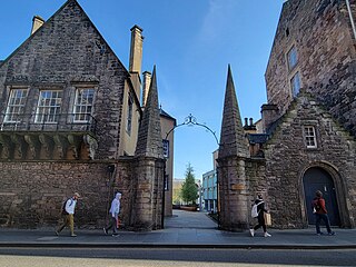
The Moray House School of Education and Sport is a school within the College of Arts, Humanities and Social Science at the University of Edinburgh. It is based in historic buildings on the Holyrood Campus, located between the Canongate and Holyrood Road.

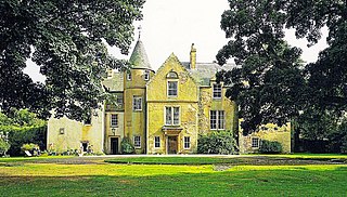
Keith Marischal is a Scottish Baronial Country house lying in the parish of Humbie, East Lothian, Scotland. The original building was an "L-shaped" Tower house, built long before 1589 when it was extended into a "U-shaped" courtyard house. The building acquired its modern appearance in the 19th century when the courtyard was filled in. The house is protected as a category B listed building.

Castle Campbell is a medieval castle situated above the town of Dollar, Clackmannanshire, in central Scotland. It was the lowland seat of the earls and dukes of Argyll, chiefs of Clan Campbell, from the 15th to the 19th century, and was visited by Mary, Queen of Scots, in the 16th century. Mary was impressed by this and said "this reminds me of home".

The Palace of Holyroodhouse, commonly known as Holyrood Palace, is the official residence of the British monarch in Scotland. Located at the bottom of the Royal Mile in Edinburgh, at the opposite end to Edinburgh Castle, Holyrood has served as the principal royal residence in Scotland since the 16th century, and is a setting for state occasions and official entertaining.

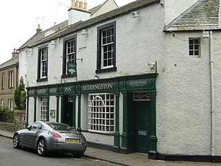
The Sheep Heid Inn is a public house in Duddingston, Edinburgh, Scotland. There has reputedly been an inn on this site since 1360, although the core of the current building appears to date from the 18th century with later additions and alterations. If the 1360 foundation date was proved correct it would make The Sheep Heid Inn perhaps the oldest surviving licensed premises in Edinburgh, if not Scotland.

The Canongate Kirkyard stands around Canongate Kirk on the Royal Mile in Edinburgh, Scotland. The churchyard was used for burials from the late 1680s until the mid-20th century.

A tolbooth or town house was the main municipal building of a Scottish burgh, from medieval times until the 19th century. The tolbooth usually provided a council meeting chamber, a court house and a jail. The tolbooth was one of three essential features in a Scottish burgh, along with the mercat cross and the kirk (church).

The Mercat Cross of Edinburgh is a market cross, which stands in Parliament Square next to St Giles' Cathedral, facing the High Street in the Old Town of Edinburgh.

The Mertoun Bridge is a bridge across the River Tweed in the Scottish Borders.

Alexander Hugh Freeland BarbourFRSE FRCPE was a Scottish gynaecologist and noted medical author. He was President of the Royal College of Physicians of Edinburgh and co-author of the world-acclaimed Manual of Gynaecology.

William Dick was a Scottish veterinarian and founder of the Dick Vet School in Edinburgh, the first veterinary college in Scotland. He is responsible for major advances in the field of veterinary science and the profession as a whole.
John Kinloch or Killoch was keeper of the royal tennis courts, a post master and stable owner in 16th-century Edinburgh and the proprietor of house used for lodgings and banquets.