A749 road

Last updated

UK road A749.svg
A749
Route information
Major junctions
South end East Kilbride
55°46′33″N4°09′48″W / 55.7759°N 4.1633°W / 55.7759; -4.1633 (A749 road (southern end))
North end Glasgow
55°51′23″N4°14′38″W / 55.8564°N 4.2438°W / 55.8564; -4.2438 (A749 road (northern end))
Location
Country United Kingdom
Constituent country Scotland
Primary
destinations
East Kilbride
Nerston
Rutherglen
Glasgow Cross
Road network

The A749 road in Scotland connects East Kilbride with Glasgow city centre via Rutherglen and Bridgeton.

Contents

Route

East Kilbride

The road starts off as a dual carriageway at a roundabout called "The Whirlies", with a junction for the A725 road. Running north it quickly meets another roundabout for the A749 spur which connects onto the A725 (added in the 1990s to bypass the Whirlies where possible to ease congestion); another exit provides access to the former Rolls-Royce engineering works, which closed in 2010s and was converted mostly to housing to complement existing commercial and retail property. The road continues past a third roundabout with exits for the Stewartfield district (as of 2020, a proposal was in place to upgrade this to a dual carriageway for better links to the A726 on the western side of the town), [1] and for the Kingsgate Retail Park (Nerston). After a traffic light junction the road becomes National Speed Limit, descending down a long hill flanked by fields towards Rutherglen, offering panoramic views over much of Greater Glasgow. In this rural section it is known as Glasgow Road.

Rutherglen

Around two miles north-west there is a grade separated staggered junction for the B759 road to Greenlees Road (for Cambuslang/Kirkhill) to the east followed by Cathkin Braes Road (for Carmunnock) to the west, and the permitted speed reduces to a 40-mile-per-hour limit. The junction can be dangerous due to the speeds involved, and the fact that the traffic for Cambuslang queued in the fast lane at busy times and crosses the southbound lanes, as does traffic from the B road onto the northbound carriageway. Fatalities have occurred [2] [3] and the construction of a new residential development in the adjacent fields led to safety measures being proposed in 2017 [4] and introduced two years later.

The road continues on to another roundabout where it meets the end of the A730 road – the Cathkin bypass. Now known as East Kilbride Road, the A749 continues north for another brief spell as a 40-mile-per-hour dual carriageway passing the Springhall and Whitlawburn housing schemes, but soon afterwards drops to a 30-mile-per-hour zone and the dual carriageway section ends at a junction with Blairbeth Road (formerly the A730 until a re-designation upon the completion of the bypass in 2017). it travels into Burnside as East Kilbride Road until reaching Burnside railway station.

Turning north onto Stonelaw Road, it meets the start of the B762 (Dukes Road), forms the traditional 'high street' retail zone for the area, [5] then and continues north and downhill to Rutherglen town centre, directly overlooked by houses at a few points but generally open space – two small parks, a care home complex set back from the road, and a bowling green – or civic buildings including the local health centre, a church and the converted building of Rutherglen Academy. It goes through a long-established cutting – concrete walls approximately 13 feet (4.0 m) high on either side, topped by vegetation – through higher ground known as Clincarthill on the west side and Wardlawhill on the east side, soon meeting the historic Main Street (B768) at Rutherglen Cross. Becoming the narrow Farmeloan Road, it crosses over the West Coast Main Line railway beside Rutherglen railway station, and under the elevated M74 motorway (however offers no access). A junction with the end of the A724 (Cambuslang Road) at Farme Cross results in another name change, to Dalmarnock Road; this is followed by crossing the River Clyde. Passing the Clyde Walkway, the road enters the City of Glasgow proper still heading in a northwesterly direction.

Glasgow

The road enters Glasgow at Dalmarnock and where it meets the Glasgow East End Regeneration Route (A728) at Dalmarnock railway station and continues past the B763 road (Dunn Street), then enters the Bridgeton District as Dalmarnock Road.

At Bridgeton Cross and Bridgeton railway station, the A749 label switches onto London Road (with small sections swapping designation with the A74 near to Glasgow Green) and carries on west to Glasgow city centre, passing Calton and The Barras flea market. It forms a brief part of the one-way system along with the A89 road (Gallowgate) on the eastern edge of the Merchant City .

It ends at Glasgow Cross, a grade junction with the A8 (High Street/Saltmarket); thereafter the road continues as the Trongate (historically part of the A82 road) into the heart of the city centre unclassified.

Public transport

The '18' bus service, one of the primary routes by the major operator in the region, First Glasgow, runs along the entire length of the A749 in both directions. [6] In the first half of the 20th century, Glasgow Corporation Tramways also operated on the route, specifically the 9A which had its terminus at Burnside. [7]

Related Research Articles

<span class="mw-page-title-main">Rutherglen</span> Town in Scotland

Rutherglen is a town in South Lanarkshire, Scotland, immediately south-east of the city of Glasgow, three miles from its centre and directly south of the River Clyde. Having existed as a Lanarkshire burgh in its own right for more than 800 years, in 1975 Rutherglen lost its own local council and administratively became a component of the City of Glasgow District within the Strathclyde region. In 1996 the towns were reallocated to the South Lanarkshire council area.

<span class="mw-page-title-main">East Kilbride</span> Town in Scotland, South Lanarkshire

East Kilbride is the largest town in South Lanarkshire in Scotland, and the country's sixth-largest locality by population. It was also designated Scotland's first new town on 6 May 1947. The area lies on a raised plateau to the south of the Cathkin Braes, about eight miles southeast of Glasgow and close to the boundary with East Renfrewshire.

<span class="mw-page-title-main">A52 road</span> Major road in the East Midlands of England

The A52 is a major road in the East Midlands, England. It runs east from a junction with the A53 at Newcastle-under-Lyme near Stoke-on-Trent via Ashbourne, Derby, Stapleford, Nottingham, West Bridgford, Bingham, Grantham, Boston and Skegness to the east Lincolnshire coast at Mablethorpe. It is approximately 147 miles (237 km) long.

<span class="mw-page-title-main">Bridgeton, Glasgow</span> Human settlement in Scotland

Bridgeton is a district to the east of Glasgow city centre. Historically part of Lanarkshire, it is bounded by Glasgow Green to the west, Dalmarnock to the east and south, Calton to the north-west at Abercromby Street/London Road and Broad street to the north-east.

<span class="mw-page-title-main">Fernhill, South Lanarkshire</span> Human settlement in Scotland

Fernhill is a residential neighbourhood in the Scottish town of Rutherglen in South Lanarkshire; it is situated south of the River Clyde and borders the Rutherglen neighbourhoods of High Burnside to the north and Cathkin to the east, the Glasgow district of Castlemilk to the west, and the open lands of Fernbrae Meadows to the south. Its location on a steep incline which is part of the Cathkin Braes range of hills offers panoramic views over the south and eastern parts of Greater Glasgow.

<span class="mw-page-title-main">A54 road</span>

The A54 road is a road in England linking Chester in Cheshire with Buxton in Derbyshire. Its route through both urban and steep rural areas presents a challenge to Cheshire County Council in maintaining the safety of the road. Many years ago it was the main east–west route in Cheshire. The importance of the A54 through Middlewich and Winsford decreased in the 1970s and 1980s with the building of the M56 motorway and dualling of the A556 at Northwich. The section through Winsford carries approximately 30,000 vehicles per day.

<span class="mw-page-title-main">A728 road</span> Road in Scotland

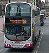
The A728 is a route number in Glasgow, Scotland applied to two connected roads.

<span class="mw-page-title-main">Burnside, South Lanarkshire</span> Human settlement in Scotland

Burnside is a mostly residential area in the town of Rutherglen in South Lanarkshire, Scotland. Including the neighbourhoods of High Burnside and High Crosshill, respectively south and north-west of its main street, it borders Overtoun Park in Rutherglen plus several other residential areas of the town, as well as western parts of neighbouring Cambuslang.

<span class="mw-page-title-main">A505 road</span> Road in southern England

The A505 is a road in the East of England. It follows part of the route of the Icknield Way and the corresponding Icknield Way Path and runs from Leighton Buzzard in Bedfordshire to the A11 Abington Interchange North in Cambridgeshire.

The Glasgow Central Railway was a railway line built in Glasgow, Scotland by the Caledonian Railway, running in tunnel east to west through the city centre. It was opened in stages from 1894 and opened up new journey opportunities for passengers and enabled the Caledonian Railway to access docks and industrial locations on the north bank of the River Clyde. An intensive and popular train service was operated, but the long tunnel sections with frequent steam trains were smoky and heartily disliked.

<span class="mw-page-title-main">A146 road</span> A road in East Anglia, England

The A146 is an A road that connects Norwich in Norfolk and Lowestoft in Suffolk, two of East Anglia's largest population centres. It is around 27 miles (43 km) in length and has primary classification along its entire route. It is mainly single carriageway throughout its route, with the exception of a section of dual carriageway on the southern edge of Norwich.

<span class="mw-page-title-main">A725 road</span> Road in Scotland

The A725 road in Scotland is a major route which is a trunk road dual carriageway for almost its whole length, connecting several of the large towns of North Lanarkshire and South Lanarkshire, linking the M8 and M74 motorways; it has been upgraded frequently since its construction, with the most recent major work completed in 2017. In combination with the A726 road which meets the M77 motorway, it forms a southern and eastern bypass for the city of Glasgow.

<span class="mw-page-title-main">A726 road</span> Road in Scotland

The A726 road in Scotland is a major route with several distinct sections with different characteristics and names; owing to its stages of construction, since 2005 it has two separate parts, the first running between Strathaven in South Lanarkshire and Junction 5 of the M77 motorway south of Newton Mearns in East Renfrewshire via East Kilbride, and the other running between Junction 3 of the M77 and the M898 motorway near the Erskine Bridge, via Paisley and Junction 29 of the M8 motorway near Glasgow International Airport.

<span class="mw-page-title-main">A730 road</span> Road in Scotland running from the centre of Glasgow to Cathkin

The A730 road in Scotland runs between the centre of Glasgow and the south-eastern edge of the city's urban area at Cathkin.

<span class="mw-page-title-main">A617 road</span>

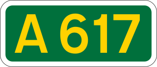
The A617 road runs through the northern East Midlands, England, between Newark-on-Trent and Chesterfield.

<span class="mw-page-title-main">A727 road</span> Road in Scotland

The A727 road in Scotland runs from East Kilbride in South Lanarkshire, through East Renfrewshire, to Junction 3 of the M77 motorway in Glasgow.

NCR 756 is a National Cycle route in Glasgow and South Lanarkshire that runs eight miles from Kelvindale to East Kilbride. It opened in 2009 following four years of construction.

The Switchback was a railway line in the East End of Glasgow, Scotland, constructed by the Caledonian Railway (CR). Connecting the lines at Rutherglen on the south side of the city with Robroyston on the north side, this route also served a number of industrial sidings and rail yards.

<span class="mw-page-title-main">Whitlawburn</span> Human settlement in Scotland

Whitlawburn is a residential area in the town of Cambuslang in South Lanarkshire, Scotland. It is located south of the town centre on high ground overlooking the Greater Glasgow urban area.

<span class="mw-page-title-main">A724 road</span> Road in Scotland

The A724 road in Scotland runs within South Lanarkshire between Rutherglen and Hamilton. It follows an ancient route which is marked on William Roy's Lowland Map of Scotland (1755) with only minor deviations from its modern course.

References

  1. Residents turn out in force to see proposals for £62m East Kilbride road dualling, Daily Record, 7 December 2019
  2. "Linzi Higgins". Daily Record/Rutherglen Reformer . 15 November 2007. Retrieved 18 March 2017.
  3. "Cambuslang dad dies in road smash". Daily Record/Rutherglen Reformer . 19 August 2009. Retrieved 18 March 2017.
  4. "Speed limit changes and possible traffic lights for busy Rutherglen road". Daily Record/Rutherglen Reformer . 10 March 2017. Retrieved 18 March 2017.
  5. South Lanarkshire Council planners knock back estate agent plan in Burnside, Glasgow Times, 31 January 2021
  6. 18 | City Centre – East Kilbride, First Glasgow, 20 August 2017. Retrieved 3 September 2021
  7. Tram routes, 1938 (Museum of Transport), The Glasgow Story
Map all coordinates using: OpenStreetMap  
Download coordinates as: KML

Coordinates: 55°49′12″N4°12′16″W / 55.8199°N 4.2044°W / 55.8199; -4.2044 (A749 road)