Partick Cross is a major road junction in Partick, in the west end of the city of Glasgow, Scotland. [1] The junction is the meeting point of Dumbarton Road, Byres Road, Partick Bridge Street and Coopers Well Street.
Partick Cross is a major road junction in Partick, in the west end of the city of Glasgow, Scotland. [1] The junction is the meeting point of Dumbarton Road, Byres Road, Partick Bridge Street and Coopers Well Street.
Riots took place on the centenary of Daniel O'Connell's birth on 6 August 1875. The Irish immigrants decided to celebrate with a march and the locals rose up in protest. The centre of what was said to be a major civil disturbance was at Partick Cross. [2] Thirty locals had to be sworn in as special constables including Rachel Hamilton and they drove the rioters back. [3]
Near to the Cross are some of the city's best known tourist destinations including:
Also nearby, in an alleyway off Dumbarton Road, is the Kelvinhall subway station – previously known as 'Partick Cross' until 1977 when modernisation work took place. [4]

Maryhill is an area of the City of Glasgow in Scotland. Maryhill is a former burgh. Maryhill stretches over 7 miles (11 km) along Maryhill Road. The Maryhill district has several sub-districts, such as Acre, Botany, Dawsholm Park, Firhill, Gairbraid, Gilshochill, Maryhill Park, North Kelvinside, Queen's Cross, St George's Cross, Cadder, Summerston, Woodside and Wyndford.
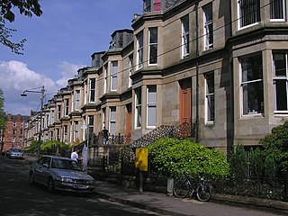
Partick is an area of Glasgow on the north bank of the River Clyde, just across from Govan. To the west lies Whiteinch, to the east Yorkhill and Kelvingrove Park, and to the north Broomhill, Hyndland, Dowanhill, Hillhead, areas which form part of the West End of Glasgow. Partick was a Police burgh from 1852 until 1912 when it was incorporated into the city. Partick is the area of the city most connected with the Highlands, and several Gaelic agencies, such as the Gaelic Books Council are located in the area. Some ATMs in the area display Gaelic.

Kelvinbridge is the common name of the Great Western Bridge, a cast iron road and pedestrian bridge located in the West End of the city of Glasgow, Scotland, built to carry the Great Western Road (A82) at a high level across the River Kelvin. Completed in 1891 by Bell & Miller, it replaced an older stone bridge, and has a similar design to the Partick Bridge crossing the same river, located a short distance to the south-west. It has been a Category A listed structure since 1986.

The North Clyde Line is a suburban railway in West Central Scotland. The route is operated by Abellio ScotRail. As a result of the incorporation of the Airdrie–Bathgate rail link and the Edinburgh–Bathgate line, this route has become the fourth rail link between Glasgow and Edinburgh.
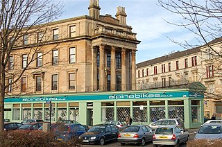
Hillhead is an area of Glasgow, Scotland. Situated north of Kelvingrove Park and to the south of the River Kelvin, Hillhead is at the heart of Glasgow's fashionable West End, with Byres Road forming the western border of the area, the other boundaries being Dumbarton Road to the south and the River Kelvin to the east and north.

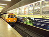
Kelvinhall is an underground station on the Glasgow Subway, renamed after the nearby Kelvin Hall. It is located in the West End of Glasgow, Scotland, near to many of the city's best known tourist destinations including:
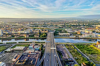
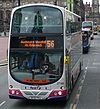
The city of Glasgow, Scotland has a transport system encompassing air, rail, road, and an underground rail line. Prior to 1962, the city was also served by trams. Commuters travelling into Glasgow from the neighbouring local authorities of North and South Lanarkshire, Renfrewshire, East Renfrewshire, and East and West Dunbartonshire have a major influence on travel patterns, with tens of thousands of residents commuting into the city each day. The most popular mode of transport in the city is the car, used by two thirds of people for journeys around the city.

Whiteinch is a district in the Scottish city of Glasgow. It is situated directly north of the River Clyde, between the Partick and Scotstoun areas of the city. Whiteinch was at one stage part of the burgh of Partick, until that burgh's absorption into the expanding city of Glasgow in 1912, and part of the Parish of Govan.

The Kelvin Hall, located on Argyle Street in Glasgow, Scotland, is one of the largest exhibition centres in Britain and now a mixed-use arts and sports venue that opened as an exhibition venue in 1927. It has also been used as a concert hall, home to the Kelvin Hall International Sports Arena to 2014, and from 1988 to 2010, Glasgow's Museum of Transport. As part of the economic redevelopment of Greater Glasgow promoted by the Scottish Development Agency and local authorities to enhance the city's tourist infrastructure and to attract further national and international conferences, the Scottish Exhibition and Conference Centre was designed as the Hall's successor for exhibitions and entertainments, built and opened on the nearby Queen's Dock in 1985 with an exhibition area equal in size to the Kelvin Hall but with the benefit of extensive car parks and land for other complementary buildings. The Hall is protected as a category B listed building, and is served by city bus services and by Kelvinhall subway station.

The West End Festival is an annual festival in the West End of Glasgow, Scotland.

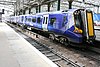
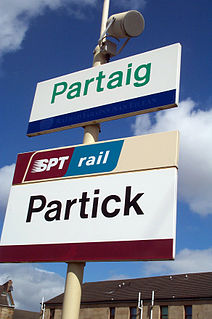
Partick station is an interchange station in the Partick area of Glasgow, Scotland. Along with an adjacent bus station, it forms one of the main transport hubs in Glasgow. The station is served by Glasgow Subway and National Rail services and was one of the first to receive bilingual English and Gaelic signs, because there is a significant Gaelic-speaking population in the Partick area.
The Stobcross Railway was a railway line built by the North British Railway to connect from Maryhill to the new dock being built at Stobcross; the dock became the Queen's Dock, opened in 1877. The line was opened first, in 1874, and gave the North British company access to the north bank of the River Clyde; there was a goods depot at Partick.

Sauchiehall Street is one of the main shopping streets in the city centre of Glasgow, Scotland, along with Buchanan Street and Argyle Street.

Byres Road is a street in Hillhead, Glasgow, Scotland. It is the central artery of the city's West End.
The Glasgow Central Railway was a railway line built in Glasgow, Scotland by the Caledonian Railway, running in tunnel east to west through the city centre. It was opened in stages from 1894 and opened up new journey opportunities for passengers and enabled the Caledonian Railway to access docks and industrial locations on the north bank of the River Clyde. An intensive and popular train service was operated, but the long tunnel sections with frequent steam trains were smoky and heartily disliked.

Glasgow Corporation Tramways were formerly one of the largest urban tramway systems in Europe. Over 1000 municipally-owned trams served the city of Glasgow, Scotland with over 100 route miles by 1922. The system closed in 1962 and was the last city tramway in Great Britain.
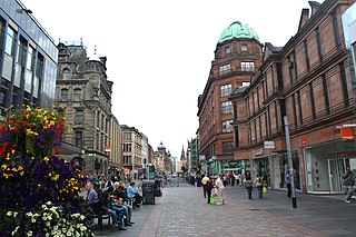
Argyle Street is a major thoroughfare in the city centre of Glasgow, Scotland.
St George's Cross is a road junction in the Woodside area of Glasgow, Scotland. Previously a major intersection for traffic approaching the central areas of the city from its north-western parts, two of the roads forming the junction, Great Western Road and Maryhill Road, were bypassed at the original site in a 1960s realignment, whereas New City Road has had access for vehicular traffic blocked off from the junction itself and is now accessed via Gladstone Street. The cross is now the meeting point of St George's Road, St George's Place, Clarendon Place and New City Road.

Rachel Hamilton (1829–1899), also known as "Big Rachel", was best known for her role in the Partick Riots of 1875.

Sandyford is an area of Glasgow, Scotland. It is north of the River Clyde and forms part of the western periphery of the city centre. Formerly the name of a ward under Glasgow Town Council in the first part of the 20th century, it is within a continuous area of fairly dense urban development bordering several other neighbourhoods whose mutual boundaries have blurred over time, and is possibly less well known than all of the places which adjoin it, particularly Anderston and Finnieston.
Coordinates: 55°52′13.8″N4°17′58.3″W / 55.870500°N 4.299528°W