Related Research Articles

Mount Florida railway station is a staffed island platform station on the Cathcart Circle. It serves the Mount Florida and Battlefield areas of Glasgow, Scotland. Services are provided by Abellio ScotRail on behalf of Strathclyde Partnership for Transport.
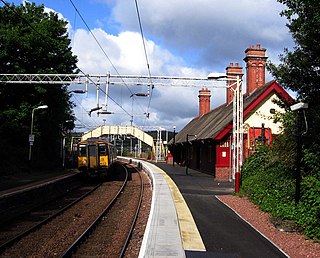
Cathcart railway station is a railway station serving the Cathcart area of Glasgow, Scotland. It is located on the Cathcart Circle Line, 3.7 miles (6 km) south of Glasgow Central. Services are provided by Abellio ScotRail on behalf of Strathclyde Partnership for Transport.

Crosshill railway station is a railway station serving the Crosshill and Govanhill areas of Glasgow, Scotland. It is located on the Cathcart Circle Line but also has trains going to and from Neilston and Newton. Services are provided by Abellio ScotRail on behalf of Strathclyde Partnership for Transport.

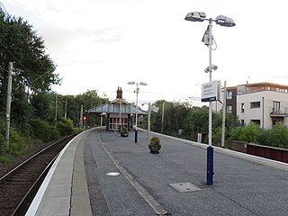
Queen's Park railway station is a railway station serving the Queen's Park, Govanhill and Strathbungo areas of Glasgow, Scotland. It is located on the Cathcart Circle Line. Services are provided by Abellio ScotRail on behalf of Strathclyde Partnership for Transport.
Fort Matilda railway station lies at the far western edge of the town of Greenock, Scotland. It is a non-staffed station, and is the last stop before the terminus of Gourock railway station on the Inverclyde Line out of Glasgow Central station.
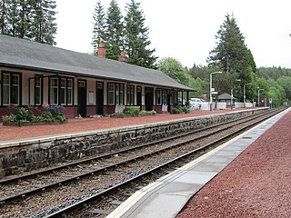
Tulloch railway station is a rural railway station in the remote Tulloch area of the Highland region of Scotland. This station is on the West Highland Line, 105 miles (169 km) north of Glasgow Queen Street.

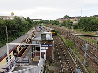
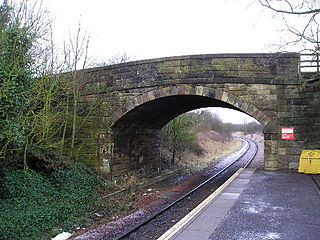
Shettleston railway station serves the Shettleston area of Glasgow, Scotland and is 3½ miles (5 km) east of Glasgow Queen Street railway station on the North Clyde Line. The station is managed by Abellio ScotRail.

Crossmyloof railway station is a railway station serving the area of Crossmyloof in Glasgow, Scotland, located 1 mile 60 chains (2.8 km) from Glasgow Central. The station is managed by Abellio ScotRail and is served by trains on the Glasgow South Western Line.
Pollokshields East railway station is one of three railway stations serving Pollokshields in Glasgow, Scotland. The station is managed by Abellio ScotRail and lies on the Cathcart Circle Line.

Pollokshaws West railway station is a railway station in Glasgow, Scotland. The station is managed by Abellio ScotRail and is served by trains on the Glasgow South Western Line.
Dunlop railway station serves the village of Dunlop in East Ayrshire, Scotland. The station is managed by Abellio ScotRail and is on the Glasgow South Western Line.

Girvan railway station is a railway station serving the town of Girvan, South Ayrshire, Scotland. The station is managed by Abellio ScotRail, who operate all passenger services from there. It is on the Ayr to Stranraer section of the Glasgow South Western Line and is situated 62 miles south of Glasgow Central. It has two platforms and is the location of one of the five passing loops on the single track line between Dalrymple Junction and Stranraer. Immediately south of the station, the line climbs steeply towards Pinmore tunnel – the climb is known as the Glendoune Bank and has a ruling gradient of 1 in 54.

New Cumnock railway station is a railway station serving the town of New Cumnock, East Ayrshire, Scotland. The station is managed by Abellio ScotRail and is on the Glasgow South Western Line, 45.5 miles (73.2 km) south west of Glasgow Central.

Thorntonhall railway station is a railway station in the village of Thorntonhall, South Lanarkshire, Scotland. The station is managed by Abellio ScotRail and is on the Glasgow South Western Line, 8+1⁄2 miles (13.7 km) south of Glasgow Central.
The Bridge of Weir Railway was an independent railway company that built a line from Johnstone to Bridge of Weir. It was taken over by the Glasgow and South Western Railway (G&SWR) in 1865 and formed the base of a line that extended to Greenock, giving the G&SWR access to the harbour facilities there, competing with the rival Caledonian Railway.
Neilston Low railway station was a railway station serving the town of Neilston, East Renfrewshire, Scotland. The station was originally part of the Glasgow, Barrhead and Neilston Direct Railway (GB&N).
The Glasgow City and District Railway was a sub-surface railway line in Glasgow, Scotland, built to connect suburban routes east and west of the city, and to relieve congestion at the Queen Street terminus.
Ibrox railway station was a railway station in Ibrox, a district of Glasgow, Scotland. The station was originally part of the Glasgow and Paisley Joint Railway.
The Barrhead Branch was a branch line built by the Glasgow and South Western Railway in Scotland. It connected Potterhill railway station on the south side of Paisley with a new Barrhead Central railway station. The line was sometimes known as the Barrhead Central Railway.
Shields railway station was a railway station in Pollokshields, Glasgow, Scotland.
References
| Preceding station | Disused railways | Following station | ||
|---|---|---|---|---|
| Bellgrove Line and station closed | North British Railway Coatbridge Branch | Terminus |
| | This Glasgow railway station-related article is a stub. You can help Wikipedia by expanding it. |